
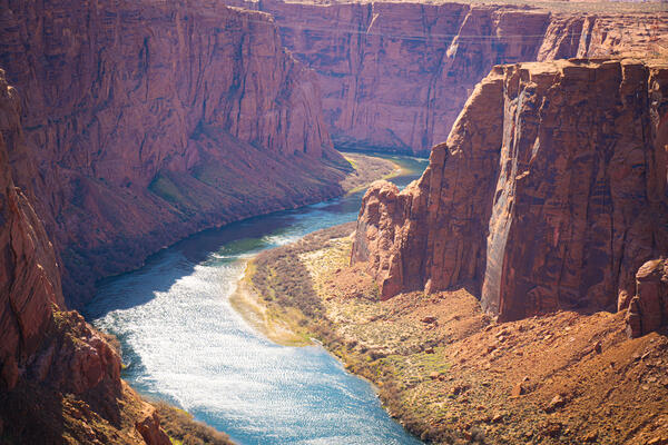
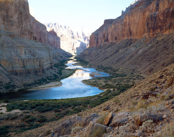
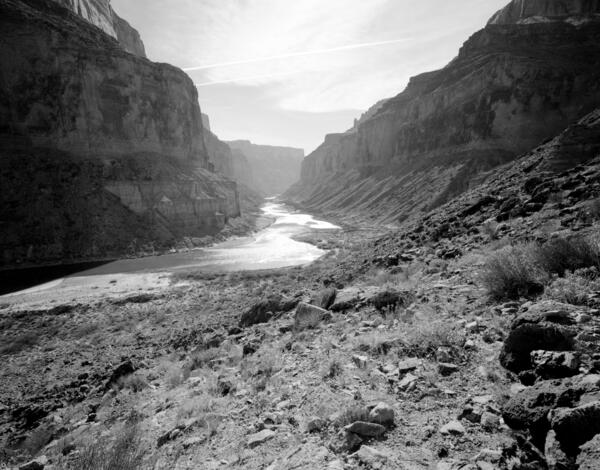
View of Colorado River in the Grand Canyon from overlook. Photo by Jordan Bush, ORISE participant, National USGS CASC.
Images
Click on an image to view it in a new browser window and to download it.
Searches include state, year, and keywords, such as: geographic location (e.g., Colorado River, or Little Colorado River), stake no. - a stake is a camera point - (e.g., s1424), or photographer name (e.g., Ray Turner, or Robert Webb).
Select "List" to see the image titles.
Can't find something? Contact us at mhartwell@usgs.gov
Filter Total Items: 34
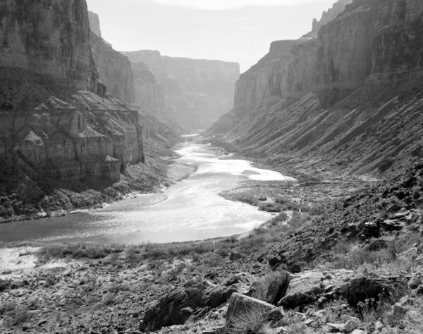
Colorado River in the Grand Canyon
View of Colorado River in the Grand Canyon from overlook. Photo by Jordan Bush, ORISE participant, National USGS CASC.

Repeat photography matching in action
An example of repeat photography in action - A researcher, Jim Malusa of the University of Arizona School of Natural Resources and the Environment, holds a clipboard with a historic photograph captured right at the spot where the image was originally taken in the 1900s, with the same mountain landscape in view.
An example of repeat photography in action - A researcher, Jim Malusa of the University of Arizona School of Natural Resources and the Environment, holds a clipboard with a historic photograph captured right at the spot where the image was originally taken in the 1900s, with the same mountain landscape in view.

Repeat color photograph taken in 2011 of Glen Canyon Dam, a match to the 1889 Stanton Expedition & 1992 USGS images
Repeat color photograph taken in 2011 of Glen Canyon Dam, a match to the 1889 Stanton Expedition & 1992 USGS imagesA USGS repeat photograph of Glen Canyon Dam taken on April 20, 2011 as a match to the 1889 Franklin Nims image of the site before the dam was built, at Colorado River mile -14.7, during the Stanton Expedition. This view was also matched in 1992 by the USGS. The view is taken upstream from river left.
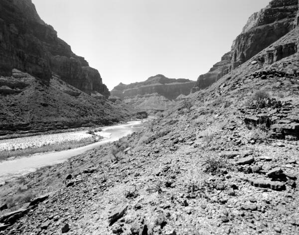
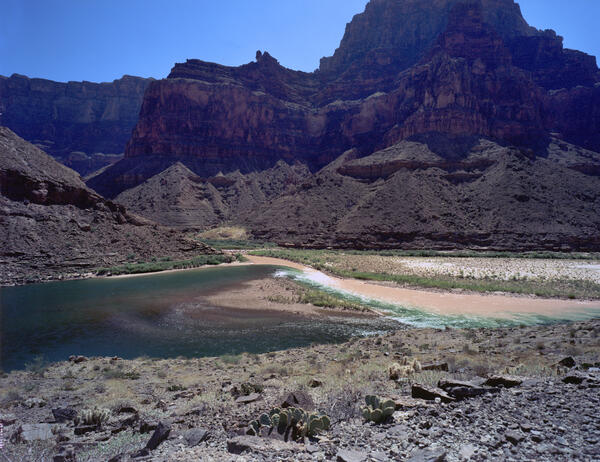
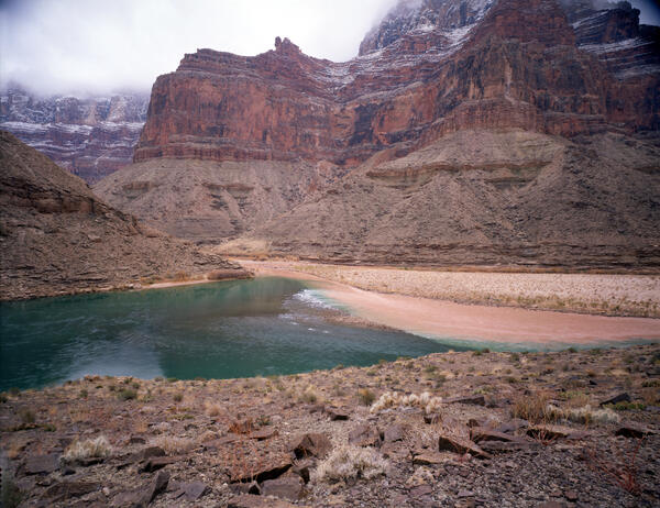
Colorado River, Grand Canyon, River Mile 61.4, Little Colorado River, Downstream View from River Right, 2010
Colorado River, Grand Canyon, River Mile 61.4, Little Colorado River, Downstream View from River Right, 2010September 19, 2010: Colorado River, Grand Canyon, River Mile 61.4, Little Colorado River, Downstream View from River Right. The muddy water of the Little Colorado River can be seen intermixing with the flow of the mainstem Colorado River, which generally runs clear in Marble Canyon due to the sediment-settling that occurs upstream in Lake Powell.
Colorado River, Grand Canyon, River Mile 65.5, Palisades Creek, Across Canyon View from River Left, 2010
Colorado River, Grand Canyon, River Mile 65.5, Palisades Creek, Across Canyon View from River Left, 2010September 19, 2010: Colorado River, Grand Canyon, River Mile 65.5, Palisades Creek, across canyon view from river left. The rapid has not changed in the intervening two decades, and many of the same mesquite thickets are still present on the debris fan in the foreground.
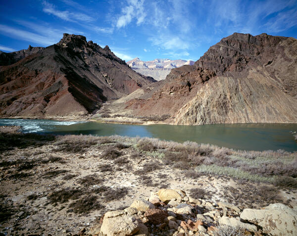
Colorado River, Grand Canyon, River Mile 61.4, Little Colorado River, Across Canyon View from River Right, 2010
Colorado River, Grand Canyon, River Mile 61.4, Little Colorado River, Across Canyon View from River Right, 2010September 19, 2010: Colorado River, Grand Canyon, River Mile 61.4, Little Colorado River, Across Canyon View from River Right. The gravel bars have changed little in their overall location, lower water levels have allowed riparian vegetation to become established on them. The riparian vegetation, mostly tamarisk and arrowweed, has increased in height and density.
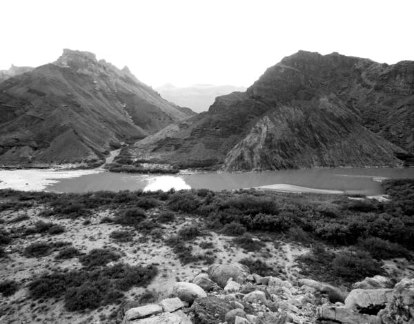
Colorado River, Grand Canyon, River Mile 52.8, Nankoweap Creek, Downstream View from River Right, 2010
Colorado River, Grand Canyon, River Mile 52.8, Nankoweap Creek, Downstream View from River Right, 2010September 18, 2010: Colorado River, Grand Canyon, River Mile 52.8, Nankoweap Creek, Downstream View from River Right. Sandbars continue to decrease in exposed area owing to erosion and establishment of vegetation, both native mesquite and non-native tamarisk.

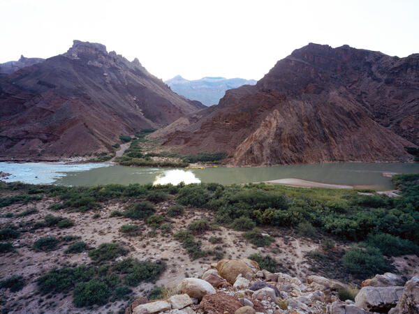
Colorado River, Grand Canyon, River Mile 52.8, Nankoweap, Downstream View from River Right, 2010
Colorado River, Grand Canyon, River Mile 52.8, Nankoweap, Downstream View from River Right, 2010September 18, 2010. Colorado River, Grand Canyon, River Mile 52.8, Nankoweap, Downstream View from River Right. Riparian vegetation continues to increase along the river, reducing the amount of sand that is visible at this distance. There has been a slight increase in the amount of mesquite, but overall it appears to be similar to that present 19 years before.
Colorado River, Grand Canyon, River Mile 52.8, Nankoweap Creek, Downstream View from River Right, 2010
Colorado River, Grand Canyon, River Mile 52.8, Nankoweap Creek, Downstream View from River Right, 2010September 18, 2010: Colorado River, Grand Canyon, River Mile 52.8, Nankoweap Creek, Downstream View from River Right. Sandbars continue to decrease in exposed area owing to erosion and establishment of vegetation, both native mesquite and non-native tamarisk.

Colorado River, Grand Canyon, River Mile 52.8, Nankoweap, Downstream View from River Right, 2010
Colorado River, Grand Canyon, River Mile 52.8, Nankoweap, Downstream View from River Right, 2010September 18, 2010. Colorado River, Grand Canyon, River Mile 52.8, Nankoweap, Downstream View from River Right. Riparian vegetation continues to increase along the river, reducing the amount of sand that is visible at this distance. There has been a slight increase in the amount of mesquite, but overall it appears to be similar to that present 19 years before.
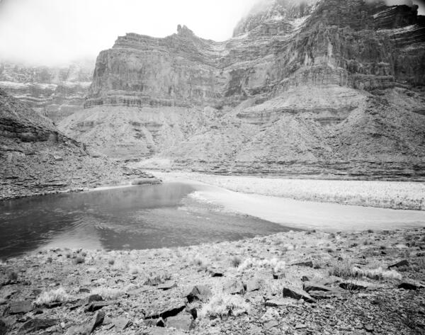
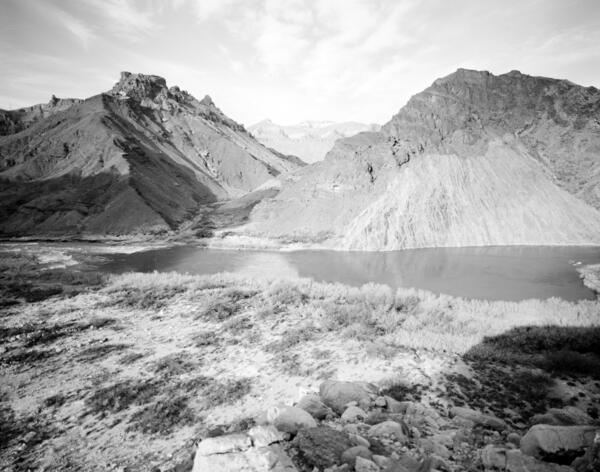
Colorado River, Grand Canyon, River Mile 61.4, Little Colorado River, Across Canyon View from River Right, 1992
Colorado River, Grand Canyon, River Mile 61.4, Little Colorado River, Across Canyon View from River Right, 1992January 5, 1992: Colorado River, Grand Canyon, River Mile 61.4, Little Colorado River, Across Canyon View from River Right. Low clouds and snow blanketed the cliffs opposite the camera station when this image was taken, creating difficult matching conditions.
Colorado River, Grand Canyon, River Mile 65.5, Palisades Creek, Across Canyon View from River Left, 1991
Colorado River, Grand Canyon, River Mile 65.5, Palisades Creek, Across Canyon View from River Left, 1991February 6, 1991: Colorado River, Grand Canyon, River Mile 65.5, Palisades Creek, Across Canyon View from River Left. Lava Canyon Rapid has changed considerably, owing to one or more debris flows over the past century from both sides of the river.
Colorado River, Grand Canyon, River Mile 65.5, Palisades Creek, Across Canyon View from River Left, 1991
Colorado River, Grand Canyon, River Mile 65.5, Palisades Creek, Across Canyon View from River Left, 1991February 6, 1991: Colorado River, Grand Canyon, River Mile 65.5, Palisades Creek, across canyon view from river left. Lava Canyon Rapid has changed considerably, owing to one or more debris flows over the past century from both sides of the river.
Colorado River, Grand Canyon, River Mile 52.8, Nankoweap, Downstream View from River Right, 1991
Colorado River, Grand Canyon, River Mile 52.8, Nankoweap, Downstream View from River Right, 1991February 5, 1991: Colorado River, Grand Canyon, River Mile 52.8, Nankoweap, Downstream View from River Right. The river level is higher than it was in the original photograph, but the sand bars appear to have shifted and eroded; mesquite has increased, but not as much as the non-native tamarisk. Many of the Mormon tea plants visible in 1890 persist. Stake no.
Colorado River, Grand Canyon, River Mile 52.8, Nankoweap, Downstream View from River Right, 1991
Colorado River, Grand Canyon, River Mile 52.8, Nankoweap, Downstream View from River Right, 1991February 5, 1991. Colorado River, Grand Canyon, River Mile 52.8, Nankoweap, Downstream View from River Right. The river level is higher than it was 1890, and overall the amount of sand lining the river has declined or is now covered with riparian vegetation. Some of the sand bars appear to have shifted and aggraded.
Colorado River, Grand Canyon, River Mile 65.5, Palisades Creek, Across Canyon View from River Left, 1990
Colorado River, Grand Canyon, River Mile 65.5, Palisades Creek, Across Canyon View from River Left, 1990Colorado River, Grand Canyon, River Mile 65.5, Palisades Creek, Across Canyon View from River Left. Stake no. s1434 in the Southwest Repeat Photography Collection. Photo by Glenn Rink.
Colorado River, Grand Canyon, River Mile 65.5, Palisades Creek, Across Canyon View from River Left, 1990
Colorado River, Grand Canyon, River Mile 65.5, Palisades Creek, Across Canyon View from River Left, 1990January 24, 1990: Colorado River, Grand Canyon, River Mile 65.5, Palisades Creek, across canyon view from River left. Stake no. s1434 in the Southwest Repeat Photography Collection. Photo by Glenn Rink.
Colorado River, Grand Canyon, River Mile 61.4, Little Colorado River, Downstream View from River Right, 1990
Colorado River, Grand Canyon, River Mile 61.4, Little Colorado River, Downstream View from River Right, 1990January 23, 1990: Colorado River, Grand Canyon, River Mile 61.4, Little Colorado River, Downstream View from River Right. A century later, many of the same plants are still visible, with some mortality and recruitment of the Mormon tea, catclaw, and prickly pear.