


Seismic Station Installation, Hall Ranch, Boulder County Open Space
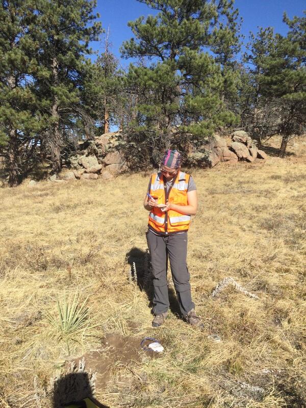
Seismic Station Installation, Hall Ranch, Boulder County Open SpaceUSGS geophysicist Stephanie James records notes as part of seismometer installation at Hall Ranch Open space, Boulder County, Colorado. The seismometer is the partially buried white rectangle near James’s feet.