



Michelle Bouchard (Former Employee)
Science and Products
Filter Total Items: 66
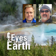
Eyes on Earth Episode 137 – Landsat Takes Yellowstone’s Temperature
How do you keep track of thousands of hot spots in an area the size of Yellowstone National Park? Check out thermal satellite data like Landsat’s!

Eyes on Earth Episode 136 – The EROS Test Site
The same as the Landsat satellite, only smaller—that’s a fair description of the field spectrometer used at the EROS test site for validating Landsat’s accuracy.

Eyes on Earth Episode 135 – Exotic Annual Grasses and Sheep Grazing
Invasive grasses are degrading sagebrush in western states. Can sheep help us restore these ecosystems?

Eyes on Earth Episode 134 – Data Accuracy: The Calibration and Validation of Landsat
Researchers and other satellite programs rely on the scientifically correct data from Landsat—every pixel and every spectral band that is measured.

Eyes on Earth Episode 133 – Vietnam War Bomb Craters
No longer used for spying, declassified spy satellite imagery is finding fascinating new uses.

Eyes on Earth Episode 132 – Moving Forward with AI at EROS
Artificial intelligence (AI) is helping to make the science work at EROS better and more efficient, as we continue to develop valuable data products.

Eyes on Earth Episode 131 – Using AI in Geospatial Work
Artificial intelligence (AI) is helping to make EROS data products better and more efficient.

Eyes on Earth Episode 130 – NLCD Accuracy
Providing accuracy metrics for a land cover map takes some work. But there’s poetry and story involved, too.

Eyes on Earth Episode 129 – What Happens During a Landsat Pass?
For this episode, we go inside the Landsat operations room at EROS to see what happens during a live Landsat pass.

Eyes on Earth Episode 128 – 2024 EROS Fall Poster Session
Posters covered a wide range of topics as local graduate students and EROS scientists shared their work in the EROS atrium.

Eyes on Earth Episode 127 – The Historic Landsat 7 Mission
Taking care of a satellite that’s 438 miles in space requires creative problem solving—we talk about those moments and memories of the nearly 25 years of land imaging from Landsat 7.

Eyes on Earth Episode 126 – Annual NLCD
The next generation of USGS land cover mapping is here. Annual NLCD provides land cover data of the U.S. every year back to 1985.

Landsat 8 Image of Lake St. Clair
Landsat captured the tug of war between winter and spring on the heart-shaped Lake St. Clair along the U.S./Canadian border near Detroit. This Landsat 8 image was acquired on March 6, 2021 and is shown as a natural color composite. Learn more about the Landsat program at www.usgs.gov/landsat
Science and Products
Filter Total Items: 66
Eyes on Earth Episode 137 – Landsat Takes Yellowstone’s Temperature
How do you keep track of thousands of hot spots in an area the size of Yellowstone National Park? Check out thermal satellite data like Landsat’s!
Eyes on Earth Episode 136 – The EROS Test Site
The same as the Landsat satellite, only smaller—that’s a fair description of the field spectrometer used at the EROS test site for validating Landsat’s accuracy.
Eyes on Earth Episode 135 – Exotic Annual Grasses and Sheep Grazing
Invasive grasses are degrading sagebrush in western states. Can sheep help us restore these ecosystems?
Eyes on Earth Episode 134 – Data Accuracy: The Calibration and Validation of Landsat
Researchers and other satellite programs rely on the scientifically correct data from Landsat—every pixel and every spectral band that is measured.
Eyes on Earth Episode 133 – Vietnam War Bomb Craters
No longer used for spying, declassified spy satellite imagery is finding fascinating new uses.
Eyes on Earth Episode 132 – Moving Forward with AI at EROS
Artificial intelligence (AI) is helping to make the science work at EROS better and more efficient, as we continue to develop valuable data products.
Eyes on Earth Episode 131 – Using AI in Geospatial Work
Artificial intelligence (AI) is helping to make EROS data products better and more efficient.
Eyes on Earth Episode 130 – NLCD Accuracy
Providing accuracy metrics for a land cover map takes some work. But there’s poetry and story involved, too.
Eyes on Earth Episode 129 – What Happens During a Landsat Pass?
For this episode, we go inside the Landsat operations room at EROS to see what happens during a live Landsat pass.
Eyes on Earth Episode 128 – 2024 EROS Fall Poster Session
Posters covered a wide range of topics as local graduate students and EROS scientists shared their work in the EROS atrium.
Eyes on Earth Episode 127 – The Historic Landsat 7 Mission
Taking care of a satellite that’s 438 miles in space requires creative problem solving—we talk about those moments and memories of the nearly 25 years of land imaging from Landsat 7.
Eyes on Earth Episode 126 – Annual NLCD
The next generation of USGS land cover mapping is here. Annual NLCD provides land cover data of the U.S. every year back to 1985.
Landsat 8 Image of Lake St. Clair
Landsat captured the tug of war between winter and spring on the heart-shaped Lake St. Clair along the U.S./Canadian border near Detroit. This Landsat 8 image was acquired on March 6, 2021 and is shown as a natural color composite. Learn more about the Landsat program at www.usgs.gov/landsat