
Our scientists are keen on understanding the impact that urban and suburban developments can have on stream habitats.
Tristan G Mohs
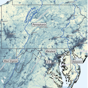
Tristan Mohs is a Physical Scientist for the MD-DE-DC Water Science Center. He has worked for the Center since August of 2018 as both a Hydrologic Technician and a Physical Scientist.
Tristan's research interests include the interdisciplinary nature of wetland, riverine, and stream ecology, specifically when it comes to the habitat and environmental stressors. Currently, Tristan's ongoing research includes topics on habitat ecology, fish health, harmful algal blooms (HABs), and emerging contaminants and he works alongside many other USGS scientists in the Chesapeake Bay watershed.
Science and Products
Evaluating the Risks of Tire-Derived Compounds to Fish in the Chesapeake Bay Watershed
Tires contain a chemical known as 6PPD which prevents them from quickly breaking down. Microscopic tire particles, generated mainly from the friction of tires on roads, release 6PPD-quinone (6PPDQ) when they come into contact with oxygen. During precipitation events, 6PPDQ can be washed off roads, harming fish in nearby waterways. In response to requests from fishery managers, the USGS is studying...

Leveraging Existing USGS Streamgage Data to Map Flood-Prone Areas
We will develop reproducible workflows in R and Python to combine already existing and underutilized field data collected as part of the USGS streamgage network with remotely sensed data to map flood-prone areas for various recurrence intervals in both gaged and ungaged stream reaches.

USGS On the Road - Habitat Assessment at Red Run
Our scientists are keen on understanding the impact that urban and suburban developments can have on stream habitats.

Day in the Life of a USGS Physical Scientist
The USGS is home to many kinds of scientists studying the earth’s hydrology, topography, geography, geology, seismology, volcanology, and more.
In this video, we show you what a day is like for scientists studying a stream’s habitability.
The USGS is home to many kinds of scientists studying the earth’s hydrology, topography, geography, geology, seismology, volcanology, and more.
In this video, we show you what a day is like for scientists studying a stream’s habitability.
")
Swamp Surveillance at Nassawango Creek (AD)
How do land use and best management practices affect the Chesapeake Bay watershed?
To find out, USGS scientists trudge through the muddy swamp of Nassawango Creek on Maryland’s Eastern Shore for a water science partnership with Virginia Tech.
How do land use and best management practices affect the Chesapeake Bay watershed?
To find out, USGS scientists trudge through the muddy swamp of Nassawango Creek on Maryland’s Eastern Shore for a water science partnership with Virginia Tech.

Swamp Surveillance at Nassawango Creek
How do land use and best management practices affect the Chesapeake Bay watershed?
To find out, USGS scientists trudge through the muddy swamp of Nassawango Creek on Maryland’s Eastern Shore for a water science partnership with Virginia Tech.
How do land use and best management practices affect the Chesapeake Bay watershed?
To find out, USGS scientists trudge through the muddy swamp of Nassawango Creek on Maryland’s Eastern Shore for a water science partnership with Virginia Tech.
Science and Products
Evaluating the Risks of Tire-Derived Compounds to Fish in the Chesapeake Bay Watershed
Tires contain a chemical known as 6PPD which prevents them from quickly breaking down. Microscopic tire particles, generated mainly from the friction of tires on roads, release 6PPD-quinone (6PPDQ) when they come into contact with oxygen. During precipitation events, 6PPDQ can be washed off roads, harming fish in nearby waterways. In response to requests from fishery managers, the USGS is studying...
Leveraging Existing USGS Streamgage Data to Map Flood-Prone Areas
We will develop reproducible workflows in R and Python to combine already existing and underutilized field data collected as part of the USGS streamgage network with remotely sensed data to map flood-prone areas for various recurrence intervals in both gaged and ungaged stream reaches.
USGS On the Road - Habitat Assessment at Red Run
Our scientists are keen on understanding the impact that urban and suburban developments can have on stream habitats.
Our scientists are keen on understanding the impact that urban and suburban developments can have on stream habitats.
Day in the Life of a USGS Physical Scientist
The USGS is home to many kinds of scientists studying the earth’s hydrology, topography, geography, geology, seismology, volcanology, and more.
In this video, we show you what a day is like for scientists studying a stream’s habitability.
The USGS is home to many kinds of scientists studying the earth’s hydrology, topography, geography, geology, seismology, volcanology, and more.
In this video, we show you what a day is like for scientists studying a stream’s habitability.
Swamp Surveillance at Nassawango Creek (AD)
How do land use and best management practices affect the Chesapeake Bay watershed?
To find out, USGS scientists trudge through the muddy swamp of Nassawango Creek on Maryland’s Eastern Shore for a water science partnership with Virginia Tech.
How do land use and best management practices affect the Chesapeake Bay watershed?
To find out, USGS scientists trudge through the muddy swamp of Nassawango Creek on Maryland’s Eastern Shore for a water science partnership with Virginia Tech.
Swamp Surveillance at Nassawango Creek
How do land use and best management practices affect the Chesapeake Bay watershed?
To find out, USGS scientists trudge through the muddy swamp of Nassawango Creek on Maryland’s Eastern Shore for a water science partnership with Virginia Tech.
How do land use and best management practices affect the Chesapeake Bay watershed?
To find out, USGS scientists trudge through the muddy swamp of Nassawango Creek on Maryland’s Eastern Shore for a water science partnership with Virginia Tech.