
Upper Midwest Water Science Center Great Waters Newsletter: Fall/Winter 2025/2026

Welcome to the Winter edition of the Upper Midwest Water Science Center Great Waters Newsletter.
In this issue, you'll see a range of topics that highlight the work we’ve done in the past year:
- Our response to the August 2025 flooding in Milwaukee, Wisconsin
- A feature on our Center’s laboratory capabilities
- A rebrand of the Mercury Research Laboratory to M3: Mercury, trace Metals/elements and Microplastics
- Technology highlights: a decision support software tool and training on an open-source flood monitoring hardware
- An upcoming Airborne Electromagnetic Survey in Michigan
- Our annual holiday social media streamgage countdown
Our staff continue to excel at executing USGS's mission. Our scientists and data technicians published 72 papers, 26 data releases, 2 software releases, and thousands of additional hydrologic data points in fiscal year 2025 that stemmed from partnerships with cooperators across Minnesota, Wisconsin and Michigan
We maintain streamgages that provide a wide range of data such as stream height, discharge, and water temperature as well as specialty parameters such as specific conductivity, pH, and turbidity to real-time nitrogen and phosphorus.
In the year ahead, we remain focused on helping our cooperators across our three States and across the Nation meet their water science needs.
Review our capabilities, and reach us at ask_umid@usgs.gov.
We're looking forward to serving you in 2026!
Sincerely,
Steve Peterson
Director, USGS Upper Midwest Water Science Center
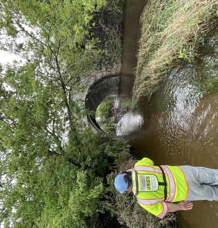
USGS Response to August 2025 Milwaukee Floods
A severe storm system brought up to 14 inches of rainfall to the Milwaukee, Wisconsin area on August 9–10, 2025, triggering widespread flooding across local waterways.
What’s in the water? USGS has the answer!
What’s in the water at the beach where I’m swimming? What’s in the water I’m drinking? What’s in the water where I’m fishing?
Groundwater Decision Support Software Release
In the Great Lakes Region, water is abundant and is a key driver for economic benefit through its many uses, including public supply, industry, and agriculture. Groundwater and surface water systems are tightly connected in the region, with groundwater supplying water to lakes and streams – particularly in times of lower rainfall.
Mercury, trace Metals/elements and Microplastics (M3) Laboratory
Social Media Spotlight: 2025 Holiday Streamgage Countdown
This December, we celebrated the holiday season on our social media platforms with our annual 12 Streamgages of Christmas countdown!

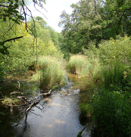
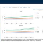
From Stream to Spider: How PFAS Move Through Aquatic and Terrestrial Food Webs
Per- and polyfluoroalkyl substances (PFAS) are persistent synthetic chemicals that accumulate in the environment and living organisms. A USGS study examined how different PFAS compounds move through a stream ecosystem and are transferred from aquatic to terrestrial food webs. The findings documented that not all PFAS behave the same once they enter the environment, leading to differences in...
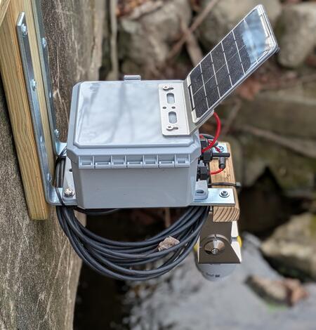
USGS scientists explore how open-source tools can support better flood prediction and research
How can we monitor more rivers, more affordably, without sacrificing data quality?
Science Spotlights
New or ongoing research projects at the Upper Midwest Water Science Center
-
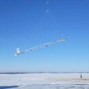
Airborne Electromagnetic (AEM) Surveys for Southwest Michigan, 2026-2027
In partnership with the Michigan Department of Environment, Great Lakes, and Energy (EGLE), the U.S. Geological Survey (USGS) is conducting an Airborne Electromagnetic (AEM) Survey project in Southwestern Michigan during 2026 and 2027.
-

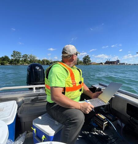
Great Lakes Water Authority Detroit Regional Water Quality Monitoring Program
The Great Lakes Water Authority Detroit Regional Water Quality Monitoring Program provides current and accurate water quality data to track progress toward water quality standard milestones and document long-term trends.
-
Investigating Links between Chloride and Harmful Algal Blooms in the Great Lakes
The USGS is investigating links between chloride concentrations in Great Lakes tributaries as a catalyst for Harmful Algal Blooms (HABs).
-

Bad River Watershed Assessments
The Bad River has one of the highest sediment loads of all Lake Superior tributaries and is an important resource for lake sturgeon and the Bad River Tribe. This study monitors the effects of streamflow variability on sediment-related problems, including understanding the influence of land cover on hydrology, habitat, erosion and sedimentation rates, and water quality of the Bad River.
Photos from the field
Our scientists conduct field work year-round to support their research. See where their projects took them this fall.
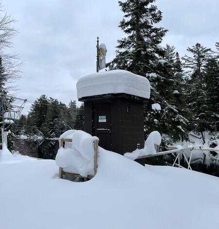
Acoustic Doppler current profiler (ADCP) at Rock River in Watertown, Wisconsin on a winter day
Acoustic Doppler current profiler (ADCP), attached to a cable, measures streamflow in the middle of Rock River in Watertown, Wisconsin on a winter day.Rock River at Watertown, WI - USGS Water Data for the Nation
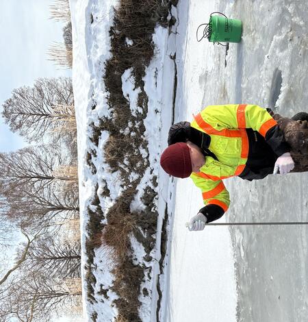
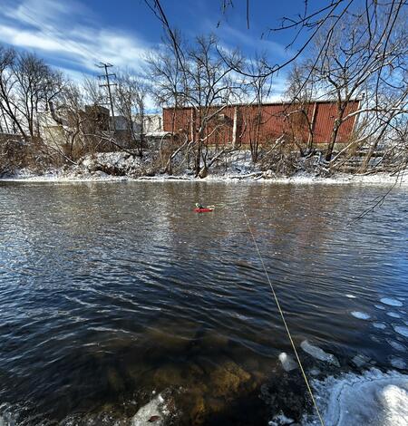
Hydrologic technician collects water sample through hole in ice on frozen River Rouge at Detroit, Michigan
Hydrologic technician Jake Fagerstrom collects a water sample through hole in ice on the frozen River Rouge at Detroit, Michigan.https://waterdata.usgs.gov/monitoring-location/USGS-04166500/
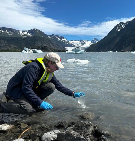
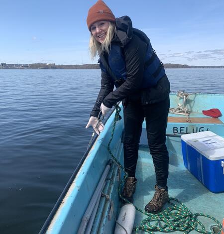
Collecting a surface water sample from Grewingk Glacer Lake in Alaska
Hydrologist Laura Flucke collects a surface water sample from Grewingk Glacer Lake in Alaska to understand glacial inputs of mercury.
Publications
Read our most recent publications
-

Publications Publications
This list of Upper Midwest Water Science Center publications spans from 1899 to present. It includes both official USGS publications and journal articles authored by our scientists. To access the full, searchable catalog of USGS publications, please visit the USGS Publications Warehouse.
Connect with us

Social Media
Follow the activities of the Upper Midwest Water Science Center on your favorite social media platforms.
Connect
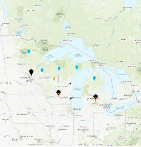
The Upper Midwest Water Science Center covers the water resources of Michigan, Minnesota, and Wisconsin. With offices and staff in all three states, we are uniquely poised to address the monitoring and science needs at local, state, regional, and national levels. Our staff consists of scientists, technicians, and support personnel who are committed to providing accurate and timely information.
Locations
Reach us at our main, project and field offices, as well as our laboratories, below.