
Upper Midwest Water Science Center Great Waters Newsletter: Spring 2026
News
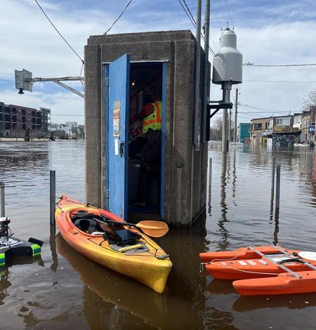
USGS Response to April 2026 Michigan and Wisconsin Floods
In mid-to late April 2026, Michigan and Wisconsin faced one of the wettest springs on record, as rapid snowmelt combined with sustained, record‑breaking rainfall produced widespread flooding across rivers and streams.
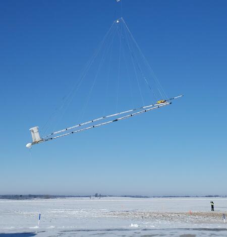
Media Advisory: USGS Announces Low-Level Flights to Image Geology and Aquifers in Southwest Michigan
In the public interest and in accordance with Federal Aviation Administration regulations, the U.S. Geological Survey is announcing the start of a low-level airborne project in Southwest Michigan. Your assistance in informing the local communities is appreciated.
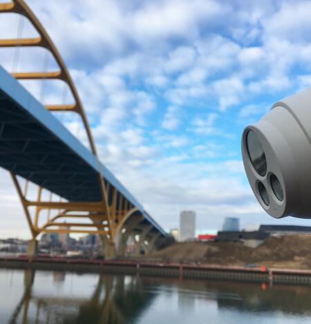
1,000 Cameras and Counting
The USGS Hydrologic Imagery Visualization and Information System (HIVIS) now has more than 1,000 active webcams providing remote visibility of current water conditions. This real-time imagery supports water science and public safety nationwide.
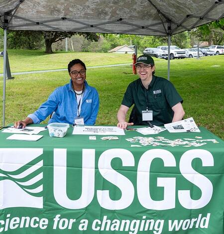
Earth Day 2026 at the Eastern Ecological Science Center
Earth Day 2026 at the USGS Eastern Ecological Science Center (EESC) was a celebration of science, discovery and community connection.
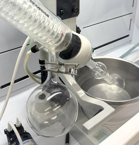
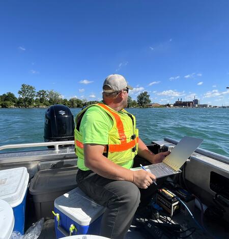
Building Cross‑Lab Expertise to Advance Cyanotoxin Detection
Scientists from the Michigan Bacteriological Research Laboratory (MI‑BaRL) in Lansing, Michigan recently partnered with the M3 Research Laboratory in Madison, Wisconsin, to optimize and validate new methods for detecting cyanotoxins in aquatic plants.
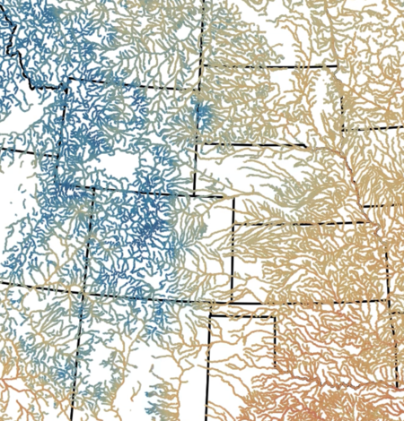
Hot spots and cold snaps: Daily stream temperature data across the U.S. from 1979-2021
USGS scientists recently published four decades of modeled daily stream temperature values for nearly 60,000 river reaches across the lower 48 United States
Science Spotlights
New or ongoing research projects at the Upper Midwest Water Science Center
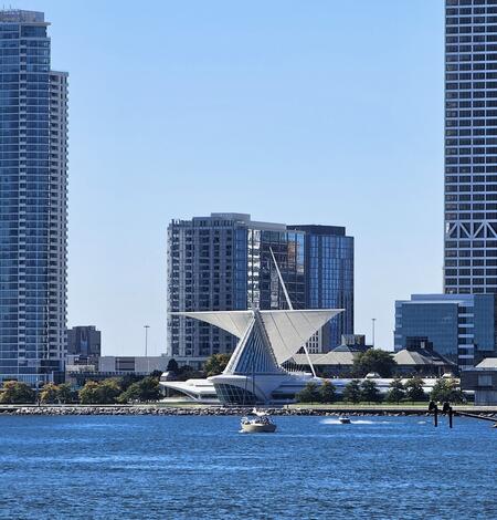
Oscillating Flows in the Milwaukee River Estuary
How do Lake Michigan water level variations and seiches affect the Milwaukee River estuary, its harbor, and rivers upstream?
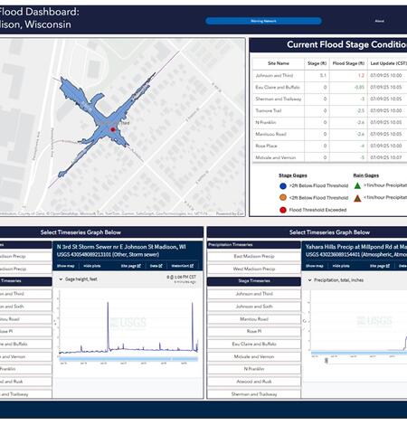
Low-Cost Sensor Networks for Pluvial Flash Flood Detection and Early Warning in Urban Areas
Flooding in urban areas is a serious weather-related threat to life and property. One type of flooding, called pluvial flooding, occurs during periods of intense rainfall where runoff overwhelms the capacity of soil to absorb it. In urban areas, pluvial flooding can be particularly dangerous because much of a city is covered by impervious surfaces such as streets, roofs, and parking lots forcing...
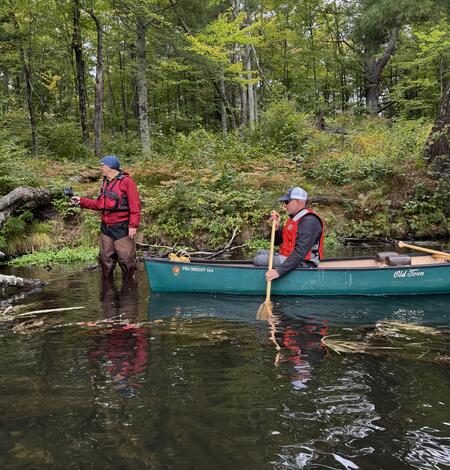
Thermal Imagery to Inform Brook Trout Habitat Suitability and Restoration Potential, Upper Namekagon River, Wisconsin
The U.S. Geological Survey (USGS), in cooperation with the National Park Service (NPS), is using thermal infrared technology to identify cold-water habitat for brook trout and other cold-water species in the upper Namekagon River in Wisconsin. The upper Namekagon River and its tributaries have long served as a stronghold for brook trout and other cold- and cool-water species; however, changing...
Making connections in the community
Conferences and career fairs
-

USGS Scientists Connect with Future Freshwater Professionals at UW–Milwaukee Career Fair USGS Scientists Connect with Future Freshwater Professionals at UW–Milwaukee Career Fair
Upper Midwest Water Science Center scientists attended the University of Wisconsin-Milwaukee School of Freshwater Sciences Career and Networking Fair.
-
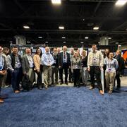
USGS attends the ESRI Federal Geographic Information Systems 2026 Conference USGS attends the ESRI Federal Geographic Information Systems 2026 Conference
Members of the Web Informatics and Mapping (WIM) team represented the USGS at a booth at the ESRI Federal Geographic Information Systems (GIS) Conference in Washington, DC.
-
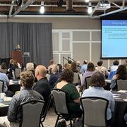
USGS attends the Wisconsin chapter of the American Water Resources Association 2026 Conference USGS attends the Wisconsin chapter of the American Water Resources Association 2026 Conference
USGS attended the 2026 Wisconsin American Water Resources Association conference in Brookfield, Wisconsin, April 9th and 10th.
-
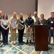
USGS presents at the Minnesota Groundwater Association annual conference USGS presents at the Minnesota Groundwater Association annual conference
The Spring 2026 Minnesota Ground Water Association (MGWA) conference took place on April 23rd at the Heritage Center in Brooklyn Center, Minnesota.
Publications
Read our most recent publications
-

Publications Publications
This list of Upper Midwest Water Science Center publications spans from 1899 to present. It includes both official USGS publications and journal articles authored by our scientists. To access the full, searchable catalog of USGS publications, please visit the USGS Publications Warehouse.
View our most recent data releases
-
-
Data Data
The Upper Midwest Water Science Center collects, analyzes, and distributes data on a variety of water-related issues and resources. Much of our data is publicly available through the USGS National Water Information System (NWIS).
Connect with us

Social Media
Follow the activities of the Upper Midwest Water Science Center on your favorite social media platforms.
Connect
The Upper Midwest Water Science Center covers the water resources of Michigan, Minnesota, and Wisconsin. With offices and staff in all three states, we are uniquely poised to address the monitoring and science needs at local, state, regional, and national levels. Our staff consists of scientists, technicians, and support personnel who are committed to providing accurate and timely information.
Locations
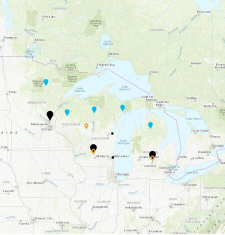
Reach us at our main, project and field offices, as well as our laboratories, below.