U.S. flag

An official website of the United States government

Images

Kīlauea images of eruptive activity, field work, and more.

Filter Total Items: 3251
An incandescent red lava flow covers a large area of a crater floor
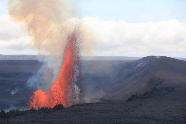
Episode 43 of the Kīlauea summit eruption

Episode 43, which began at 9:17 a.m. HST on March 10, erupted for just over 9 hours before pausing again at 6:21 p.m. This panoramic view of episode 43 lava flows on Halema‘uma‘u crater floor was taken a few minutes after the fountaining stopped. USGS photo taken by L. DeSmither near Keanakāko‘i on the southeast rim of the caldera.

Episode 43, which began at 9:17 a.m. HST on March 10, erupted for just over 9 hours before pausing again at 6:21 p.m. This panoramic view of episode 43 lava flows on Halema‘uma‘u crater floor was taken a few minutes after the fountaining stopped. USGS photo taken by L. DeSmither near Keanakāko‘i on the southeast rim of the caldera.

Color microscope photograph of ash
March 10, 2026 — Ash that fell in Hilo during episode 43 at Kīlauea

Microscopic images of Pele's hair and ash deposited in Hilo during Kīlauea's episode 43 fountains on March 10, 2026. The area in the center shows a bubble wall that was cooled and preserved. UHH/USGS photo by L. Gallant.

Microscopic images of Pele's hair and ash deposited in Hilo during Kīlauea's episode 43 fountains on March 10, 2026. The area in the center shows a bubble wall that was cooled and preserved. UHH/USGS photo by L. Gallant.

Color photograph of road covered with volcanic fallout
March 10, 2026 — Edge of episode 43 (Kīlauea) tephra deposit

Episode 43 of Kīlauea's ongoing eruption occurred on March 10, 2026. This photo is taken on the Mauna Loa Road within Hawai‘i Volcanoes National Park, looking northwest. This photo shows the edge of the episode 43 tephra deposit.

Episode 43 of Kīlauea's ongoing eruption occurred on March 10, 2026. This photo is taken on the Mauna Loa Road within Hawai‘i Volcanoes National Park, looking northwest. This photo shows the edge of the episode 43 tephra deposit.

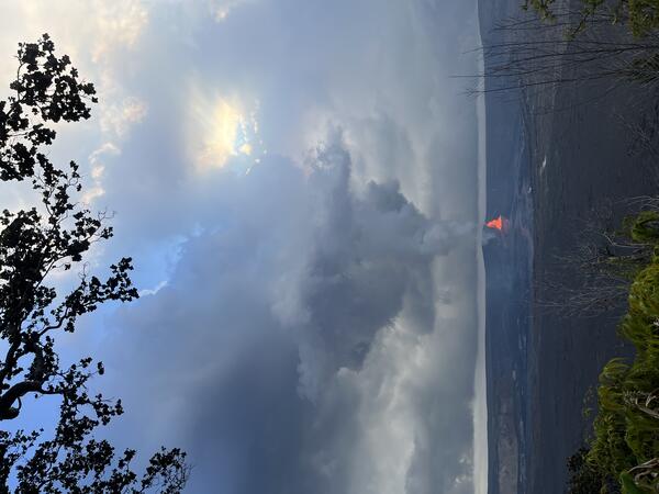
Color photograph of volcanic plume
March 10, 2026 — Kīlauea episode 43 lava fountains seen from Footprints Trail

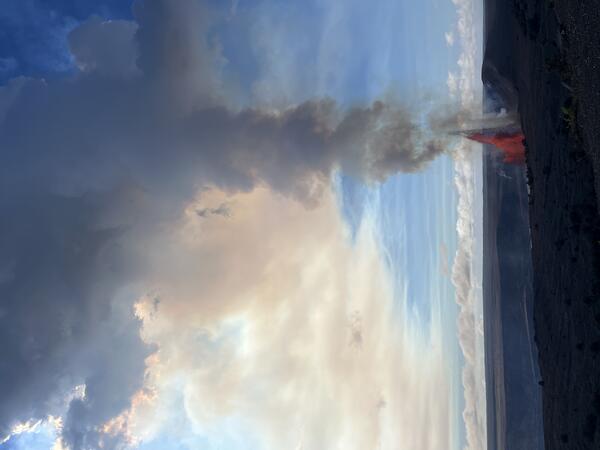
Episode 43 of Kīlauea's ongoing summit eruption started at 9:17 a.m. H.S.T. on March 11, 2026. This photo was taken at noon from the Footprints Trail looking east. This site is nearly 6 miles (9 miles) from north and south vents. The fountain from south vent is clearly visible, along with towering volcanic plume.

Episode 43 of Kīlauea's ongoing summit eruption started at 9:17 a.m. H.S.T. on March 11, 2026. This photo was taken at noon from the Footprints Trail looking east. This site is nearly 6 miles (9 miles) from north and south vents. The fountain from south vent is clearly visible, along with towering volcanic plume.

Large white plume of volcanic gas and steam rising from lava fountains in a crater
Episode 43 of the Kīlauea summit eruption

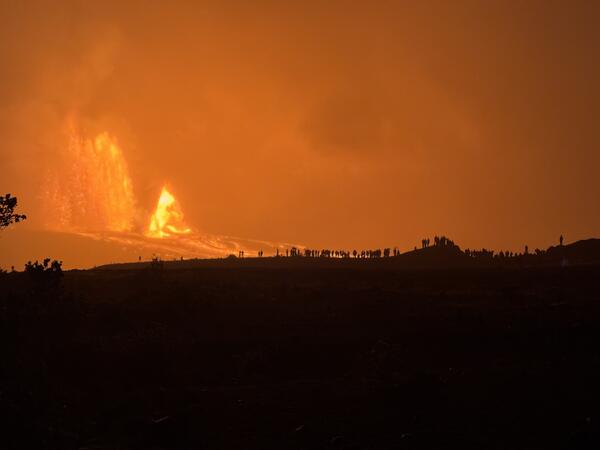
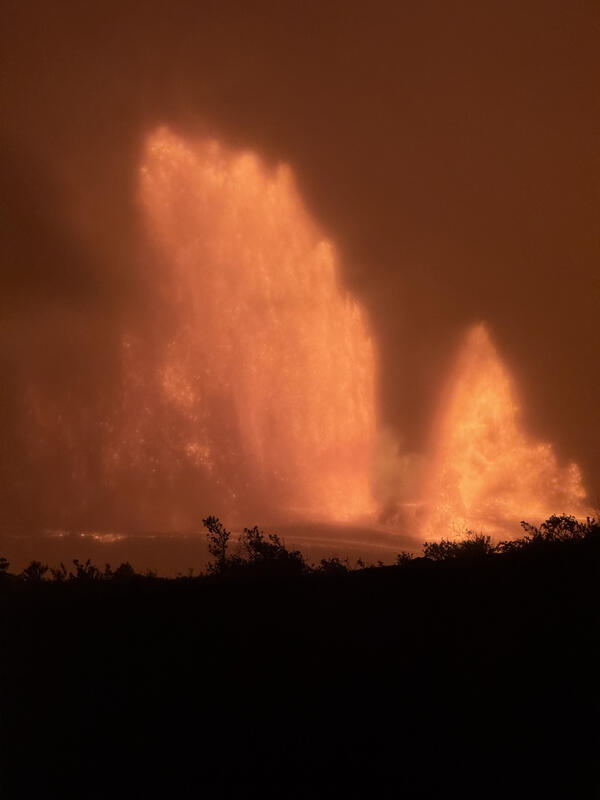
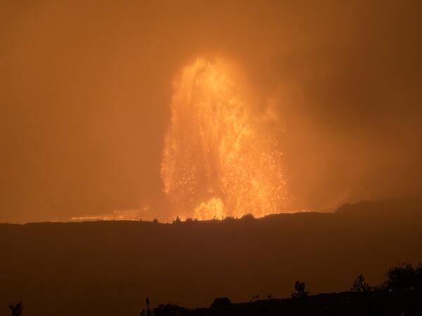
Episode 43 of the ongoing Kīlauea summit eruption occurred on March 10. Lava fountains from the north and south vents on the western side of Halema‘uma‘u crater floor produced a large eruption plume of volcanic gases and rock fragments (tephra).

Episode 43 of the ongoing Kīlauea summit eruption occurred on March 10. Lava fountains from the north and south vents on the western side of Halema‘uma‘u crater floor produced a large eruption plume of volcanic gases and rock fragments (tephra).

Color flyer promoting a website to report if tephra is falling
Flyer: Is Tephra Falling?

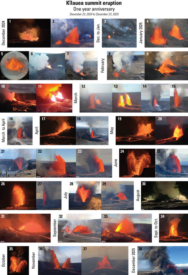
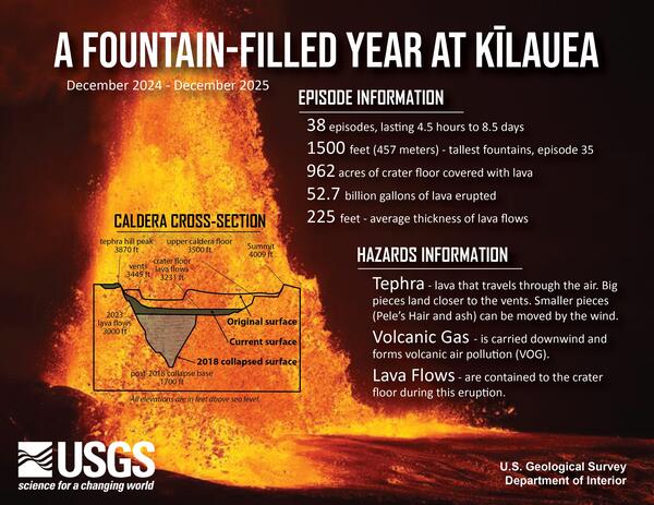
Kīlauea has erupting episodically within Hawaiʻi Volcanoes National Park since December 23, 2024. While lava flows are contained to the caldera, tephra fallout from the lava fountains can affect communities downwind. Tephra is any material erupted from a volcano that travels through the air and it includes volcanic ash, Pele's hair, and other larger tephra

Kīlauea has erupting episodically within Hawaiʻi Volcanoes National Park since December 23, 2024. While lava flows are contained to the caldera, tephra fallout from the lava fountains can affect communities downwind. Tephra is any material erupted from a volcano that travels through the air and it includes volcanic ash, Pele's hair, and other larger tephra

Color map of recent eruption location
March 2, 2026—Kīlauea summit eruption reference map

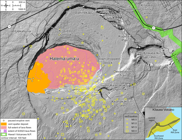
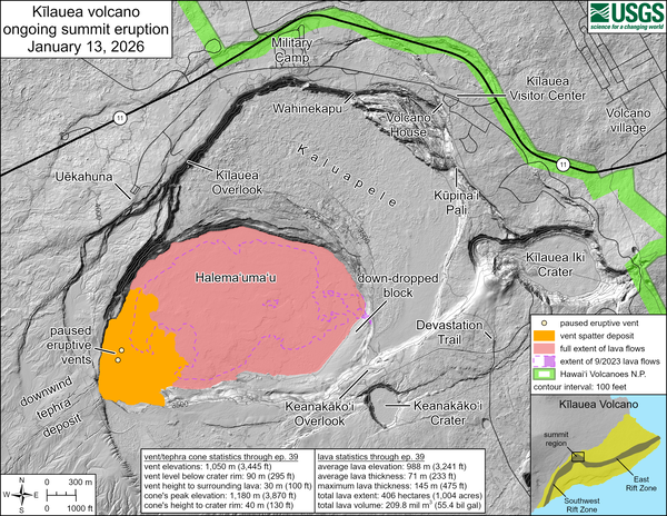
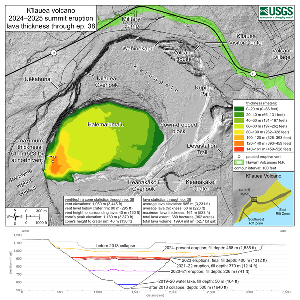
This reference map depicts the Kīlauea summit eruption within Halema‘uma‘u crater that began on December 23, 2024. As of this posting on March 2, 2026, the eruption has had forty-two episodes, with the most recent occurring on February 15.

This reference map depicts the Kīlauea summit eruption within Halema‘uma‘u crater that began on December 23, 2024. As of this posting on March 2, 2026, the eruption has had forty-two episodes, with the most recent occurring on February 15.

Color photograph of volcanic vents degassing
February 26, 2026 — Low pass over eruptive vents at the summit of Kīlauea

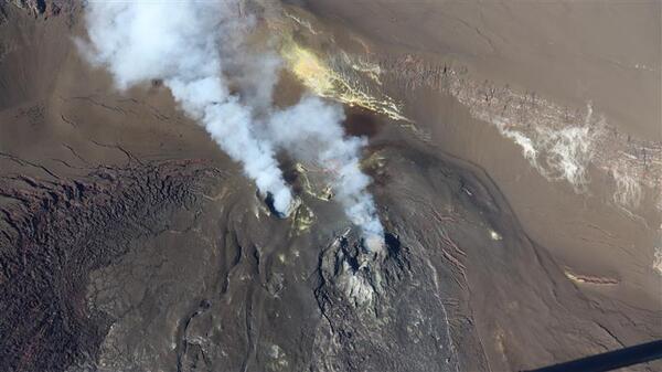
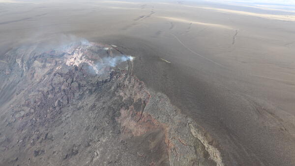
Despite hazy conditions on Thursday, February 26, the USGS Hawaiian Volcano Observatory monitoring overflight crew had clear views of the Kīlauea summit eruptive vents during a low pass over western Halema‘uma‘u crater. No lava or incandescence was visible in either the north (lower-right) or south (upper-left) vent. USGS photo by M. Zoeller.

Despite hazy conditions on Thursday, February 26, the USGS Hawaiian Volcano Observatory monitoring overflight crew had clear views of the Kīlauea summit eruptive vents during a low pass over western Halema‘uma‘u crater. No lava or incandescence was visible in either the north (lower-right) or south (upper-left) vent. USGS photo by M. Zoeller.

Color photograph of scientist collecting sample of lava flow
February 26, 2026 — Sampling on Halemaʻumaʻu crater floor, Kīlauea summit

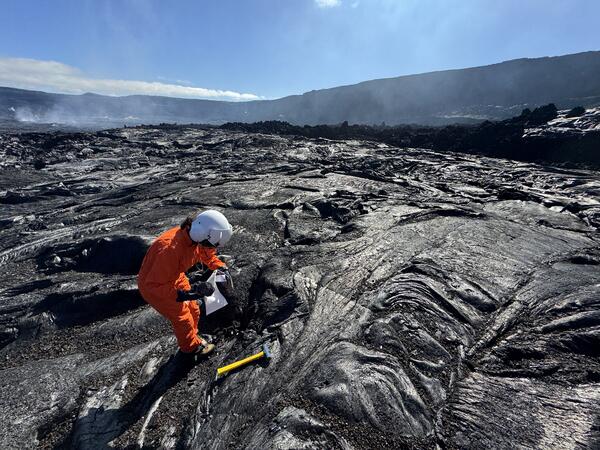
A USGS Hawaiian Volcano Observatory geologist collects a cooled lava sample from the front of the episode 42 lava flow on Halema‘uma‘u crater floor at Kīlauea summit. The chemistry of these lava samples is analyzed to better understand the magmatic plumbing system and inform our understanding of eruptive hazards. USGS photo by M. Patrick.

A USGS Hawaiian Volcano Observatory geologist collects a cooled lava sample from the front of the episode 42 lava flow on Halema‘uma‘u crater floor at Kīlauea summit. The chemistry of these lava samples is analyzed to better understand the magmatic plumbing system and inform our understanding of eruptive hazards. USGS photo by M. Patrick.

Color map showing temperature of crater floor
February 26, 2026 — Thermal maps of Kīlauea summit in February 2026

These thermal maps at the summit of Kīlauea show the crater floor after episodes 41 and 42. Episode 41 produced a lava flow that covered much of the eastern crater floor, while episode 42 produced flows that stopped short of reaching the eastern edge of the crater floor. 

These thermal maps at the summit of Kīlauea show the crater floor after episodes 41 and 42. Episode 41 produced a lava flow that covered much of the eastern crater floor, while episode 42 produced flows that stopped short of reaching the eastern edge of the crater floor. 

Color photograph of misty volcanic crater
February 26, 2026 — Halemaʻumaʻu overflight, Kīlauea summit

USGS Hawaiian Volcano Observatory (HVO) geologists on a routine KILAUEA summit monitoring helicopter overflight on Thursday, February 26, collected visual and thermal images to map out the changes on the crater floor following episode 42 lava fountaining at KILAUEA summit that took place on February 15, 2026.

USGS Hawaiian Volcano Observatory (HVO) geologists on a routine KILAUEA summit monitoring helicopter overflight on Thursday, February 26, collected visual and thermal images to map out the changes on the crater floor following episode 42 lava fountaining at KILAUEA summit that took place on February 15, 2026.

Color photograph of volcanic crater degassing
February 26, 2026 — Overview of Halema‘uma‘u

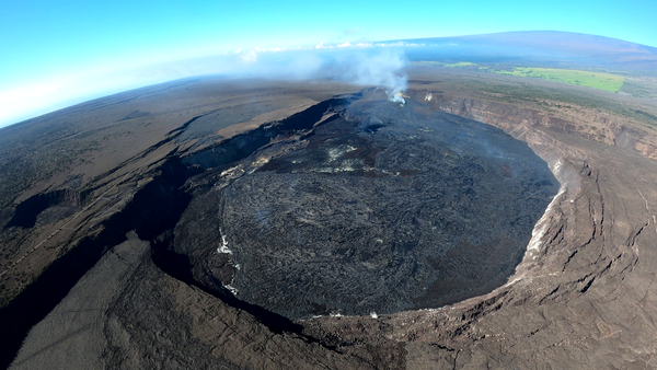
On Thursday, February 26, USGS Hawaiian Volcano Observatory scientists completed a monitoring helicopter overflight of Halema‘uma‘u crater at the summit of Kīlauea.

On Thursday, February 26, USGS Hawaiian Volcano Observatory scientists completed a monitoring helicopter overflight of Halema‘uma‘u crater at the summit of Kīlauea.

Color photograph of scientist assembling gear on lava flows located on crater floor
February 26, 2026 — Sampling on Halemaʻumaʻu crater floor, Kīlauea summit

At the end of their Kīlauea summit overflight on Thursday, February 26, two USGS Hawaiian Volcano Observatory geologists were dropped off on the floor of Halema‘uma‘u crater to sample lava from summit eruption episode 42 on February 15.

At the end of their Kīlauea summit overflight on Thursday, February 26, two USGS Hawaiian Volcano Observatory geologists were dropped off on the floor of Halema‘uma‘u crater to sample lava from summit eruption episode 42 on February 15.

Color photograph of field engineer servicing a livestream camera with volcanic vents degassing in the background
February 26, 2026 — Updating the V3 livestreaming camera, Kīlauea summit

On February 26, 2026, USGS Hawaiian Volcano Observatory staff visited and serviced the V3 livestreaming camera on the south rim of Halemaʻumaʻu crater, at the summit of Kīlauea. USGS photo by M. Patrick. 

On February 26, 2026, USGS Hawaiian Volcano Observatory staff visited and serviced the V3 livestreaming camera on the south rim of Halemaʻumaʻu crater, at the summit of Kīlauea. USGS photo by M. Patrick. 

Color photograph showing fallout area from volcanic eruption
February 18, 2026 — Kīlauea lava flow and tephra fall map following episode 24

This map shows lava flow and tephra accumulation at the summit of Kīlauea volcano associated with episode 42 of the ongoing eruption in Halemaʻumaʻu that started on December 23, 2024, using data recorded by the Italian Space Agency's (ASI) COSMO-SkyMed Second Generation satellite constellation.

This map shows lava flow and tephra accumulation at the summit of Kīlauea volcano associated with episode 42 of the ongoing eruption in Halemaʻumaʻu that started on December 23, 2024, using data recorded by the Italian Space Agency's (ASI) COSMO-SkyMed Second Generation satellite constellation.

Color photograph of strands of volcanic glass in a hand
February 17, 2026 — Kīlauea episode 42 Pele's hair in Pāhala

Long strands of Pele's hair, which is made of volcanic glass, drifted on the wind to the southwest during episode 42 of Kīlauea summit lava fountaining on February 15, 2026. This photo shows a bundle of these long strands of Pele's hair after they had blown around in the wind in the community of Pāhala and became tangled up. USGS photo by D. Downs.

Long strands of Pele's hair, which is made of volcanic glass, drifted on the wind to the southwest during episode 42 of Kīlauea summit lava fountaining on February 15, 2026. This photo shows a bundle of these long strands of Pele's hair after they had blown around in the wind in the community of Pāhala and became tangled up. USGS photo by D. Downs.

Color photograph showing volcanic material accumulated on vehicle
February 16, 2026 — Kīlauea episode 42 ash in Pāhala

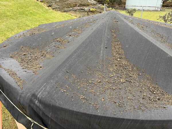
Tephra accumulated in the community of Pāhala, about 18.5 miles (30 km) to the southwest of north and south vents in Halema‘uma‘u crater at the summit of Kīlauea. A few hours after episode 42 started on February 15, 2026, fine ash of less than 0.03 inch (1 mm) diameter began to accumulate on surfaces.

Tephra accumulated in the community of Pāhala, about 18.5 miles (30 km) to the southwest of north and south vents in Halema‘uma‘u crater at the summit of Kīlauea. A few hours after episode 42 started on February 15, 2026, fine ash of less than 0.03 inch (1 mm) diameter began to accumulate on surfaces.

Color telephoto of lava fountain
February 15, 2026 — Kīlauea episode 42 lava fountains

A telephoto view of the south vent fountain, taken from the south rim of Halema‘uma‘u crater at night on February 15, 2026. Molten clasts falling near the base of the fountain were feeding a channelized flow that carried lava into the eastern portion of the crater.

A telephoto view of the south vent fountain, taken from the south rim of Halema‘uma‘u crater at night on February 15, 2026. Molten clasts falling near the base of the fountain were feeding a channelized flow that carried lava into the eastern portion of the crater.

Color photograph of two lava fountains at night
February 15, 2026 — Kīlauea night time lava fountains during episode 42

This night-time photo shows north and south vent lava fountains at the summit of Kīlauea, from the south rim of the Halema‘uma‘u crater. The south fountain (left) was fluctuating in height over timescales of seconds. At the bottom of the photo, a spatter-fed ‘a‘ā flow slowly advances, with clinker collapsing along its front. USGS photo by M. Patrick.

This night-time photo shows north and south vent lava fountains at the summit of Kīlauea, from the south rim of the Halema‘uma‘u crater. The south fountain (left) was fluctuating in height over timescales of seconds. At the bottom of the photo, a spatter-fed ‘a‘ā flow slowly advances, with clinker collapsing along its front. USGS photo by M. Patrick.

Color photograph of lava fountain
February 15, 2026 — Semi-molten clasts falling from the north vent feed into Kīlauea lava flow during episode 42

Photograph of the north vent fountain during episode 42, taken from the northwest rim of Halema‘uma‘u crater on February 15, 2026. Semi-molten clasts feed a small ‘a‘ā lava flow carrying lava north from the base of the north vent lava fountain within the caldera.

Was this page helpful?