
U.S. flag

An official website of the United States government

Western Geographic Science Center

The WGSC is responsible for research and applications to understand coupled human-environmental systems in the face of land change and delivering pertinent information to decision makers on the vulnerability and resilience of these systems.  WGSC scientists collaborate with partners to advance the goals of the USGS Core Science Systems and Ecosystems Mission Areas and their programs. 

News

Dr. Pardhasaradhi Teluguntla receives ESRI's Award for Best Scientific Paper in GIS -1st Place

Dr. Pardhasaradhi Teluguntla receives ESRI's Award for Best Scientific Paper in GIS -1st Place

Earth Science Matters - Vol. 21 | Issue 1

Earth Science Matters - Vol. 21 | Issue 1

WGSC cloud-based tidal marsh biomass mapping tool

WGSC cloud-based tidal marsh biomass mapping tool

Publications

Hyperspectral narrowband imaging spectroscopy: A new paradigm for Earth observation Hyperspectral narrowband imaging spectroscopy: A new paradigm for Earth observation

This editorial introduces the Special Issue entitled “Hyperspectral Narrowband Imaging Spectroscopy: A New Paradigm for Earth Observation” in the August 2026 issue of Photogrammetric Engineering & Remote Sensing (PE&RS), the flagship journal of the American Society for Photogrammetry and Remote Sensing (ASPRS). This volume represents the fourth dedicated hyperspectral special issue...
Authors
Prasad Thenkabail, Itiya Aneece, Pardasaradhi Teluguntla

Multi-temporal mapping and analyses of post-wildfire surface soil moisture modeled from Landsat Thermal-IR and Sentinel-1 SAR Multi-temporal mapping and analyses of post-wildfire surface soil moisture modeled from Landsat Thermal-IR and Sentinel-1 SAR

Wildfires alter surface soil moisture by consuming vegetation and exposing the soil to increased solar radiation, increased precipitation throughfall, and reduced infiltration from soil hydrophobicity. This can affect the water balance within the watershed and, in turn, influence post-fire nutrient cycling and ecosystem succession. Modeling surface soil moisture over large areas using...
Authors
Britt Windsor Smith, Miguel L. Villarreal, Christopher E. Soulard, Joshua W. von Nonn

Comparing DESIS hyperspectral and Landsat 10 simulated superspectral data for crop type classification in California's Central Valley Comparing DESIS hyperspectral and Landsat 10 simulated superspectral data for crop type classification in California's Central Valley

To advance crop type mapping in support of global food and water security, this study compared three spectral configurations: (A) the full 60-band DLR Earth Sensing Imaging Spectrometer (DESIS) hyperspectral narrowband (HNB) dataset, (B) a 14-band subset of DESIS-derived HNBs aligned with the planned Landsat 10 (formerly Landsat Next) spectral configuration (400–1000 nm), and (C) DESIS...
Authors
Itiya Aneece, Prasad Thenkabail, Pardhasaradhi Teluguntla, Adam Oliphant, Daniel Foley, Jake Dylan Lawton

Science

New Tools for Modern Land Management Decisions
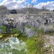
In an era of rapid land use changes, it is imperative that land managers and policymakers have actionable and current information available for decision processes. In this work, we seek to meet these needs through new data products and decision support tools built on digital soil mapping, new vegetation cover maps, agency inventory and monitoring data sets, and cutting-edge analytical frameworks...
New Tools for Modern Land Management Decisions

New Tools for Modern Land Management Decisions

In an era of rapid land use changes, it is imperative that land managers and policymakers have actionable and current information available for decision processes. In this work, we seek to meet these needs through new data products and decision support tools built on digital soil mapping, new vegetation cover maps, agency inventory and monitoring data sets, and cutting-edge analytical frameworks...
Learn More

Las Moras Wash Restoration: Integrated Geomorphic Assessment, Modeling, Monitoring, and Adaptive Management

The Las Moras Wash, within the Santa Margarita Ranch, Altar Valley, AZ, exhibits channel incision, gully expansion, head‑cut migration, vegetation loss, and reduced hydrologic connectivity between upper watershed and floodplains.
Las Moras Wash Restoration: Integrated Geomorphic Assessment, Modeling, Monitoring, and Adaptive Management

Las Moras Wash Restoration: Integrated Geomorphic Assessment, Modeling, Monitoring, and Adaptive Management

The Las Moras Wash, within the Santa Margarita Ranch, Altar Valley, AZ, exhibits channel incision, gully expansion, head‑cut migration, vegetation loss, and reduced hydrologic connectivity between upper watershed and floodplains.
Learn More

Supporting energy and mineral development through successful reclamation

Federal lands of the US contain important reserves of oil, gas and other resources important for Unleashing American Energy (SO 3418). After development of these resources is complete, successfully reclaiming disturbed lands is a necessary step towards restoring wildlife habitat, forage production, and maintaining natural resources for future use. To improve reclamation outcomes on these lands and...
Supporting energy and mineral development through successful reclamation

Supporting energy and mineral development through successful reclamation

Federal lands of the US contain important reserves of oil, gas and other resources important for Unleashing American Energy (SO 3418). After development of these resources is complete, successfully reclaiming disturbed lands is a necessary step towards restoring wildlife habitat, forage production, and maintaining natural resources for future use. To improve reclamation outcomes on these lands and...
Learn More
Was this page helpful?