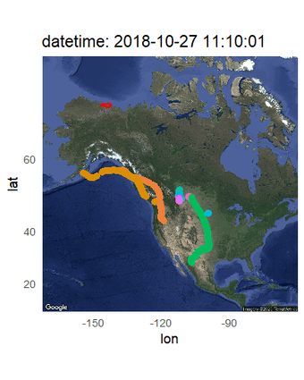
Ecosystems Analytics
Science Center Objects
The Ecosystems Analytics group uses novel and cutting edge statistical, mapping, and graphical methods to conduct research on a variety of taxa. Our overarching goal is to help inform wildlife and land management decisions through assisting partners with designing monitoring programs, analyzing existing data, and developing new research projects. Our focus often involves modeling wildlife population dynamics through space and time and predicting how populations may respond to ecological and anthropogenic changes in the future.
Return to Ecosystems >> Terrestrial Ecosystems
Intra- and interagency analytical support
Land managers and ecologists are experts in their chosen concentrations, whether that’s a species or taxonomic group or physiological or ecological process. As analytical techniques have become more complex, it’s increasingly difficult for content experts to also become fluent in emerging statistical methods, GIS software, or data visualization. This has created a need to solicit help from analysts to complete portions of projects or better design a novel study that can incorporate recently developed methods (for more information on common analytical areas, see topic descriptions below).
Our group provides analytical support ranging from specific coding questions to general analysis assistance. Our goal is to save time spent analyzing data by those less familiar with certain techniques or improve inference by employing novel or emerging techniques to existing data. We can help with software coding, spatial analyses, regression, mixed-effects and hierarchical models, power analyses, sampling design, Bayesian models, web-based data applications, and web and publication quality figures. We select projects based on analyst ability and experience, time investment and concordance with DOI, USGS and Center priorities.
Specifically, we have experience in the following programs and topics:
- R
- Data formatting, data analysis, data simulation, spatial analysis, plotting, mapping, report automation (Rmarkdown)
- Assistance with package development/debugging
- ‘Shiny’ web apps
- Python basics
- Tensorflow
- ArcGIS
- Github
- Jupyter notebook
- SQL and database formatting, extraction and debugging
- Bayesian modeling (e.g., WinBUGS, JAGS, Nimble)
- High-performance computing on the USGS supercomputer (Yeti)
- USGS code/data releases
How to cite our help:
(in Acknowledgements): Analytical support provided by the USGS Alaska Science Center Ecosystems Analytics group.
Note: extensive assistance that results in a publication may result in request for coauthorship of the analyst(s), which can be determined on a case-by-case basis.
Demographic models
To understand why populations are exhibiting specific patterns, managers are tasked with estimating vital rates and characteristics such as age structure, annual or seasonal survival, nest survival, reproductive rate, and population change. Additionally, they are often interested in identifying which vital rates are contributing most to population change and projecting populations into the future based on vital rate estimates. These questions require a diverse set of analytical techniques depending on the species, sampling design, and study objectives. Common tools to estimate these population metrics include: mark-recapture/recovery models, spatial capture-recapture models, daily nest survival models, matrix population models, population viability analyses, and sensitivity analyses. Recently, statistical techniques have emerged that facilitate combining disparate datasets collected on the same population to characterize multiple population dynamics simultaneously, identify data gaps, and reduce uncertainty in individual vital rate estimates. These integrated models are a powerful tool that increase the power of any individual study to make inference regarding a population. Our group has extensive experience implementing a suite of demographic models to address individual vital rates such as nest survival of landbirds and shorebirds as well as integrating multiple datasets to answer broader question of population dynamics and viability.
Occupancy/abundance modeling
Often managers are tasked with determining where species of concern are present and their population size. Recent advances in hierarchical modeling facilitate estimation of occupancy or abundance of wildlife species while accounting for imperfect detection of individuals during surveys. Further, these models easily incorporate spatial and temporal covariates that can help identify areas of suitable habitat, climatic niches, and expected abundance or density of the study species. These spatio-temporal relationships can then be used to create maps of presence, abundance, species diversity, temporal trends and hotspots of these metrics to better inform local-scale management of species. Our group has worked extensively on modeling spatio-temporal patterns in presence, abundance, and population change of wildlife species including plants, landbirds, waterfowl, and seagrass.
Project and monitoring design
Monitoring wild populations is an essential part of informing management and policy decisions, often by tracking population trends or identifying spatial hotspots with high population densities. To provide the best possible information, monitoring programs can be designed to accurately represent the population of interest. Considerations include factors such as spatial or temporal distribution of surveys, number of sites surveyed, and number of repeat visits. Algorithms are available to identify spatially balanced sampling schemes that account for habitat classes or other strata of interest. Power analyses can also be used to identify the expected consequences of various levels of sampling effort, helping to develop monitoring plans that will be able to answer the questions of interest, such as detecting a population trend of a specified magnitude. Our group has assisted with designing monitoring programs or developing analytical techniques for a variety of taxa (birds, butterflies, and phytoplankton).
Advancing wildlife survey and monitoring methodology
Wildlife often occur in remote areas with extreme climates that are difficult to access. Aerial or boat-based surveys have been the standard tools for sampling these populations because they can access roadless terrain and cover large areas relatively quickly. Imperfect detection of target species, inclement weather, and expense all act to restrict sampling intensity and inference from these types of surveys. Advances in computing power, unmanned aircraft and artificial intelligence have dramatically improved our ability to sample and monitor fish and wildlife to estimate distribution, abundance, and reproduction. Our group is currently working on using AI to automate identification of target species from photographic and video imagery collected during aerial surveys. This emerging technology will improve the accuracy and precision of abundance estimates as well as save save time and money spent on manually tallying each image.
Marking techniques used to sample wildlife may have unintended consequences on population characteristics of interest (e.g., survival). For that reason, designing studies that incorporate ways to evaluate possible marker effects is crucial to advancing marking technologies forward and ensuring unbiased vital rate estimates and sufficient sample sizes to answer questions of interest. We have worked extensively on studies evaluating marker types on birds including radiotransmitters on adults and young, geolocators, nape tags, and leg bands and flags.