
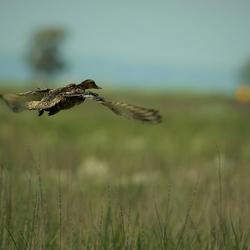
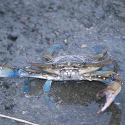
Coastal Habitats and Waterbirds
Coastal Habitats and Waterbirds
Prioritizing marsh restoration needs throughout Chesapeake Bay
The coastal areas of the Chesapeake provide habitats for fish and crabs, migratory waterfowl, and space where nearly 10 million people live, work, and recreate. The USGS efforts include assessing and forecasting risks to coastal areas from sea-level rise and development, and the associated threats to waterbirds. The findings are being used to inform restoration and climate-adaptation efforts.
Filter Total Items: 35
Avian Influenza Spread, Prevalence and Persistence
USGS researchers seek to understand the factors influencing the spread and persistence of avian influenza viruses on the landscape. This research also addresses how novel strains of highly pathogenic avian influenza are impacting a larger number and diversity of host species, including waterfowl, shorebirds, raptors and other birds.
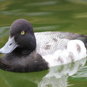
Combining Field and Laboratory Studies to Understand Viral Ecology in Avian Species
USGS researchers are pairing field and laboratory studies to gain deeper insights into the role of Lesser Scaup ( Aythya affinis) in the spread and persistence of avian influenza viruses.
USGS Chesapeake Bay Science Accomplishments for 2025
The Chesapeake Bay watershed is home to 18 million people and some of America’s most treasured natural resources – lands, waters, and wildlife that support a strong economy and cherished outdoor traditions, such as hunting and fishing. From local organizations to federal agencies, partners throughout the watershed are working to protect these resources. These partners rely on our unbiased, gold...
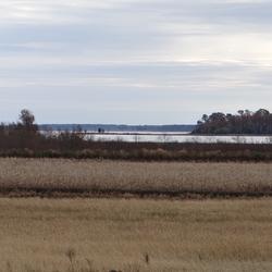
Prioritizing marsh restoration needs throughout Chesapeake Bay
A new USGS study estimates potential losses of Chesapeake Bay salt marshes that could occur in the next 80 years if no marsh restoration is undertaken. Using a suite of models, USGS researchers identified how future potential marsh changes can be used to prioritize present-day site-specific planning and restoration needs.

Key considerations to accurately predict tidal marsh longevity
A recent study provides key considerations about modeling the timeline of tidal marsh longevity. These timelines can help resource managers envision what future marsh conditions may look like, informing current and long-term adaptive management strategies.

Key Values of a Century of EESC Science
The USGS Eastern Ecological Science Center (EESC) is rooted in a proud tradition of service to the nation—advancing science that informs the conservation and management of fish, wildlife, and habitats across the eastern United States and beyond. Our mission is clear: deliver reliable, partner-driven science that supports natural resource decisions today, while ensuring these resources remain...
EESC Makes an Impact: Restoring the Chesapeake Bay Watershed
The Chesapeake Bay provides over $100 billion in annual economic value and is home to 18 million people. The USGS, including scientists from the Eastern Ecological Science Center (EESC), works with Federal, State, local, and academic partners to provide research and monitoring and to communicate results to inform management for the Chesapeake and other important landscapes across the Nation.

Coastal Wetland Vulnerability to Climate Change and Sea-Level Rise: Understanding Ecological Thresholds and Ecosystem Transformations
Eighteen USGS coastal scientists from all four coasts of the conterminous United States are working together to advance the understanding of climate change and sea-level rise impacts to coastal wetlands.
By
California Water Science Center, Chesapeake Bay Activities, Eastern Ecological Science Center, Florence Bascom Geoscience Center, Great Lakes Science Center, Pacific Coastal and Marine Science Center, St. Petersburg Coastal and Marine Science Center, Western Ecological Research Center (WERC), Western Geographic Science Center, Wetland and Aquatic Research Center , Woods Hole Coastal and Marine Science Center

Discovering Connections Across America's Lands and Waters
Through collaboration and coordination, USGS research helps preserve and restore America’s most iconic landscapes. We apply insights across ecosystems to understand how these systems function and change, helping natural resource managers protect our Nation’s natural heritage for generations to come.

USGS Chesapeake Accomplishments and Highlights for 2024
As a home to 18 million people and a destination for countless visitors seeking recreational opportunities, the health of the Chesapeake Bay watershed is of critical importance. The U.S. Geological Survey (USGS) is a leading provider of data-driven insights about the condition of the watershed’s lands, waters, fish, and wildlife. These insights and our collaborative work with partners throughout...

Osprey (Pandion haliaetus) Population and the Availability of Menhaden (Brevoortia tyrannus) as Their Food Source in Chesapeake Bay: Historical and Present-day Comparison
USGS is collaborating with many biologists in analysis of data on osprey ( Pandion haliaetus) and their prey (menhaden, Brevoortia tyrannus, and other species of fish) in the middle and lower Chesapeake Bay and its tributaries. The data compiled and collected will help determine if a lack of menhaden or other environmental factors are affecting osprey reproductive success in portions of the...

Review of Wildlife Health Outcomes and Potentially Toxic Algal Blooms in the Chesapeake Bay
Scientists provide resources that review algal toxin data, explore links between avian mortality and toxin exposure, and identify future research needs to predict algal toxin health hazards and risks for birds and other wildlife in the Chesapeake Bay.