
EO-1 Sensors
The three primary instruments on the EO-1 spacecraft are the Advanced Land Imager (ALI), the Hyperion, and the Linear Etalon Imaging Spectrometer Array (LEISA) Atmospheric Corrector (LAC).
The EO-1 ALI consists of a 15° Wide Field Telescope (WFT) and partially populated focal plane occupying 1/5th of the field-of-view, giving a ground swath width of 37 km. Hyperion is a grating imaging spectrometer having a 30 meter ground sample distance over a 7.7 kilometer swath. It provides 10nm (sampling interval) contiguous bands of the solar reflected spectrum from 400-2500nm. LAC is an imaging spectrometer covering the spectral range from 900 to 1600 nm, which was well suited for the EO-1 Science Validation Team to monitor the atmospheric water absorption lines for correction of atmospheric effects in multispectral imagers during the first year.
Level 1R products for ALI and Hyperion are distributed by the U.S. Geological Survey (USGS) Earth Resources Observation and Science (EROS), but LAC data are not being collected nor distributed during the Extended Mission. A summary of each instrument's characteristics is available below.
Advanced Land Imager (ALI)
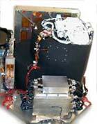
The EO-1 ALI is the first Earth-Observing instrument to be flown under NASA's New Millennium Program (NMP). The ALI employs novel wide-angle optics and a highly integrated multispectral and panchromatic spectrometer.
EO-1 is a technology verification project designed to demonstrate comparable or improved Landsat spatial and spectral resolution with substantial mass, volume, and cost savings. MIT Lincoln Laboratory developed the ALI with NMP instrument team members: Raytheon/Santa Barbara Remote Sensing (SBRS) for the focal plane system, and Sensor Systems Group, Inc. (SSG) for the optical system.
Instrument Overview
The EO-1 ALI is a technology verification instrument under the NMP. The focal plane for this instrument is partially populated with four sensor chip assemblies (SCA) and also covers 3° by 1.625°. Operating in a pushbroom fashion at an orbit of 705 km, the ALI provides Landsat type panchromatic and multispectral bands. These bands have been designed to mimic six Landsat bands with three additional bands covering 0.433-0.453, 0.845-0.890, and 1.20-1.30 µm. The ALI also contains wide-angle optics designed to provide a continuous 15° x 1.625° field of view for a fully populated focal plane with 30-meter resolution for the multispectral pixels and 10-meter resolution for the panchromatic pixels.

| Band | Wavelengh(µm) | Ground Sample Distance(m) |
|---|---|---|
| Pan | 0.48 - 0.69 | 10 |
| MS - 1' | 0.433 - 0.453 | 30 |
| MS - 1 | 0.45 - 0.515 | 30 |
| MS - 2 | 0.525 - 0.605 | 30 |
| MS - 3 | 0.63 - 0.69 | 30 |
| MS - 4 | 0.775 - 0.805 | 30 |
| MS - 4' | 0.845 - 0.89 | 30 |
| MS - 5' | 1.2 - 1.3 | 30 |
| MS - 5 | 1.55 - 1.75 | 30 |
| MS - 7 | 2.08 - 2.35 | 30 |
The following key technologies are incorporated in the ALI instrument to achieve its dramatic cost, weight, and performance advantages:
- Silicon Carbide Optics
- Wide Field of View Optics
- Multispectral Imaging Capability
Benefit
The ALI technologies will enable the reduction of mass, power, complexity, and cost of future Earth imaging systems. A fully operational ALI has the potential for reducing the cost and size of future Landsat-type instruments by a factor of 4 to 5.
Hyperion
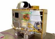
The Hyperion instrument provides a new class of Earth observation data for improved Earth surface characterization. The Hyperion provides a science grade instrument with quality calibration based on heritage from the LEWIS Hyperspectral Imaging Instrument (HSI). The Hyperion capabilities provide resolution of surface properties into hundreds of spectral bands versus the ten multispectral bands flown on traditional Landsat imaging missions. Through these spectral bands, complex land eco-systems can be imaged and accurately classified.
Instrument Overview
The Hyperion provides a high resolution hyperspectral imager capable of resolving 220 spectral bands (from 0.4 to 2.5 µm) with a 30-meter resolution. The instrument can image a 7.5 km by 100 km land area per image, and provide detailed spectral mapping across all 220 channels with high radiometric accuracy. The major components of the instrument include the following:
System fore-optics design based on the Korea Muli-Purpose Satellite (KOMPSAT) Electro Optical Camera (EOC) mission. The telescope provides for two separate grating image spectrometers to improve signal-to-noise ratio (SNR).
Benefit
A focal plane array which provides separate Short Wavelength Infrared(SWIR) and Visible and Near Infrared (VNIR) detectors based on spare hardware from the LEWIS HSI program.
A cryocooler identical to that fabricated for the LEWIS HSI mission for cooling of the SWIR focal plane.
Hyperspectral imaging has wide ranging applications in mining, geology, forestry, agriculture, and environmental management. Detailed classification of land assets through the Hyperion will enable more accurate remote mineral exploration, better predictions of crop yield and assessments, and better containment mapping.
Linear Etalon Imaging Spectrometer Array (LEISA) Atmospheric Corrector (LAC)

Earth imagery is degraded by atmospheric absorption and scattering. The New Millennium Program's EO-1 mission provided the first space-based test of an Atmospheric Corrector (AC) for increasing the accuracy of surface reflectance estimates.
Instrument Overview
The AC provided the following capabilities via a compact and simple bolt on design for future Earth Science, land imaging missions:
- High spectral, moderate spatial resolution hyperspectral imager using a wedge filter technology.
- Spectral coverage of .85-1.5 um, bands are selected for optimal correction of high spatial resolution images.
- Correction of surface imagery for atmospheric variability (primarily water vapor).
Benefits
The AC is applicable to any scientific or commercial Earth remote sensing mission where atmospheric absorption due to water vapor or aerosols degrades surface reflectance measurements. Using the AC, instrument measurements of actual rather than modeled absorption values, enables more precise predictive models to be constructed for remote sensing applications.
The AC instrument has provided significant improvements in generating accurate reflectance measurements for land imaging missions. The algorithms developed will enabled more accurate measurement and classification of land resources and better models for land management.