Application Development
Application Development
Filter Total Items: 27
The Strain and Genetic Online Tissue Repository for Chronic Wasting Disease
The Strain and Genetic Online Tissue Repository (SAGOTR) is being developed by the USGS Fort Collins Science Center to document, track, discover, and request physical samples of Chronic Wasting Disease (CWD). SAGOTR connects natural resource managers, tissue repositories, and researchers in one online platform, making it easier to locate and share samples and support research and management of CWD...
Greater Sage-Grouse Population Monitoring Framework
Greater sage-grouse ( Centrocercus urophasianus) are at the center of state and national land use policies largely because of their unique life-history traits as an ecological indicator for health of sagebrush ecosystems. Researchers within the U.S. Geological Survey (USGS) and Colorado State University (CSU) worked with the Bureau of Land Management (BLM) and state wildlife agencies to develop a...
Land management research in support of streamlined energy development, economic growth, and wildfire management
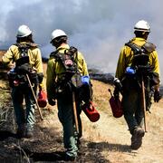
FORT researchers provide sound science to support the Department of the Interior in its efforts to streamline reliable energy development, enhance cost efficiency in public lands management, and manage fire-prone habitats for public safety. This research is developed in partnership with resource managers from local, State, Federal and Tribal governments, industry, and nongovernmental organizations...
Research to support conservation of America’s national mammal, the bison
Once numbering in the tens of millions, plains bison ( Bison bison bison) were nearly driven to extinction with only a few hundred individuals remaining by the late 19th century. Plains bison have since recovered to approximately 20,000 animals managed in conservation herds throughout North America, yet substantial challenges to their recovery remain. The Department of the Interior (DOI) stewards...
Values Mapping for Planning in Regional Ecosystems (VaMPIRE)
As part of the Values Mapping for Planning in Regional Ecosystems project, also known as VaMPIRE, USGS scientists are developing a public participatory GIS application that aids in gathering information about visitors’ values for public lands and waters.
North American Bat Monitoring Program (NABat)
Bats are essential contributing members of healthy, functioning ecosystems. They perform numerous ecosystem services like insect pest control and plant pollination, and provide enormous economic benefits through ecotourism, medical research, and novel biotechnologies. North American bats face unprecedented threats including habitat loss and fragmentation, white-nose syndrome, and wind energy...
INHABIT: A web tool for invasive plant management across the contiguous United States
INHABIT is a desktop-optimized web application and decision support tool with mapped and tabular summaries of habitat suitability models for over two hundred fifty terrestrial invasive plant species of management concern across the contiguous United States. It is the product of a scientist-practitioner partnership and is designed to facilitate enhanced invasive species management actions...
Greater Sage-Grouse Population Monitoring Framework: Cheat Sheet
The Greater Sage-grouse Population Monitoring Framework fills a prominent information gap to help inform current assessments of sage-grouse population trends at nested spatial and temporal scales. It is centered on four objectives: (1) create a standardized database of lek counts; (2) develop spatial population structures by clustering leks; (3) estimate spatial trends at different temporal...
Greater Sage-Grouse Population Monitoring Framework: Targeted Annual Warning System Information Sheet
The Greater Sage-grouse Population Monitoring Framework fills a prominent information gap to aid current assessments of sage-grouse population trends across spatial and temporal scales. It centers on four objectives: 1) create a standardized database of lek counts; 2) cluster leks to develop spatial population structures; 3) estimate spatial trends across temporal extents; and 4) develop a system...
Greater Sage-Grouse Population Monitoring Framework: Glossary of Terms
The Greater Sage-grouse Population Monitoring Framework fills a prominent information gap to aid current assessments of sage-grouse population trends across spatial and temporal scales. It centers on four objectives: 1) create a standardized database of lek counts; 2) cluster leks to develop spatial population structures; 3) estimate spatial trends across temporal extents; and 4) develop a system...
Greater Sage-Grouse Population Monitoring Framework: Frequently Asked Questions
The Greater Sage-grouse Population Monitoring Framework fills a prominent information gap to aid current assessments of sage-grouse population trends across spatial and temporal scales. It centers on four objectives: 1) create a standardized database of lek counts; 2) cluster leks to develop spatial population structures; 3) estimate spatial trends across temporal extents; and 4) develop a system...
Greater Sage-Grouse Population Monitoring Framework Data Inputs Information Sheet
To support management decisions, western state wildlife agencies identified the need for a range-wide database that tracks annual counts of greater sage-grouse ( Centrocercus urophasianus; sage-grouse) at leks (breeding sites), recorded since the early 1950s. Researchers at Colorado State University (CSU) and U.S. Geological Survey (USGS) worked with state wildlife agencies to 1) construct this...


