
Sunrise ahead near the Manitowoc, Wisconsin lighthouse as the R/V Arcticus heads out for a day of bottom trawling. Photo credit: Patty Dieter, USGS.
Images
Images captured by GLSC scientists while working in and around the Great Lakes.
Filter Total Items: 494

Heading Into the Sunrise
Sunrise ahead near the Manitowoc, Wisconsin lighthouse as the R/V Arcticus heads out for a day of bottom trawling. Photo credit: Patty Dieter, USGS.

Aurora Borealis
The aurora borealis, or northern lights, shined bright and danced in the sky for several days in mid-September as USGS researchers conducted night survey work near Tobermory, Ontario. Photo credit: Lyle Grivicich, USGS.
The aurora borealis, or northern lights, shined bright and danced in the sky for several days in mid-September as USGS researchers conducted night survey work near Tobermory, Ontario. Photo credit: Lyle Grivicich, USGS.

AUV in Porte des Morts
USGS scientists (GLSC; Ann Arbor, Michigna) prepare to launch an autonomous underwater vehicle from the GLSC’s R/V Dragonfly in Porte des Morts within the Lake Michigan waters of Wisconsin. Photo credit: Alden Tilley, USGS.
USGS scientists (GLSC; Ann Arbor, Michigna) prepare to launch an autonomous underwater vehicle from the GLSC’s R/V Dragonfly in Porte des Morts within the Lake Michigan waters of Wisconsin. Photo credit: Alden Tilley, USGS.

Fall Forage Net Out
USGS vessel crewmembers (GLSC; Cheboygan, Michigan) and science crew (GLSC; Ann Arbor, Michigan) heave out the cod end of a bottom trawl net during the 2023 fall prey fish assessment in Lake Michigan aboard the GLSC’s R/V Arcticus. Photo credit: Cory Brant, USGS.
USGS vessel crewmembers (GLSC; Cheboygan, Michigan) and science crew (GLSC; Ann Arbor, Michigan) heave out the cod end of a bottom trawl net during the 2023 fall prey fish assessment in Lake Michigan aboard the GLSC’s R/V Arcticus. Photo credit: Cory Brant, USGS.

Wake Up Frankfort
Sunrise near Frankfort, Michigan on misty Betsie Lake as the R/V Arcticus heads out to Lake Michigan for a day of bottom trawling. Photo credit: Patty Dieter, USGS.
Sunrise near Frankfort, Michigan on misty Betsie Lake as the R/V Arcticus heads out to Lake Michigan for a day of bottom trawling. Photo credit: Patty Dieter, USGS.

Many Eyes on You
A native deepwater sculpin (Myoxocephalus thompsonii) next to a clump of eyed eggs collected from a bottom trawl net aboard the R/V Arcticus on Lake Michigan. Photo credit: Patty Dieter, USGS.
A native deepwater sculpin (Myoxocephalus thompsonii) next to a clump of eyed eggs collected from a bottom trawl net aboard the R/V Arcticus on Lake Michigan. Photo credit: Patty Dieter, USGS.
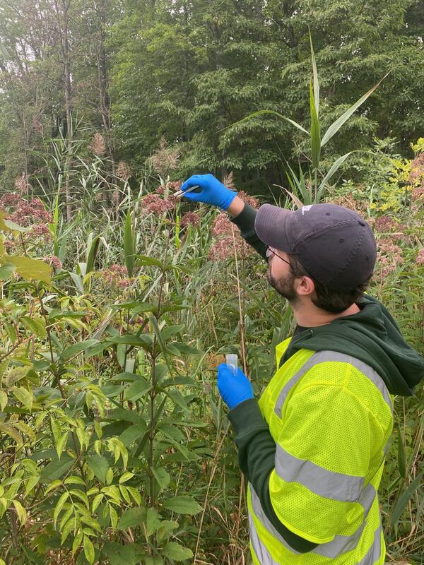
Sampling in the (Joe's Pye) Weeds
A USGS technician (GLSC; Chesterton, Indiana) sampling Joe's Pye Weed that were visited by bumblebees in order to capture environmental DNA (eDNA) shed by the bees. Photo credit: Leslie Reyes, USGS Contractor.
A USGS technician (GLSC; Chesterton, Indiana) sampling Joe's Pye Weed that were visited by bumblebees in order to capture environmental DNA (eDNA) shed by the bees. Photo credit: Leslie Reyes, USGS Contractor.
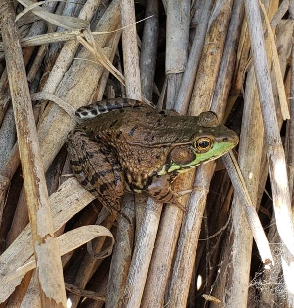
Lithobates clamitans
A green frog (Lithobates clamitans) waiting patiently on dead Phragmites australis stems for its next meal. Photo credit: Meagan Froeba, USGS.
A green frog (Lithobates clamitans) waiting patiently on dead Phragmites australis stems for its next meal. Photo credit: Meagan Froeba, USGS.
Jon Boat Journey
A USGS wetland scientist (GLSC; Ann Arbor, Michigan) walks alongside a treated invasive Phragmites australis site. Photo credit: Taaja Tucker-Silva, USGS.
A USGS wetland scientist (GLSC; Ann Arbor, Michigan) walks alongside a treated invasive Phragmites australis site. Photo credit: Taaja Tucker-Silva, USGS.
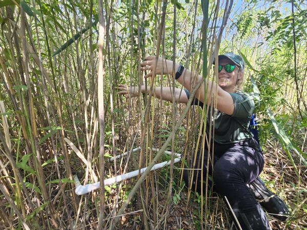
Wetland Scientist
A USGS wetland scientist (GLSC; Ann Arbor, Michigan) counts the number of invasive Phragmites australis stems within a sampling quadrat in an effort to provide information about various control strategies used to manage the plant. Photo credit: Taaja Tucker-Silva, USGS.
A USGS wetland scientist (GLSC; Ann Arbor, Michigan) counts the number of invasive Phragmites australis stems within a sampling quadrat in an effort to provide information about various control strategies used to manage the plant. Photo credit: Taaja Tucker-Silva, USGS.
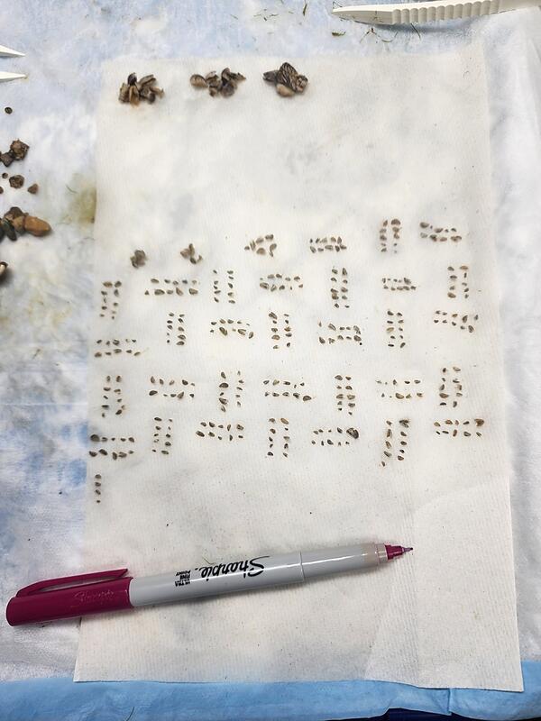
Every Mussel Counts
Over 370 mussels, all of them less than nine millimeters in length, sitting on an absorbent pad after being sorted into groups of ten by USGS researchers (GLSC; Chesterton, Indiana). Photo credit: Jessica Oswald, USGS Contractor.
Over 370 mussels, all of them less than nine millimeters in length, sitting on an absorbent pad after being sorted into groups of ten by USGS researchers (GLSC; Chesterton, Indiana). Photo credit: Jessica Oswald, USGS Contractor.

An Aster for Your Thoughts
Flower sampling in the GLSC greenhouse in Chesterton, Indiana for simulated environmental DNA degradation experiments. Photo credit: Muruleedhara Byappanahalli, USGS.
Flower sampling in the GLSC greenhouse in Chesterton, Indiana for simulated environmental DNA degradation experiments. Photo credit: Muruleedhara Byappanahalli, USGS.
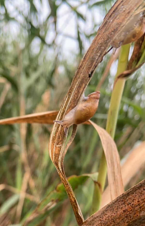
Slow and Steady
An ambersnail (genus Succinea) climbing a drooping, desiccated invasive Phragmites australis leaf in Lyon Oaks Metropark in South Lyon, MI. Photo credit: Nickolas Holcomb, USGS Contractor.
An ambersnail (genus Succinea) climbing a drooping, desiccated invasive Phragmites australis leaf in Lyon Oaks Metropark in South Lyon, MI. Photo credit: Nickolas Holcomb, USGS Contractor.
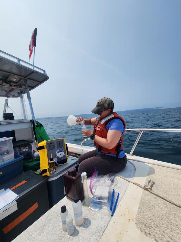
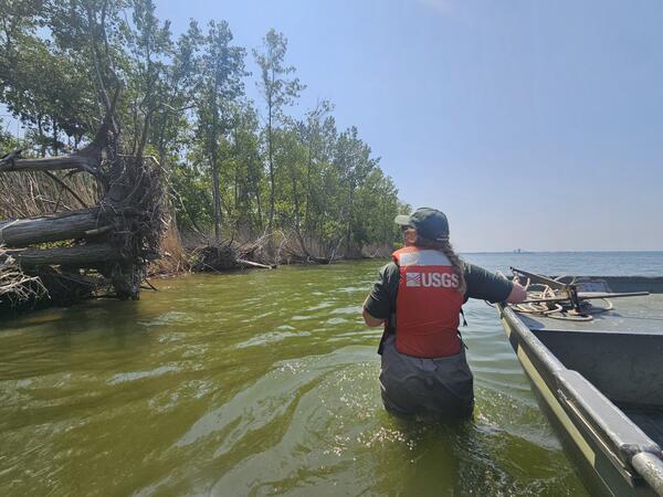
Don’t Rock the Boat!
A USGS research technician (GLSC; Chesterton, Indiana) uses a peristaltic pump to filter lake water before pouring it into various bottles to be sent off for nutrient analysis. Photo credit: Leslie Reyes, USGS Contractor.
A USGS research technician (GLSC; Chesterton, Indiana) uses a peristaltic pump to filter lake water before pouring it into various bottles to be sent off for nutrient analysis. Photo credit: Leslie Reyes, USGS Contractor.
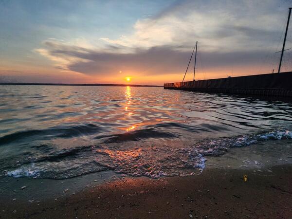
Great Lake, Greater View
Enjoying the beautiful sunset on Lake Michigan after a hard day’s work. Photo credit: Jessica Oswald, USGS Contractor.
Enjoying the beautiful sunset on Lake Michigan after a hard day’s work. Photo credit: Jessica Oswald, USGS Contractor.

Plant Metrics
USGS wetland scientists (GLSC; Ann Arbor, Michigan) collecting plant growth data during an invasive Phragmites australis control experiment. Photo credit: Spenser Widin, USGS.
USGS wetland scientists (GLSC; Ann Arbor, Michigan) collecting plant growth data during an invasive Phragmites australis control experiment. Photo credit: Spenser Widin, USGS.

Saildrone is towed onto Lake Erie, July 2023
A Saildrone Explorer being towed on Lake Erie at the beginning of a mission to collect data to improve fishery surveys in July 2023.
A Saildrone Explorer being towed on Lake Erie at the beginning of a mission to collect data to improve fishery surveys in July 2023.

Saildrone at the dock in Erie, PA before launch
A Saildrone Explorer in the harbor before its launch on Lake Erie for the beginning of a mission to collect data to improve fishery surveys in July 2023.
A Saildrone Explorer in the harbor before its launch on Lake Erie for the beginning of a mission to collect data to improve fishery surveys in July 2023.

Saildrone is towed on Lake Erie, July 2023
A Saildrone Explorer being towed on Lake Erie at the beginning of a mission to collect data to improve fishery surveys in July 2023.
A Saildrone Explorer being towed on Lake Erie at the beginning of a mission to collect data to improve fishery surveys in July 2023.

Saildrone being towed into Lake Erie, July 2023
A Saildrone Explorer in the harbor being towed out onto Lake Erie for the beginning of a mission to collect data to improve fishery surveys on July 14, 2023.
A Saildrone Explorer in the harbor being towed out onto Lake Erie for the beginning of a mission to collect data to improve fishery surveys on July 14, 2023.

Saildrone being towed through the harbor in Erie, PA
Saildrone being towed through the harbor in Erie, PAA Saildrone Explorer being towed through the harbor in Erie, PA at the beginning of a mission to collect data to improve fishery surveys in July 2023.
Saildrone being towed through the harbor in Erie, PA
Saildrone being towed through the harbor in Erie, PAA Saildrone Explorer being towed through the harbor in Erie, PA at the beginning of a mission to collect data to improve fishery surveys in July 2023.