
A Saildrone Explorer being towed in the harbor in Erie, PA at the beginning of a mission to collect data to improve fishery surveys in July 2023.
Images
Images captured by GLSC scientists while working in and around the Great Lakes.
Filter Total Items: 494

Saildrone being towed through Erie, PA harbor
A Saildrone Explorer being towed in the harbor in Erie, PA at the beginning of a mission to collect data to improve fishery surveys in July 2023.

Saildrone being towed on before launch on Lake Erie
Saildrone being towed on before launch on Lake ErieA Saildrone Explorer being towed through the harbor in Erie, PA at the beginning of a mission to collect data to improve fishery surveys in July 2023.
Saildrone being towed on before launch on Lake Erie
Saildrone being towed on before launch on Lake ErieA Saildrone Explorer being towed through the harbor in Erie, PA at the beginning of a mission to collect data to improve fishery surveys in July 2023.

Sauble Falls Provincial Park
Sauble Falls in Sauble Falls Provincial Park, Ontario, Canada. Photo credit: Alden Tilley, USGS.
Sauble Falls in Sauble Falls Provincial Park, Ontario, Canada. Photo credit: Alden Tilley, USGS.

Little Dunks Bay
Little Dunks Bay, Lake Huron, at the tip of the Bruce Peninsula in Ontario, Canada. Photo credit: Alden Tilley, USGS.
Little Dunks Bay, Lake Huron, at the tip of the Bruce Peninsula in Ontario, Canada. Photo credit: Alden Tilley, USGS.

Lake Erie Saildrone Sampling Tracks for 2023
A map of Lake Erie that includes the rough dates of operation of autonomous and crewed vehicles by USGS, Saildrone, Monterey Bay Aquarium Research Institute (MBARI), and State and Ontario partners throughout Lake Erie during summer 2023.
A map of Lake Erie that includes the rough dates of operation of autonomous and crewed vehicles by USGS, Saildrone, Monterey Bay Aquarium Research Institute (MBARI), and State and Ontario partners throughout Lake Erie during summer 2023.

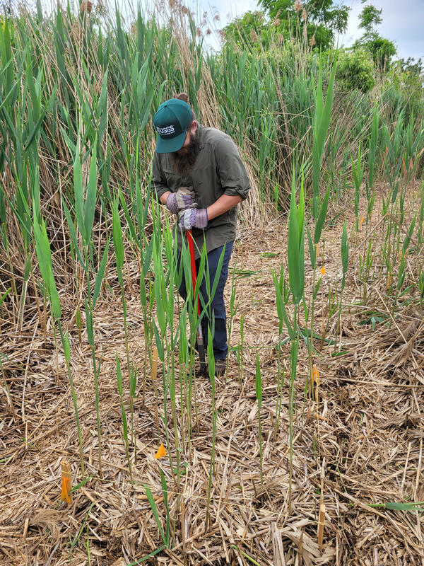
Phragmites
A USGS field crew (GLSC; Ann Arbor, Michigan) on an excursion in Metzger Marsh on Lake Erie to monitor invasive Phragmites australis. Photo credit: Kaira Liggett, USGS Contractor.
A USGS field crew (GLSC; Ann Arbor, Michigan) on an excursion in Metzger Marsh on Lake Erie to monitor invasive Phragmites australis. Photo credit: Kaira Liggett, USGS Contractor.
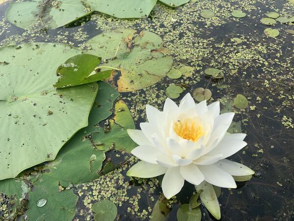
Water Lily
A water lily (Nymphaea) in full bloom surrounded by European frog-bit (Hydrocharis morsus-ranae), and Duckweed (Lemnaceae) in Mezger Marsh, part of the Ottawa National Wildlife Refuge on Lake Erie in Ohio. Photo credit: Kaira Liggett, USGS Contractor.
A water lily (Nymphaea) in full bloom surrounded by European frog-bit (Hydrocharis morsus-ranae), and Duckweed (Lemnaceae) in Mezger Marsh, part of the Ottawa National Wildlife Refuge on Lake Erie in Ohio. Photo credit: Kaira Liggett, USGS Contractor.
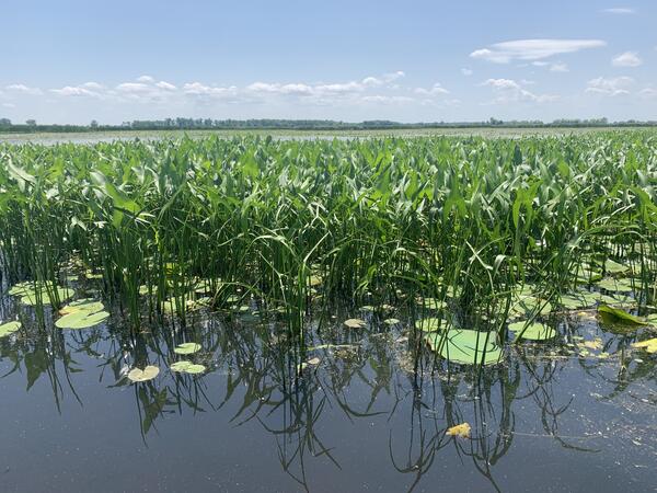
Summertime Marsh
Aquatic vegetation, including arrowhead (Sagittaria), water lily (Nymphaea), lotus (Nelumbo) and European frog-bit (Hydrocharis morsus-ranae), photographed in Metzger Marsh, part of the Ottawa National Wildlife Refuge on Lake Erie in Ohio. Photo credit: Kaira Liggett, USGS Contractor.
Aquatic vegetation, including arrowhead (Sagittaria), water lily (Nymphaea), lotus (Nelumbo) and European frog-bit (Hydrocharis morsus-ranae), photographed in Metzger Marsh, part of the Ottawa National Wildlife Refuge on Lake Erie in Ohio. Photo credit: Kaira Liggett, USGS Contractor.
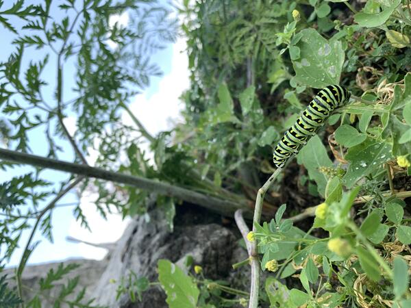
Black Swallowtail Caterpillar
A black swallowtail caterpillar (Papilio polyxenes) feeding on vegetation at the Metzger Marsh boat launch, part of the Ottawa National Wildlife Refuge on Lake Erie in Ohio. Photo credit: Kaira Liggett, USGS Contractor.
A black swallowtail caterpillar (Papilio polyxenes) feeding on vegetation at the Metzger Marsh boat launch, part of the Ottawa National Wildlife Refuge on Lake Erie in Ohio. Photo credit: Kaira Liggett, USGS Contractor.

Benthic Sampling Sorting Squad
USGS lab personnel (GLSC; Chesterton, Indiana) holding benthic sample processing trays; each team member works on a different part of the process. Photo credit: Kasia Przybyla-Kelly, USGS.
USGS lab personnel (GLSC; Chesterton, Indiana) holding benthic sample processing trays; each team member works on a different part of the process. Photo credit: Kasia Przybyla-Kelly, USGS.

Happy Hooking
Retrieval of a submerged acoustic telemetry receiver by USGS biological science technicians (GLSC; Ann Arbor, Michigan) from offshore waters of Lake Michigan, using a grapnel drag to hook a 'snag' line attached to the mooring. Photo credit: Greg Kennedy, USGS.
Retrieval of a submerged acoustic telemetry receiver by USGS biological science technicians (GLSC; Ann Arbor, Michigan) from offshore waters of Lake Michigan, using a grapnel drag to hook a 'snag' line attached to the mooring. Photo credit: Greg Kennedy, USGS.

Leland in the Rearview Mirror
The R/V Sculpin II departing the Leland harbor for a day on Lake Michigan tending acoustic telemetry fish-tracking arrays. Photo credit: Greg Kennedy, USGS.
The R/V Sculpin II departing the Leland harbor for a day on Lake Michigan tending acoustic telemetry fish-tracking arrays. Photo credit: Greg Kennedy, USGS.

A Record Year for Coregonine Recruitment
Age-1 coregonine fish caught in a trawl at Jackfish Bay, Lake Superior in June 2023 aboard the R/V Kiyi (GLSC; Ashland, Wisconsin). Photo credit: Lori Evrard, USGS.
Age-1 coregonine fish caught in a trawl at Jackfish Bay, Lake Superior in June 2023 aboard the R/V Kiyi (GLSC; Ashland, Wisconsin). Photo credit: Lori Evrard, USGS.

Down the Pipe
A bottom trawl being deployed by USGS biological science technicians (GLSC; Huron, Ohio) aboard the GLSC’s R/V Muskie. Photo credit: Kevin Keretz, USGS.
A bottom trawl being deployed by USGS biological science technicians (GLSC; Huron, Ohio) aboard the GLSC’s R/V Muskie. Photo credit: Kevin Keretz, USGS.

Anchored in Whitefish Bay, Lake Superior
An evening view of Whitefish Bay shoreline, Lake Superior, Ontario, Canada looking south from Pancake Bay. Photo credit: Lori Evrard, USGS.
An evening view of Whitefish Bay shoreline, Lake Superior, Ontario, Canada looking south from Pancake Bay. Photo credit: Lori Evrard, USGS.
Ditch Diggin'
USGS wetland scientist (GLSC; Ann Arbor, Michigan) uses a root spade to severe below-ground connections to an experimental plot as part of a larger invasive Phragmites australis control experiment. Photo credit: Margaret Kimpling, USGS Contractor.
USGS wetland scientist (GLSC; Ann Arbor, Michigan) uses a root spade to severe below-ground connections to an experimental plot as part of a larger invasive Phragmites australis control experiment. Photo credit: Margaret Kimpling, USGS Contractor.

Waterfall at Pictured Rocks National Lakeshore
A waterfall flowing into Lake Superior along Pictured Rocks National Lakeshore. Photo credit: Alden Tilley, USGS.
A waterfall flowing into Lake Superior along Pictured Rocks National Lakeshore. Photo credit: Alden Tilley, USGS.
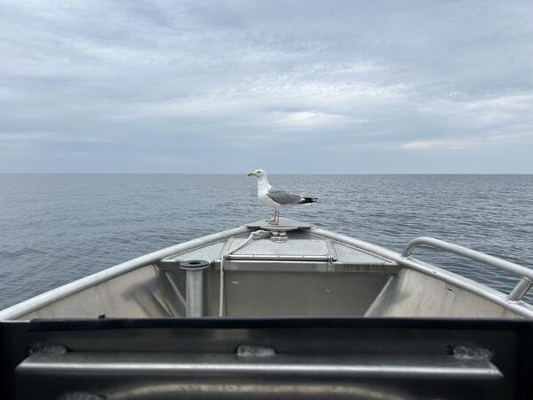
Gull Speed Ahead!
A gull riding the bow of the R/V Desmid in Lake Huron. Photo credit: Nick Yeager, USGS.
A gull riding the bow of the R/V Desmid in Lake Huron. Photo credit: Nick Yeager, USGS.

Captivating Cladophora
USGS divers (GLSC; Ann Arbor, Michigan) take close-up photos and videos of sampling locations before collecting samples, such as this example taken three meters below the surface in Lake Ontario that is full of Cladophora growing on rocks. Photo credit: Megan Lewan, USGS.
USGS divers (GLSC; Ann Arbor, Michigan) take close-up photos and videos of sampling locations before collecting samples, such as this example taken three meters below the surface in Lake Ontario that is full of Cladophora growing on rocks. Photo credit: Megan Lewan, USGS.

Rock Bottom
A USGS diver (GLSC; Ann Arbor, Michigan) records information on her dive slate before collecting a benthic sample of submerged aquatic vegetation and invasive dreissenid mussels. Photo credit: Megan Lewan, USGS.
A USGS diver (GLSC; Ann Arbor, Michigan) records information on her dive slate before collecting a benthic sample of submerged aquatic vegetation and invasive dreissenid mussels. Photo credit: Megan Lewan, USGS.

Cerulean Skies
Sugar Island on a beautiful blue backdrop as seen aboard the R/V Stonecat while sampling on Lake Huron near Alpena, Michigan. Photo credit: Megan Lewan, USGS.
Sugar Island on a beautiful blue backdrop as seen aboard the R/V Stonecat while sampling on Lake Huron near Alpena, Michigan. Photo credit: Megan Lewan, USGS.