



Drinking Water
Drinking Water
Filter Total Items: 12

Potential Effects of Reductions in Wastewater Return Flow on the Freshwater Flow System in Falmouth, Massachusetts
The U.S. Geological Survey (USGS), in cooperation with the Town of Falmouth, is simulating the potential effects of proposed changes to wastewater return flow on the freshwater system in Falmouth, Massachusetts, using an existing regional groundwater flow model.
Collaborations with EPA on Contaminated Site Hydrology
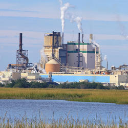
The U.S. Geological Survey (USGS), in cooperation with the U.S. Environmental Protection Agency (EPA), is developing tools and methods to help assess the fate and transport of anthropogenic and geologically sourced contaminants in the water cycle at waste sites throughout the nation.

Augmented Site Characterization of PFAS Manufacturing and Processing Facilities
The U.S. Geological Survey (USGS) is supporting the U.S. Environmental Protection Agency (EPA) in assessing facilities nationwide that have historically produced per- and polyfluoroalkyl substances (PFAS) or used them in chemical manufacturing processes. In collaboration with EPA subcontractors, USGS is providing subject-matter expertise in PFAS fate and transport in the vadose zone and...

Detailed Characterization of the Savage Superfund Site, New Hampshire
The U.S. Geological Survey (USGS), in cooperation with the U.S. Environmental Protection Agency and the New Hampshire Department of Environmental Services, is conducting advanced site characterization activities at the Savage Municipal Water Supply Superfund site in Milford, New Hampshire, and implementing new remediation efforts based on USGS science and tools.

Water Quality Monitoring in the Cambridge Drinking-Water Source Area, Massachusetts
The Cambridge Water Department supplies approximately 13 million gallons per day of drinking water to more than 100,000 customers. Raw water is obtained from a serial system of three primary storage reservoirs—Cambridge Reservoir (also known as the Hobbs Brook Reservoir), Stony Brook Reservoir, and Fresh Pond Reservoir—in parts of Cambridge, Lexington, Lincoln, Waltham, and Weston, Massachusetts...

Predictive Analysis of Water Demand for Providence, Rhode Island
The Providence Water Supply Board (Providence Water) and the U.S. Geological Survey (USGS) are collaborating on a study to predict future water demand in and around the city of Providence.

Chloride Data for Streams in Connecticut, Massachusetts, and Rhode Island
As part of water-quality data collection activities in New England, water samples are analyzed for chloride in monitoring networks and projects across Connecticut, Massachusetts, and Rhode Island. Chloride is of interest because high concentrations may affect aquatic life in streams or affect water quality of reservoirs and aquifers used for drinking water.

Water Quality Monitoring in the Scituate Reservoir Drainage Area, Rhode Island
The Scituate Reservoir system is the largest inland body of water in Rhode Island and the principal drinking-water supply for more than 60 percent of the State’s population. The system includes the Scituate Reservoir and five tributary reservoirs with a maximum storage capacity of 37 billion gallons. The drainage basin that contributes water to the reservoir extends across 93 square miles in...

New England Drought Information
Droughts are one of the most expensive and damaging hydrologic hazards in the United States. They are generally slow in developing, frequently occur over a long period of time, and can affect large areas and populations.

New England Water Use
Monthly water use estimates for New England and the rest of the conterminous U.S. are now available for the three largest categories of use in the United States: public supply, crop irrigation, and thermoelectric power generation.

Assessment of Potential Effects of Water-Supply Withdrawals on Groundwater Levels near the Hyannis Ponds Complex, Barnstable, Massachusetts
The USGS, in cooperation with the Town of Barnstable and MassWildlife, is assessing the potential effects of new water-supply withdrawals on groundwater levels in the Hyannis Ponds Wildlife Management Area on Cape Cod. A groundwater-flow model is being used to simulate the effects of several possible withdrawal and wastewater-return flow scenarios developed by the Town of Barnstable and...

Towards Understanding the Impact of Drought on the Arsenic Hazard for the Private Domestic Well Population in the United States
The USGS and the Centers for Disease Control and Prevention are examining the potential effects of droughts on the arsenic hazard in private well water across the Nation.