
Water Availability
Water Availability
Filter Total Items: 20
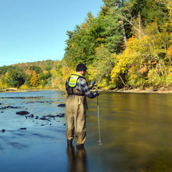
Assessing Sustainable Water Use in Connecticut
The U.S. Geological Survey (USGS) New England Water Science Center, in cooperation with the Connecticut Department of Energy and Environmental Protection (CT DEEP), is updating a planning-level support tool to help decision makers estimate daily mean streamflows and selected streamflow statistics to assess sustainable water use across the state of Connecticut.
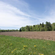
Determining How New England’s Water Resources Respond to Various Climate Scenarios
Possible changes in temperature and precipitation over the next several decades may have implications for New England’s agricultural community, such as changing plant water availability and crop yield variability. The U.S. Geological Survey, in cooperation with the U.S. Department of Agriculture and the University of Maine, is predicting the potential hydrological effects based on these climatic...
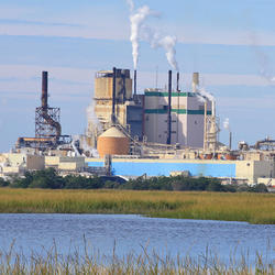
Collaborations with EPA on Contaminated Site Hydrology
The U.S. Geological Survey (USGS), in cooperation with the U.S. Environmental Protection Agency (EPA), is developing tools and methods to help assess the fate and transport of anthropogenic and geologically sourced contaminants in the water cycle at waste sites throughout the nation.

Water Cycle Center
The Water Cycle Center is a cooperation between U.S. Geological Survey and academic partners in the Northeast that studies complete water cycles and watersheds, from mountaintops to shorelines, concentrating on freshwater ecosystems. This research advances the understanding of processes that determine water availability and is needed to best address future water resource challenges.

Detailed Characterization of the Savage Superfund Site, New Hampshire
The U.S. Geological Survey (USGS), in cooperation with the U.S. Environmental Protection Agency and the New Hampshire Department of Environmental Services, is conducting advanced site characterization activities at the Savage Municipal Water Supply Superfund site in Milford, New Hampshire, and implementing new remediation efforts based on USGS science and tools.

Predictive Analysis of Water Demand for Providence, Rhode Island
The Providence Water Supply Board (Providence Water) and the U.S. Geological Survey (USGS) are collaborating on a study to predict future water demand in and around the city of Providence.

Long-Term Data Collection Provides Insight to Changes in Water Resources in New England
Primarily through the efforts of Glenn Hodgkins and Robert Dudley, the New England Water Science Center has been studying historical changes in streamflows, groundwater levels, and lake ice in New England and across the country for 20 years. Glenn and Rob have analyzed a wealth of historical data, including 100+ years of streamflow data and 150+ years of lake-ice data at some locations...

New England Drought, 2020
Below average and infrequent rainfall from May through September 2020 led to an extreme hydrologic drought across much of New England, with some areas experiencing a flash (quick-onset) drought.

New England Drought Information
Droughts are one of the most expensive and damaging hydrologic hazards in the United States. They are generally slow in developing, frequently occur over a long period of time, and can affect large areas and populations.

New England Water Use
Monthly water use estimates for New England and the rest of the conterminous U.S. are now available for the three largest categories of use in the United States: public supply, crop irrigation, and thermoelectric power generation.

Recharge Estimates for Maine: 25-year Average, Range, and Uncertainty, 1990-2015
The USGS Soil-Water-Balance model (SWB) has been used to estimate potential recharge across the State of Maine. The average and range (minimum and maximum) of annual recharge were estimated for the 25-year period from 1990 to 2015. Datasets of estimated recharge and the modeled uncertainty in the recharge estimates are available for download.

Assessment of Potential Effects of Water-Supply Withdrawals on Groundwater Levels near the Hyannis Ponds Complex, Barnstable, Massachusetts
The USGS, in cooperation with the Town of Barnstable and MassWildlife, is assessing the potential effects of new water-supply withdrawals on groundwater levels in the Hyannis Ponds Wildlife Management Area on Cape Cod. A groundwater-flow model is being used to simulate the effects of several possible withdrawal and wastewater-return flow scenarios developed by the Town of Barnstable and...