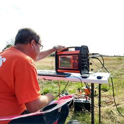
U.S. flag

An official website of the United States government

Coastal Science

The NYWSC carries out multidisciplinary science activities across the State’s diverse coastal waters and landscapes on the Atlantic Ocean and the Great Lakes, including the many interconnected waterways, the barrier beaches that form and erode continually, the open waterways that are prone to the effects of major storms and hurricanes, and upland surface-water and groundwater source areas. These areas are also some of the most productive ecosystems in the State and host most of the population and economic development of the State. As a result, the interplay of environmental- and human-health concerns is a prominent thread that connects much of the coastal science activities of the USGS and involves cooperation not only among science disciplines but also across the Nation and internationally. Major topics of study include nearshore environmental health (ecosystem health and water and sediment quality), beach and barrier dynamics, tide and wave hydrodynamics, wetlands, climate and land-use change, and flood hazards.

Filter Total Items: 36

Assessment of compound flood risk from the combined effects of sea level rise on storm surge, tidal and groundwater flooding, and stormwater

BACKGROUND Long Island Sound has 600 miles of coastline and there are over 23 million people living within 50 miles of its shores. In response to water-quality issues and nitrogen pollution in the Sound, Congress created the Long Island Sound Study (LISS) in 1985. LISS is a partnership of federal, state, and local government agencies, private organizations and educational institutions working tog
link

Assessment of compound flood risk from the combined effects of sea level rise on storm surge, tidal and groundwater flooding, and stormwater

BACKGROUND Long Island Sound has 600 miles of coastline and there are over 23 million people living within 50 miles of its shores. In response to water-quality issues and nitrogen pollution in the Sound, Congress created the Long Island Sound Study (LISS) in 1985. LISS is a partnership of federal, state, and local government agencies, private organizations and educational institutions working tog
Learn More
link

Search for New York Water Science Center Projects by County

Search for NYWSC projects by county name.
Learn More

Hurricane Sandy

Gale- to storm-force winds associated with the passage of Sandy across central New Jersey and eastern Pennsylvania that lasted 12 to 18 hours caused major to record coastal flooding in southeastern New York on October 29, 2012.
link

Hurricane Sandy

Gale- to storm-force winds associated with the passage of Sandy across central New Jersey and eastern Pennsylvania that lasted 12 to 18 hours caused major to record coastal flooding in southeastern New York on October 29, 2012.
Learn More

Compilation of Mercury Data and Associated Risk to Human and Ecosystem Health, Bad River Band of Lake Superior Chippewa

Purpose and Scope The Natural Resources Department of the Bad River Band of Lake Superior Chippewa, Odanah, Wisconsin has requested assistance with compiling existing mercury (Hg) concentration data from measurements in a variety of environmental media in an effort to evaluate risks to ecosystem and human health and to identify key data gaps that could be addressed through future sampling. These d
link

Compilation of Mercury Data and Associated Risk to Human and Ecosystem Health, Bad River Band of Lake Superior Chippewa

Purpose and Scope The Natural Resources Department of the Bad River Band of Lake Superior Chippewa, Odanah, Wisconsin has requested assistance with compiling existing mercury (Hg) concentration data from measurements in a variety of environmental media in an effort to evaluate risks to ecosystem and human health and to identify key data gaps that could be addressed through future sampling. These d
Learn More

Groundwater Sustainability of the Long Island Aquifer System

Groundwater sustainability can be best defined as the development and use of groundwater in a manner that can be maintained for an indefinite time without causing unacceptable environmental or socioeconomic consequences. Informed management of the Long Island aquifer system can help ensure a regionally sustainable groundwater resource. The USGS and New York State Department of Environmental...
link

Groundwater Sustainability of the Long Island Aquifer System

Groundwater sustainability can be best defined as the development and use of groundwater in a manner that can be maintained for an indefinite time without causing unacceptable environmental or socioeconomic consequences. Informed management of the Long Island aquifer system can help ensure a regionally sustainable groundwater resource. The USGS and New York State Department of Environmental...
Learn More

Hydrogeologic-Framework Mapping - Long Island, New York

Home Long Island is underlain by unconsolidated Holocene deposits, glacial deposits of Pleistocene age, and coastal-plain deposits of Late Cretaceous age. These sediments consist of gravel, sand, silt, and clay underlain by crystalline bedrock of early Paleozoic age (fig. 1). The bedrock is relatively impermeable, and forms the base of the groundwater-flow system on Long Island. The geologic and...
link

Hydrogeologic-Framework Mapping - Long Island, New York

Home Long Island is underlain by unconsolidated Holocene deposits, glacial deposits of Pleistocene age, and coastal-plain deposits of Late Cretaceous age. These sediments consist of gravel, sand, silt, and clay underlain by crystalline bedrock of early Paleozoic age (fig. 1). The bedrock is relatively impermeable, and forms the base of the groundwater-flow system on Long Island. The geologic and...
Learn More

Saltwater-Interface Mapping - Long Island, New York

Home Saltwater intrusion is the most common type of water-quality degradation in coastal-plain aquifers. In coastal areas, the hydraulic head under predevelopment (nonpumping) conditions is higher on land than in the surrounding saltwater embayments; thus, fresh groundwater flows seaward (from areas of high potential to areas of lower potential) and meets saltwater at an equilibrium point...
link

Saltwater-Interface Mapping - Long Island, New York

Home Saltwater intrusion is the most common type of water-quality degradation in coastal-plain aquifers. In coastal areas, the hydraulic head under predevelopment (nonpumping) conditions is higher on land than in the surrounding saltwater embayments; thus, fresh groundwater flows seaward (from areas of high potential to areas of lower potential) and meets saltwater at an equilibrium point...
Learn More

Groundwater Sustainability - Long Island, New York

Home Groundwater sustainability can best be defined as the development and use of groundwater in a manner that can be maintained for an indefinite time without causing unacceptable environmental or socioeconomic consequences. Informed management of the Long Island aquifer system can help ensure a regionally sustainable groundwater resource. This study will evaluate the sustainability of Long...
link

Groundwater Sustainability - Long Island, New York

Home Groundwater sustainability can best be defined as the development and use of groundwater in a manner that can be maintained for an indefinite time without causing unacceptable environmental or socioeconomic consequences. Informed management of the Long Island aquifer system can help ensure a regionally sustainable groundwater resource. This study will evaluate the sustainability of Long...
Learn More

Our Science

The New York Water Science Center conducts research and investigations used across a broad range of industries and other services.
link

Our Science

The New York Water Science Center conducts research and investigations used across a broad range of industries and other services.
Learn More

Long Island Groundwater Network

U.S. Geological Survey Hydrologic Monitoring on Long Island, New York Groundwater is the sole source of water supply for more than 3 million people on Long Island, New York. Large-scale groundwater pumpage, installation of sanitary- and storm-sewer systems, and frequent variations in precipitation all have significant effects on regional groundwater levels and aquifer storage. In order to properly...
link

Long Island Groundwater Network

U.S. Geological Survey Hydrologic Monitoring on Long Island, New York Groundwater is the sole source of water supply for more than 3 million people on Long Island, New York. Large-scale groundwater pumpage, installation of sanitary- and storm-sewer systems, and frequent variations in precipitation all have significant effects on regional groundwater levels and aquifer storage. In order to properly...
Learn More

Using Microbial Source Tracking to Identify Pollution Sources in Pathogen Impaired Embayments in Long Island, New York

Problem The presence of pathogens in Long Island marine embayments and the hazards they pose to marine resources and human health is of increasing concern. Many waterbodies on the New York State Section 303(d) List of Impaired Waters have pathogens listed as the primary pollutant that are suspected to originate from urban/storm runoff. There is neither a clear understanding of the relative magnit
link

Using Microbial Source Tracking to Identify Pollution Sources in Pathogen Impaired Embayments in Long Island, New York

Problem The presence of pathogens in Long Island marine embayments and the hazards they pose to marine resources and human health is of increasing concern. Many waterbodies on the New York State Section 303(d) List of Impaired Waters have pathogens listed as the primary pollutant that are suspected to originate from urban/storm runoff. There is neither a clear understanding of the relative magnit
Learn More

Long Island - Location and Physical Setting

Long Island, the eastern-most part of New York State, extends east-northeastward roughly parallel to the Connecticut coastline. It is bounded on the north by Long Island Sound, on the east and south by the Atlantic Ocean, and on the west by New York Bay and the East River. Long Island is joined to the mainland specifically, to the Borough of the Bronx, which is one of the five boroughs of New York...
link

Long Island - Location and Physical Setting

Long Island, the eastern-most part of New York State, extends east-northeastward roughly parallel to the Connecticut coastline. It is bounded on the north by Long Island Sound, on the east and south by the Atlantic Ocean, and on the west by New York Bay and the East River. Long Island is joined to the mainland specifically, to the Borough of the Bronx, which is one of the five boroughs of New York...
Learn More