Aerial view of a southeast Louisiana coastal marsh
Aerial view of a southeast Louisiana coastal marshAerial view of a southeast Louisiana coastal marsh.


Official websites use .gov
A .gov website belongs to an official government organization in the United States.

Secure .gov websites use HTTPS
A lock () or https:// means you’ve safely connected to the .gov website. Share sensitive information only on official, secure websites.

St. Petersburg Coastal and Marine Science Center images.

Aerial view of a southeast Louisiana coastal marsh.
Aerial view of a southeast Louisiana coastal marsh.

East end of Fire Island, showing white sandy beaches and marshes, depicted with airborne imagery, and lidar-derived bathymetric features in the estuary behind the island, in the offshore region, and in the channel connecting the estuary to the ocean.
East end of Fire Island, showing white sandy beaches and marshes, depicted with airborne imagery, and lidar-derived bathymetric features in the estuary behind the island, in the offshore region, and in the channel connecting the estuary to the ocean.

Scientists at the USGS St. Petersburg Coastal and Marine Science Center use Hydro-MEM, a two-dimensional coastal wetland model that integrates an Advanced Circulation hydrodynamic model with a Marsh Equilibrium Model to project marsh response to sea-level rise.
Scientists at the USGS St. Petersburg Coastal and Marine Science Center use Hydro-MEM, a two-dimensional coastal wetland model that integrates an Advanced Circulation hydrodynamic model with a Marsh Equilibrium Model to project marsh response to sea-level rise.

In an effort spanning the Natural Hazards and Ecosystems Mission Areas, pilots from the Saint Petersburg and Woods Hole Coastal and Marine Science Centers collect imagery data using Unmanned Aerial System (UAS) while personnel from the Wetlands and Aquatic Research Center (WARC) conduct ground-based site surveys of Pelican Island, Alabama.
In an effort spanning the Natural Hazards and Ecosystems Mission Areas, pilots from the Saint Petersburg and Woods Hole Coastal and Marine Science Centers collect imagery data using Unmanned Aerial System (UAS) while personnel from the Wetlands and Aquatic Research Center (WARC) conduct ground-based site surveys of Pelican Island, Alabama.

For more than 15 years, the USGS has actively studied natural and human changes to the shoreline, beaches, and dunes at Fire Island.
For more than 15 years, the USGS has actively studied natural and human changes to the shoreline, beaches, and dunes at Fire Island.
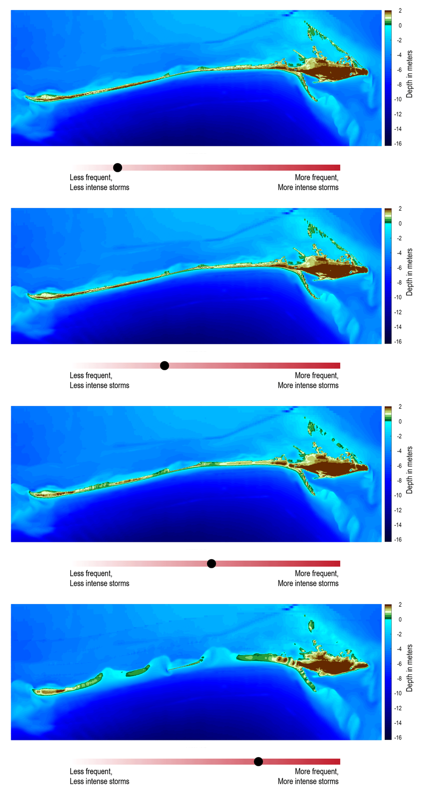
Storm and sea level rise scenario models, like the one shown here, can be used to explore the future. This model shows what Dauphin Island may look like 10 years from now if storms become stronger and more frequent (Passeri and others, 2018).
Storm and sea level rise scenario models, like the one shown here, can be used to explore the future. This model shows what Dauphin Island may look like 10 years from now if storms become stronger and more frequent (Passeri and others, 2018).

Fire Island is a 50-km long barrier island along the south shore of Long Island, NY. The island is comprised of seventeen year-round communities; federal, state, and county parks; and supports distinct ecosystems alongside areas of economic and cultural value.
Fire Island is a 50-km long barrier island along the south shore of Long Island, NY. The island is comprised of seventeen year-round communities; federal, state, and county parks; and supports distinct ecosystems alongside areas of economic and cultural value.

Scientist surveying the presence and behavior of birds at Pelican Island, Alabama. The CMHRP is working with personnel within the Ecosystems Mission Area on this project to identify how physical characteristics of barrier islands influence use by wintering shorebirds.
Scientist surveying the presence and behavior of birds at Pelican Island, Alabama. The CMHRP is working with personnel within the Ecosystems Mission Area on this project to identify how physical characteristics of barrier islands influence use by wintering shorebirds.
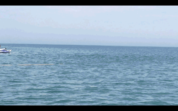
Most underwater seismic data is collected from large research vessels; however, the shoreface environment is shallower than areas in which most seismic surveys occur. To get the information we need to assess changes in shoreface geology, we mount our seismic instruments on pontoon floats and deploy the instrument from the beach.
Most underwater seismic data is collected from large research vessels; however, the shoreface environment is shallower than areas in which most seismic surveys occur. To get the information we need to assess changes in shoreface geology, we mount our seismic instruments on pontoon floats and deploy the instrument from the beach.

We mount our seismic instrument on pontoon floats with wheels. This setup is deployed from the beach and eventually towed behind our survey vessel.
We mount our seismic instrument on pontoon floats with wheels. This setup is deployed from the beach and eventually towed behind our survey vessel.

Scientists at the St.

Coastal wetland ecosystems in Jamaica Bay, New York, provide important ecosystem services along the highly urbanized Atlantic coast.
Coastal wetland ecosystems in Jamaica Bay, New York, provide important ecosystem services along the highly urbanized Atlantic coast.

A brain coral infected with Stony Coral Tissue Loss Disease (SCTLD) in the Florida Keys National Marine Sanctuary in April 2018.
A brain coral infected with Stony Coral Tissue Loss Disease (SCTLD) in the Florida Keys National Marine Sanctuary in April 2018.

Illustration shows the cross-section of a barrier island progressing from ocean (on the right) to marsh and then lagoon (on the left).
Illustration shows the cross-section of a barrier island progressing from ocean (on the right) to marsh and then lagoon (on the left).

Two divers work to collect a long core sample from a coral reef in Florida.
Two divers work to collect a long core sample from a coral reef in Florida.

Coastal bathymetry, St. Thomas, US Virgin Islands, mapped using lidar and depicted with false-color (purple is deep, orange is shallow). Land areas are depicted with satellite imagery.
Coastal bathymetry, St. Thomas, US Virgin Islands, mapped using lidar and depicted with false-color (purple is deep, orange is shallow). Land areas are depicted with satellite imagery.

This model shows what Dauphin Island, Alabama, may look like under moderate storms but with increasing rates of sea level rise (Passeri and others, 2018).
This model shows what Dauphin Island, Alabama, may look like under moderate storms but with increasing rates of sea level rise (Passeri and others, 2018).

USGS unmanned aerial system (uas) mapping team on the beach in Dauphin Island, Alabama
USGS unmanned aerial system (uas) mapping team on the beach in Dauphin Island, Alabama

Perspective view of coastal bathymetry looking onshore, St. Thomas, US Virgin Islands, mapped using lidar and depicted with false-color, showing detailed submerged features, including coral reefs.
Perspective view of coastal bathymetry looking onshore, St. Thomas, US Virgin Islands, mapped using lidar and depicted with false-color, showing detailed submerged features, including coral reefs.

SPCMSC Research Microbiologist Christina Kellogg loading coral samples into an automated DNA extraction instrument for processing.
SPCMSC Research Microbiologist Christina Kellogg loading coral samples into an automated DNA extraction instrument for processing.

A panoramic view on Dauphin Island, Alabama. The island protects mainland Alabama’s coastal communities and resources from storms, while also providing recreational opportunities (fishing, beach tourism, etc.) and other economic benefits to the local community and state.
A panoramic view on Dauphin Island, Alabama. The island protects mainland Alabama’s coastal communities and resources from storms, while also providing recreational opportunities (fishing, beach tourism, etc.) and other economic benefits to the local community and state.