



This informational webpage provides an overview to community planners and emergency managers regarding the coastal hazards associated with collision, a regime within the storm impact scale. This page describes the conditions that lead to a collision regime and the risks it poses to local resources. Collision is the second of four storm impact regimes, and the first regime where substantial impacts are expected to the beach complex. Risks to people and infrastructure remain low.
This page is part of an eight-page series on coastal storm-impact regimes, or storm-impact scale. It builds on the overview page How Storm-Impact Regimes Affect Beach Complexes: Coastal Hazards, three "Let's Get Technical" deep dives (Beach Complex, Dunes & Beach Metrics, and Water Levels), and four pages describing the storm-impact regimes (Swash, Collision, Overwash, and Inundation). You can explore the full set through the linked text or the clickable tiles at the bottom of this page. We suggest reading the How Storm-Impact Regimes Affect Beach Complexes: Coastal Hazards overview and the Swash Regime pages first.
Collision Regime
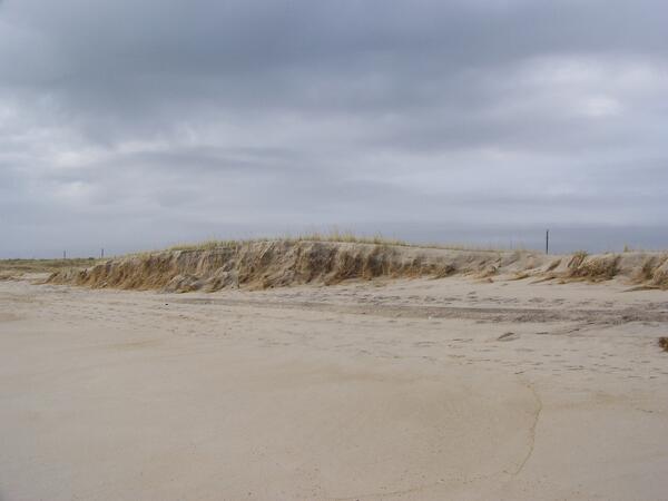
Over the course of a storm event (hurricanes, nor’easters or severe storm systems), coastal water levels can vary widely. The collision regime occurs if total water levels due to tide, surge, and waves reach or just exceed the elevation of the dune toe/base (Image 1).
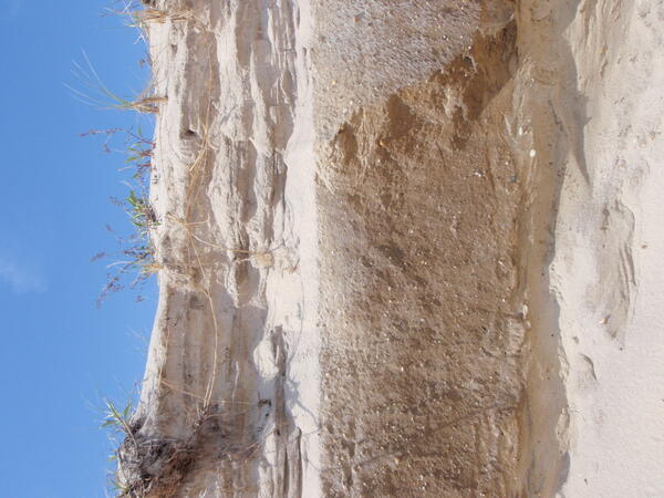
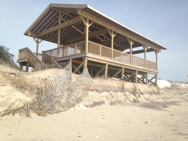
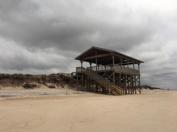
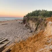
A collision regime typically leads to erosion of the seaward portion of the dune toe/base and a portion of the main dune (Images 2a and 2b). If the dune toe is eroded away, the dune may collapse, threatening the health of the beach system. Unlike erosion during swash regime, erosion of the dune toe does not repair quickly.
If the erosion of the dune is relegated to a small scarp (steep front of the dune, Image 2a) at the dune base, the dune can recover more quickly, provided that no additional impacts occur. If, however, the erosional event cuts away a significant portion of the seaward dune (Image 2b), recovery could take much longer.
Evidence of a collision event includes a very apparent dune scarp or exposed structures like old dune fencing or seawalls. Depending on how much of the dune was eroded away, the local community will likely be more susceptible to future storms until the dune has recovered.

Dune Erosion and Risks to Communities Associated with Collision Regime
Beach access can be impacted by the collision regime. If beach access is via dune cuts from parking lots, beachgoers may face a steep scarp that they have to climb up and down to reach the beach. If, instead, a dune walkover structure is built for beach access, collision can damage the lowest portion of the walkover on the beachside, creating a hazard for beachgoers or restricting access at that location.
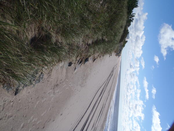
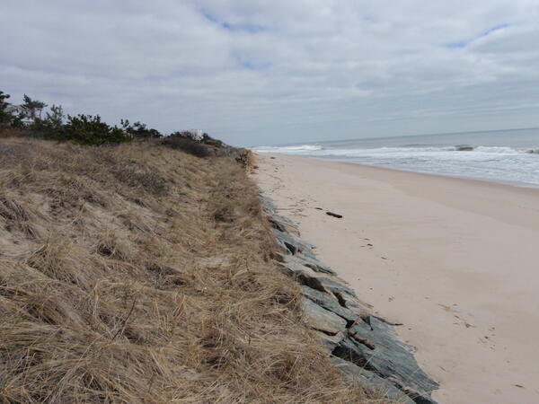
A collision event may reduce the area of dry beach available to beachgoers, particularly during rising or high tide. Additional hazards, such as rock seawalls (Image 3), portions of wood or rip-rap groins, or dilapidated sand fences with broken wood slats and sharp wires, may create tripping or falling hazards on the beach. Successive collision events can compound these threats. With a subsequent storm, beach and dune erosion could transition from a simple nuisance to an actual threat for beachgoers (Images 4a and 4b).
A single event may weaken the dune, but not generate any resultant hazards (a steep beach scarp, for instance) for the community’s beach. Subsequent storm events that would traditionally cause no negative impacts can instead compound existing damage, increasing impacts to the beach complex and beachgoers.
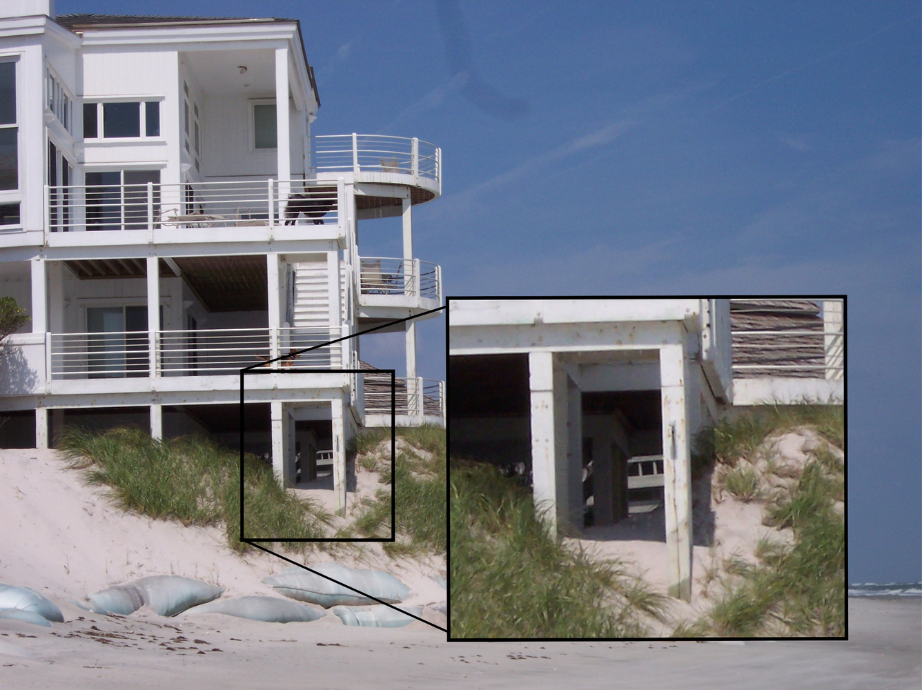
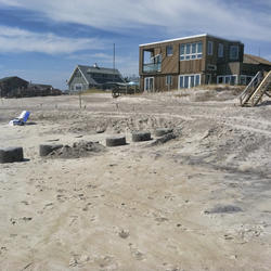
Whether a home is undermined depends on the extent of erosion and on local construction ordinances governing how close homes can be built to a dune. In many beachfront areas around the United States, homes are built perched right near the dune crest, in close proximity to the dune toe/base. For homes and businesses that are truly beachfront, a collision regime could undermine the building structure and/or cause significant damage to the lowest portions of the buildings (Image 5).
The big picture and the science behind it: The overview introduces the topic; the "Let's Get Technical" pages cover the beach complex, dunes, and water levels in detail.
How Storm-Impact Regimes Affect Beach Complexes: Coastal Hazards - Overview
Let's Get Technical: Beach Complex
Let's Get Technical: Dunes & Beach Metrics
Let's Get Technical: Water Levels
How severe is a coastal storm? Explore the four storm-impact regimes of increasing severity, from swash to inundation.
Swash Regime
Collision Regime
Overwash Regime
Inundation Regime

Swash Regime

Overwash Regime
Inundation Regime

Let’s Get Technical: Beach Complex
Let’s Get Technical: Dunes & Beach Metrics

Let's Get Technical: Water Levels
How Storm-Impact Regimes Affect Beach Complexes: Coastal Hazards

Scenario-Based Assessments for Coastal Change Hazard Forecasts

Storm-Induced Coastal Processes

Integration of Processes over Different Spatial and Temporal Scales

Forecasting Coastal Change
This informational webpage provides an overview to community planners and emergency managers regarding the coastal hazards associated with collision, a regime within the storm impact scale. This page describes the conditions that lead to a collision regime and the risks it poses to local resources. Collision is the second of four storm impact regimes, and the first regime where substantial impacts are expected to the beach complex. Risks to people and infrastructure remain low.
This page is part of an eight-page series on coastal storm-impact regimes, or storm-impact scale. It builds on the overview page How Storm-Impact Regimes Affect Beach Complexes: Coastal Hazards, three "Let's Get Technical" deep dives (Beach Complex, Dunes & Beach Metrics, and Water Levels), and four pages describing the storm-impact regimes (Swash, Collision, Overwash, and Inundation). You can explore the full set through the linked text or the clickable tiles at the bottom of this page. We suggest reading the How Storm-Impact Regimes Affect Beach Complexes: Coastal Hazards overview and the Swash Regime pages first.
Collision Regime
Over the course of a storm event (hurricanes, nor’easters or severe storm systems), coastal water levels can vary widely. The collision regime occurs if total water levels due to tide, surge, and waves reach or just exceed the elevation of the dune toe/base (Image 1).
A collision regime typically leads to erosion of the seaward portion of the dune toe/base and a portion of the main dune (Images 2a and 2b). If the dune toe is eroded away, the dune may collapse, threatening the health of the beach system. Unlike erosion during swash regime, erosion of the dune toe does not repair quickly.
If the erosion of the dune is relegated to a small scarp (steep front of the dune, Image 2a) at the dune base, the dune can recover more quickly, provided that no additional impacts occur. If, however, the erosional event cuts away a significant portion of the seaward dune (Image 2b), recovery could take much longer.
Evidence of a collision event includes a very apparent dune scarp or exposed structures like old dune fencing or seawalls. Depending on how much of the dune was eroded away, the local community will likely be more susceptible to future storms until the dune has recovered.
Dune Erosion and Risks to Communities Associated with Collision Regime
Beach access can be impacted by the collision regime. If beach access is via dune cuts from parking lots, beachgoers may face a steep scarp that they have to climb up and down to reach the beach. If, instead, a dune walkover structure is built for beach access, collision can damage the lowest portion of the walkover on the beachside, creating a hazard for beachgoers or restricting access at that location.
A collision event may reduce the area of dry beach available to beachgoers, particularly during rising or high tide. Additional hazards, such as rock seawalls (Image 3), portions of wood or rip-rap groins, or dilapidated sand fences with broken wood slats and sharp wires, may create tripping or falling hazards on the beach. Successive collision events can compound these threats. With a subsequent storm, beach and dune erosion could transition from a simple nuisance to an actual threat for beachgoers (Images 4a and 4b).
A single event may weaken the dune, but not generate any resultant hazards (a steep beach scarp, for instance) for the community’s beach. Subsequent storm events that would traditionally cause no negative impacts can instead compound existing damage, increasing impacts to the beach complex and beachgoers.
Whether a home is undermined depends on the extent of erosion and on local construction ordinances governing how close homes can be built to a dune. In many beachfront areas around the United States, homes are built perched right near the dune crest, in close proximity to the dune toe/base. For homes and businesses that are truly beachfront, a collision regime could undermine the building structure and/or cause significant damage to the lowest portions of the buildings (Image 5).
The big picture and the science behind it: The overview introduces the topic; the "Let's Get Technical" pages cover the beach complex, dunes, and water levels in detail.
How Storm-Impact Regimes Affect Beach Complexes: Coastal Hazards - Overview
Let's Get Technical: Beach Complex
Let's Get Technical: Dunes & Beach Metrics
Let's Get Technical: Water Levels
How severe is a coastal storm? Explore the four storm-impact regimes of increasing severity, from swash to inundation.
Swash Regime
Collision Regime
Overwash Regime
Inundation Regime
Swash Regime
Overwash Regime
Inundation Regime
Let’s Get Technical: Beach Complex
Let’s Get Technical: Dunes & Beach Metrics
Let's Get Technical: Water Levels
How Storm-Impact Regimes Affect Beach Complexes: Coastal Hazards
Scenario-Based Assessments for Coastal Change Hazard Forecasts
Storm-Induced Coastal Processes
Integration of Processes over Different Spatial and Temporal Scales