
Storm Impacts - Coastal System Change at Fire Island, New York
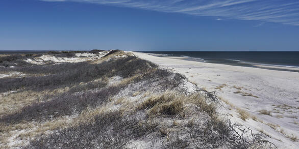
Fire Island is vulnerable to considerable storm activity year-round from both hurricanes and nor’easters. Storms are important drivers of coastal change in barrier island settings such as Fire Island. Larger storms carry sediment to the interior of the island via overwash, helping to create new habitat and build island resilience by adding back barrier width and interior elevation. Storms also cause flooding and erosion of beaches and dunes, creating hazards for ocean-front property, communities, and infrastructure. Over the last century, data collection efforts have resulted in a number of pre- and post-storm datasets that have allowed USGS researchers to quantify storm impacts from a variety of moderate to major storms.
Fire Island Home Page
USGS coastal research utilizes an integrated approach to measure long- and short-term changes to the Fire Island barrier island system, including open ocean/marine, nearshore, barrier island, and estuarine environments.
Hurricane Sandy

Hurricane Sandy was a unique storm for Fire Island because the metrics we typically use to measure storm impacts didn’t capture the magnitude of the event. USGS developed new metrics and models to quantify storm impacts and subsequent recovery.
Research
USGS measures and predicts storm-related coastal change to inform decision-makers and managers about impacts to people, infrastructure, and cultural and natural resources.


Hurricane Sandy
Resources and funding in the wake of Hurricane Sandy provided the opportunity to study the impacts of and recovery from a major storm event at Fire Island in a comprehensive way.
Other Storm Impacts to Fire Island
Since the late 1990s, USGS has been conducting research to quantify the impact from other hurricanes and nor'easters on the beaches and dunes at Fire Island.
Below are other science projects associated with this project.

Coastal System Change at Fire Island, New York

Back-barrier and Estuarine - Coastal System Change at Fire Island, New York

Oceanside Beaches and Dunes - Coastal System Change at Fire Island, New York

Open Ocean/Marine - Coastal System Change at Fire Island, New York

Nearshore - Coastal System Change at Fire Island, New York
Fire Island is vulnerable to considerable storm activity year-round from both hurricanes and nor’easters. Storms are important drivers of coastal change in barrier island settings such as Fire Island. Larger storms carry sediment to the interior of the island via overwash, helping to create new habitat and build island resilience by adding back barrier width and interior elevation. Storms also cause flooding and erosion of beaches and dunes, creating hazards for ocean-front property, communities, and infrastructure. Over the last century, data collection efforts have resulted in a number of pre- and post-storm datasets that have allowed USGS researchers to quantify storm impacts from a variety of moderate to major storms.
Fire Island Home Page
USGS coastal research utilizes an integrated approach to measure long- and short-term changes to the Fire Island barrier island system, including open ocean/marine, nearshore, barrier island, and estuarine environments.
Hurricane Sandy
Hurricane Sandy was a unique storm for Fire Island because the metrics we typically use to measure storm impacts didn’t capture the magnitude of the event. USGS developed new metrics and models to quantify storm impacts and subsequent recovery.
Research
USGS measures and predicts storm-related coastal change to inform decision-makers and managers about impacts to people, infrastructure, and cultural and natural resources.
Hurricane Sandy
Resources and funding in the wake of Hurricane Sandy provided the opportunity to study the impacts of and recovery from a major storm event at Fire Island in a comprehensive way.
Other Storm Impacts to Fire Island
Since the late 1990s, USGS has been conducting research to quantify the impact from other hurricanes and nor'easters on the beaches and dunes at Fire Island.
Below are other science projects associated with this project.
Coastal System Change at Fire Island, New York
Back-barrier and Estuarine - Coastal System Change at Fire Island, New York
Oceanside Beaches and Dunes - Coastal System Change at Fire Island, New York
Open Ocean/Marine - Coastal System Change at Fire Island, New York