U.S. flag

An official website of the United States government

Images

Upper Midwest Water Science Center images.

Filter Total Items: 581
Hydrologist measuring streamflow standing on a bridge, holding the end of a rope attached to an ADCP in a flowing brown river
Hydrologic Technician measuring streamflow using ADCP in Wisconsin

Hydrologic Technician Matt Bach measuring streamflow day after a rain event at USGS streamgage 04085078, DUTCHMAN CREEK AT HANSEN RD AT ASHWAUBENON, WI, using an Acoustic Doppler Current Profiler (ADCP). The ADCP measures water currents by transmitting "pings" of sound at a constant frequency into the water.

Hydrologic Technician Matt Bach measuring streamflow day after a rain event at USGS streamgage 04085078, DUTCHMAN CREEK AT HANSEN RD AT ASHWAUBENON, WI, using an Acoustic Doppler Current Profiler (ADCP). The ADCP measures water currents by transmitting "pings" of sound at a constant frequency into the water.

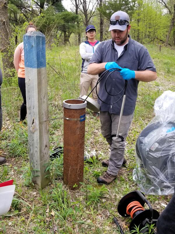
A man conducts a groundwater well monitoring demonstration in a grassy area
Groundwater well monitoring demonstration at Miesville Ravine Park, Minnesota
Installing a rapid deployment gage, MI
USGS crews install a rapid deployment gage, Midland, MI

A USGS hydrologic technician finishes installation of a rapid-deployment streamgage at Gordonville Road on the Tittabawassee River in Midland, Michigan.

Submerged equipment during Michigan flooding

This image shows a GLRI nutrient sampler submerged during major flooding on the Rifle River, Michigan, in May 2020. This site is near the Rifle River Near Sterling USGS streamgage.

Three scientists smile while one holds a large white sample jug under a fume hood
Scientists pose with filtration spike experiment

(L to R) Research Hydrologist Laura Hubbard, Supervisory Hydrologist Carrie Givens, and Microbiologist Erin Stelzer pose with filtration spike experiment equipment at the Michigan Bacteriological Research Laboratory (MI-BaRL) in Lansing, Michigan.

(L to R) Research Hydrologist Laura Hubbard, Supervisory Hydrologist Carrie Givens, and Microbiologist Erin Stelzer pose with filtration spike experiment equipment at the Michigan Bacteriological Research Laboratory (MI-BaRL) in Lansing, Michigan.

Hydrologic technician in bright green jacket measures stream discharge standing in creek surrounded by snow
Hydrotech making a winter discharge measurement at Allequash Creek near Sayner, Wisconsin

Hydrologic Technician Jarvis Kaderlik makes a discharge measurement at Allequash Creek near Sayner, Wisconsin, after making a long snowmobile trip and walking a half mile to the stream gage with plenty of snow on the ground. https://waterdata.usgs.gov/monitoring-location/05357205/

Canada geese in large numbers can contribute fecal contamination to waterbodies
Canada geese contribute fecal contamination to waterbodies
Illustration of subsurface-drained agricultural field

A hypothetical configuration of one of the two drained field sites, including a weather station for measuring climate data, a piezometer network for continuous water level measurements, soil moisture probes, and subsurface drainage flow. The third undrained field site will have a similar configuration, with the absence of subsurface drainage flow.

A hypothetical configuration of one of the two drained field sites, including a weather station for measuring climate data, a piezometer network for continuous water level measurements, soil moisture probes, and subsurface drainage flow. The third undrained field site will have a similar configuration, with the absence of subsurface drainage flow.

Streamgage mounted to bridge, view facing downstream river at dusk
Durand streamgage mounted to bridge

Durand streamgage mounted to bridge - looking downstream.

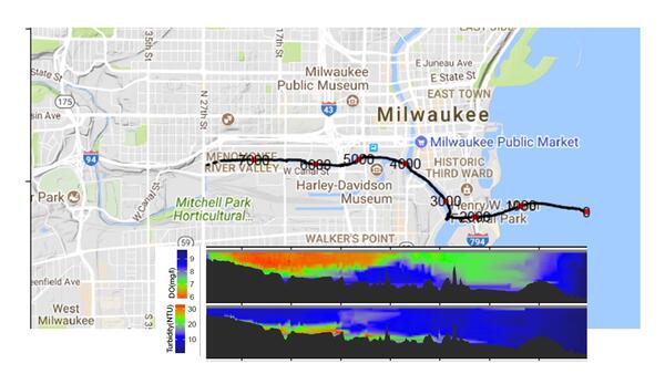
Map dissolved oxygen and turbidity Milwaukee River

Map of dissolved oxygen and turbidity along the Milwaukee River.

These data are preliminary or provisional and are subject to revision. They are being provided to meet the need for timely best science.

Map of dissolved oxygen and turbidity along the Milwaukee River.

These data are preliminary or provisional and are subject to revision. They are being provided to meet the need for timely best science.

Illustration with scientist sampling water, map of the pool lakes along with sampling sites, sediment coring sites, and buoy
Phosphorus Loading in the Winnebago Pool Lakes

The Winnebago Pool is a chain of 4 shallow lakes in Wisconsin. The drawing relates real-time monitoring as well as sampling that took place on the lakes, the agricultural factors affecting the nutrient loading of the pool, and the importance of the Winnebago Pool fishery.

The Winnebago Pool is a chain of 4 shallow lakes in Wisconsin. The drawing relates real-time monitoring as well as sampling that took place on the lakes, the agricultural factors affecting the nutrient loading of the pool, and the importance of the Winnebago Pool fishery.

Drawing represents 5 significant chemicals– Atrazine, Deet, BPA, Metolachlor, and 4-nonnylphenol
Chemicals of Ecological Concern

Great Lakes tributaries are influenced by a multitude of stressors that may cause adverse ecological effects. The drawing represents 5 of the many significant chemicals effecting the ecosystems – Atrazine, Deet, BPA, Metolachlor, and 4-nonylphenol.

Great Lakes tributaries are influenced by a multitude of stressors that may cause adverse ecological effects. The drawing represents 5 of the many significant chemicals effecting the ecosystems – Atrazine, Deet, BPA, Metolachlor, and 4-nonylphenol.

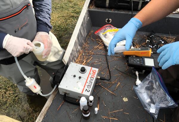
Two scientists filtering water in the field
Field filtration of water in the Florida Everglades

USGS scientists filter water while in the field in the Florida Everglades, to detect mercury in environmental samples.

Was this page helpful?