
Great Salt Lake
Great Salt Lake
Great Salt Lake Hydro Mapper
Deep Brine Layer and the Railroad Causeway that Separated the Lake
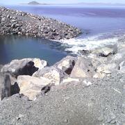
The Great Salt Lake is a kaliedoscope of colors and conditions. You may never see the same thing twice but you will never forget each moment you are there. It is a remnant of its former self, Lake Bonneville, and patriarch to its future self. Visit the lake and it will never cease to amaze.
Filter Total Items: 6
Dust from the Great Salt Lake dry lakebed: a possible health risk for communities in northern Utah
By analyzing dust samples in northern Utah, the USGS is providing crucial insights about the importance of water and lakebed management to mitigate dust pollution and protect vulnerable communities in northern Utah.

Great Salt Lake Elevations and Areal Extent
Great Salt Lake is unique among lakes in the Western Hemisphere because of its size and salt content. It occupies a low part of the desert area of western Utah and is a terminal lake with no outlet to the sea. It varies considerably in size, depending on its surface elevation. At an elevation of 4,200 feet above sea level, the approximate historical average, it covers about 1, 700 square miles and...

Quantifying Nutrient Mass and Internal Cycling in Great Salt Lake
The Great Salt Lake (GSL) is an indispensable economic and ecological resource. It provides critical habitat and food for millions of migratory birds, and generates nearly $200 million per year from recreational activities and the brine shrimp harvest industry (Bioeconomics, 2012). These uses, habitat and aquaculture, rely on a balanced supply of nutrients in the Great Salt Lake to support...

General Information, Facts, News, Publications and Partners
The western part of the conterminous United States is often thought of as being a desert without any large bodies of water. In the desert area of western Utah, however, lies Great Salt Lake, which in 1986, at its highest level, covered approximately 2,300 square miles and contained 30 million acre-feet of water (an acre-foot is the amount of water necessary to cover 1 acre of land with water 1...

Great Salt Lake - Fifty years of change through satellite images
The completion of the Railroad Causeway in 1959 divided the Great Salt Lake in half. Because all of the freshwater inflows enter the southern part of the lake, the north arm became much more saline than the south; well defined in the satellite images. Several years of greater than normal precipitation resulted in a large increase in the lake’s area during the early 1980's and the creation of a new...

Deep Brine Layer
In 1959, a solid-fill railroad causeway was constructed across the middle of the Great Salt Lake. The construction of the causeway divided the lake into two parts; the north (Gunnison Bay) and the south (Gilbert Bay). By 2013, water flowed from one side to the other through only two culverts near the center of the causeway. In December 2013, concern about the structural integrity of the culverts...