
Water Availability and Use
Featured Science | Assessing Baseflow in Scatter Creek
We are studying where and when Scatter Creek goes dry, as well as where and how much of its water is lost to the ground.
Featured Science | Streamflow Permanence in the Pacific Northwest
We are gathering data, developing new models, and providing data visualization and outreach tools.
Featured Science | Southeast Sound Groundwater Flow Model
Major aquifer study including the construction and calibration of a numerical groundwater flow model.
We research water availability so that the public knows how much water is available now and into the future. Our research focuses on determining the quantity, quality, and timing of water. In addition to conducting extensive monitoring, we develop detailed models to aid in addressing these complex topics.
Water Budgets
Water budgets are detailed accounts of water systems. They summarize the ins and outs, and sometimes the timing of water exchanges. Our work to develop water budgets helps water resource managers and communities make informed decisions about how they are using water.
Groundwater - Surface Water Interactions
In most areas of Washington, groundwater is hydraulically connected to nearby rivers, lakes, and wetlands. We study the groundwater – surface water interface to better understand how much water is moving from above and below ground. Knowledge of ground and surface water exchange helps managers protect these interconnected resources.
Hydrogeology
Our hydrogeologic studies focus on regional groundwater assessments, aquifer delineation, and inter-agency science support. We specialize in estimating aquifer properties, mapping 3-D hydrogeologic frameworks, determining flow rates and directions, and conducting tracer analyses.

Groundwater Model Support for Underground Injection Control Analysis, Pierce County, Washington

Updated classifications of flow permanence on streams in the Colville National Forest

Analysis of USGS Surface Water Monitoring Networks

Aquifer Recharge Study and Water-Budget Components of San Juan County, Washington

Aquifer Recharge Area Study of Guemes Island
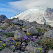
Drought preparedness in Mt. Rainier National Park

Hydrochemical Analysis of Groundwater in Jewel Cave National Monument

Assess the utility of a regional aquifer system groundwater model to inform the USGS National Hydrologic Model

Walla Walla River Basin groundwater-flow system, Oregon-Washington

Southeast Sound Groundwater Flow Model

Puget Sound Groundwater Low Flows Near Term Action Project
