Long Branch Monitoring Site in winter, Fairfax, VA
Long Branch Monitoring Site in winter, Fairfax, VAPhoto of the Long Branch intensive water monitoring site.

Official websites use .gov
A .gov website belongs to an official government organization in the United States.
Secure .gov websites use HTTPS
A lock () or https:// means you’ve safely connected to the .gov website. Share sensitive information only on official, secure websites.
Explore our planet and learn more about our work through photographs and imagery from scientists and support staff.

Photo of the Long Branch intensive water monitoring site.
Photo of the Long Branch intensive water monitoring site.

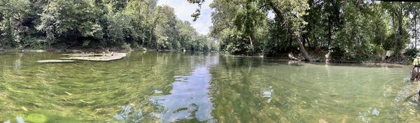
An intensive water quality monitoring station next to an urban stream in Fairfax, Virginia. During stormflow events, water levels can rise quickly and transport large amounts of nutrients and suspended sediment.
An intensive water quality monitoring station next to an urban stream in Fairfax, Virginia. During stormflow events, water levels can rise quickly and transport large amounts of nutrients and suspended sediment.

Clay pads are used to monitor sediment deposition in the Long Branch watershed in Fairfax, Virginia. Once installed, the amount of sediment deposited atop the clay pad can be periodically measured. This clay pad is obscured by one year's worth of sediment deposition.
Clay pads are used to monitor sediment deposition in the Long Branch watershed in Fairfax, Virginia. Once installed, the amount of sediment deposited atop the clay pad can be periodically measured. This clay pad is obscured by one year's worth of sediment deposition.

Stormflow in a Fairfax county stream. Part of the Fairfax County Water Resources Monitoring Network
Stormflow in a Fairfax county stream. Part of the Fairfax County Water Resources Monitoring Network

A flooded, turbid stream at Flatlick Branch Above Frog Branch at Chantilly, VA.
North Fork of the Shenandoah River, Virginia during a harmful algal bloom event. Mats of benthic algae coat the river bed.
North Fork of the Shenandoah River, Virginia during a harmful algal bloom event. Mats of benthic algae coat the river bed.

The stream gage at the Difficult Run Near Great Falls, VA monitoring station. This site is a part of the USGS Nontidal Network.
The stream gage at the Difficult Run Near Great Falls, VA monitoring station. This site is a part of the USGS Nontidal Network.

A water quality sampling bottle used to collect samples from S F Quantico Creek Near Independent Hill, VA. This site is part of the USGS nontidal network.
A water quality sampling bottle used to collect samples from S F Quantico Creek Near Independent Hill, VA. This site is part of the USGS nontidal network.

Water quality monitoring sondes installed at Difficult Run Near Great Falls, VA. Part of the USGS nontidal network.
Water quality monitoring sondes installed at Difficult Run Near Great Falls, VA. Part of the USGS nontidal network.

Accotink Creek is an urban creek in the Potomac watershed. Like many urban streams, it suffers from bank erosion, leading to high suspended sediment loads, steep banks, and fallen trees.
Accotink Creek is an urban creek in the Potomac watershed. Like many urban streams, it suffers from bank erosion, leading to high suspended sediment loads, steep banks, and fallen trees.

A USGS hydrotech conducts horizontally-integrated synoptic water quality sampling at Accotink Creek Near Annandale, VA.
A USGS hydrotech conducts horizontally-integrated synoptic water quality sampling at Accotink Creek Near Annandale, VA.

A USGS hydrotech uses a water quality sonde to measure conditions at Accotink Creek Near Annandale, VA. This monitoring station is part of the USGS nontidal network.
A USGS hydrotech uses a water quality sonde to measure conditions at Accotink Creek Near Annandale, VA. This monitoring station is part of the USGS nontidal network.

The Rabbit Branch stream in Fairfax County before the stream was restored. The effects of this stream restoration is monitored as a part of the Fairfax County Water Resources Monitoring Network.
The Rabbit Branch stream in Fairfax County before the stream was restored. The effects of this stream restoration is monitored as a part of the Fairfax County Water Resources Monitoring Network.

Photograph of the Rabbit Branch designed stream, located in Fairfax County. The effects of this stream restoration is monitored as a part of the Fairfax County Water Resources Monitoring Network.
Photograph of the Rabbit Branch designed stream, located in Fairfax County. The effects of this stream restoration is monitored as a part of the Fairfax County Water Resources Monitoring Network.

Photo of Blake Dudding, USGS, performing a survey on the banks of Lake Anna, Virginia
Photo of Blake Dudding, USGS, performing a survey on the banks of Lake Anna, Virginia

USGS Monitoring Station 016701405, alongside tributary and road side, Near Lake Anna, Virginia
Data for this monitoring station can be found at USGS Water Data for the Nation
USGS Monitoring Station 016701405, alongside tributary and road side, Near Lake Anna, Virginia
Data for this monitoring station can be found at USGS Water Data for the Nation

A USGS hydrologist conducts horizontally-integrated synoptic water sampling of the James River at Cartersville as part of the USGS's nontidal network monitoring efforts.
A USGS hydrologist conducts horizontally-integrated synoptic water sampling of the James River at Cartersville as part of the USGS's nontidal network monitoring efforts.

A U.S. Geological Survey (USGS) hydrologic technician prepares a sonde for deployment for collecting continuous water-quality data.
A U.S. Geological Survey (USGS) hydrologic technician prepares a sonde for deployment for collecting continuous water-quality data.

Turbidity is a measure of water clarity. High amounts of suspended solids increase turbidity. The more turbid the water, the less light can penetrate. In turbid waters, aquatic plants may die due to decreased light availability.
Turbidity is a measure of water clarity. High amounts of suspended solids increase turbidity. The more turbid the water, the less light can penetrate. In turbid waters, aquatic plants may die due to decreased light availability.

Nutrient pollution is caused when excess nutrients in the form of nitrogen and phosphorus are introduced into aquatic ecosystems, often due to leaching or surface water runoff. These excess nutrients can contribute to the degradation of downstream ecosystems.
Nutrient pollution is caused when excess nutrients in the form of nitrogen and phosphorus are introduced into aquatic ecosystems, often due to leaching or surface water runoff. These excess nutrients can contribute to the degradation of downstream ecosystems.

Lake Anna is a lake in Virginia impacted by Harmful Algal Blooms, or HABs. Note the greenish color of the water. This is caused by an excess of algae, some species of which could be toxic.
Lake Anna is a lake in Virginia impacted by Harmful Algal Blooms, or HABs. Note the greenish color of the water. This is caused by an excess of algae, some species of which could be toxic.