
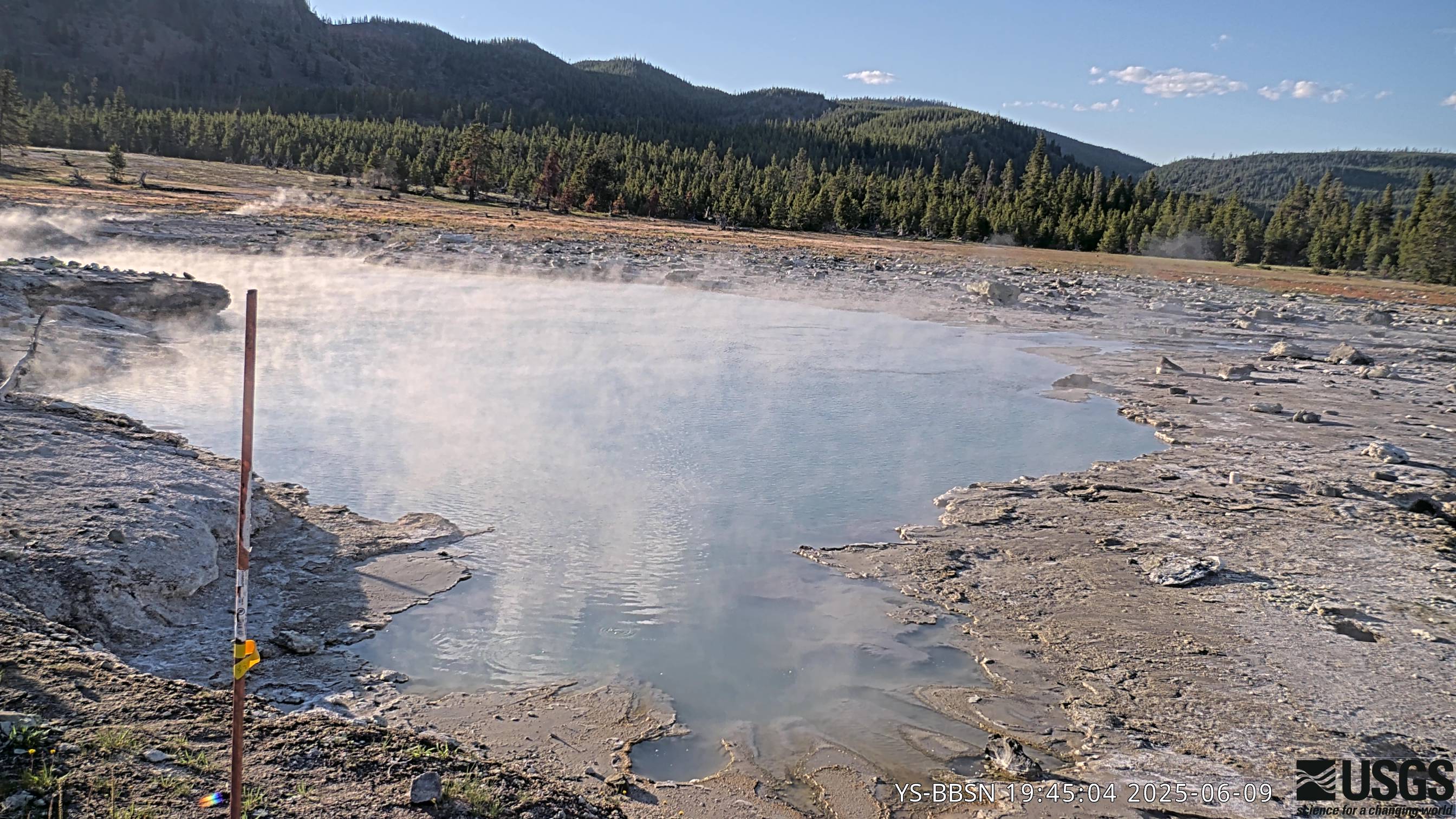
The camera view is north-northwest from the Biscuit Basin boardwalk looking at Black Diamond Pool, which is in the foreground (the tilted viewing angle is due to the slope of the boardwalk).
Webcams
Volcano Hazard Program webcams.
Filter Total Items: 40
Biscuit Basin webcam
The camera view is north-northwest from the Biscuit Basin boardwalk looking at Black Diamond Pool, which is in the foreground (the tilted viewing angle is due to the slope of the boardwalk).
Johnston Ridge Observatory, Mount St. Helens
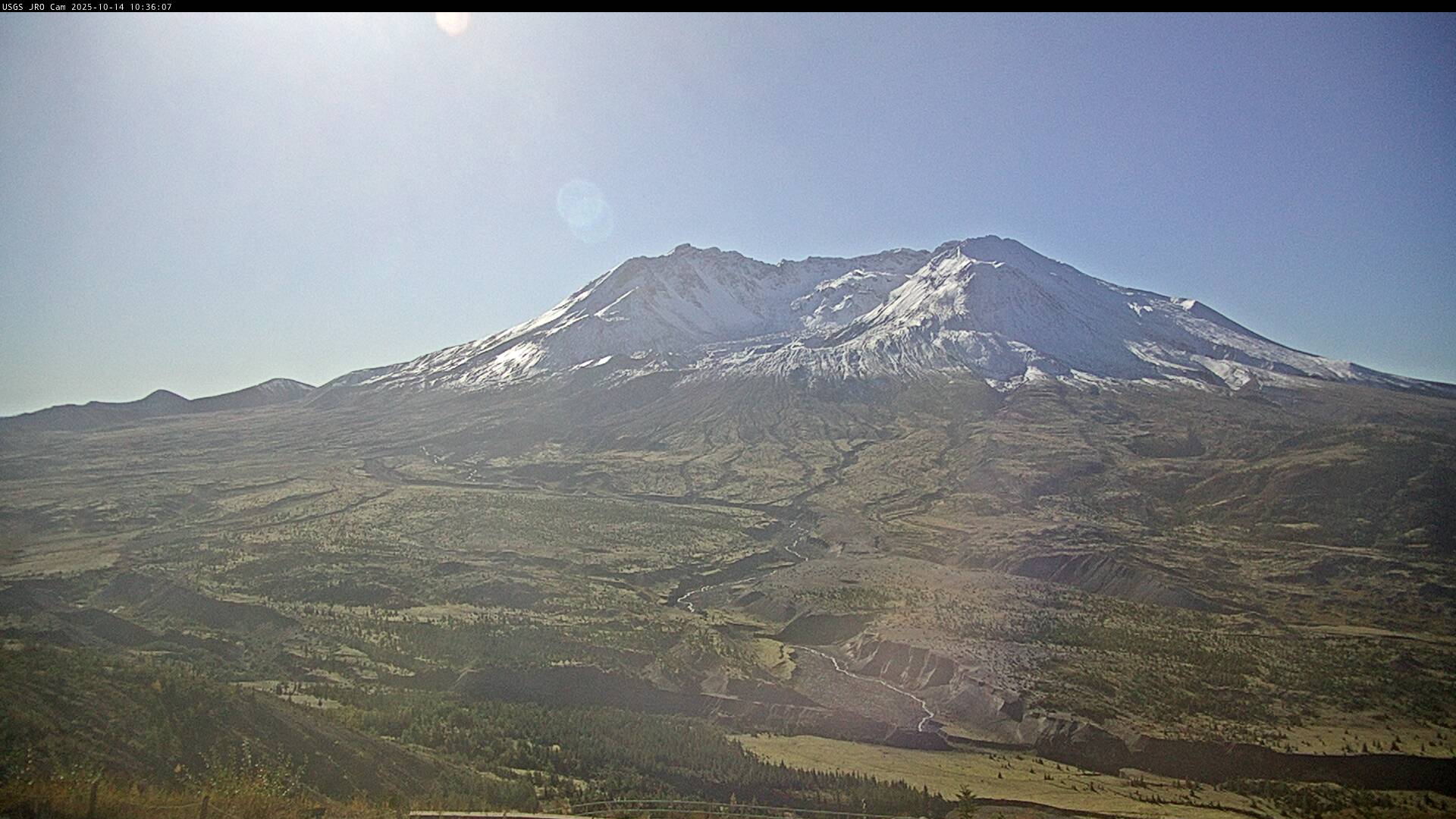
This static image is from a USGS Cascades Volcano Observatory research camera located at the Johnston Ridge Observatory, north of Mount St. Helens. The view is to the south. This camera is intended to assist the USGS with situational awareness. At times, clouds, rain, and snow obscure visibility.
This static image is from a USGS Cascades Volcano Observatory research camera located at the Johnston Ridge Observatory, north of Mount St. Helens. The view is to the south. This camera is intended to assist the USGS with situational awareness. At times, clouds, rain, and snow obscure visibility.

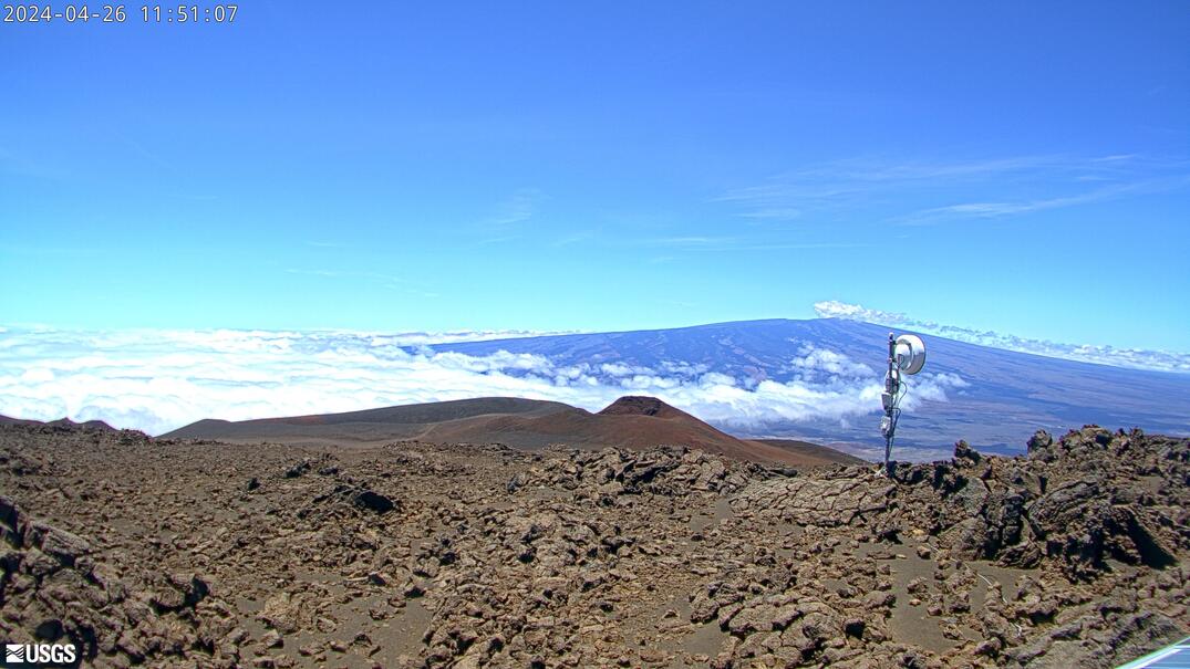
[HLcam] Live Image of Mauna Loa's northwest flank from Hualālai volcano
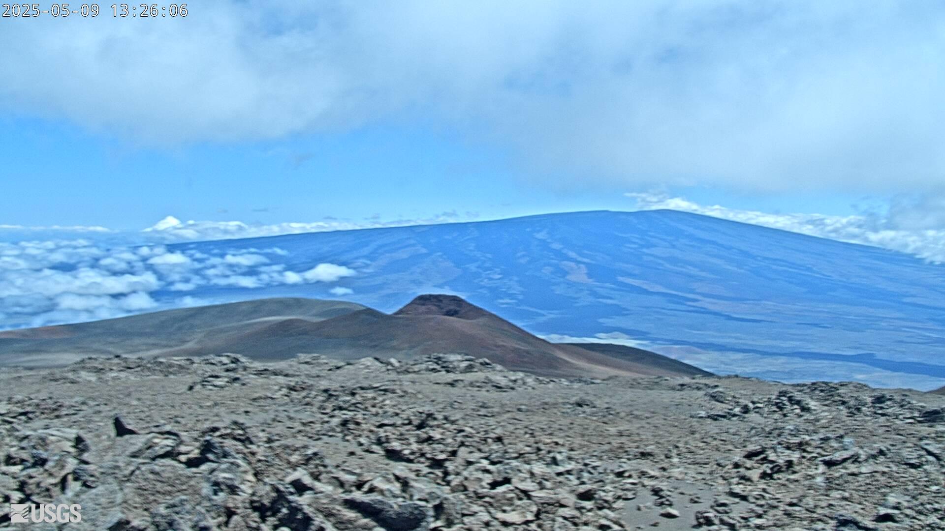
[HLcam] Live Image of Mauna Loa's northwest flank from Hualālai volcanoLive view of the northwest flank of Mauna Loa; the view is from the southeast flank of Hualālai [HLcam]. This camera is a pan-tilt-zoom model and the view may change depending on activity.
[HLcam] Live Image of Mauna Loa's northwest flank from Hualālai volcano
[HLcam] Live Image of Mauna Loa's northwest flank from Hualālai volcanoLive view of the northwest flank of Mauna Loa; the view is from the southeast flank of Hualālai [HLcam]. This camera is a pan-tilt-zoom model and the view may change depending on activity.
[MK2cam] Mauna Loa's Summit and Northeast Rift Zone from Mauna Kea
[MK2cam] Mauna Loa's Summit and Northeast Rift Zone from Mauna KeaLive Image of Mauna Loa's Summit and Northeast Rift Zone from Mauna Kea [MK2cam]. This camera is a pan-tilt-zoom model and the view may change depending on activity.
[MK2cam] Mauna Loa's Summit and Northeast Rift Zone from Mauna Kea
[MK2cam] Mauna Loa's Summit and Northeast Rift Zone from Mauna KeaLive Image of Mauna Loa's Summit and Northeast Rift Zone from Mauna Kea [MK2cam]. This camera is a pan-tilt-zoom model and the view may change depending on activity.

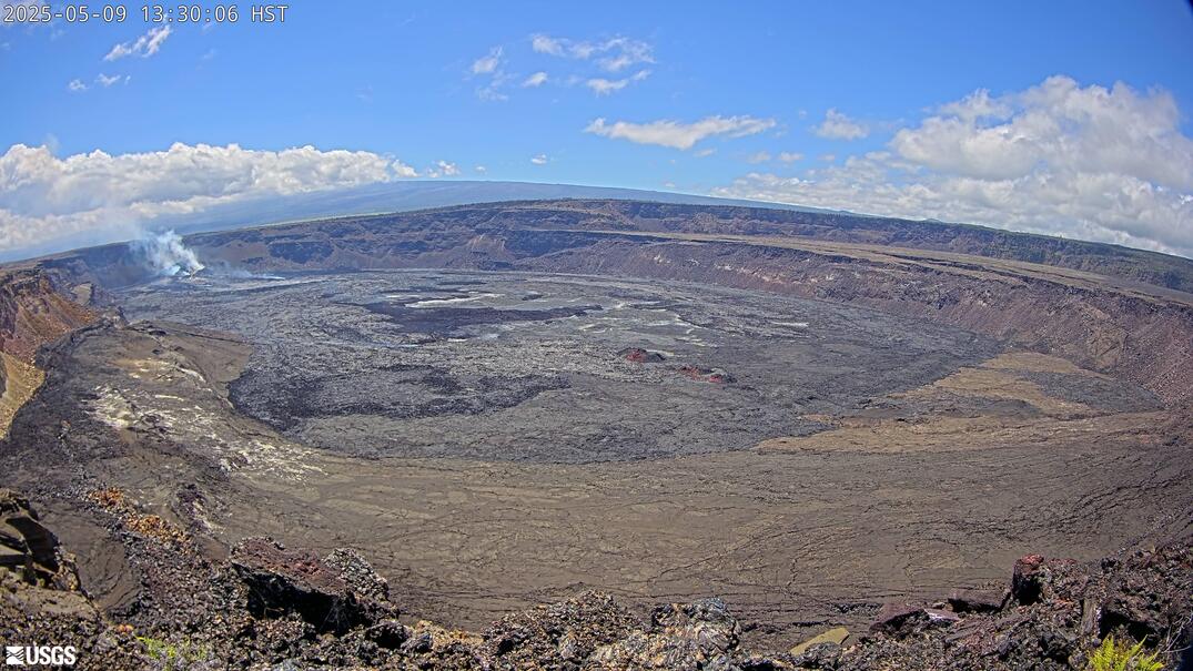
[V1cam] Kīlauea volcano, Hawaii (west Halemaʻumaʻu crater)
[V1cam] Kīlauea volcano, Hawaii (west Halemaʻumaʻu crater)Live view of Halemaʻumaʻu crater within Kaluapele (Kīlauea caldera), from the northwest rim of the crater [V1cam]. This camera is a pan-tilt-zoom model and the view may change depending on activity.
Disclaimer
[PScam] Puʻu ʻŌʻō South Flank from the South Rim
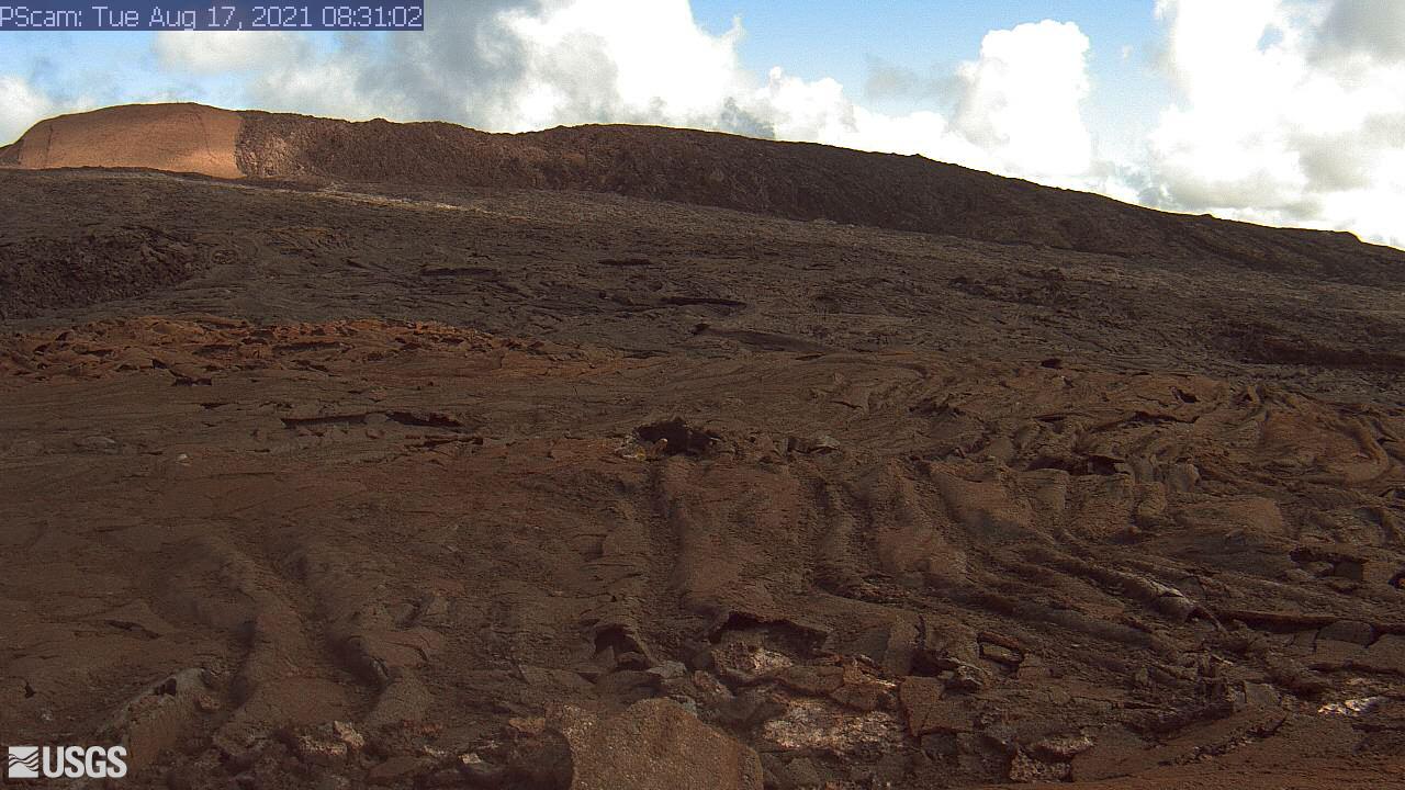
This image is from a temporary research camera positioned just south of Puʻu ʻŌʻō, looking north at the southern flank of Puʻu ʻŌʻō's cone.
Disclaimer
This image is from a temporary research camera positioned just south of Puʻu ʻŌʻō, looking north at the southern flank of Puʻu ʻŌʻō's cone.
Disclaimer
[B1cam] - Kīlauea caldera down-dropped block and Halemaʻumaʻu
[B1cam] - Kīlauea caldera down-dropped block and HalemaʻumaʻuLive view of Kīlauea caldera down-dropped block and Halemaʻumaʻu crater from the east rim of the caldera.
[B1cam] - Kīlauea caldera down-dropped block and Halemaʻumaʻu
[B1cam] - Kīlauea caldera down-dropped block and HalemaʻumaʻuLive view of Kīlauea caldera down-dropped block and Halemaʻumaʻu crater from the east rim of the caldera.
[MKcam]: Mauna Loa's Summit and Northeast Rift Zone from Mauna Kea
[MKcam]: Mauna Loa's Summit and Northeast Rift Zone from Mauna KeaLive Image of Mauna Loa's Summit and Northeast Rift Zone from Mauna Kea [MKcam].
[MKcam]: Mauna Loa's Summit and Northeast Rift Zone from Mauna Kea
[MKcam]: Mauna Loa's Summit and Northeast Rift Zone from Mauna KeaLive Image of Mauna Loa's Summit and Northeast Rift Zone from Mauna Kea [MKcam].
[S1cam] - Live view of the upper Southwest Rift Zone of Kīlauea, view is to the south
[S1cam] - Live view of the upper Southwest Rift Zone of Kīlauea, view is to the southLive view of the upper Southwest Rift Zone of Kīlauea, view is to the south - temporary webcam image [S1cam].
[S1cam] - Live view of the upper Southwest Rift Zone of Kīlauea, view is to the south
[S1cam] - Live view of the upper Southwest Rift Zone of Kīlauea, view is to the southLive view of the upper Southwest Rift Zone of Kīlauea, view is to the south - temporary webcam image [S1cam].
[KPcam] - Kīlauea Summit from Mauna Loa Strip Road
[KPcam] - Kīlauea Summit from Mauna Loa Strip RoadView from Mauna Loa Strip Road looking at the Kīlauea summit to document volcanic eruption plumes.
Disclaimer
[KPcam] - Kīlauea Summit from Mauna Loa Strip Road
[KPcam] - Kīlauea Summit from Mauna Loa Strip RoadView from Mauna Loa Strip Road looking at the Kīlauea summit to document volcanic eruption plumes.
Disclaimer

[KWcam] - Halemaʻumaʻu and down-dropped caldera floor; from the west rim of the summit caldera, looking southeast.
[KWcam] - Halemaʻumaʻu and down-dropped caldera floor; from the west rim of the summit caldera, looking southeast.Live Panorama of Halemaʻumaʻu and down-dropped caldera floor from the west rim of the summit caldera, looking southeast [KWcam].
Disclaimer
[MUcam] - Mauna Ulu Cam
This image is from a temporary research camera located on Mauna Ulu, looking northeast.
This image is from a temporary research camera located on Mauna Ulu, looking northeast.
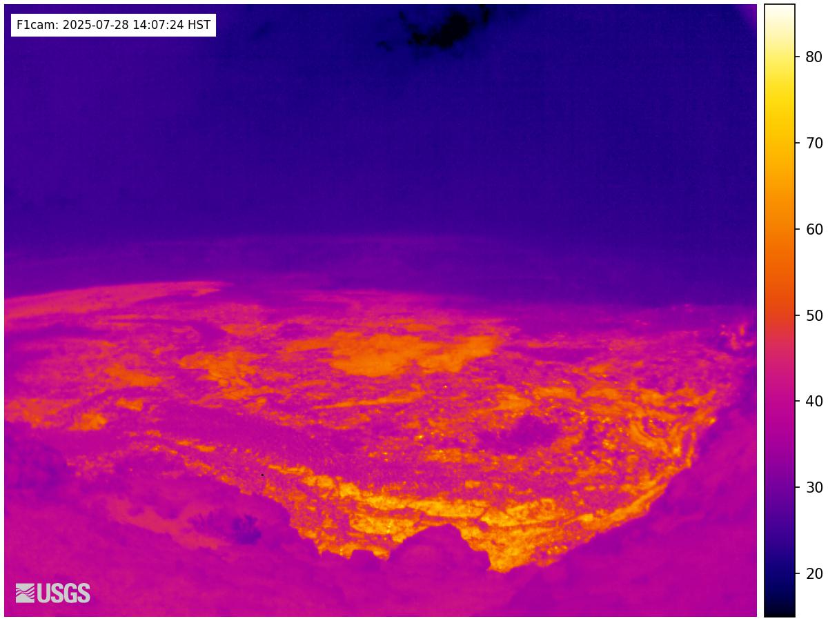
[F1cam] - Kīlauea summit thermal from the west rim of the summit caldera, looking southeast
[F1cam] - Kīlauea summit thermal from the west rim of the summit caldera, looking southeastLive Panorama of Halemaʻumaʻu - thermal image from the west rim of the summit caldera, looking southeast [F1cam].
[F1cam] - Kīlauea summit thermal from the west rim of the summit caldera, looking southeast
[F1cam] - Kīlauea summit thermal from the west rim of the summit caldera, looking southeastLive Panorama of Halemaʻumaʻu - thermal image from the west rim of the summit caldera, looking southeast [F1cam].
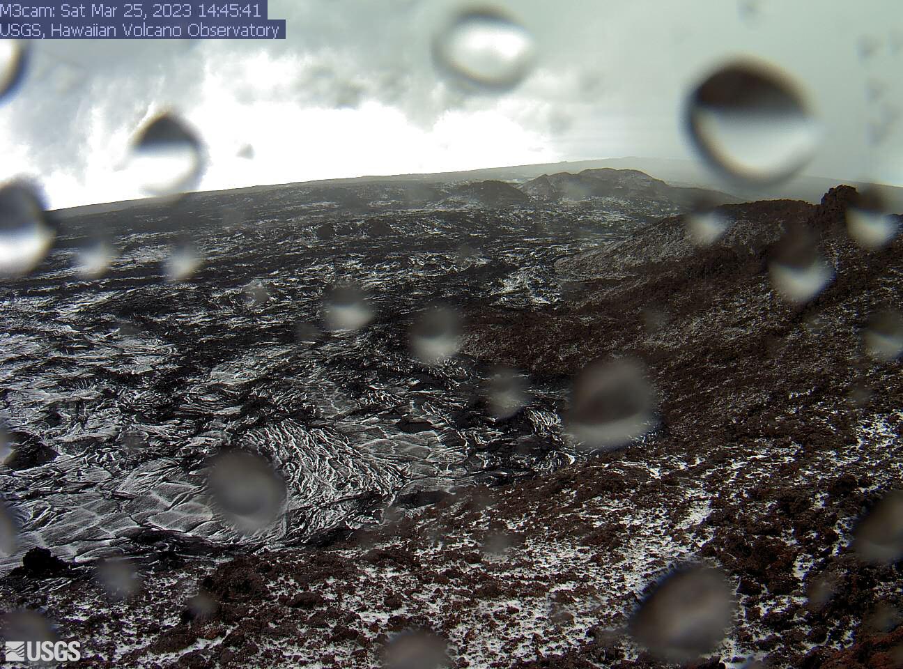
[M3cam] The Upper Part of Mauna Loa's Southwest Rift Zone
[M3cam] The Upper Part of Mauna Loa's Southwest Rift ZoneThis image is from a research camera positioned on a cone in Mauna Loa's Southwest Rift Zone in Hawaiʻi Volcanoes National Park. The camera looks northeast (upslope), focusing on the upper part of the Southwest Rift Zone. The upper flank of Mauna Loa forms the skyline.
Disclaimer
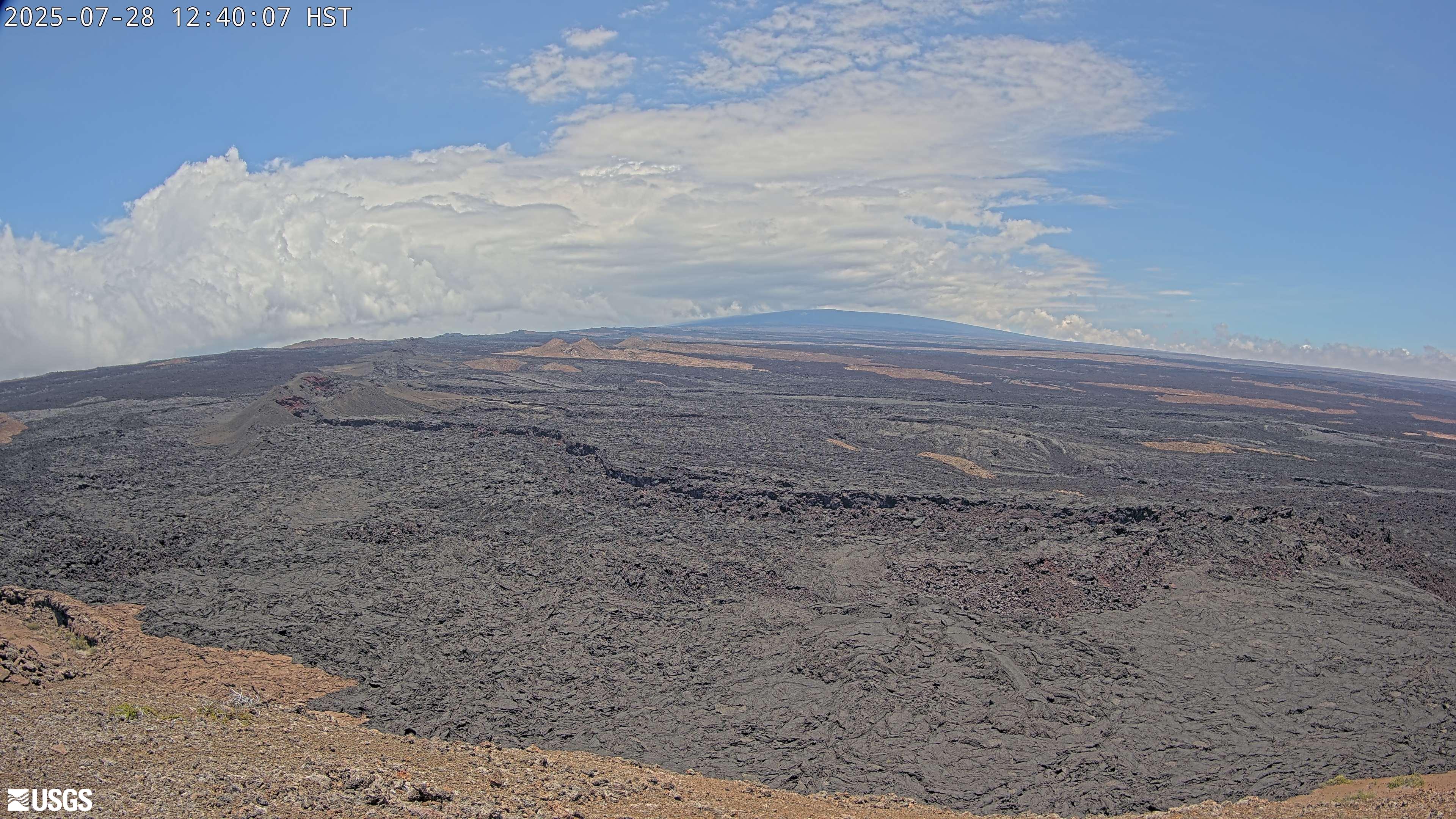
[M2cam] The Middle Part of Mauna Loa's Southwest Rift Zone
[M2cam] The Middle Part of Mauna Loa's Southwest Rift ZoneThis image is from a research camera positioned on a cone in Mauna Loa's Southwest Rift Zone in Hawaiʻi Volcanoes National Park. The camera looks northeast (upslope), focusing on the middle part of the Southwest Rift Zone. The volcano's summit is at upper right.
Disclaimer
[MLcam] Mokuʻāweoweo Caldera from the Northwest Rim
[MLcam] Mokuʻāweoweo Caldera from the Northwest RimThis image is from a research camera positioned on the north rim of Mokuʻāweoweo, the summit caldera of Mauna Loa volcano by the USGS Hawaiian Volcano Observatory. If you look carefully around early morning or late evening, you may see a few thermal areas emitting steam. See 'Current Activity' for the latest Mauna Loa information.

[HPcam] Lava Flow 61G from Holei Pali
This image is from a research camera positioned on Holei Pali, looking east towards Lava Flow 61G and Kalapana.
Disclaimer
This image is from a research camera positioned on Holei Pali, looking east towards Lava Flow 61G and Kalapana.
Disclaimer
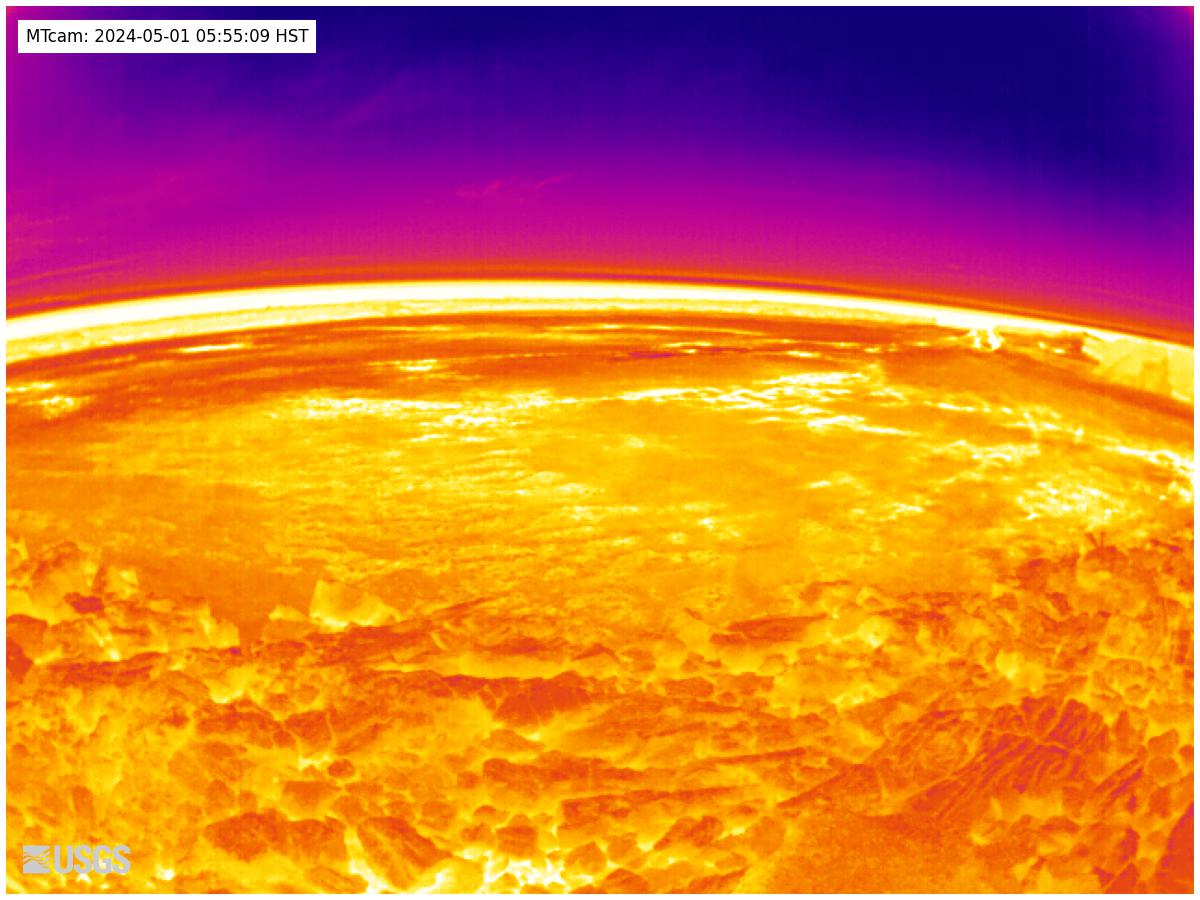
[MTcam] Mokuʻāweoweo Caldera Thermal from the Northwest Rim
[MTcam] Mokuʻāweoweo Caldera Thermal from the Northwest RimThis image is from a thermal camera located on the north rim of Mauna Loa's summit caldera. The camera was upgraded on November 8, 2023. Thermal webcams record in Centigrade, conversions to Fahrenheit are provided here for your convenience: 20°C=68°F, 40°C=104°F, 60°C=140°F, 80°C=176°F.
Disclaimer
[PGcam] Lower East Rift Zone Camera from Lower East Rift Zone
[PGcam] Lower East Rift Zone Camera from Lower East Rift ZoneThis image is from atop Puʻu Honuaula looking southwest towards Leilani Estates. Fissure 22 is on the far left, and Puʻu Kaliu is the cone left of center on the skyline. The fissure 8 channel wraps from the center of the image to the lower right side of the image.
Disclaimer
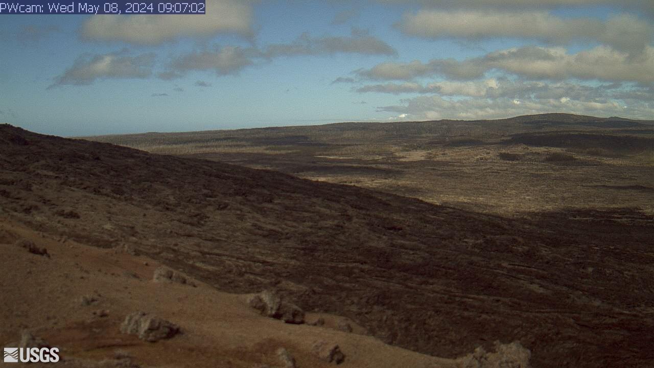
[PWcam] Puʻu ʻŌʻō West Flank from Puʻu ʻŌʻō
This image is from a research camera positioned on the northwest flank of Puʻu ʻŌʻō, looking southwest. On the morning of May 24, 2016, this camera was rotated to be pointed northeast to follow a new breakout on the east flank of Puʻu ʻŌʻō.
Disclaimer
This image is from a research camera positioned on the northwest flank of Puʻu ʻŌʻō, looking southwest. On the morning of May 24, 2016, this camera was rotated to be pointed northeast to follow a new breakout on the east flank of Puʻu ʻŌʻō.
Disclaimer
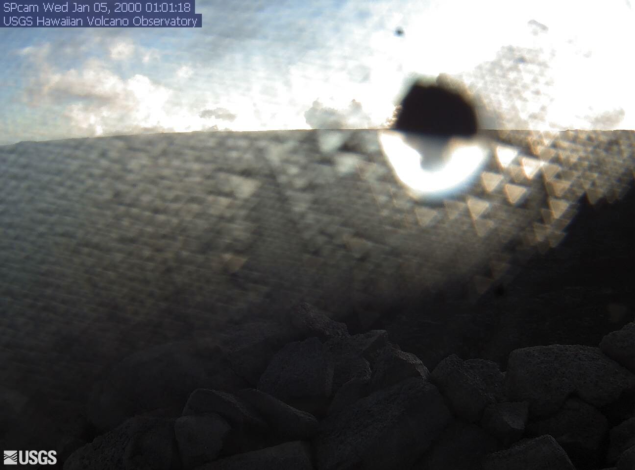
[SPcam] South Pit from South Rim
This image is from a research camera positioned on the south rim of Mokuʻāweoweo, Mauna Loa's summit caldera, in Hawaiʻi Volcanoes National Park. The camera looks west-southwest, across South Pit, focusing on the south part of Mauna Loa's summit region and upper Southwest Rift Zone.
Disclaimer
This image is from a research camera positioned on the south rim of Mokuʻāweoweo, Mauna Loa's summit caldera, in Hawaiʻi Volcanoes National Park. The camera looks west-southwest, across South Pit, focusing on the south part of Mauna Loa's summit region and upper Southwest Rift Zone.
Disclaimer