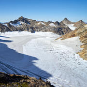
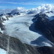
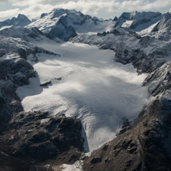
Scientist working on Sperry Glacier in Glacier National Park, Montana. Sperry Glacier occupies a broad, shallow cirque situated just beneath and west of the Continental Divide in the Lewis Mountain Range of Glacier National Park, Montana. Due to its position on the Continental Divide the glacier is influenced by both maritime and continental air masses.
Caitlyn Florentine, Ph.D.
I research the cryosphere (frozen Earth) using an approach that integrates in situ data collected in the field, remotely-sensed data, and simple numerical models. My main research interest is in quantitative glaciology, especially regarding the physics of glacier flow and glacier-climate relationships.
Research Interests
The snow and ice systems I study are intimately linked to the lithosphere, biosphere, and hydrosphere. My research therefore often overlaps with avalanche science, geology, geomorphology, ecology, and hydrology in alpine and Arctic settings. Currently I work with the U.S. Geological Survey Glaciers and Climate Project and the Climate Change in Mountain Ecosystems group.
Education and Certifications
Ph.D. Geosciences. 2018. University of Montana, Missoula, Montana
M.S. Earth Sciences. 2011. Montana State University, Bozeman, Montana
B.A. Geology. 2007. Colorado College, Colorado Springs, Colorado
Science and Products
Glaciers and Climate Project
Lemon Creek Glacier
South Cascade Glacier
Gulkana Glacier
Sperry Glacier
Additional Research Glaciers
Wolverine Glacier
Mass Balance Summary
Mass Balance Methods - Measuring Glacier Change
Glaciers—Understanding Climate Drivers
Assessing the Vulnerability of Alaska’s Glaciers in a Changing Climate
USGS Benchmark Glacier Project
Annual End-of-Summer Snow Cover on Glaciers in Alaska and Northwest Canada
Firn Density and Stratigraphy Observations from USGS Benchmark Glaciers
Scanned field notebooks from a USGS Benchmark Glacier: South Cascade Glacier, Washington,1957 - 2022
USGS Benchmark Glacier Mass Balance and Project Data
Geodetic Data for USGS Benchmark Glaciers: Orthophotos, Digital Elevation Models, Glacier Boundaries and Surveyed Positions
Glacier-Wide Mass Balance and Compiled Data Inputs
Raw Ground Penetrating Radar Data on North American Glaciers
Scientist working on Sperry Glacier in Glacier National Park, Montana. Sperry Glacier occupies a broad, shallow cirque situated just beneath and west of the Continental Divide in the Lewis Mountain Range of Glacier National Park, Montana. Due to its position on the Continental Divide the glacier is influenced by both maritime and continental air masses.
Two USGS scientists walk across the surface of Lemon Creek Glacier near the end of the melt season surrounded by green hills and barren rock.
Researchers walk amid the glacial ice and crevasses left bare by summer melt on Lemon Creek Glacier, AK.
Researchers use ground penetrating radar to determine the depth of the snow on Wolverine Glacier. Wolverine Glacier is in the Kenai Mountains on the coast of south-central Alaska. In 1966 scientists with the USGS began making direct measurements of surface mass balance at Wolverine Glacier, one of the "benchmark glaciers" in Alaska.
South Cascade Glacier, northwestern Washington State. South Cascade Glacier located in a north-northwest facing valley near the crest of the Cascade Range in northwest Washington state. In 1959 scientists with the USGS began collecting mass balance data on South Cascade Glacier, now one of five "benchmark glaciers" in the US.
Wolverine weather station collects weather data near the glacier to aid mass balance. Wolverine Glacier is in the Kenai Mountains on the coast of south-central Alaska. In 1966 scientists with the USGS began making direct measurements of surface mass balance at Wolverine Glacier, one of the "benchmark glaciers" in Alaska.
Scientists collecting snow core samples on Sperry Glacier in Glacier National Park, Montana.
Scientist collection samples on South Cascade Glacier, northwestern Washington State. South Cascade Glacier located in a north-northwest facing valley near the crest of the Cascade Range in northwest Washington state. In 1959 scientists with the USGS began collecting mass balance data on South Cascade Glacier, now one of five "benchmark glaciers" in the US.
Scientists collecting data on South Cascade Glacier, Washington State. South Cascade Glacier is located in a north-northwest facing valley near the crest of the Cascade Range in northwest Washington state. In 1959 scientists with the USGS began collecting mass balance data on South Cascade Glacier, now one of five "benchmark glaciers" in the US.
Aerial view of Sperry Glacier in Glacier National Park, Montana. Sperry Glacier occupies a broad, shallow cirque situated just beneath and west of the Continental Divide in the Lewis Mountain Range of Glacier National Park, Montana. Due to its position on the Continental Divide the glacier is influenced by both maritime and continental air masses.
Direct measurements of firn-density evolution from 2016 to 2022 at Wolverine Glacier, Alaska
Glaciers and ice caps outside Greenland
Observing glacier elevation changes from spaceborne optical and radar sensors – an inter-comparison experiment using ASTER and TanDEM-X data
Brief communication: Recent estimates of glacier mass loss for western North America from laser altimetry
How to handle glacier area change in geodetic mass balance
Historical Structure from Motion (HSfM): Automated processing of historical aerial photographs for long-term topographic change analysis
Uncertainty of ICESat-2 ATL06- and ATL08-derived snow depths for glacierized and vegetated mountain regions
U.S. Geological Survey Benchmark Glacier Project
The U.S. Geological Survey Benchmark Glacier Project combines decades of direct glaciological data with remote sensing data to advance the quantitative understanding of glacier-climate interactions. The global loss of glaciers, and consequent implications for water resources, sea level rise, and ecosystem function underscores the importance of U.S. Geological Survey glaciology research to facilit
Specialized meltwater biodiversity persists despite widespread deglaciation
Parsing complex terrain controls on mountain glacier response to climate forcing
Glacier retreat in Glacier National Park, Montana
Reanalysis of the U.S. Geological Survey Benchmark Glaciers: Long-term insight into climate forcing of glacier mass balance
Non-USGS Publications**
reflects the present-day internal flow field in the ablation zone of western
Greenland Ice Sheet. Frontiers in Earth Science 6, 1-11. https://doi.org/10.3389/feart.2018.00044
and internal deformation at Lone Peak rock glacier, Big Sky, Montana, USA.
Journal of Glaciology 60, 453-462. https://doi.org/10.3189/2014JoG13J160
**Disclaimer: The views expressed in Non-USGS publications are those of the author and do not represent the views of the USGS, Department of the Interior, or the U.S. Government.
Glacier Dashboard
The U.S. Geological Survey Alaska Climate Adaptation Science Center collaborated with the Alaska Science Center and Northern Rocky Mountain Science Center to compile available datasets on glacier outlines, ice thickness, ice velocity, and glacier surface elevation change to assess the vulnerability of Alaskan glaciers. This data viewer reflects that effort.
The Glacier - Climate Connection
The Glacier-Climate Connection geonarrative tells the story of the U.S. Geological Survey Benchmark Glacier Project, one of the longest running studies of glaciers on Earth.