
Latest in Landsat July 2025 - Vol. 4 | Issue 6
Annual Land Cover Record Reaches 40 Years
Landsat-based products provide extensive time series analysis of U.S. landscapes
The USGS Annual National Land Cover Database (NLCD) is comprised of 6 raster-based land use and land cover science products for the conterminous United States.
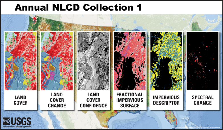
- Land Cover – This dataset provides 16 land cover classes such as deciduous and evergreen forest, grassland, cultivated crops and developed.
- Land Cover Change – These data represent annual land cover changes from one year to the next.
- Land Cover Confidence – This layer provides confidence levels for the land cover classifications.
- Fractional Impervious Surface – This component provides the proportion of land covered by developed surfaces, such as roads and rooftops.
- Impervious Descriptor – This feature offers additional information about impervious surfaces by distinguishing between roads and other built surfaces.
- Spectral Change Day of Year – This attribute captures the specific day of the year when significant changes in surface reflectance occur.
How is Annual NLCD data used?
Annual NLCD supports thousands of applications in the private, public and academic sectors. It has been used to develop land management policies, assess ecosystem status and health, and examine spatial patterns of biodiversity. It also serves as a critical data layer in national assessments of surface and ground water quality, wildfire monitoring and modeling, conservation efforts and more.
The following articles describe great examples of how Annual NLCD is being used to study land cover and land change in the United States.
-

Plenty of Water in Prairie Potholes Plenty of Water in Prairie Potholes
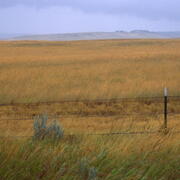
The landscape of the Prairie Pothole Region of North and South Dakota formed when glaciers from the last ice age receded. The potholes are shallow depressional wetlands left behind by the glaciers now popular with migratory waterfowl.
-
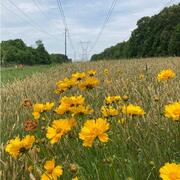
Landsat at Work: Energy Nurturing Nature Landsat at Work: Energy Nurturing Nature
The more land managers know about the land they manage, the better decisions they can make. This applies to everyone from farmers and ranchers to timber companies, and even utilities.
-
When Crops Take a Break When Crops Take a Break
Agricultural crops are grown on nearly 16% of the land across the lower 48 states. Thanks to the Landsat Satellite Program and the U.S. Geological Survey’s Annual National Land Cover Database (NLCD), we can tell where cropland has remained stable as cropland over the past 39 years. We can also see where it has changed from something else into cropland, or from cropland into something else.
USGS EROS Calibration/Validation Center of Excellence (ECCOE) Updates
The USGS EROS Calibration/Validation Center of Excellence (ECCOE) is a global leader in improving the accuracy, precision, and quality of remote sensing data. ECCOE focuses on improving the accuracy, precision, calibration, and product quality of remote-sensing data, leveraging years of multiscale optical system geometric and radiometric calibration and characterization experience. Visit the EROS CalVal Center of Excellence (ECCOE) Web Site to keep up to date on Landsat Calibration/Validation, Uncrewed Aircraft Systems, Lidar-3DEP, and Satellite Derived Bathymetry activities. Recent updates in ECCOE include:
Landsat Quarterly Calibration/Validation reports
The ECCOE Landsat Cal/Val Team continually monitors the geometric and radiometric performance of active Landsat missions and makes calibration adjustments, as needed, to maintain data quality at the highest level. Results of their analysis are summarized in quarterly USGS Open File Reports. The last report of 2024 was recently published, and joins all previous issues on the ECCOE's Landsat Calibration and Validation webpage.
2025 JACIE Workshop Presentation Recordings Available
The JACIE 2025 Workshop was held in April at the USGS Headquarters in Washington, DC. Over 95 presentations were highlighted over the 5 day meeting. The recordings and files of the presentations are available to peruse on the JACIE Workshop Presentations Search webpage.
Validating Landsat Passes
-

Eyes on Earth Episode 136 – The EROS Test Site
The same as the Landsat satellite, only smaller—that’s a fair description of the field spectrometer used at the EROS test site for validating Landsat’s accuracy.
Don't miss these interesting topics!
The Landsat 8/9 Long Term Acquisition Plan for Earth’s continental landmasses and near-shore coastal zones, Version 1.0
Landsat 8 and Landsat 9 Earth imaging acquisitions are guided by their respective Long Term Acquisition Plan (LTAP), that has been established for each satellite observatory. The LTAP is structured around the Worldwide Reference System-2 (WRS-2) grid, which partitions Landsat swath imaging of the Earth into ~185 × 180 km scenes using a path/row notation. These WRS-2 scenes represent the
An Introduction to Landsat Data Access and Processing in the Cloud
This video is a recording of a previous webinar entitled: “An Introduction to Landsat Data Access and Processing in the Cloud!.” This webinar was recorded on April 17, 2025.The United States Geological Survey (USGS) Earth Resources Observation and Science (EROS) Center maintains one of the largest civilian collection of images of the Earth’s land surface. At EROS we study land change and produce…
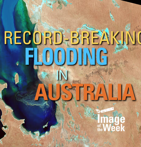
Record-Breaking Flooding in Australia (Image of the Week)
In May 2025, record rainfall in Australia's New South Wales created major flooding along the coast. In Taree, a mid-North Coast city, the Manning River reached a height of 6.4m on May 21st. The previous record of six meters was set back in 1929. The torrential rains have left almost 800 properties and counting uninhabitable in New South Wales.South Australia was hit in late March through early…
Do you have questions about Landsat? Check these out!
-

Landsat Frequently Asked Questions Landsat Frequently Asked Questions
This page lists commonly asked questions pertaining to the Landsat satellite missions, the science behind maintaining high quality Landsat data, and what products are available - and how to download them.
-

Connect Connect
Access the information on this page to learn more about Landsat, access our social media platforms, or contact us with questions you have about the Landsat missions, the available science products, and how to access Landsat data!
Keep up to date with Latest in Landsat!
Direct to your inbox, Landsat's monthly newsletter features current news, uses, tools, and announcements about America's Earth-observing satellite program.
The Landsat Program is a joint effort of the U.S. Geological Survey (USGS) and the National Aeronautics and Space Administration (NASA). This partnership creates the unprecedented, continuous record of changes to the Earth's surface worldwide.