California Volcano Observatory
Find U.S. Volcano
Learn More
Learn More
Settings
Map Legend
Map Legend
Current Updates and Notifications
As a part of the U.S. Geological Survey's Volcano Hazards Program, the California Volcano Observatory aims to advance scientific understanding of volcanic processes and lessen the harmful impacts of volcanic activity in the volcanically active areas of California and Nevada.
Young Volcanoes in California & Nevada
Very High Threat Potential 1
Lassen Volcanic Center
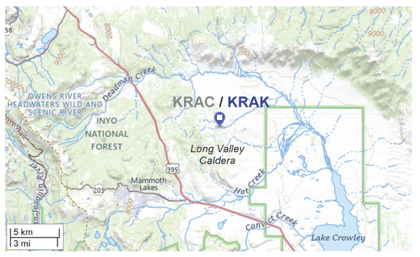
Long Valley Caldera
Mount Shasta
High Threat Potential 1
Clear Lake Volcanic Field
Medicine Lake
Mono-Inyo Chain
Salton Buttes
Moderate Threat Potential 1
Coso Volcanic Field
Mammoth Mountain
Mono Lake Volcanic Field
Soda Lakes (NV)
Ubehebe Craters
1. View the threat rankings of US Volcanoes.
California's Volcanic Hazards Geonarrative

GIS-based interactive website guides you through the eight young volcanic areas within California that pose the highest threat.
Volcano Research Laboratories

CalVO hosts several laboratories for multidisciplinary research of geologic phenomena.
The U.S. Geological Survey California Volcano Observatory (USGS CalVO) was formed in 2012 and is headquartered at Moffett Field, CA. It replaced the former Long Valley Observatory (LVO), which was established in 1982 to monitor the restless Long Valley Caldera and Mono-Inyo Craters region of Eastern California. CalVO now monitors these and other potentially hazardous volcanoes in California and Nevada to help communities and government authorities understand, prepare for, and respond to, volcanic activity.
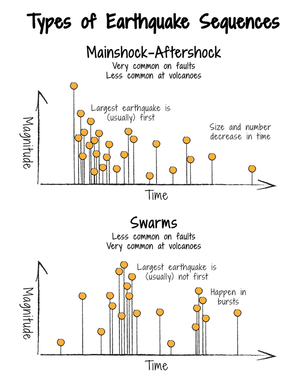
Sixteen young volcanoes designated as Low Threat to Very High Threat are dispersed throughout the State. Partially molten rock (magma) resides beneath at least seven of these—Medicine Lake Volcano, Mount Shasta, Lassen Volcanic Center, Clear Lake Volcanic Field, the Long Valley Volcanic Region, Coso Volcanic Field, and Salton Buttes— producing volcanic earthquakes(seismicity), toxic gas emissions, hot springs, and (or) ground movement (deformation).
News
Convening on caldera collapses
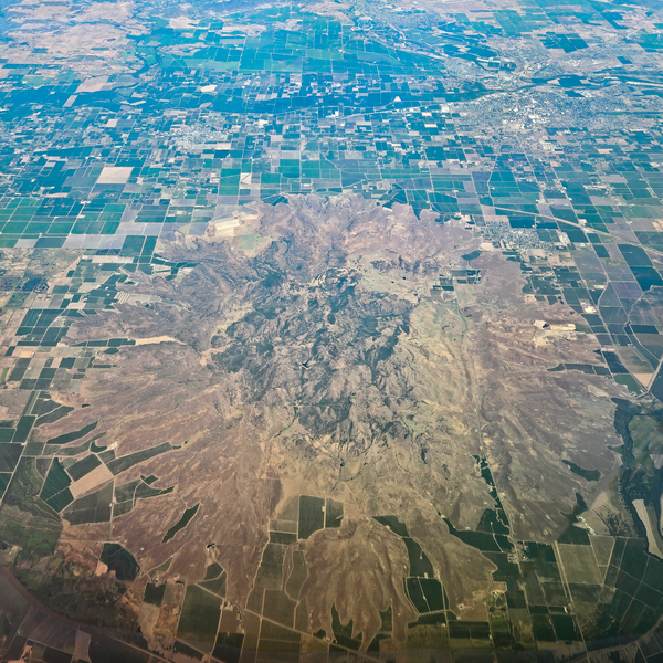
Why is there a volcano in California's Central Valley?
From macro to micro: Geologists study volcanoes at all scales!
Publications
Multidisciplinary constraints on magma compressibility, the pre-eruptive exsolved volatile fraction, and the H2O/CO2 molar ratio for the 2006 Augustine eruption, Alaska Multidisciplinary constraints on magma compressibility, the pre-eruptive exsolved volatile fraction, and the H2O/CO2 molar ratio for the 2006 Augustine eruption, Alaska
California’s exposure to volcanic hazards California’s exposure to volcanic hazards
Eruption probabilities for the Lassen Volcanic Center and regional volcanism, northern California, and probabilities for large explosive eruptions in the Cascade Range Eruption probabilities for the Lassen Volcanic Center and regional volcanism, northern California, and probabilities for large explosive eruptions in the Cascade Range
Science

Volcano Hazards Assessments

Volcano Monitoring at California Volcano Observatory