



R/V Petrel surveying off Beach Haven, NJ during USGS FA 2018-001-FA
Images
Images related to natural hazards.
Filter Total Items: 7275

R/V Petrel
R/V Petrel surveying off Beach Haven, NJ during USGS FA 2018-001-FA

Screenshot of Our Coast, Our Future
Screenshot of Our Coast, Our Future (OCOF) interactive map view of Stinson Beach, California, showing extent of flooding predicted if subjected to a sea-level rise of 100 centimeters (about 40 inches) and elevated water levels caused by a 100-year storm.
Screenshot of Our Coast, Our Future (OCOF) interactive map view of Stinson Beach, California, showing extent of flooding predicted if subjected to a sea-level rise of 100 centimeters (about 40 inches) and elevated water levels caused by a 100-year storm.

Clear day view of Mauna Loa during tradewind conditions from the su...
Clear day view of Mauna Loa during tradewind conditions from the su...Clear day view of Mauna Loa during tradewind conditions from the summit of Kīlauea Volcano.
Clear day view of Mauna Loa during tradewind conditions from the su...
Clear day view of Mauna Loa during tradewind conditions from the su...Clear day view of Mauna Loa during tradewind conditions from the summit of Kīlauea Volcano.

ShakeAlert sensor station being serviced by USGS personnel
ShakeAlert sensor station being serviced by USGS personnelA USGS electronics technician performs maintenance on a ShakeAlert Earthquake Early Warning (EEW) sensor station, located in the San Francisco Bay Area. ShakeAlert station components include strong-motion accelerometers, solar panel and battery power systems, and communications & telemetry equipment for communication with the wider ShakeAlert network.
ShakeAlert sensor station being serviced by USGS personnel
ShakeAlert sensor station being serviced by USGS personnelA USGS electronics technician performs maintenance on a ShakeAlert Earthquake Early Warning (EEW) sensor station, located in the San Francisco Bay Area. ShakeAlert station components include strong-motion accelerometers, solar panel and battery power systems, and communications & telemetry equipment for communication with the wider ShakeAlert network.

Mount Shasta, a steep-sided Cascade Range stratovolcano in Northern Ca
Mount Shasta, a steep-sided Cascade Range stratovolcano in Northern CaMount Shasta, a steep-sided Cascade Range stratovolcano in Northern California, looms above Little Glass Mountain, a thick obsidian flow erupted from the Medicine Lake shield volcano about 1,000 years ago. These are just two of the young volcanic areas monitored by the USGS California Volcano Observatory. USGS photo.
Mount Shasta, a steep-sided Cascade Range stratovolcano in Northern Ca
Mount Shasta, a steep-sided Cascade Range stratovolcano in Northern CaMount Shasta, a steep-sided Cascade Range stratovolcano in Northern California, looms above Little Glass Mountain, a thick obsidian flow erupted from the Medicine Lake shield volcano about 1,000 years ago. These are just two of the young volcanic areas monitored by the USGS California Volcano Observatory. USGS photo.

Nantucket and Marthas Vineyard geologic illustrations
Nantucket and Marthas Vineyard geologic illustrationsGeologic sections (C-C', D-D', and E-E') illustrating the general distributions and thicknesses of seismic stratigraphic units and major unconformities in the Martha’s Vineyard and Nantucket study areas.
Nantucket and Marthas Vineyard geologic illustrations
Nantucket and Marthas Vineyard geologic illustrationsGeologic sections (C-C', D-D', and E-E') illustrating the general distributions and thicknesses of seismic stratigraphic units and major unconformities in the Martha’s Vineyard and Nantucket study areas.

Faults and features of the Big Sur area
Shaded-relief map of central California showing location of the Big Sur area (white dashed line). Red line shows the San Gregorio-Hosgri fault (SGHF) and the Big Sur Bend between Point Sur (PS) and Piedras Blancas (PB). Black lines show other faults.
Shaded-relief map of central California showing location of the Big Sur area (white dashed line). Red line shows the San Gregorio-Hosgri fault (SGHF) and the Big Sur Bend between Point Sur (PS) and Piedras Blancas (PB). Black lines show other faults.

Big Sur Bend
Perspective view of part of the Big Sur Bend in the San Gregorio-Hosgri fault. The steep slope beside the fault results from uplift along the fault, which is part of the strike-slip fault system that forms the boundary in California between the Pacific and North American tectonic plates.
Perspective view of part of the Big Sur Bend in the San Gregorio-Hosgri fault. The steep slope beside the fault results from uplift along the fault, which is part of the strike-slip fault system that forms the boundary in California between the Pacific and North American tectonic plates.

Landslide near Potter Hill, Anchorage, Alaska
Landslide near Potter Hill, Anchorage, Alaska, after 2018 Anchorage earthquake.
Landslide near Potter Hill, Anchorage, Alaska, after 2018 Anchorage earthquake.

RV Petrel towing subbottom profiler
RV Petrel towing subbottom profiler (yellow raft) parallel to the beach to measure the thickness of sand offshore.
RV Petrel towing subbottom profiler (yellow raft) parallel to the beach to measure the thickness of sand offshore.

Ocean Bottom Seismometer Recovery
A WHCMSC and WHOI team recovered six intermediate period ocean bottom seismographs from the continental slope offshore New England in Georges Bank. The instruments had been deployed for about ten months to record background, ambient seismic noise.
A WHCMSC and WHOI team recovered six intermediate period ocean bottom seismographs from the continental slope offshore New England in Georges Bank. The instruments had been deployed for about ten months to record background, ambient seismic noise.

Views of Mauna Loa Volcano during clear weather day and on day when...
Views of Mauna Loa Volcano during clear weather day and on day when...These views of Mauna Loa are from near the Hawaiian Volcano Observatory looking toward the west. The view on left is typical during strong trade winds that blow the plume from Halema‘uma‘u Crater southwest of the summit area. The view on right is common during slack winds that allow vog conditions to develop in the summit area of Kīlauea.
Views of Mauna Loa Volcano during clear weather day and on day when...
Views of Mauna Loa Volcano during clear weather day and on day when...These views of Mauna Loa are from near the Hawaiian Volcano Observatory looking toward the west. The view on left is typical during strong trade winds that blow the plume from Halema‘uma‘u Crater southwest of the summit area. The view on right is common during slack winds that allow vog conditions to develop in the summit area of Kīlauea.

SEABOSS Collage
SEABed Observation and Sampling System (SEABOSS) (center image) and the MiniSEABOSS (right) designed for rapid, inexpensive, and effective collection of seabed imagery (photographs and video) as well sediment samples from the coastal/inner-continental shelf regions.
SEABed Observation and Sampling System (SEABOSS) (center image) and the MiniSEABOSS (right) designed for rapid, inexpensive, and effective collection of seabed imagery (photographs and video) as well sediment samples from the coastal/inner-continental shelf regions.

UAS pilots at Kilauea
Department of Interior UAS pilots from left to right – Elizabeth Pendleton (USGS, Woods Hole, MA), Colin Milone (Office of Aviation Services, AK), John Vogel (USGS; Flagstaff, AZ), Sandy Brosnahan (USGS, Woods Hole, MA), Brandon Forbes (USGS; Tucson, AZ), Chris Holmquist-Johnson (USGS; Fort Collins, CO),&nb
Department of Interior UAS pilots from left to right – Elizabeth Pendleton (USGS, Woods Hole, MA), Colin Milone (Office of Aviation Services, AK), John Vogel (USGS; Flagstaff, AZ), Sandy Brosnahan (USGS, Woods Hole, MA), Brandon Forbes (USGS; Tucson, AZ), Chris Holmquist-Johnson (USGS; Fort Collins, CO),&nb

Map of volcano threat category designated by color
Map of volcano threat category designated by colorMap showing the locations of all U.S. volcanoes with their threat category designated by color. Very high threat is red, high is orange, moderate is yellow, low is green, and very low is blue.
Map of volcano threat category designated by color
Map of volcano threat category designated by colorMap showing the locations of all U.S. volcanoes with their threat category designated by color. Very high threat is red, high is orange, moderate is yellow, low is green, and very low is blue.

Sediment textures distribution from Nantucket and Marthas Vineyard, MA
Sediment textures distribution from Nantucket and Marthas Vineyard, MAThe distribution of sediment textures within the study area. The bottom-type classification is from Barnhardt and others (1998) and is based on 16 sediment classes. The classification is based on four sediment units that include gravel (G), mud (M), rock (R), and sand (S). If the texture is greater than 90 percent, it is labeled with a single letter.
Sediment textures distribution from Nantucket and Marthas Vineyard, MA
Sediment textures distribution from Nantucket and Marthas Vineyard, MAThe distribution of sediment textures within the study area. The bottom-type classification is from Barnhardt and others (1998) and is based on 16 sediment classes. The classification is based on four sediment units that include gravel (G), mud (M), rock (R), and sand (S). If the texture is greater than 90 percent, it is labeled with a single letter.
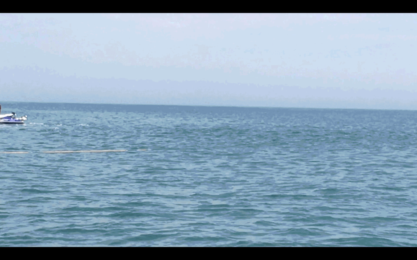
Deployment of the chirp seismic instrument from the beach
Deployment of the chirp seismic instrument from the beachMost underwater seismic data is collected from large research vessels; however, the shoreface environment is shallower than areas in which most seismic surveys occur. To get the information we need to assess changes in shoreface geology, we mount our seismic instruments on pontoon floats and deploy the instrument from the beach.
Deployment of the chirp seismic instrument from the beach
Deployment of the chirp seismic instrument from the beachMost underwater seismic data is collected from large research vessels; however, the shoreface environment is shallower than areas in which most seismic surveys occur. To get the information we need to assess changes in shoreface geology, we mount our seismic instruments on pontoon floats and deploy the instrument from the beach.

Seismic instrument on pontoon floats deployed from the beach
Seismic instrument on pontoon floats deployed from the beachWe mount our seismic instrument on pontoon floats with wheels. This setup is deployed from the beach and eventually towed behind our survey vessel.
Seismic instrument on pontoon floats deployed from the beach
Seismic instrument on pontoon floats deployed from the beachWe mount our seismic instrument on pontoon floats with wheels. This setup is deployed from the beach and eventually towed behind our survey vessel.

Three-dimensional model of Chimney Bluffs, New York along Lake Ontari
Three-dimensional model of Chimney Bluffs, New York along Lake OntariThree-dimensional model of Chimney Bluffs, New York along Lake Ontario created from low-altitude digital images collected from an unmanned aerial system (UAS).
Three-dimensional model of Chimney Bluffs, New York along Lake Ontari
Three-dimensional model of Chimney Bluffs, New York along Lake OntariThree-dimensional model of Chimney Bluffs, New York along Lake Ontario created from low-altitude digital images collected from an unmanned aerial system (UAS).

Coastal bathymetry, St. Thomas, US Virgin Islands, mapped using lidar
Coastal bathymetry, St. Thomas, US Virgin Islands, mapped using lidarCoastal bathymetry, St. Thomas, US Virgin Islands, mapped using lidar and depicted with false-color (purple is deep, orange is shallow). Land areas are depicted with satellite imagery.
Coastal bathymetry, St. Thomas, US Virgin Islands, mapped using lidar
Coastal bathymetry, St. Thomas, US Virgin Islands, mapped using lidarCoastal bathymetry, St. Thomas, US Virgin Islands, mapped using lidar and depicted with false-color (purple is deep, orange is shallow). Land areas are depicted with satellite imagery.
