
Video camera snapshot at Cowells Beach in Santa Cruz, California, looking southward. Learn more about the cameras and how we're using them to study coastal change.
Webcams
Webcams intro.
Filter Total Items: 94
Santa Cruz Cowells Beach
Video camera snapshot at Cowells Beach in Santa Cruz, California, looking southward. Learn more about the cameras and how we're using them to study coastal change.

Santa Cruz Main Beach, Time-Averaged
Video camera time-exposure image at Main Beach in Santa Cruz, California, looking eastward. Learn more about the cameras and how we're using them to study coastal change.
Video camera time-exposure image at Main Beach in Santa Cruz, California, looking eastward. Learn more about the cameras and how we're using them to study coastal change.

Santa Cruz Cowells Beach, Time-Averaged
Video camera time-exposure image at Cowells Beach in Santa Cruz, California, looking southward. Learn more about the cameras and how we're using them to study coastal change.
Video camera time-exposure image at Cowells Beach in Santa Cruz, California, looking southward. Learn more about the cameras and how we're using them to study coastal change.
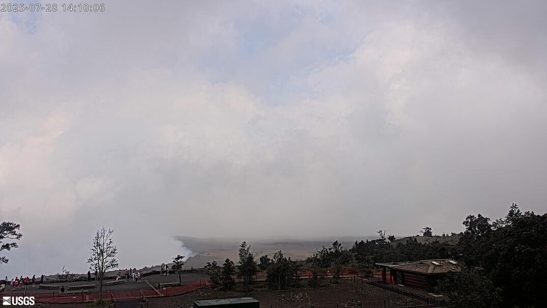
[M2cam] The Middle Part of Mauna Loa's Southwest Rift Zone
This image is from a research camera positioned on a cone in Mauna Loa's Southwest Rift Zone in Hawaiʻi Volcanoes National Park. The camera looks northeast (upslope), focusing on the middle part of the Southwest Rift Zone. The volcano's summit is at upper right.
Disclaimer
This image is from a research camera positioned on a cone in Mauna Loa's Southwest Rift Zone in Hawaiʻi Volcanoes National Park. The camera looks northeast (upslope), focusing on the middle part of the Southwest Rift Zone. The volcano's summit is at upper right.
Disclaimer
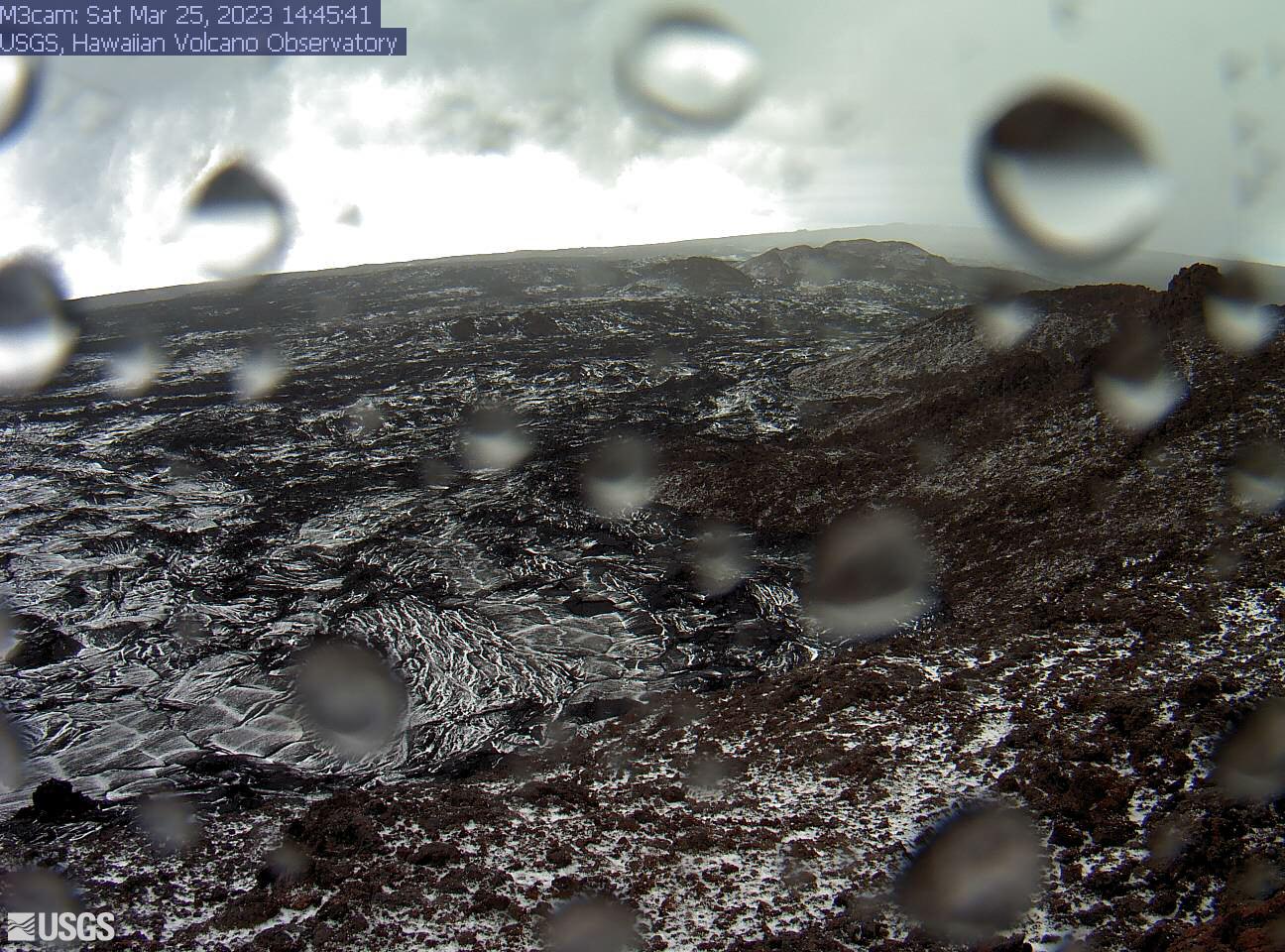
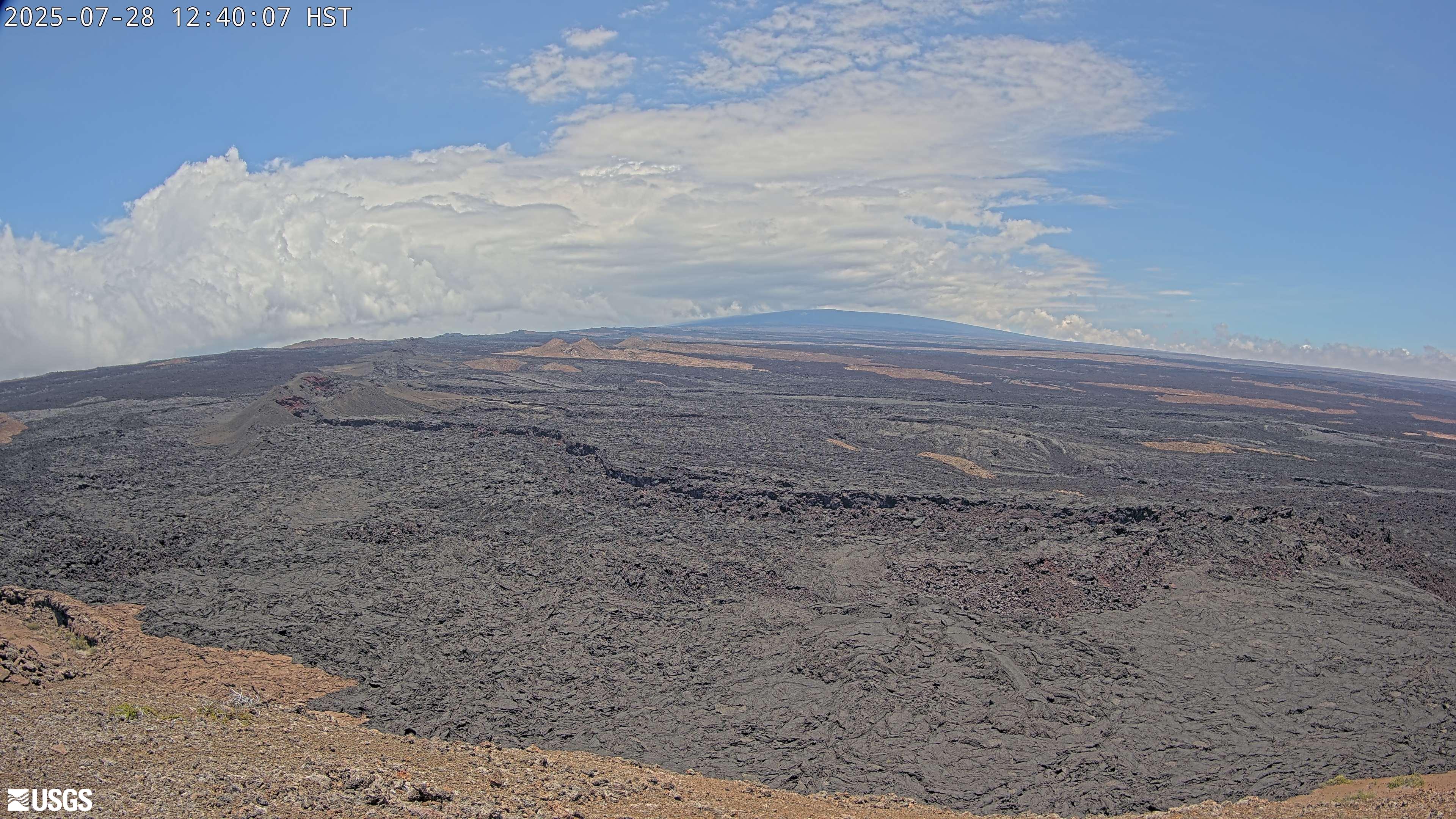
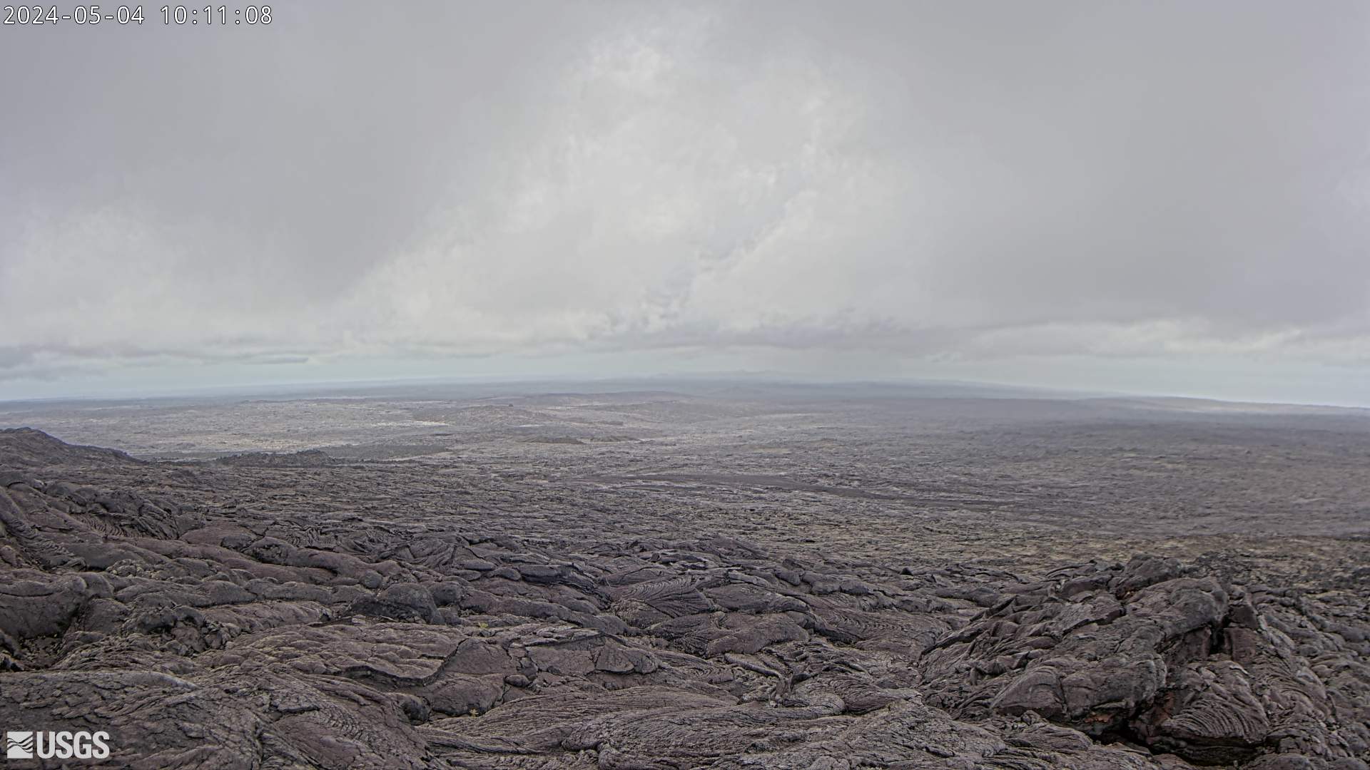
[M3cam] The Upper Part of Mauna Loa's Southwest Rift Zone
This image is from a research camera positioned on a cone in Mauna Loa's Southwest Rift Zone in Hawaiʻi Volcanoes National Park. The camera looks northeast (upslope), focusing on the upper part of the Southwest Rift Zone. The upper flank of Mauna Loa forms the skyline.
Disclaimer
This image is from a research camera positioned on a cone in Mauna Loa's Southwest Rift Zone in Hawaiʻi Volcanoes National Park. The camera looks northeast (upslope), focusing on the upper part of the Southwest Rift Zone. The upper flank of Mauna Loa forms the skyline.
Disclaimer
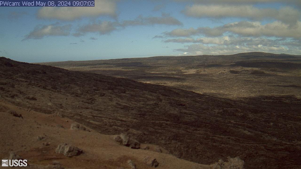
[PWcam] Puʻu ʻŌʻō West Flank from Puʻu ʻŌʻō
This image is from a research camera positioned on the northwest flank of Puʻu ʻŌʻō, looking southwest. On the morning of May 24, 2016, this camera was rotated to be pointed northeast to follow a new breakout on the east flank of Puʻu ʻŌʻō.
Disclaimer
This image is from a research camera positioned on the northwest flank of Puʻu ʻŌʻō, looking southwest. On the morning of May 24, 2016, this camera was rotated to be pointed northeast to follow a new breakout on the east flank of Puʻu ʻŌʻō.
Disclaimer
[R3cam] Mobile Cam 3
This image is from a research camera positioned on the southeast flank of Puʻu ʻŌʻō, looking toward the southeast.
This image is from a research camera positioned on the southeast flank of Puʻu ʻŌʻō, looking toward the southeast.

[HPcam] Lava Flow 61G from Holei Pali
This image is from a research camera positioned on Holei Pali, looking east towards Lava Flow 61G and Kalapana.
Disclaimer
This image is from a research camera positioned on Holei Pali, looking east towards Lava Flow 61G and Kalapana.
Disclaimer
[MLcam] Mokuʻāweoweo Caldera from the Northwest Rim
This image is from a research camera positioned on the north rim of Mokuʻāweoweo, the summit caldera of Mauna Loa volcano by the USGS Hawaiian Volcano Observatory. If you look carefully around early morning or late evening, you may see a few thermal areas emitting steam. See 'Current Activity' for the latest Mauna Loa information.
This image is from a research camera positioned on the north rim of Mokuʻāweoweo, the summit caldera of Mauna Loa volcano by the USGS Hawaiian Volcano Observatory. If you look carefully around early morning or late evening, you may see a few thermal areas emitting steam. See 'Current Activity' for the latest Mauna Loa information.
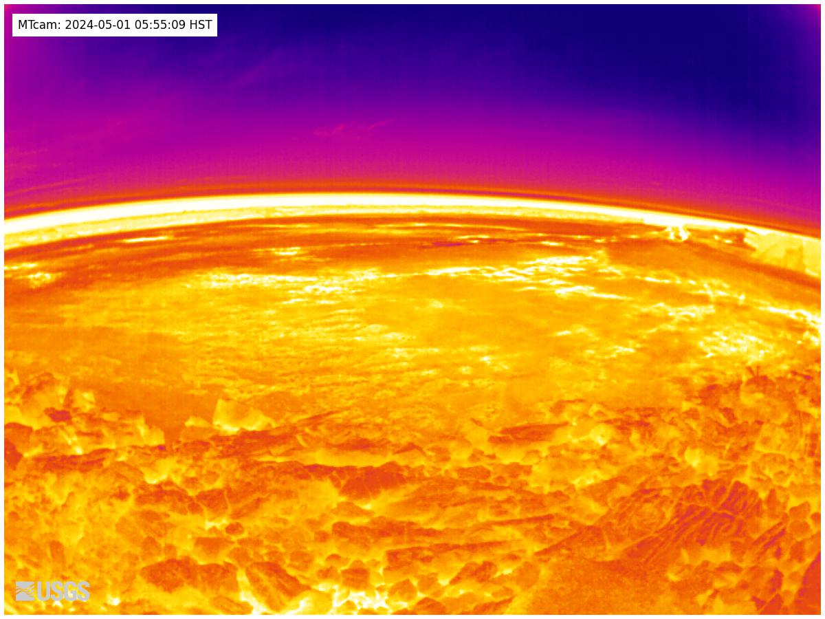
[MTcam] Mokuʻāweoweo Caldera Thermal from the Northwest Rim
This image is from a thermal camera located on the north rim of Mauna Loa's summit caldera. The camera was upgraded on November 8, 2023. The new camera is not currently temperature-calibrated, therefore it only provides a relative comparison of temperatures within view. For this reason, no temperature scale can be displayed at this time.
This image is from a thermal camera located on the north rim of Mauna Loa's summit caldera. The camera was upgraded on November 8, 2023. The new camera is not currently temperature-calibrated, therefore it only provides a relative comparison of temperatures within view. For this reason, no temperature scale can be displayed at this time.
[PGcam] Lower East Rift Zone Camera from Lower East Rift Zone
This image is from atop Puʻu Honuaula looking southwest towards Leilani Estates. Fissure 22 is on the far left, and Puʻu Kaliu is the cone left of center on the skyline. The fissure 8 channel wraps from the center of the image to the lower right side of the image.
Disclaimer
This image is from atop Puʻu Honuaula looking southwest towards Leilani Estates. Fissure 22 is on the far left, and Puʻu Kaliu is the cone left of center on the skyline. The fissure 8 channel wraps from the center of the image to the lower right side of the image.
Disclaimer
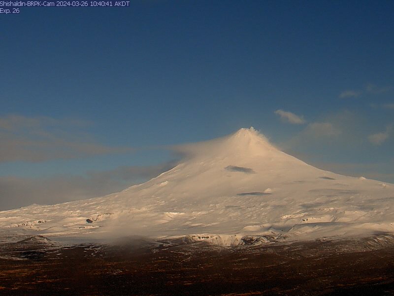
Shishaldin Volcano BRPK
View from the webcam located at Shishaldin Volcano, hosted by AVO. Read more details about Shishaldin Volcano.
View from the webcam located at Shishaldin Volcano, hosted by AVO. Read more details about Shishaldin Volcano.
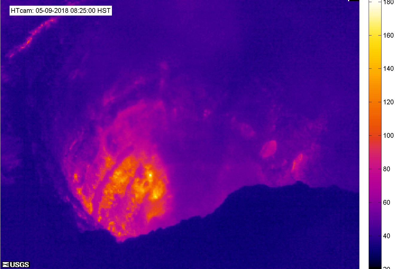
[HTcam] Halemaʻumaʻu Overlook Vent Thermal from Halemaʻumaʻu Overlook
This image is from a temporary thermal camera located on the south rim of Halemaʻumaʻu and looking steeply toward the north at the active Halemaʻumaʻu vent.
This image is from a temporary thermal camera located on the south rim of Halemaʻumaʻu and looking steeply toward the north at the active Halemaʻumaʻu vent.
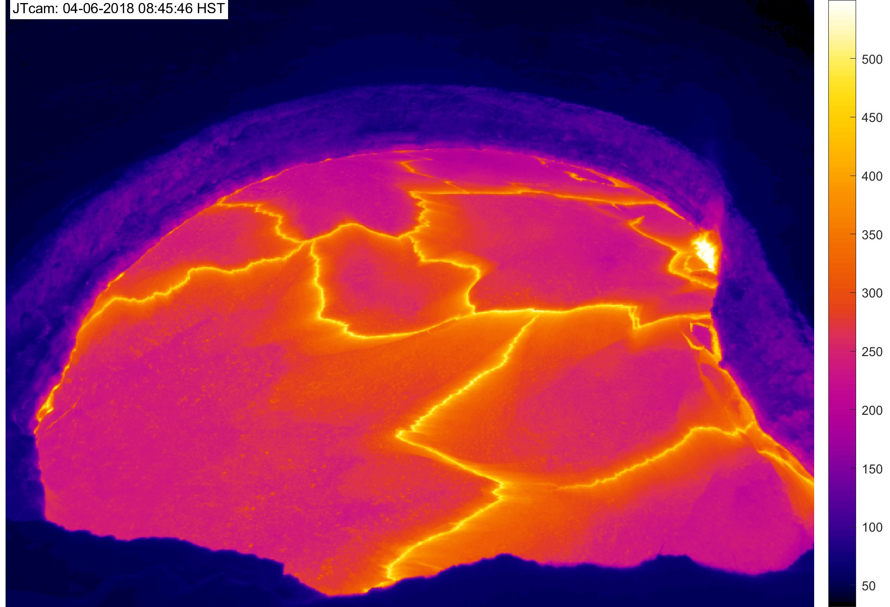
[JTcam] Halemaʻumaʻu Overlook Vent Thermal HD at Halemaʻumaʻu Overlook
This image is from a temporary thermal camera. The temperature scale is in degrees Celsius up to a maximum of 500 Celsius (932 Fahrenheit) for this camera model, and scales based on the maximum and minimum temperatures within the frame.
This image is from a temporary thermal camera. The temperature scale is in degrees Celsius up to a maximum of 500 Celsius (932 Fahrenheit) for this camera model, and scales based on the maximum and minimum temperatures within the frame.
[PEcam] Puʻu ʻŌʻō East Flank from East of Puʻu ʻŌʻō
This image is from a temporary research camera positioned northeast of Puʻu ʻŌʻō, on Puʻu Halulu, looking southwest toward the northeast flank of Puʻu ʻŌʻō.
Disclaimer
This image is from a temporary research camera positioned northeast of Puʻu ʻŌʻō, on Puʻu Halulu, looking southwest toward the northeast flank of Puʻu ʻŌʻō.
Disclaimer
[K2cam] Live Image of Kaluapele (Kīlauea caldera) from Uēkahuna bluff
This image is from a research camera on the bluff at Uēkahuna, overlooking the summit caldera of Kīlauea. This camera is a pan-tilt-zoom model and the view may change depending on activity.
This image is from a research camera on the bluff at Uēkahuna, overlooking the summit caldera of Kīlauea. This camera is a pan-tilt-zoom model and the view may change depending on activity.

Makushin Volcano [MREP]
This camera is located at MREP, on the southeast flank of Makushin, and looks northwest towards Makushin's summit. Read more about Makushin volcano.
This camera is located at MREP, on the southeast flank of Makushin, and looks northwest towards Makushin's summit. Read more about Makushin volcano.
Okmok OKIF
View of the webcam from Okmok OKIF from the AVO. Read more details about Okmok volcano.
View of the webcam from Okmok OKIF from the AVO. Read more details about Okmok volcano.
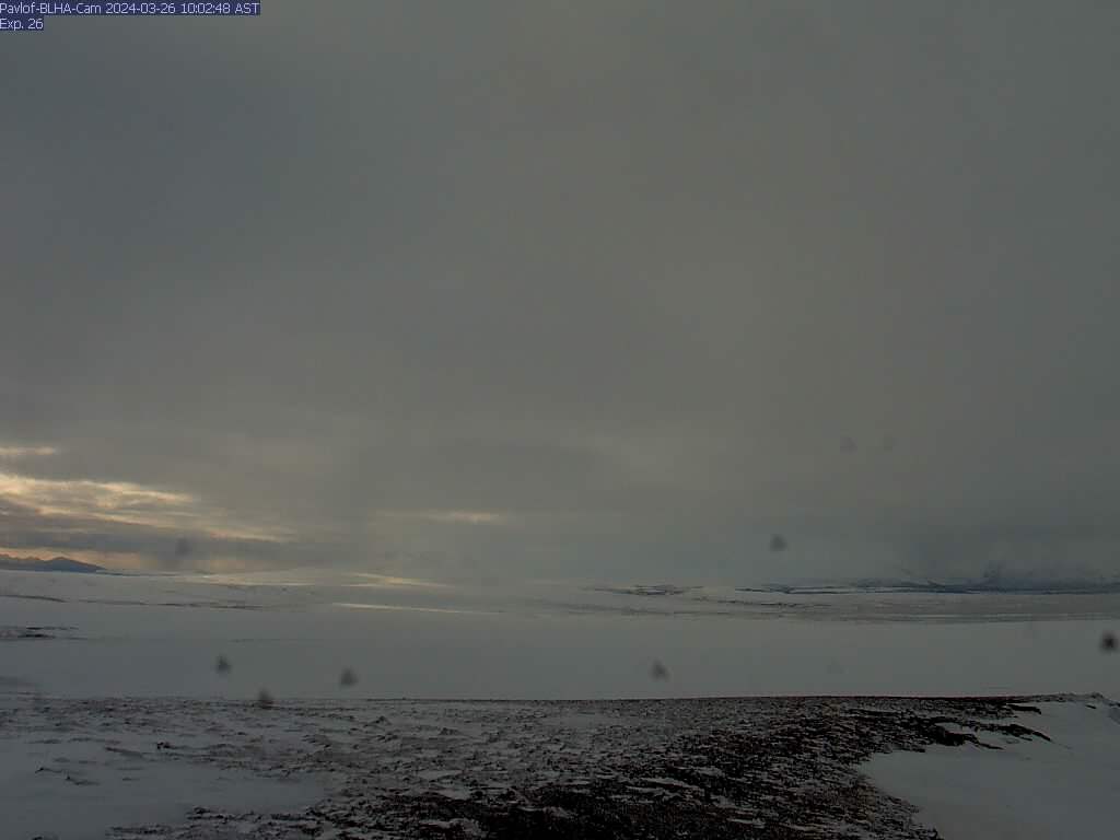
Pavlof - BLHA
There is a known issue with the timestamp on images from this camera: they are an hour ahead. AVO is working on a solution for this problem. This camera is co-located with seismic station BLHA, and looks southwest to Pavlof. Read more about Pavlof volcano.
There is a known issue with the timestamp on images from this camera: they are an hour ahead. AVO is working on a solution for this problem. This camera is co-located with seismic station BLHA, and looks southwest to Pavlof. Read more about Pavlof volcano.
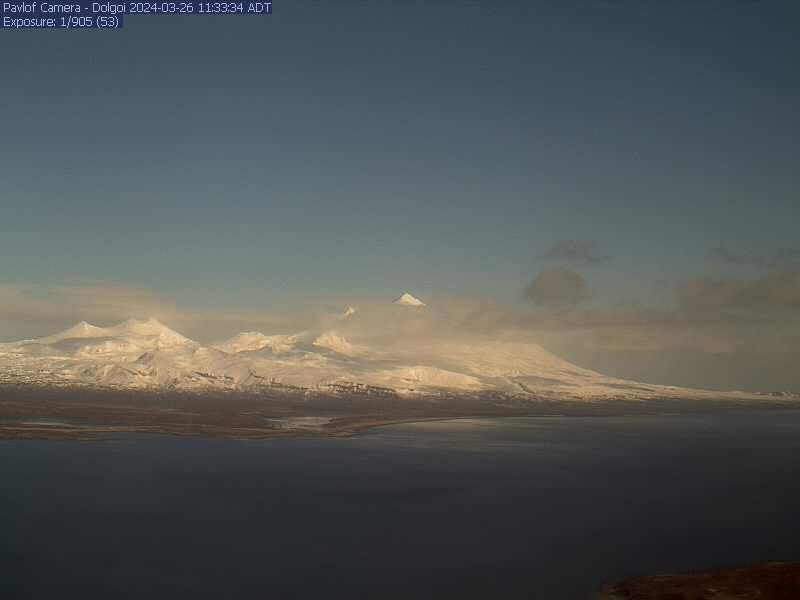
Pavlof - DOL
The Pavlof team (Ketner/Wech/Wellik) activated a new camera at station DOL on Tuesday (July 4). This camera looks north and provides good coverage of the volcanic complex in this region. Read more about Pavlof volcano.
The Pavlof team (Ketner/Wech/Wellik) activated a new camera at station DOL on Tuesday (July 4). This camera looks north and provides good coverage of the volcanic complex in this region. Read more about Pavlof volcano.

Peulik Volcano
Camera is located at Whale Mountain, showing a flank of Peulik, Becharof Lake, the Gas Rocks, and Chiginagak in the distance. Current image interval is 60 minutes. This camera lens is often covered by snow and ice.
Camera is located at Whale Mountain, showing a flank of Peulik, Becharof Lake, the Gas Rocks, and Chiginagak in the distance. Current image interval is 60 minutes. This camera lens is often covered by snow and ice.