
Earthquakes
Earthquakes
Filter Total Items: 175
ANSS Mission
The mission of ANSS is to provide accurate and timely data and information products for seismic events, including their effects on buildings and structures, employing modern monitoring methods and technologies.

Geologic Cracks Record Earthquakes on the Reelfoot Fault in Central U.S.
Release Date: APRIL 25, 2019 New high-resolution lidar data reveals cracks produced from strong shaking in past earthquakes in the New Madrid seismic zone.

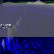
Preliminary Analysis of the April 2007 Solomon Islands Tsunami, Southwest Pacific Ocean
Information focused on geologic aspects of the April 2007 disaster.

Preliminary simulations of the 2011 Japan tsunami
Preliminary simulations of the tsunami from the March 11, 2011 M=9.1 subduction zone earthquake offshore of Honshu, Japan.

Preliminary simulation of the 2017 Mexico tsunami
Preliminary simulation of the tsunami from the September 8, 2017 M=8.1 intermediate-depth earthquake offshore of Chiapas, Mexico
Preliminary simulations of the 2010 Chilean tsunami
Preliminary simulations of the 2010 Chilean tsunami from the 27 February 2010 M=8.8 subduction zone earthquake, offshore Bio-Bio, Chile

Preserving Historic Earthquake Records and Photos of the Instruments that Recorded Them
Release Date: FEBRUARY 4, 2019 A project to scan a small selection of the film chips of historical earthquake recordings to digital files was started in 1996. In addition to archiving historic data from the early years, the USGS has also worked to archive photos and descriptions of early seismometers.

Collection of 3D Geometries of Global Subduction Zones
Release Date: NOVEMBER 12, 2018 A new picture of the geometry of subducting slabs around the world, the locations of the world’s largest earthquakes.

New Methods for Dating and Sequencing Ancient Earthquakes Along the Wasatch Fault Zone
Release Date: OCTOBER 12, 2018 Complex geologic sites, like those between the fault segments along the Wasatch fault zone in Utah, make the dating and ordering past earthquakes a difficult task. Two new methods were used to make this task easier and to get better results.

A New Map of Rodgers Creek Fault in Sonoma County, California
Release Date: JULY 16, 2018 A new more detailed and higher resolution map of the Rodgers Creek Fault in Sonoma County, California, has been produced using aerial photography and hillshade imagery derived from LiDAR data.

A Possible Cause of Earthquakes in the Continental Interior
Release Date: JUNE 18, 2018 A new map of crustal stress across the U.S. shows that the plate interior stress is variable, with contributions from plate boundary stress, crustal collapse due to gravity, and more local and subtle changes to style, orientation, and earthquake rate.