Tranquil High-Water Marks
High-water marks left behind by relatively calm, low-energy flood waters, creating smooth and even depositions with smaller uncertainty.
Mud Lines
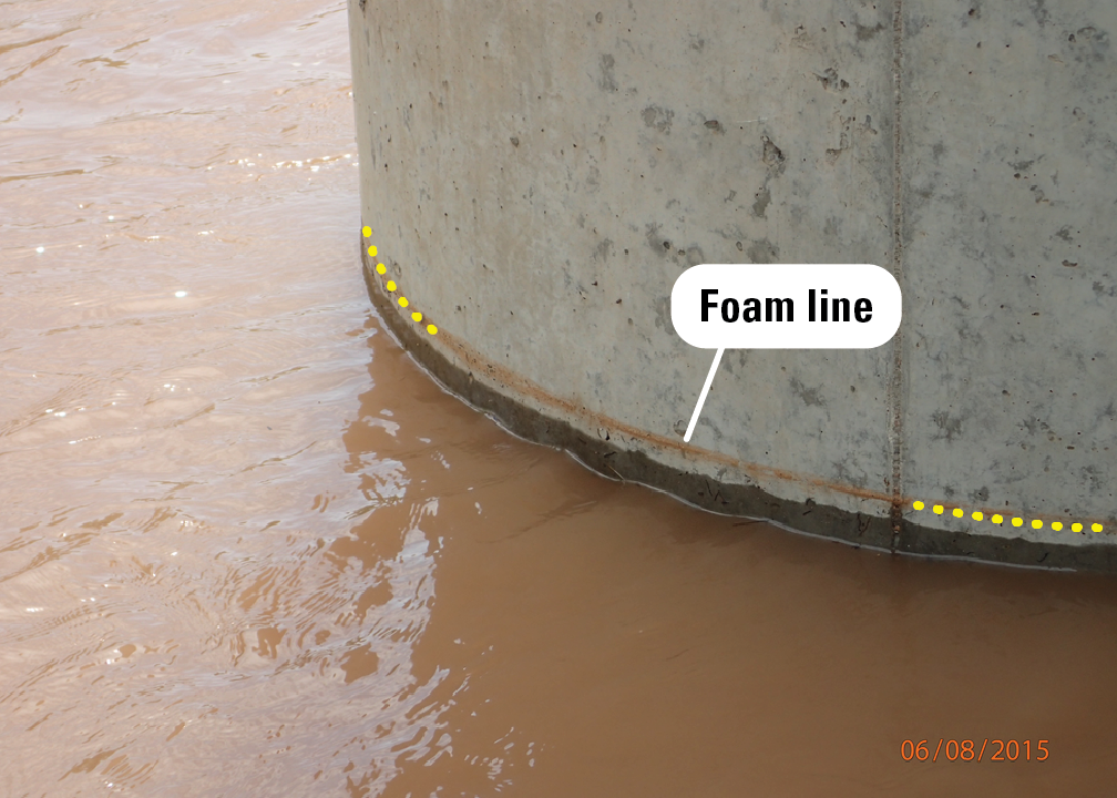
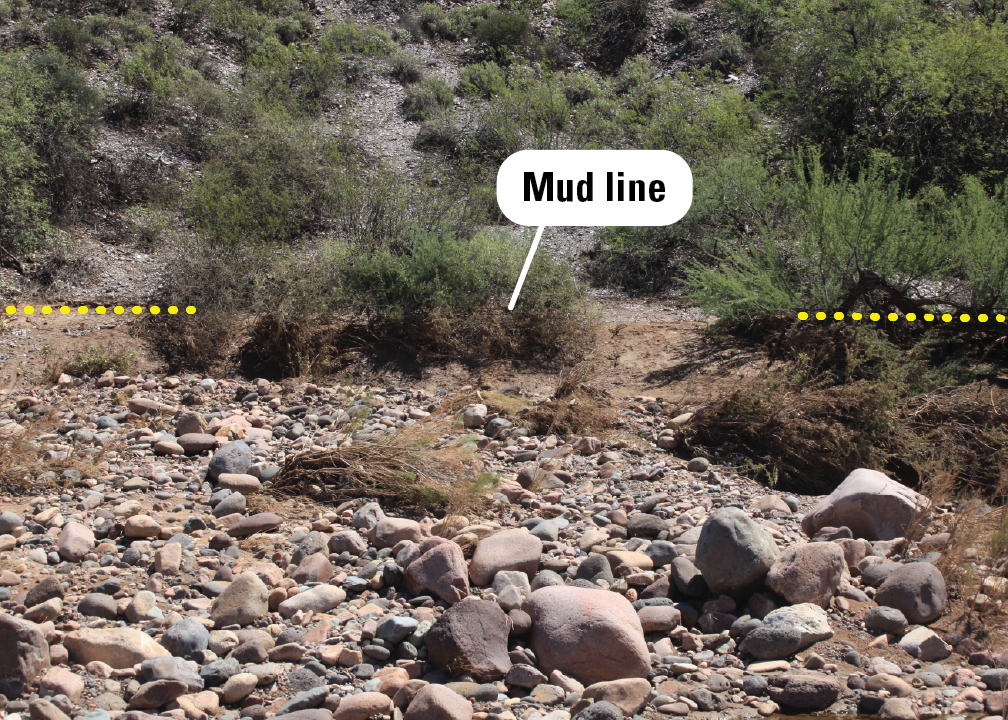
Turbid water can leave a "mud line" (or sometimes "foam line" or "stain line") on nonporous surfaces like buildings or paved roads when it recedes after flooding. These lines can be reliable indicators of high-water marks, particularly those found on hard surfaces within structures—especially when deposited by tranquil water. Mud lines on natural features like grasses or shrubs can also serve as high-water marks and are generally easier to identify from a distance.
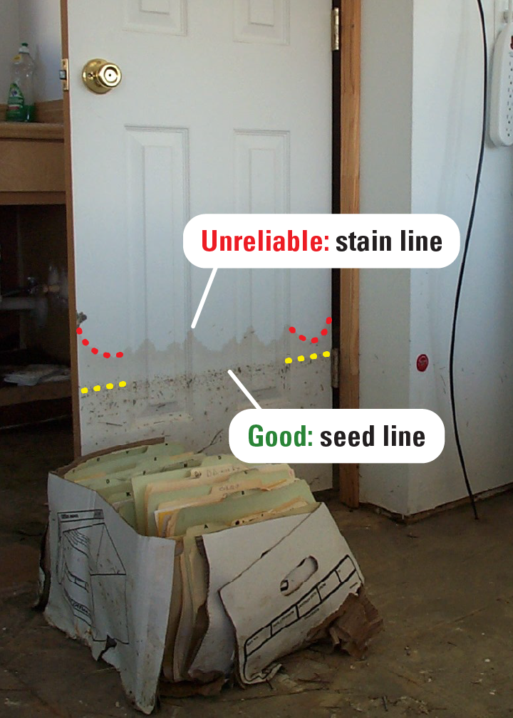
Porous materials such as wood and concrete can absorb floodwater, leaving a stain line that could indicate a flood peak. However, because these materials can wick water higher than the actual peak water surface, high-water elevation may be overestimated. To ensure accuracy, hydrographers search for corroborating high-water marks, especially those found on nearby nonporous surfaces.
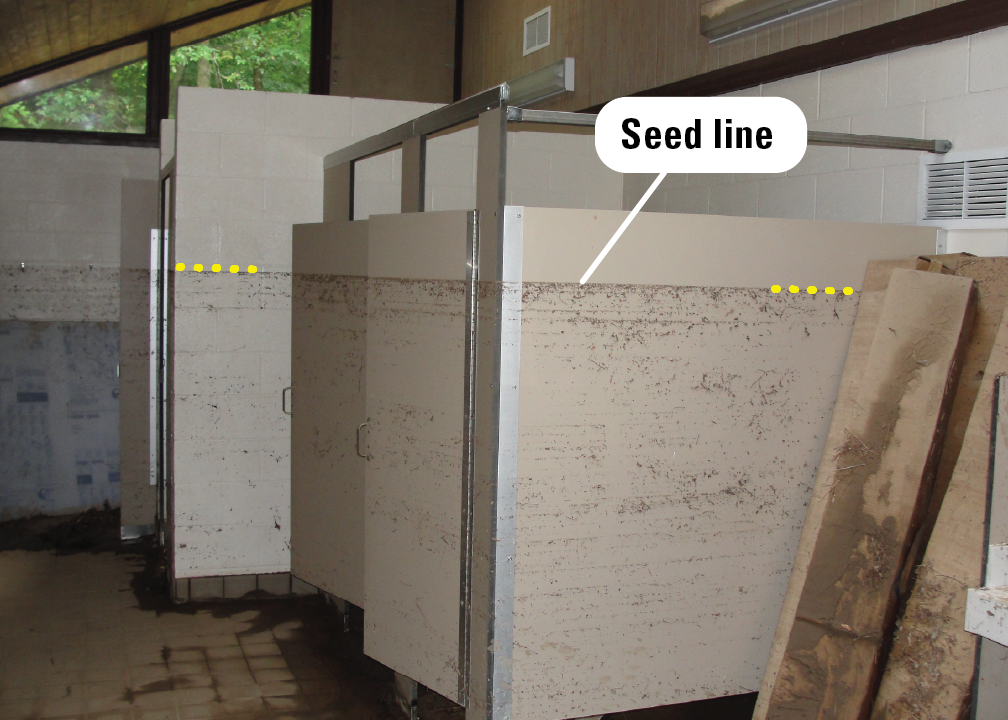
Seed Lines
Seed lines, formed when fine materials float on top of tranquil water and remain on objects after floodwaters recede, can be left on tree trunks, bridge piers, buildings, and other objects in the flooded reach of a stream. Seed lines can be more reliable than mud lines because they are not prone to wicking, but they can be easily disturbed by wind or touch.
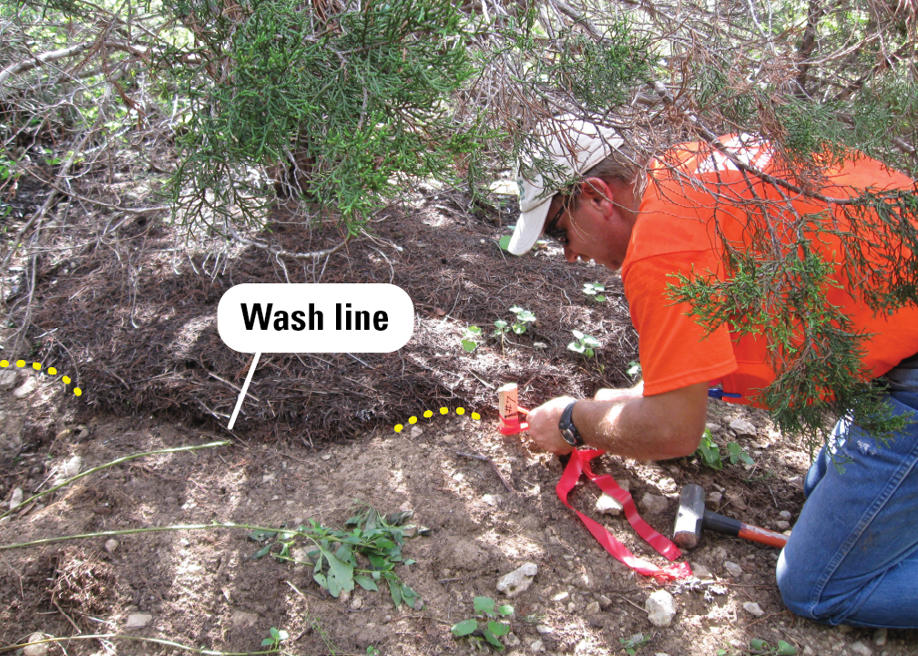
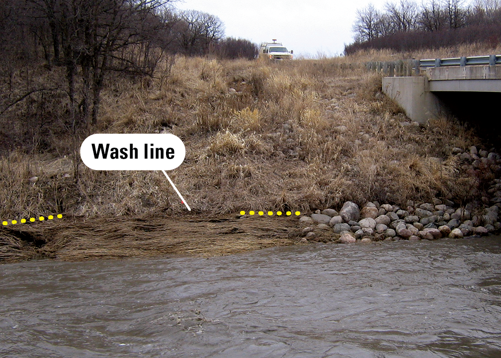
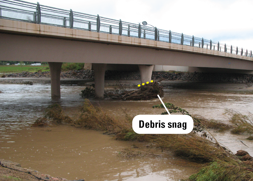
Debris Lines
Debris lines are trails of twigs, grasses, and other small debris left on sloping ground at the edge of a river where calmer water, as it receded, deposited the material. Debris lines can be less reliable than seed lines due to their coarser structure and tendency to sag.
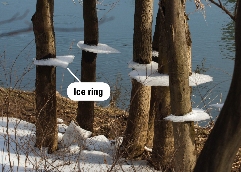
Ice Rings
When floods recede during freezing periods, ice sheets may form at the water surface. As the under-surface water recedes, suspended plates of ice, referred to as ice rings, may be left behind around cold objects such as fence posts or vegetation.


")
