
Leaf litter removal practices in Vermont
Images
Explore our planet through photography and imagery, including climate change and water all the way back to the 1800s when the USGS was surveying the country by horse and buggy.
Filter Total Items: 21343

Leaf litter removal practices
Leaf litter removal practices in Vermont

Storm overwash, Surf Drive Beach, Falmouth MA
Storm overwash on Surf Drive Beach, Falmouth, MA
Storm overwash on Surf Drive Beach, Falmouth, MA

Storm overwash, Surf Drive Beach, Falmouth, MA
Storm overwash, Surf Drive Beach, Falmouth, MA
Storm overwash, Surf Drive Beach, Falmouth, MA

Storm overwash, Surf Drive Beach, Falmouth, MA
Storm overwash, Surf Drive Beach, Falmouth, MA
Storm overwash, Surf Drive Beach, Falmouth, MA

Surf Drive Beach, Falmouth, MA
Overwash from Surf Drive Beach, Falmouth, MA

Alsea River in Autumn near Alsea Falls, Oregon
The Alsea River in the Oregon Coast Range

Lake Measurement - GNSS - Lake Panamoka, Long Island, NY
Lake Measurement - GNSS - Lake Panamoka, Long Island, NYLake Measurement - GNSS - Lake Panamoka, Suffolk County, Long Island, NY
Lake Measurement - GNSS - Lake Panamoka, Long Island, NY
Lake Measurement - GNSS - Lake Panamoka, Long Island, NYLake Measurement - GNSS - Lake Panamoka, Suffolk County, Long Island, NY

Lake measurement GNSS Suffolk County, NY
Lake elevation measurement in Suffolk County, NY
Lake elevation measurement in Suffolk County, NY

Hurricane Sandy's Lasting Effects on Fire Island, NY
Hurricane Sandy's Lasting Effects on Fire Island, NYAs Hurricane Sandy made landfall on October 29, 2012, the storm’s waves and wind cut a breach in a narrow part of Fire Island, a barrier island south of Long Island, New York.
Hurricane Sandy's Lasting Effects on Fire Island, NY
Hurricane Sandy's Lasting Effects on Fire Island, NYAs Hurricane Sandy made landfall on October 29, 2012, the storm’s waves and wind cut a breach in a narrow part of Fire Island, a barrier island south of Long Island, New York.

USGS Ecologist and Least Bell's Vireo in Net
USGS ecologist Lisa Allen carefully removes an endangered Least Bell's Vireo from a net. She and Principal Investigator Barbara Kus are studying these birds' migration patterns to provide the U.S. Fish and Wildlife Service and international efforts with information to assist in species recovery.
USGS ecologist Lisa Allen carefully removes an endangered Least Bell's Vireo from a net. She and Principal Investigator Barbara Kus are studying these birds' migration patterns to provide the U.S. Fish and Wildlife Service and international efforts with information to assist in species recovery.

WERC Researchers Survey Miraflores Wash
USGS researchers Lisa Allen and Ryan Pottinger survey Miraflores Wash in Baja, California for Least Bell's Vireos, an endangered migratory bird.
USGS researchers Lisa Allen and Ryan Pottinger survey Miraflores Wash in Baja, California for Least Bell's Vireos, an endangered migratory bird.

Maumee River at Antwerp, OH - low flow
Maumee River at Antwerp, OH - low flow

School Branch at Brownsburg IN - Fall of 2017
School Branch at Brownsburg IN - Fall of 2017

East Fork Whitewater River at Richmond IN - gage location
East Fork Whitewater River at Richmond IN - gage locationEast Fork Whitewater River at Richmond IN - gage location
East Fork Whitewater River at Richmond IN - gage location
East Fork Whitewater River at Richmond IN - gage locationEast Fork Whitewater River at Richmond IN - gage location

East Fork Whitewater River at Richmond IN - low flow
East Fork Whitewater River at Richmond IN - low flowEast Fork Whitewater River at Richmond IN - low flow
East Fork Whitewater River at Richmond IN - low flow
East Fork Whitewater River at Richmond IN - low flowEast Fork Whitewater River at Richmond IN - low flow

White River at Hazelton IN - view downstream of gage
White River at Hazelton IN - view downstream of gageWhite River at Hazelton IN - view downstream of gage
White River at Hazelton IN - view downstream of gage
White River at Hazelton IN - view downstream of gageWhite River at Hazelton IN - view downstream of gage

White River at Hazelton, IN - downstream view
White River at Hazelton, IN - downstream view

New USGS video about Kīlauea's summit eruption is now online
New USGS video about Kīlauea's summit eruption is now onlineThe lava lake within Halema‘uma‘u, a crater at the summit of Kīlauea, was about 30 m (98 ft) below the vent rim on the day of this photo (January 7, 2016).
New USGS video about Kīlauea's summit eruption is now online
New USGS video about Kīlauea's summit eruption is now onlineThe lava lake within Halema‘uma‘u, a crater at the summit of Kīlauea, was about 30 m (98 ft) below the vent rim on the day of this photo (January 7, 2016).

Sunset lake in Black Sand Basin of Yellowstone National Park
Sunset lake in Black Sand Basin of Yellowstone National ParkSunset lake in Black Sand Basin of Yellowstone National Park
Sunset lake in Black Sand Basin of Yellowstone National Park
Sunset lake in Black Sand Basin of Yellowstone National ParkSunset lake in Black Sand Basin of Yellowstone National Park

View of the Silver Gate landslide complex from Bunsen Peak
View of the Silver Gate landslide complex from Bunsen PeakView of the Silver Gate landslide complex from Bunsen Peak in Yellowstone National Park. The landslide originates from Terrace Mountain.
View of the Silver Gate landslide complex from Bunsen Peak
View of the Silver Gate landslide complex from Bunsen PeakView of the Silver Gate landslide complex from Bunsen Peak in Yellowstone National Park. The landslide originates from Terrace Mountain.
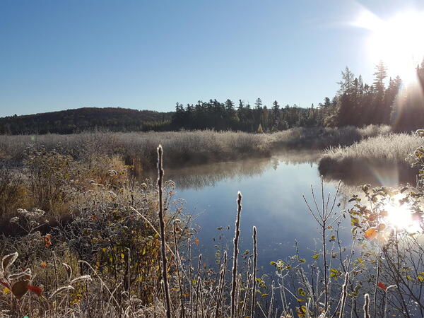
Boreal bog in the Adirondack Park, New York
Boreal bog in the Adirondack Park, New York