The pike killifish, native to Mexico and Central America, was one of 13 nonnative fish species that biologists discovered during the two-day Fish Slam in Big Cypress National Preserve, March 22 and 23, 2017.

Official websites use .gov
A .gov website belongs to an official government organization in the United States.
Secure .gov websites use HTTPS
A lock () or https:// means you’ve safely connected to the .gov website. Share sensitive information only on official, secure websites.
Explore our planet through photography and imagery, including climate change and water all the way back to the 1800s when the USGS was surveying the country by horse and buggy.

The pike killifish, native to Mexico and Central America, was one of 13 nonnative fish species that biologists discovered during the two-day Fish Slam in Big Cypress National Preserve, March 22 and 23, 2017.
The pike killifish, native to Mexico and Central America, was one of 13 nonnative fish species that biologists discovered during the two-day Fish Slam in Big Cypress National Preserve, March 22 and 23, 2017.

Mineral: Rutile
Primary Commodity: Titanium
Primary Commodity Uses: The vast majority of titanium is used in whiteners in the form of titanium oxide. Titanium metal makes up a comparatively small amount of the use for titanium, but as a metal it is used in metal coatings and medical implants.
Mineral: Rutile
Primary Commodity: Titanium
Primary Commodity Uses: The vast majority of titanium is used in whiteners in the form of titanium oxide. Titanium metal makes up a comparatively small amount of the use for titanium, but as a metal it is used in metal coatings and medical implants.

The sailfin catfish is one of 13 species of nonnative fish that biologists discovered during the Fish Slam in Big Cypress National Preserve, March 23, 2017.
The sailfin catfish is one of 13 species of nonnative fish that biologists discovered during the Fish Slam in Big Cypress National Preserve, March 23, 2017.

Mineral: Halite (NaCl)
Primary mineral Commodity: Salt
Mineral: Halite (NaCl)
Primary mineral Commodity: Salt

Mineral: Halite (NaCl)
Primary mineral Commodity: Salt
Mineral: Halite (NaCl)
Primary mineral Commodity: Salt

Mineral: Silicon Carbide
Mineral Origin: Sample donated by Norton Company
Primary Commodity: Silica (abrasive)
Primary Commodity Uses: Just as their name implies, abrasives are used to abrade, clean, etch, grind, polish, scour, or otherwise remove material
Mineral: Silicon Carbide
Mineral Origin: Sample donated by Norton Company
Primary Commodity: Silica (abrasive)
Primary Commodity Uses: Just as their name implies, abrasives are used to abrade, clean, etch, grind, polish, scour, or otherwise remove material

Mineral: Silicon Carbide
Mineral Origin: Sample donated by Norton Company
Primary Commodity: Silica (abrasive)
Primary Commodity Uses: Just as their name implies, abrasives are used to abrade, clean, etch, grind, polish, scour, or otherwise remove material
Mineral: Silicon Carbide
Mineral Origin: Sample donated by Norton Company
Primary Commodity: Silica (abrasive)
Primary Commodity Uses: Just as their name implies, abrasives are used to abrade, clean, etch, grind, polish, scour, or otherwise remove material

Mineral: Silicon Carbide
Mineral Origin: Sample donated by Norton Company
Primary Commodity: Silica (abrasive)
Primary Commodity Uses: Just as their name implies, abrasives are used to abrade, clean, etch, grind, polish, scour, or otherwise remove material
Mineral: Silicon Carbide
Mineral Origin: Sample donated by Norton Company
Primary Commodity: Silica (abrasive)
Primary Commodity Uses: Just as their name implies, abrasives are used to abrade, clean, etch, grind, polish, scour, or otherwise remove material

Mineral: Specularite (a variety of Hematite)
Mineral Origin: Republic Mine, MI
Primary Mineral Commodity: Iron
Commodity Uses: Steelmaking
Mineral: Specularite (a variety of Hematite)
Mineral Origin: Republic Mine, MI
Primary Mineral Commodity: Iron
Commodity Uses: Steelmaking

Sphalerite, zinc sulfide, is and has been the principal ore mineral in the world. Zinc uses range from metal products to rubber and medicines. Zinc alloys readily with other metals and is chemically active. On exposure to air, it develops a thin gray oxide film (patina), which inhibits deeper oxidation (corrosion) of the metal.
Sphalerite, zinc sulfide, is and has been the principal ore mineral in the world. Zinc uses range from metal products to rubber and medicines. Zinc alloys readily with other metals and is chemically active. On exposure to air, it develops a thin gray oxide film (patina), which inhibits deeper oxidation (corrosion) of the metal.
Mineral origin: Hallman Beam Mine, Cherryville, NC
Primary mineral commodity: Lithium
Uses: batteries for cell phones, laptops, and electric and hybrid vehicles
Mineral origin: Hallman Beam Mine, Cherryville, NC
Primary mineral commodity: Lithium
Uses: batteries for cell phones, laptops, and electric and hybrid vehicles

Stibnite (Sb2S3) is the predominant ore mineral of antimony. Antimony compounds help prevent skin burns, increase battery life, and refine glass used for cellphones. A surprising 83% of antimony consumed stateside is imported—mostly from China—leaving the US susceptible to supply disruption.
Stibnite (Sb2S3) is the predominant ore mineral of antimony. Antimony compounds help prevent skin burns, increase battery life, and refine glass used for cellphones. A surprising 83% of antimony consumed stateside is imported—mostly from China—leaving the US susceptible to supply disruption.

Mineral: Tetrahedrite (a copper antimony sulfosalt)
Mineral Origin: Bingham Canyon, UT
Main Commodity: Silver
Mineral: Tetrahedrite (a copper antimony sulfosalt)
Mineral Origin: Bingham Canyon, UT
Main Commodity: Silver

Mineral: Vanadinite
Mineral Origin: J.C. Holmes Claim, Patagonia, AZ (Sample donated by G. van Oss)
Primary Commodity: Vanadium
Mineral: Vanadinite
Mineral Origin: J.C. Holmes Claim, Patagonia, AZ (Sample donated by G. van Oss)
Primary Commodity: Vanadium

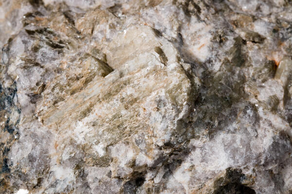
Mineral: Wolframite
Primary Commodity: Tungsten
Primary Commodity Uses: Tungsten is one of the densest metals on the planet, and therefore gets used in metalworking and construction, as well as in heat sinks, weights, and even vibrating batteries.
Mineral: Wolframite
Primary Commodity: Tungsten
Primary Commodity Uses: Tungsten is one of the densest metals on the planet, and therefore gets used in metalworking and construction, as well as in heat sinks, weights, and even vibrating batteries.

Stacy M Kinsey collecting eDNA sample from Snake Riv nr Astoria HS, WY
Stacy M Kinsey collecting eDNA sample from Snake Riv nr Astoria HS, WY

Scientists deploy a Chirp seismic instrument from the beach. Seismic data provide view of sub-seafloor geology, which records depositional and erosional events and reveals geologic controls on sediment supply.
Scientists deploy a Chirp seismic instrument from the beach. Seismic data provide view of sub-seafloor geology, which records depositional and erosional events and reveals geologic controls on sediment supply.

USGS scientists recently collected peat and lake core samples from the swamp to help reconstruct natural, environmental conditions over the past 12,000 years.
USGS scientists recently collected peat and lake core samples from the swamp to help reconstruct natural, environmental conditions over the past 12,000 years.

Centuries of ditching, draining and harvesting resources have greatly altered the Great Dismal Swamp in Virginia.
Centuries of ditching, draining and harvesting resources have greatly altered the Great Dismal Swamp in Virginia.

Scientists never stop learning! USGS scientists participate in ongoing training to keep up on the latest scientific methods, tools, and best practices. In this photo, USGS scientists participate in a field class about collecting groundwater data using USGS standards and procedures.
Scientists never stop learning! USGS scientists participate in ongoing training to keep up on the latest scientific methods, tools, and best practices. In this photo, USGS scientists participate in a field class about collecting groundwater data using USGS standards and procedures.

Sampling for microplastics on Lake Mead, March 21, 2017
Sampling for microplastics on Lake Mead, March 21, 2017