
Big bear scat found while in the field
Images
Explore photos, graphics, and illustrations related to projects from across the CASC Network. And be sure to check out our Climate Illustrations page, featuring free-to-download illustrations that help describe tricky climate concepts and explain how climate change affects the world around us.
Filter Total Items: 639
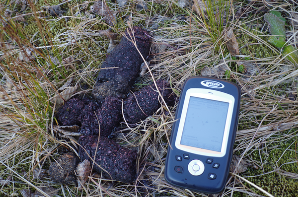
Big bear scat found while in the field

Miller collecting geospatial data in East Africa
Miller collecting geospatial data as part of his dissertation research on drought resources in East Africa.
Miller collecting geospatial data as part of his dissertation research on drought resources in East Africa.

Michelle Staudinger dissecting a dolphinfish
Staudinger dissecting a dolphinfish at the Annual Ducks Fishing tournament in Morehead City, North Carolina. Credit: Joshua Snyder
Staudinger dissecting a dolphinfish at the Annual Ducks Fishing tournament in Morehead City, North Carolina. Credit: Joshua Snyder

Dauphin Island, Alabama
A view of a vegetated inland coastline overlooking the water on Dauphin Island, Alabama. The island protects mainland Alabama’s coastal communities and resources from storms, while also providing recreational opportunities (fishing, beach tourism, etc.) and other economic benefits to the local community and state.
A view of a vegetated inland coastline overlooking the water on Dauphin Island, Alabama. The island protects mainland Alabama’s coastal communities and resources from storms, while also providing recreational opportunities (fishing, beach tourism, etc.) and other economic benefits to the local community and state.

Isla Verde, San Juan, Puerto Rico
The urban reef at Isla Verde supports various species of protected corals, sea turtles, and crustaceans, as well as many Caribbean fish. It also protects the International Airport and numerous homes and resorts on the coast.
The urban reef at Isla Verde supports various species of protected corals, sea turtles, and crustaceans, as well as many Caribbean fish. It also protects the International Airport and numerous homes and resorts on the coast.
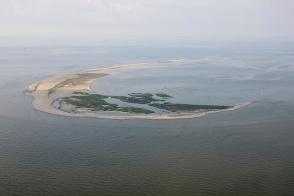
Aerial photograph looking southwest along Breton Island, Louisiana
Aerial photograph looking southwest along Breton Island, LouisianaAerial photograph looking southwest along Breton Island, Louisiana, taken July 2013
Aerial photograph looking southwest along Breton Island, Louisiana
Aerial photograph looking southwest along Breton Island, LouisianaAerial photograph looking southwest along Breton Island, Louisiana, taken July 2013
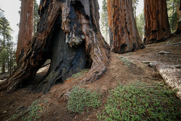
Burned, hollowed out base of a sequoia tree in Sequoia National Park
Burned, hollowed out base of a sequoia tree in Sequoia National ParkBurned, hollowed out base of a sequoia tree in Sequoia National Park
Burned, hollowed out base of a sequoia tree in Sequoia National Park
Burned, hollowed out base of a sequoia tree in Sequoia National ParkBurned, hollowed out base of a sequoia tree in Sequoia National Park

Adirondack Fall Foliage, NY
Waning fall foliage as seen on a rural Adirondack road during the Western Adirondack Stream Survey (WASS) conducted in November, 2018. Photo by Scott George
Waning fall foliage as seen on a rural Adirondack road during the Western Adirondack Stream Survey (WASS) conducted in November, 2018. Photo by Scott George

The Androscoggin river in Maine during Fall
The Androscoggin river in Maine during Fall colors.
The Androscoggin river in Maine during Fall colors.

Cape Cod National Seashore
A look to the north along the bluffs at the Cape Cod National Seashore, from Marconi Station. Over the years, the USGS continues to work with the National Park Service at the Cape Cod National Seashore.
A look to the north along the bluffs at the Cape Cod National Seashore, from Marconi Station. Over the years, the USGS continues to work with the National Park Service at the Cape Cod National Seashore.
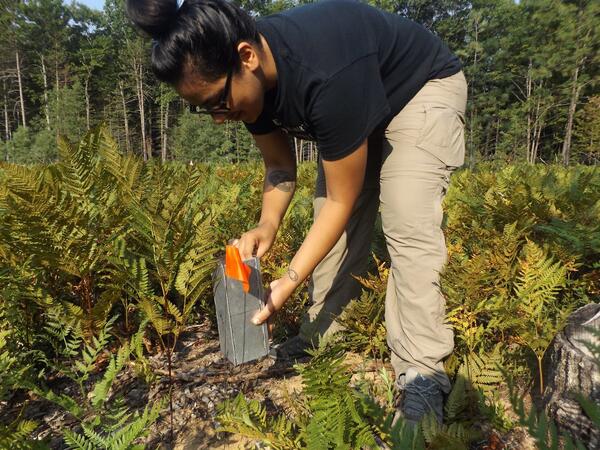
Mari Rodriguez
Mari Rodriguez checks a trap for mice at a field site in Michigan for research.
Mari Rodriguez checks a trap for mice at a field site in Michigan for research.

Assessing fish habitat and population dynamics of fisheries resources
Assessing fish habitat and population dynamics of fisheries resourcesThroughout Hawaii, fishponds are considered by their local communities as important cultural touchstones, a source of local, sustainably produced food, and an important component to the development of community-based management for nearshore fisheries.

Assessing the Functional Equivalency of Hawaiian fishponds
Assessing the Functional Equivalency of Hawaiian fishpondsHawaiian fishponds were important cultural and economic resources for native Hawaiians as they were an important component of a sophisticated, integrated food production system. However, changing demographics and systems of land ownership resulted in a decline in the use and upkeep of Hawaiian fishponds throughout the 19th century.
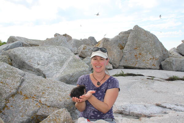
Atlantic puffin chick
Staudinger holding a Atlantic puffin chick on Seal Island National Wildlife Refuge.
Staudinger holding a Atlantic puffin chick on Seal Island National Wildlife Refuge.

A native brown-belted bumble bee visiting leadplant
A native brown-belted bumble bee visiting leadplantA native brown-belted bumble bee (Bombus griseocollis) visiting leadplant (Amorpha canescens).
A native brown-belted bumble bee visiting leadplant
A native brown-belted bumble bee visiting leadplantA native brown-belted bumble bee (Bombus griseocollis) visiting leadplant (Amorpha canescens).

Like many Keys corals, this one has no new growth
A modern coral reef in Dry Tortugas National Park. There is little living coral and high rates of bioerosion. Photo taken under research permit number DRTO-2018-SCI-0005. Credit: Lauren Toth, USGS
A modern coral reef in Dry Tortugas National Park. There is little living coral and high rates of bioerosion. Photo taken under research permit number DRTO-2018-SCI-0005. Credit: Lauren Toth, USGS


Native sunflowers in a Kansas Conservation Reserve Program (CRP) field
Native sunflowers in a Kansas Conservation Reserve Program (CRP) fieldNative sunflowers in a Kansas Conservation Reserve Program (CRP) field
Native sunflowers in a Kansas Conservation Reserve Program (CRP) field
Native sunflowers in a Kansas Conservation Reserve Program (CRP) fieldNative sunflowers in a Kansas Conservation Reserve Program (CRP) field

Ash plume rises above Pu‘u ‘Ō‘ō
At 10:30 HST, ground shaking from a preliminary magnitude-5.0 earthquake south of Pu‘u ‘Ō‘ō caused rockfalls and possibly additional collapse into the Pu‘u ‘Ō‘ō crater on Kīlauea Volcano's East Rift Zone. A short-lived plume of ash produced by this event lofted skyward and dissipated as it drifted southwest from Pu‘u ‘Ō‘ō.
At 10:30 HST, ground shaking from a preliminary magnitude-5.0 earthquake south of Pu‘u ‘Ō‘ō caused rockfalls and possibly additional collapse into the Pu‘u ‘Ō‘ō crater on Kīlauea Volcano's East Rift Zone. A short-lived plume of ash produced by this event lofted skyward and dissipated as it drifted southwest from Pu‘u ‘Ō‘ō.

Staudinger tagging alewife
Staudinger with Abigail Archer (Woods Hole Sea Grant and Cape Cod Cooperative Extension) and Jonathan Franklin (Harvard University) tagging adult alewife for a passage study looking at pre- and post movements after a dam removal at Town Brook in Plymouth, Massachusetts.
Staudinger with Abigail Archer (Woods Hole Sea Grant and Cape Cod Cooperative Extension) and Jonathan Franklin (Harvard University) tagging adult alewife for a passage study looking at pre- and post movements after a dam removal at Town Brook in Plymouth, Massachusetts.

Longleaf Pine forest in Florida
Longleaf pine stand near Tall Timbers Research Station, Florida. Longleaf forests such as these are dependent on frequent, low-intensity fires to maintain habitat structure and function.
Longleaf pine stand near Tall Timbers Research Station, Florida. Longleaf forests such as these are dependent on frequent, low-intensity fires to maintain habitat structure and function.