
USGS Graduate Research Assistant Legna Torres-Garcia installs a temperature logger on a coral reef in Dry Tortugas National Park. She and her team deployed a vertical array with temperature loggers every 1m from the seabed to near-surface with the goal to capture any changes in temperature through time and across depth.
Images
Coastal and Marine Hazards and Resources Program images.
Filter Total Items: 2398

Legna Torres-Garcia
USGS Graduate Research Assistant Legna Torres-Garcia installs a temperature logger on a coral reef in Dry Tortugas National Park. She and her team deployed a vertical array with temperature loggers every 1m from the seabed to near-surface with the goal to capture any changes in temperature through time and across depth.

Drone footage of Woods Hole Oceanographic facility
Drone footage of Woods Hole Oceanographic facilityDrone footage taken of the Woods Hole Oceanographic facility on the Quissett campus in Woods Hole Ma. This is an example of a tidally restricted marsh system cutoff from tidal flows by the bike path.

Trunk River, Woods Hole, MA
Trunk River is an example of a tidally restricted impounded wetland (Cape Cod, MA).
Trunk River is an example of a tidally restricted impounded wetland (Cape Cod, MA).

Red crabs on seep mussels
A red crab trying to crack open a seep mussel, seen during the Deepwater Canyons 2012 Expedition.
A red crab trying to crack open a seep mussel, seen during the Deepwater Canyons 2012 Expedition.

USGS scientists scan the ice for resting walruses
Sarah Sonsthagen (left) drives a skiff as Tony Fischbach scans the ice for resting walruses to radio-tag. On an hourly basis, these instruments show whether the walrus is in the water, resting out of the water, or foraging at the seafloor. The radio tag will fall off after 3 to 12 weeks.
Sarah Sonsthagen (left) drives a skiff as Tony Fischbach scans the ice for resting walruses to radio-tag. On an hourly basis, these instruments show whether the walrus is in the water, resting out of the water, or foraging at the seafloor. The radio tag will fall off after 3 to 12 weeks.
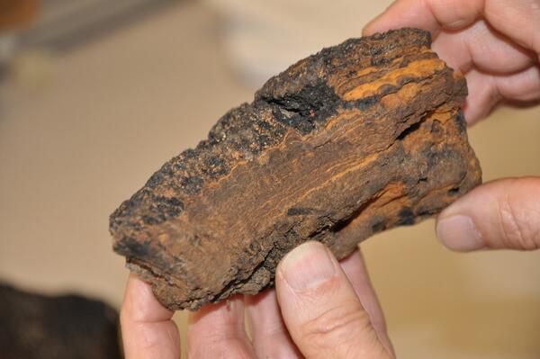
Dredge subsample
Subsample from dredge DR2-001, collected as a part of the U.S. Extended Continental Shelf Project's research in the Arctic aboard the USCGC Healy on cruise HLY1202 (Field Activity 2012-038-FA).
Subsample from dredge DR2-001, collected as a part of the U.S. Extended Continental Shelf Project's research in the Arctic aboard the USCGC Healy on cruise HLY1202 (Field Activity 2012-038-FA).

Dunes, Beach Towns and Resilience
Sand dunes in Avon on Cape Hatteras, NC are the only separation between many beach house communities and the Atlantic Ocean.
Sand dunes in Avon on Cape Hatteras, NC are the only separation between many beach house communities and the Atlantic Ocean.

Shaded relief image of Vineyard Sound MA
Shaded relief image of Vineyard Sound, MA
Shaded relief image of Vineyard Sound, MA

Gulf of Mexico Deep-Sea Coral
A fish (Gephyroberyx darwinii) peeks through a forest of soft corals and anemones at about 300 meters in depth in the Gulf of Mexico.
A fish (Gephyroberyx darwinii) peeks through a forest of soft corals and anemones at about 300 meters in depth in the Gulf of Mexico.

Deep-Sea Cold Water Coral
A conger eel (Conger oceanicus) cruises through a thicket of Lophelia pertusa coral.
A conger eel (Conger oceanicus) cruises through a thicket of Lophelia pertusa coral.

Seaside Heights, NJ after Hurricane Sandy
Hurricane Sandy struck the New Jersey shore October 29–31, 2012. Houses, cars, and a street in Seaside Heights, New Jersey, were covered in beach sand after the hurricane's storm tide receded
Hurricane Sandy struck the New Jersey shore October 29–31, 2012. Houses, cars, and a street in Seaside Heights, New Jersey, were covered in beach sand after the hurricane's storm tide receded

Photo of Sunset Beach, Florida, during tropical storm Colin, June 2016
Photo of Sunset Beach, Florida, during tropical storm Colin, June 2016Photo of Sunset Beach, Florida, during tropical storm Colin in June 2016. The storm resulted in large waves and elevated water levels that caused erosion in this area, as can be seen in the scarp forming at the vegetation line. CMHRP researchers surveyed the elevation of the beach before and after the storm to quantify the storm's impacts.

Paramuricea polyps
A close-up of the Paramuricea polyps when open.
A close-up of the Paramuricea polyps when open.

Corals and anemones in Mississippi Canyon
Large Lophelia colonies and numerous anemones at a depth of about 1,500 feet in Mississippi Canyon. Red laser beams, projected from a remotely operated vehicle, represent a separation of 10 centimeters (about 4 inches). A western roughy is seen to the left of the structure.
Large Lophelia colonies and numerous anemones at a depth of about 1,500 feet in Mississippi Canyon. Red laser beams, projected from a remotely operated vehicle, represent a separation of 10 centimeters (about 4 inches). A western roughy is seen to the left of the structure.

Healthy vs. unhealthy corals
Underwater photograph off Molokaʻi Hawaiʻi, showing some of the impacts of land-based pollution, such as terrestrial sediment, on coral reefs: burial by sediment, algal overgrowth, and coral bleaching.
Underwater photograph off Molokaʻi Hawaiʻi, showing some of the impacts of land-based pollution, such as terrestrial sediment, on coral reefs: burial by sediment, algal overgrowth, and coral bleaching.

Image showing a study area from Boston Harbor to the mouth of Cape Cod
Image showing a study area from Boston Harbor to the mouth of Cape CodImage showing a study area from Boston Harbor to the mouth of Cape Cod Bay including some images of geophysical and sample data available in the associated report.

Deep-Sea Cold Water Coral
A black-bellied rosefish (Helicolenus dactylopterus) peaks out of the Lophelia coral. Behind the fish, a squat lobster (Eumunida picta) hangs upside down from a coral branch.
A black-bellied rosefish (Helicolenus dactylopterus) peaks out of the Lophelia coral. Behind the fish, a squat lobster (Eumunida picta) hangs upside down from a coral branch.

Aerial imagery sequence of Indian Point, Louisiana, 1950–2012
Aerial imagery sequence of Indian Point, Louisiana, 1950–2012Aerial imagery sequence of Indian Point, Louisiana, showing the contraction of the peninsula marsh in response to shoreline erosion since 1950.
Aerial imagery sequence of Indian Point, Louisiana, 1950–2012
Aerial imagery sequence of Indian Point, Louisiana, 1950–2012Aerial imagery sequence of Indian Point, Louisiana, showing the contraction of the peninsula marsh in response to shoreline erosion since 1950.

Deep-Sea Coral: Lophelia pertusa
Live Lophelia pertusa is white because the calcium carbonate skeleton shows through the nonpigmented coral tissue. Dead coral is soon covered in a brown biofilm. The red-orange squat lobster (Eumunida picta) in the center of the photo is prepared to catch its dinner.
Live Lophelia pertusa is white because the calcium carbonate skeleton shows through the nonpigmented coral tissue. Dead coral is soon covered in a brown biofilm. The red-orange squat lobster (Eumunida picta) in the center of the photo is prepared to catch its dinner.

Deep-Sea, Cold Water Coral
Close-up image of the cold-water coral Lophelia pertusa, with polyps extended. The coral polyps eat by grabbing tiny suspended particulates (visible against the dark water background). The bright orange claws of a squat lobster (Eumunida picta) can be seen peeking out from behind the coral branches.
Close-up image of the cold-water coral Lophelia pertusa, with polyps extended. The coral polyps eat by grabbing tiny suspended particulates (visible against the dark water background). The bright orange claws of a squat lobster (Eumunida picta) can be seen peeking out from behind the coral branches.

Trochammina hadai Uchio
Figure 2 from the 2012 publication, "Arrival and Expansion of the Invasive Foraminifera Trochammina hadai Uchio in Padilla Bay, Washington," by McGann, et al. Trochammina hadai Uchio: A, dorsal view; B, edge view; C, ventral view.
Figure 2 from the 2012 publication, "Arrival and Expansion of the Invasive Foraminifera Trochammina hadai Uchio in Padilla Bay, Washington," by McGann, et al. Trochammina hadai Uchio: A, dorsal view; B, edge view; C, ventral view.