
Barrier Islands
Barrier Islands
Filter Total Items: 19
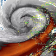
Typhoon Merbok Disaster Recovery Project: Accomplishments
Supported by Title VII of Division N of the Consolidated Appropriations Act, 2023, the Typhoon Merbok Disaster Emergency Recovery Efforts project addresses critical data and capacity gaps in coastal Alaska by generating high resolution environmental datasets, hazard analyses, and monitoring tools needed to quantify erosion, flooding, and permafrost-related risks at the community scale.

USGS CoastCams
The U.S. Geological Survey (USGS) uses a nationwide network of coastal observing cameras, or CoastCams, to monitor coastal conditions in near real-time and support research by the USGS and its partners into a variety of coastal processes and hazards. The most recent CoastCam images are made publicly available within minutes of data collection and can be accessed using the links below or by...

Using Video Imagery to Study Sediment Transport and Wave Dynamics: Nuvuk (Point Barrow)
Two coastal observing video cameras were installed atop a utility pole near the northernmost point of land in the United States, at Nuvuk (Point Barrow), Alaska. The cameras pointed northwest toward the Arctic Ocean and the boundary between the Chukchi and Beaufort Seas, and were used to observe and quantify coastal processes such as wave run-up, bluff erosion, movement of sandbars and ice floes...

USGS DUNEX Operations on the Outer Banks
DUring Nearshore Event eXperiment (DUNEX) is a multi-agency, academic, and non-governmental organization (NGO) collaborative community experiment designed to study nearshore coastal processes during storm events. The experiment began in 2019 and is scheduled for completion in the fall of 2021. USGS participation in DUNEX will contribute new measurements and models that will increase our...

Coastal Sediment Availability and Flux (CSAF)
Sediments are the foundation of coastal systems, including barrier islands. Their behavior is driven by not only sediment availability, but also sediment exchanges between barrier island environments. We collect geophysical, remote sensing, and sediment data to estimate these parameters, which are integrated with models to improve prediction of coastal response to extreme storms and sea-level rise...

Sea-Level Rise Hazards and Decision Support
The Sea-Level Rise Hazards and Decision-Support project assesses present and future coastal vulnerability to provide actionable information for management of our Nation’s coasts. Through multidisciplinary research and collaborative partnerships with decision-makers, physical, biological, and social factors that describe landscape and habitat changes are incorporated in a probabilistic modeling...

Geology and Sediment Availability - Coastal System Change at Fire Island, New York
Sediment supply is a critical control on barrier island vulnerability and resilience over a variety of time scales (e.g., storms to sea level rise). Past work at Fire Island and elsewhere has demonstrated a link between inner shelf sediment availability and barrier island evolution over geologic and historical time scales. However, there have been few opportunities to explore nearshore sediment...

Woods Hole Coastal and Marine Science Center in the Field
In the Field; Land, Sea, and Air Woods Hole Coastal and Marine Science Center scientists and staff study coastal and ocean resources and processes from the land, sea, and air, to shorelines and estuaries to the continental shelf, deep sea, lake floor, river bottoms and shallow subsurfaces environments. We have implemented new safety and fieldwork processes to maintain social distancing to ensure...

Estuarine Processes, Hazards, and Ecosystems
Estuarine processes, hazards, and ecosystems describes several interdisciplinary projects that aim to quantify and understand estuarine processes through observations and numerical modeling. Both the spatial and temporal scales of these mechanisms are important, and therefore require modern instrumentation and state-of-the-art hydrodynamic models. These projects are led from the U.S. Geological...

Geologic Mapping of the Massachusetts Seafloor
The U.S. Geological Survey, in cooperation with the Massachusetts Office of Coastal Zone Management (CZM) is conducting geologic mapping of the sea floor to characterize the surface and shallow subsurface geologic framework within the Massachusetts coastal zone. The long-term goal of this mapping effort is to produce high-resolution geologic maps and a Geographic Information System (GIS) that will...

Coastal Landscape Response to Sea-Level Rise Assessment for the Northeastern United States
The Coastal Landscape Response to Sea-Level Rise Assessment creates multidecadal predictions of where and when the coast is likely to adapt or inundate. Results are produced for four decades—the 2030s, 2050s, 2080s, and 2100s. This information helps users determine where land will be available in its current or changed form or become submerged in response to future sea level change. Providing...

Coastal and Estuarine Dynamics Project
Coastal and Estuarine Dynamics Project exists to support ocean, coastal and estuarine research. The staff have a broad set of skills; from instrument design and development to all forms of work at sea to software development and data management. The team has successfully deployed and recovered more than 1000 data collection platforms for research in the last 30 years.