
Restoration Effectiveness
Restoration Effectiveness
Filter Total Items: 36

New Tools for Modern Land Management Decisions
In an era of rapid land use changes, it is imperative that land managers and policymakers have actionable and current information available for decision processes. In this work, we seek to meet these needs through new data products and decision support tools built on digital soil mapping, new vegetation cover maps, agency inventory and monitoring data sets, and cutting-edge analytical frameworks...
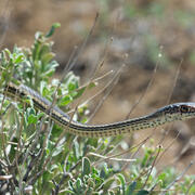
Wildlife Ecology and Habitat Restoration Team
Our team conducts research on wildlife species ecology, threats to species, causes of population dynamics, and ways to mitigate threats for species recovery. For example, we conduct research on ecological restoration in terrestrial and aquatic environments, and investigate wildlife responses to restoration. We also evaluate standardized methods used to monitor post-restoration outcomes and develop...

USGS Sagebrush Science: Supporting Public Safety and Economic Decision Making Across the West
The sagebrush biome is one of the largest ecosystems in North America. Encompassing nearly one-third of the continental U.S., it provides critical resources for millions of Americans and a home for hundreds of plants and animal species in the West. Natural resource management in sagebrush ecosystems can be complex, and science can support management decisions by providing knowledge and tools to...
By
Core Science Systems Mission Area, Ecosystems Mission Area, Biological Threats and Invasive Species Research Program, Climate Adaptation Science Centers, Cooperative Research Units, Land Management Research Program, Species Management Research Program, Earth Resources Observation and Science (EROS) Center, Forest and Rangeland Ecosystem Science Center, Fort Collins Science Center, Northern Rocky Mountain Science Center, Southwest Biological Science Center, Western Ecological Research Center (WERC), Wildland Fire Science

Prioritizing Restoration of Sagebrush Ecosystems Tool (PReSET): A USGS-facilitated Decision-support Tool for Sagebrush Ecosystem Conservation and Restoration Actions
Sagebrush ecosystems represent one of the most imperiled systems in North America and face continued and widespread degradation due to multiple factors including invasive species and increased human development. Effective sagebrush management must consider how to best conserve and restore habitats to stem the decline of species that rely on them, especially given limited conservation resources. To...

SBSC: Providing Unbiased Actionable Science & Information to Support Natural Resource Management Needs of the U.S. & Department of the Interior Priorities
The U.S. Geological Survey Southwest Biological Science Center (SBSC) is uniquely positioned in the Colorado River Basin to provide sound information, specialized expertise, and innovative tools to support the management and sustained use of natural resources on public and Tribal lands in the Southwest U.S.

Land management research in support of streamlined energy development, economic growth, and wildfire management
FORT researchers provide sound science to support the Department of the Interior in its efforts to streamline reliable energy development, enhance cost efficiency in public lands management, and manage fire-prone habitats for public safety. This research is developed in partnership with resource managers from local, State, Federal and Tribal governments, industry, and nongovernmental organizations...

Ground-truthing an easy guide to biocrust morphogroups
Land and resource managers are increasingly aware of the contribution of biocrusts to ecological functions and have expressed interest in training and resources to recognize biocrusts in the field. This knowledge will help enable managers to address biocrusts in carrying out analyses under the National Environmental Policy Act (NEPA). WERC scientists have drafted a single page, easy guide to...

State of Knowledge of Biological Soil Crusts: A synthesis of work to inform land management.
Land and resource managers are increasingly interested in up-to-date information for biocrust conservation and management. To facilitate the use of evolving science by land managers, WERC scientists are compiling a synthesis of recent work on biocrusts related to their ecology and management. This knowledge will help enable managers to address biocrusts in carrying out analyses under the National...

WebDART: A Cutting-edge Web Tool that Evaluates Land Condition
WebDART is an online ecological assessment tool available to a wide audience that incorporates Landsat satellite remote sensing imagery, topography, geology, soil conditions, and rangeland geospatial and vegetation mapping to compare altered terrain with an unspoiled area that has similar characteristics in the same region. The tool gives resource managers, landowners, companies, and other...

Prioritizing restoration and conservation of sagebrush ecosystems in northwestern Colorado
We are working with Colorado Parks and Wildlife (CPW) to pilot an expansion of the Prioritizing Restoration of Sagebrush Ecosystems Tool (PReSET; Duchardt et al. 2021) across northwestern Colorado. We recently completed Phase I of this project where we leveraged existing data resources to provide customized scenarios that are now directly guiding landscape-scale conservation delivery by CPW...

Assessing vegetation and avian community response to juniper reduction treatments in Southwest Montana
The Southwest Montana Sagebrush Partnership (SMSP) team, including land managers, landowners, and scientists, is implementing conifer removal projects encompassing over 55,000 acres of private, state, and federal lands throughout the region. To date, little place-based information exists regarding likely vegetation and bird responses to such treatments in Southwestern Montana. To address this...

Effects of the herbicide, Indaziflam, on invasive annual grasses
Invasive annual grasses are spreading across the sagebrush ecosystem, threatening the survival of native plant species and the wildlife habitats they support. Researchers from the U.S. Geological Survey, Colorado State University, University of Wyoming, the Bureau of Land Management, National Park Service, and the U.S. Fish and Wildlife Service are collaboratively investigating the factors that...