
Anoxic groundwater pumped from the embayment-uplands aquifers for municipal supply is oxygenated as it cascades over aerator trays. The iron and manganese that are dissolved in the water precipitate and are filtered from the water.
Images
Images intro.
Filter Total Items: 139

Public supply well and aerator
Anoxic groundwater pumped from the embayment-uplands aquifers for municipal supply is oxygenated as it cascades over aerator trays. The iron and manganese that are dissolved in the water precipitate and are filtered from the water.

Latham River at Jekyll Island State Park, Georgia
Latham River at Jekyll Island State Park, Georgia, where the river flows into Jekyll Sound. The health of the Jekyll Sound ecosystem is influenced by streamflow and the associated nutrient loads.
Latham River at Jekyll Island State Park, Georgia, where the river flows into Jekyll Sound. The health of the Jekyll Sound ecosystem is influenced by streamflow and the associated nutrient loads.

Conoco limestone outcrop
A rock hammer posed next to an outcrop of the Conococheague Formation, an Appalachian bedrock unit of Cambrian age. Photo is from Circular 1360, Water Quality of Principal Aquifers of the United States, 1991-2010.
A rock hammer posed next to an outcrop of the Conococheague Formation, an Appalachian bedrock unit of Cambrian age. Photo is from Circular 1360, Water Quality of Principal Aquifers of the United States, 1991-2010.

Ashumet Pond, Cape Cod with sample grid markers
Sunset view looking northwest from Fishermans Cove, across Ashumet Pond, Cape Cod, Massachusetts. The small sticks and flags in the lake are a sampling grid.
Sunset view looking northwest from Fishermans Cove, across Ashumet Pond, Cape Cod, Massachusetts. The small sticks and flags in the lake are a sampling grid.

Sunfish
Sunfish from the Southeast Stream Quality Assessment. An increase in sunfish in southeastern streams, intentionally stocked or unintentionally transplanted, has caused the composition of fish species among streams in the Southeast to become more similar. Such homogenization of species is an emergi
Sunfish from the Southeast Stream Quality Assessment. An increase in sunfish in southeastern streams, intentionally stocked or unintentionally transplanted, has caused the composition of fish species among streams in the Southeast to become more similar. Such homogenization of species is an emergi

Pole Bridge Creek (1) sampled as part of RSQA
Pole Bridge Creek is one of the sites investigated in the USGS Regional Stream Quality Assessment, during which water quality and ecological condition were sampled.
Pole Bridge Creek is one of the sites investigated in the USGS Regional Stream Quality Assessment, during which water quality and ecological condition were sampled.

Little Haynes Creek, Georgia, was sampled for RSQA
Little Haynes Creek, Georgia, was sampled for RSQALittle Haynes Creek is one of the sites investigated in the USGS Regional Stream Quality Assessment, during which water quality and ecological condition were sampled.
Little Haynes Creek, Georgia, was sampled for RSQA
Little Haynes Creek, Georgia, was sampled for RSQALittle Haynes Creek is one of the sites investigated in the USGS Regional Stream Quality Assessment, during which water quality and ecological condition were sampled.

Collecting a sample of aquatic invertebrates, South Fork Broad River
Collecting a sample of aquatic invertebrates, South Fork Broad RiverUSGS hydrologists and technicians use a kicknet to collect a sample of aquatic invertebrates for an ecological survey on South Fork Broad River iin Georgia. Broad River was one of the sites investigated in the USGS Regional Stream Quality Assessment, during which water quality and ecological condition were sampled.

Ashumet Pond, Cape Cod
View looking west from Fishermans Cove, across Ashumet Pond, Cape Cod, Massachusetts. The small sticks in the lake are a small-scale sampling grid.
View looking west from Fishermans Cove, across Ashumet Pond, Cape Cod, Massachusetts. The small sticks in the lake are a small-scale sampling grid.

Hydrologists deploy sampler in Mississippi River
USGS hydrologists ready a 287-lb D-99 bag sampler to deploy in the Mississippi River. The USGS regularly collects samples for water-quality analysis from the large rivers of the Nation; data are available at https://cida.usgs.gov/quality/rivers/home.
USGS hydrologists ready a 287-lb D-99 bag sampler to deploy in the Mississippi River. The USGS regularly collects samples for water-quality analysis from the large rivers of the Nation; data are available at https://cida.usgs.gov/quality/rivers/home.

Collecting a sample of groundwater
This well is being sampled for water-quality constituents as part of the NAWQA Enhanced Trend Network project.
This well is being sampled for water-quality constituents as part of the NAWQA Enhanced Trend Network project.

Set up to sample groundwater quality
This well is being sampled for water-quality constituents as part of the NAWQA Enhanced Trend Network project.
This well is being sampled for water-quality constituents as part of the NAWQA Enhanced Trend Network project.

Large-volume public supply well
A large-volume public supply well in San Antonio, Texas. This well is being sampled for water-quality constituents as part of the NAWQA Enhanced Trend Network project.
A large-volume public supply well in San Antonio, Texas. This well is being sampled for water-quality constituents as part of the NAWQA Enhanced Trend Network project.

Collecting a groundwater-quality sample
This well is being sampled for water-quality constituents as part of the NAWQA Enhanced Trend Network project.
This well is being sampled for water-quality constituents as part of the NAWQA Enhanced Trend Network project.

Big Darby Creek flows through a heavily wooded area
Big Darby Creek flows through a heavily wooded areaBig Darby Creek is near Lake Darby, Ohio. Find out about the water quality of this stream and others in the Midwest studied by the Midwest Stream Quality Assessment.
Big Darby Creek flows through a heavily wooded area
Big Darby Creek flows through a heavily wooded areaBig Darby Creek is near Lake Darby, Ohio. Find out about the water quality of this stream and others in the Midwest studied by the Midwest Stream Quality Assessment.

Midwest streams flow through intensive row cropping
Midwest streams flow through intensive row croppingIn the Corn Belt states of the Midwestern U.S., intensive row-cropping surrounds small streams, effectively eliminating riparian cover and habitat. Agricultural activities can have profound effects on the chemical and physical characteristics of small streams.

CAFOs in Midwest a source of nitrogen
Many small farms in the Corn Belt state of the Midwest also have confined animal feeding operations (CAFOs). These CAFOs can be a source of nitrogen to receiving small streams. The USGS Regional Stream Quality Assessment (RSQA) investigated the water quality of small streams across the Midwest during 2013.
Many small farms in the Corn Belt state of the Midwest also have confined animal feeding operations (CAFOs). These CAFOs can be a source of nitrogen to receiving small streams. The USGS Regional Stream Quality Assessment (RSQA) investigated the water quality of small streams across the Midwest during 2013.
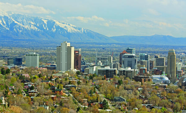
Salt Lake City Skyline
Salt Lake City skyline showing buildings with mountains in the background.
Salt Lake City skyline showing buildings with mountains in the background.