
Mangroves grow along the outside of a playa, one of may in the Florida Bay area.
Images
Images below come from a wide variety of USGS science activities in the Northeast Region. Science Center staff showcase what we do, who we are, and where we work conducting science that inform decision makers and addresses societal needs.
Filter Total Items: 2050

Mangroves Surrounding a Playa, Florida Bay 2018
Mangroves grow along the outside of a playa, one of may in the Florida Bay area.

Confined disposal facility, East Chicago, Indiana
Front cover for the publication titled "Geochemistry and microbiology of groundwater and solids from extraction and monitoring wells and their relation to well efficiency at a Federally operated confined disposal facility, East Chicago, Indiana"
Front cover for the publication titled "Geochemistry and microbiology of groundwater and solids from extraction and monitoring wells and their relation to well efficiency at a Federally operated confined disposal facility, East Chicago, Indiana"

Nantucket and Marthas Vineyard geologic illustrations
Nantucket and Marthas Vineyard geologic illustrationsGeologic sections (C-C', D-D', and E-E') illustrating the general distributions and thicknesses of seismic stratigraphic units and major unconformities in the Martha’s Vineyard and Nantucket study areas.

Coastal wetland ecosystems in Jamaica Bay, New York,
Coastal wetland ecosystems in Jamaica Bay, New York,Coastal wetland ecosystems in Jamaica Bay, New York, provide important ecosystem services along the highly urbanized Atlantic coast.
Coastal wetland ecosystems in Jamaica Bay, New York,
Coastal wetland ecosystems in Jamaica Bay, New York,Coastal wetland ecosystems in Jamaica Bay, New York, provide important ecosystem services along the highly urbanized Atlantic coast.

Yellow Creek near Oak Grove, IN - gage on bridge
Yellow Creek near Oak Grove, IN - gage on bridge

RV Petrel towing subbottom profiler
RV Petrel towing subbottom profiler (yellow raft) parallel to the beach to measure the thickness of sand offshore.
RV Petrel towing subbottom profiler (yellow raft) parallel to the beach to measure the thickness of sand offshore.
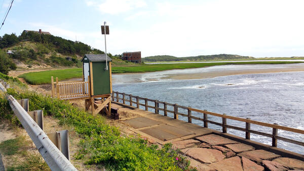
USGS station 011058798, Herring River at Chequessett Neck Road dike, downstream
USGS station 011058798, Herring River at Chequessett Neck Road dike, downstreamUSGS Station 011058798, Herring River at Chequessett Neck Road dike, looking downstream.
USGS station 011058798, Herring River at Chequessett Neck Road dike, downstream
USGS station 011058798, Herring River at Chequessett Neck Road dike, downstreamUSGS Station 011058798, Herring River at Chequessett Neck Road dike, looking downstream.

Thawing Permafrost, Alaska
Thawing permafrost on various peatlands in Alaska. Permafrost thaw results in ground subsidence and inundation that kills black spruce and other understory plants living on the permafrost plateau. The black spruce forests found on permafrost plateaus are replaced with sedge- and moss-dominated bogs and fens, altering the ecosystem structure and function.
Thawing permafrost on various peatlands in Alaska. Permafrost thaw results in ground subsidence and inundation that kills black spruce and other understory plants living on the permafrost plateau. The black spruce forests found on permafrost plateaus are replaced with sedge- and moss-dominated bogs and fens, altering the ecosystem structure and function.

Mangroves Surrounding a Playa, Florida Bay 2018
Mangroves on the outside of a playa within Florida Bay.
Mangroves on the outside of a playa within Florida Bay.

SEABOSS Collage
SEABed Observation and Sampling System (SEABOSS) (center image) and the MiniSEABOSS (right) designed for rapid, inexpensive, and effective collection of seabed imagery (photographs and video) as well sediment samples from the coastal/inner-continental shelf regions.
SEABed Observation and Sampling System (SEABOSS) (center image) and the MiniSEABOSS (right) designed for rapid, inexpensive, and effective collection of seabed imagery (photographs and video) as well sediment samples from the coastal/inner-continental shelf regions.

UAS pilots at Kilauea
Department of Interior UAS pilots from left to right – Elizabeth Pendleton (USGS, Woods Hole, MA), Colin Milone (Office of Aviation Services, AK), John Vogel (USGS; Flagstaff, AZ), Sandy Brosnahan (USGS, Woods Hole, MA), Brandon Forbes (USGS; Tucson, AZ), Chris Holmquist-Johnson (USGS; Fort Collins, CO),&nb
Department of Interior UAS pilots from left to right – Elizabeth Pendleton (USGS, Woods Hole, MA), Colin Milone (Office of Aviation Services, AK), John Vogel (USGS; Flagstaff, AZ), Sandy Brosnahan (USGS, Woods Hole, MA), Brandon Forbes (USGS; Tucson, AZ), Chris Holmquist-Johnson (USGS; Fort Collins, CO),&nb

Sediment textures distribution from Nantucket and Marthas Vineyard, MA
Sediment textures distribution from Nantucket and Marthas Vineyard, MAThe distribution of sediment textures within the study area. The bottom-type classification is from Barnhardt and others (1998) and is based on 16 sediment classes. The classification is based on four sediment units that include gravel (G), mud (M), rock (R), and sand (S). If the texture is greater than 90 percent, it is labeled with a single letter.

Scientist surveying the behavior of birds at Pelican Island, Alabama
Scientist surveying the behavior of birds at Pelican Island, AlabamaScientist surveying the presence and behavior of birds at Pelican Island, Alabama. The CMHRP is working with personnel within the Ecosystems Mission Area on this project to identify how physical characteristics of barrier islands influence use by wintering shorebirds.

USGS aerial imaging mapping team
USGS unmanned aerial system (uas) mapping team on the beach in Dauphin Island, Alabama
USGS unmanned aerial system (uas) mapping team on the beach in Dauphin Island, Alabama

Yellow River at Knox, IN - upstream of bridge
Yellow River at Knox, IN - upstream of bridge

Ready to dive in Yucatan Peninsula
USGS personnel preparing to dive in Yucatan Peninsula.
USGS personnel preparing to dive in Yucatan Peninsula.

Collecting water samples in Yucatan Peninsula, Mexico
Collecting water samples in Yucatan Peninsula, MexicoCollecting water samples in Yucatan Peninsula, Mexico.
Collecting water samples in Yucatan Peninsula, Mexico
Collecting water samples in Yucatan Peninsula, MexicoCollecting water samples in Yucatan Peninsula, Mexico.

Tulum, Mexico jungle panorama
Tulum, Mexico jungle panorama

Tulum, Mexico hike through the jungle
Hike through the jungle in Tulum, Mexico
Hike through the jungle in Tulum, Mexico


Eagle Creek at Zionsville, IN - downstream of gage
Eagle Creek at Zionsville, IN - downstream of gageEagle Creek at Zionsville, IN - downstream of gage
Eagle Creek at Zionsville, IN - downstream of gage
Eagle Creek at Zionsville, IN - downstream of gageEagle Creek at Zionsville, IN - downstream of gage