
Yellow River at Knox, IN - downstream of bridge
Images
Images below come from a wide variety of USGS science activities in the Northeast Region. Science Center staff showcase what we do, who we are, and where we work conducting science that inform decision makers and addresses societal needs.
Filter Total Items: 2050

Yellow River at Knox, IN - downstream of bridge

Yellow River at Knox, IN - control under bridge
Yellow River at Knox, IN - control under bridge

Kanakee River at Davis, IN - downstream of bridge
Kanakee River at Davis, IN - downstrean of bridge
Kanakee River at Davis, IN - downstrean of bridge

Grand River near Painesville, OH - bridge view
Grand River near Painesville, OH - bridge view
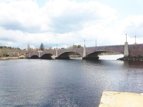
Berkley Bridge over the Taunton River in Massachusetts
Berkley Bridge over the Taunton River in MassachusettsA view of the Berkley-Dighton Bridge that cross over the Taunton River in Massachusetts. USGS and the Massachusetts Department of Environmental Protection collects water quality data in the Taunton River.

Core Sampling - Shinnecock, Long Island, NY
Drilling and core sampling on the Shinnecock Tribal Lands, Long Island, NY
Drilling and core sampling on the Shinnecock Tribal Lands, Long Island, NY

NYWSC scientist collecting groundwater samples
NYWSC scientist collecting groundwater samples
NYWSC scientist collecting groundwater samples

"Miss Q" Ready to Go
The Maine Office boat, "Miss Q", is parked next to the boat launch on Verona Island, ready to begin data collection on the Penobscot River. The crew was preparing to collect ADCP data (depth and velocity) as well as conductivity, temperature and depth profiles at various locations. In the background is the Penobscot Narrows Bridge and Fort Knox.
The Maine Office boat, "Miss Q", is parked next to the boat launch on Verona Island, ready to begin data collection on the Penobscot River. The crew was preparing to collect ADCP data (depth and velocity) as well as conductivity, temperature and depth profiles at various locations. In the background is the Penobscot Narrows Bridge and Fort Knox.

Thawing Peatlands, Alaska
Cores were collected from various areas of thawing permafrost-peatlands in Alaska. Permafrost thaw results in ground subsidence and inundation that kills black spruce and other understory plants living on the permafrost plateau.
Cores were collected from various areas of thawing permafrost-peatlands in Alaska. Permafrost thaw results in ground subsidence and inundation that kills black spruce and other understory plants living on the permafrost plateau.

SeaBOSS on the fantail of the R/V Auk
Page Valentine and Dann Blackwood on the fantail of the NOAA R/V Auk. Dann is photographing a sediment sample collected on the seabed.
Page Valentine and Dann Blackwood on the fantail of the NOAA R/V Auk. Dann is photographing a sediment sample collected on the seabed.

SEABoss Deployment on Stellwagen Bank
Page Valentine works with NOAA staff from the Stellwagen Bank National Marine Sanctuary to ready the SEABoss for deployment off the fantail of the NOAA R/V Auk.
Page Valentine works with NOAA staff from the Stellwagen Bank National Marine Sanctuary to ready the SEABoss for deployment off the fantail of the NOAA R/V Auk.

01174565 streamgage station, West Branch Swift River, Shutesbury, MA
01174565 streamgage station, West Branch Swift River, Shutesbury, MAUSGS 01174565 gaging station, West Branch Swift River near Shutesbury, Massachusetts
01174565 streamgage station, West Branch Swift River, Shutesbury, MA
01174565 streamgage station, West Branch Swift River, Shutesbury, MAUSGS 01174565 gaging station, West Branch Swift River near Shutesbury, Massachusetts

USGS Research Scientist, Meagan Gonneea, shares science
USGS Research Scientist, Meagan Gonneea, shares scienceUSGS Research Scientist, Meagan Gonneea, talking about the differences between coastal salt marshes and invasive phragmites at the 2017 Woods Hole Science Stroll outreach event
USGS Research Scientist, Meagan Gonneea, shares science
USGS Research Scientist, Meagan Gonneea, shares scienceUSGS Research Scientist, Meagan Gonneea, talking about the differences between coastal salt marshes and invasive phragmites at the 2017 Woods Hole Science Stroll outreach event

USGS Science Stroll Dream Team
Woods Hole Coastal and Marine Science Center Science Stroll participants; Dann Blackwood, Andrea Toran, Emily Sturdivant, Ellyn Montgomery, Sara Zeigler, Neil Ganju, Seth Ackerman, Laura Brothers, Meagan Gonneea
Woods Hole Coastal and Marine Science Center Science Stroll participants; Dann Blackwood, Andrea Toran, Emily Sturdivant, Ellyn Montgomery, Sara Zeigler, Neil Ganju, Seth Ackerman, Laura Brothers, Meagan Gonneea

Family fun with the SeaBOSS!
SeaBOSS Selfies were a big hit at the 2017 Woods Hole Science Stroll.
SeaBOSS Selfies were a big hit at the 2017 Woods Hole Science Stroll.

USGS Drone demonstration at Woods Hole Science Stroll
USGS Drone demonstration at Woods Hole Science StrollWoods Hole Coastal and Marine Science Center drone pilot, Emily Sturdivant, provides a demonstration of drone capabilities at the 2017 Woods Hole Science Stroll
USGS Drone demonstration at Woods Hole Science Stroll
USGS Drone demonstration at Woods Hole Science StrollWoods Hole Coastal and Marine Science Center drone pilot, Emily Sturdivant, provides a demonstration of drone capabilities at the 2017 Woods Hole Science Stroll

Drone's Eye View of Woods Hole, MA
Aeiral image of Woods Hole, MA taken during the 2017 Woods Hole Science Stroll. The green USGS tent generated a lot of interest and participation from Science Stroll attendees
Aeiral image of Woods Hole, MA taken during the 2017 Woods Hole Science Stroll. The green USGS tent generated a lot of interest and participation from Science Stroll attendees

Drone on target!
Woods Hole Coastal and Marine Science Center drone pilot, Emily Sturdivant, lands a drone on target at the 2017 Woods Hole Science Stroll
Woods Hole Coastal and Marine Science Center drone pilot, Emily Sturdivant, lands a drone on target at the 2017 Woods Hole Science Stroll

USGS employee conducts gage inspection at gage 1175500 Swift River MA
USGS employee conducts gage inspection at gage 1175500 Swift River MAUSGS employee conducts gage inspection at the 1175500 Swift River, MA gage location.
USGS employee conducts gage inspection at gage 1175500 Swift River MA
USGS employee conducts gage inspection at gage 1175500 Swift River MAUSGS employee conducts gage inspection at the 1175500 Swift River, MA gage location.

USGS Streamgage 1174500 East Branch Swift River Near Hardwick, MA

SOD sampling Mohawk RIver
USGS scientist SOD sampling in the Mohawk RIver
USGS scientist SOD sampling in the Mohawk RIver