
Sound Waves Newsletter: June-July 2025
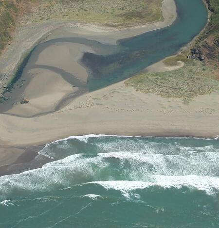
California’s Seasonally Rotating Pocket Beaches
New research led by USGS finds that along California’s rugged coastline, some of the state’s most scenic “pocket beaches”—short stretches of sand nestled between rocky headlands—undergo predictable rotations each year in response to changing wave conditions.

Projecting Accelerated Erosion of O‘ahu's Shorelines
Hawai‘i’s iconic beaches—essential to the state’s identity, economy, and ecosystems—are disappearing faster than previously predicted. New projections of shoreline change by the University of Hawai‘i at Mānoa and USGS finds that 81% of sandy shorelines on the island of O‘ahu could be lost by the end of the century, with nearly 40% of that loss occurring within just the next five years.

USGS Coastal Storm Projection Data Inform Department of Defense Infrastructure Risk Assessments
Using USGS data, the U.S. Department of Defense's (DoD) Regional Sea Level Database supports DoD efforts to assess and respond to coastal infrastructure exposures and vulnerabilities from plausible scenarios of future mean sea level and extreme, storm-driven water levels.
USGS Seafloor Mapping Provides the Scientific Foundation Needed to Address National Priorities
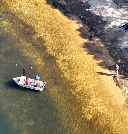
Helping Our Neighbors: USGS Surveys Primary Drinking Water Source for the Town of Falmouth
USGS conducted a mapping survey of Long Pond in Falmouth, Massachusetts, at the request of the Town to determine the total water volume of the reservoir, as well as the water volumes available based on varying water surface elevations. Long Pond is Falmouth’s primary source of drinking water.
USGS Stands Ready for a Potentially Active Atlantic Hurricane Season
The 2025 Atlantic hurricane Season runs from June 1 through November 30. Throughout the season, the U.S. Geological Survey is prepared to aid coastal and inland communities by informing critical decisions before, during, and after hurricanes, which can help save lives and protect property.
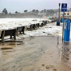
Frequency and Intensity of Storm Surges Underestimated Nationally, Study Finds
Coastal communities around the world face increasing threats from storm surges—intense rises in sea level caused by powerful storms pushing water ashore. A new study using advanced statistical modeling and historical sea-level observational data shows that the likelihood of these events occurring is much higher than previously estimated along U.S. coasts.
Stories related to the USGS-led seafloor mapping expedition on the Aleutian Arc offshore Alaska
-

Celebrating an Aleutian Anniversary Celebrating an Aleutian Anniversary
A USGS-led expedition in the Aleutian Arc off Alaska will provide critical information on energy resources, underwater earthquakes and other hazards, seafloor habitats, and biological resources, including key fisheries, as well as potential seabed minerals. One USGS scientist celebrates a return to the Aleutians - 21 years later.
-

Connecting Communities to Ocean Exploration: Outreach from the Aleutian Arc Expedition Connecting Communities to Ocean Exploration: Outreach from the Aleutian Arc Expedition
A USGS-led expedition in the Aleutian Arc off Alaska will provide critical information on energy resources, underwater earthquakes and other hazards, seafloor habitats, and biological resources, including key fisheries, as well as potential seabed minerals. Before departing, the science team led several community outreach events.
-
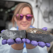
Investigating Potential Seabed Minerals in the Aleutian Arc Investigating Potential Seabed Minerals in the Aleutian Arc
A USGS-led expedition in the Aleutian Arc off Alaska will provide critical information on energy resources, underwater earthquakes and other hazards, seafloor habitats, and biological resources, including key fisheries, as well as potential seabed minerals. Scientists are investigating potential hydrothermal mineral specimens on the seafloor.
-
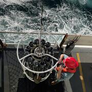
Detecting Hydrothermal Vents and Collecting Environmental DNA: Investigating the Water Column in the Aleutian Arc Detecting Hydrothermal Vents and Collecting Environmental DNA: Investigating the Water Column in the Aleutian Arc
A USGS-led expedition in the Aleutian Arc off Alaska will provide critical information on energy resources, underwater earthquakes and other hazards, seafloor habitats, and biological resources, including key fisheries, as well as potential seabed minerals. Scientists are collecting critical environmental data using an oceanographic tool known as a CTD.
-

Exploring Critical Minerals and Volcanic Processes in Aleutian Rocks Exploring Critical Minerals and Volcanic Processes in Aleutian Rocks
A USGS-led expedition in the Aleutian Arc off Alaska will provide critical information on energy resources, underwater earthquakes and other hazards, seafloor habitats, and biological resources, including key fisheries, as well as potential seabed minerals.

Woods Hole Coastal and Marine Science Center Newsletter: June-July 2025
Welcome to our newsletter, where we share science stories, popular social media posts, recent publications, fieldwork activities, and more center happenings.
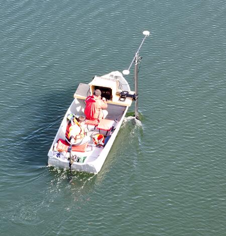
Photo Roundup: June-July 2025
A selection of coastal and ocean videos and photographs from across the USGS.
News Briefs: June-July 2025
News Briefs - featuring coastal and ocean science from across the USGS.