
Estuaries and Embayments
Estuaries and Embayments
The USGS conducts monitoring and interdisciplinary studies that aim to understand and quantify water quality, ecosystems, and processes in estuaries and embayments of Long Island Sound. Monitoring is conducted to document water-quality conditions and identify pollutant sources. Observational and modeling studies are used to better understand estuarine processes and responses to coastal hazards.
Filter Total Items: 10
Changes in Nitrogen Contributions from Groundwater to the Niantic River Before and After Sewering
Onsite residential septic systems can be a major nonpoint source of nitrogen contamination. The excess nitrogen entering Connecticut’s Niantic River estuary is associated with high nitrate concentrations in the groundwater of the river’s 28-square-mile watershed, creating unsuitable habitat for the growth and recovery of eelgrass (Zostera marina). In an attempt to improve the river’s water quality...

Life History and Migration of Sturgeons in New England Waters
Sturgeons appear in the fossil record as early as the Triassic, 200 million years ago. Although most populations could once tolerate harvesting pressures, most populations have collapsed and nearly all of the 28 species alive today are listed as threatened or endangered. In New England, dams and water regulation challenge population recoveries of the two resident species, the shortnose and...

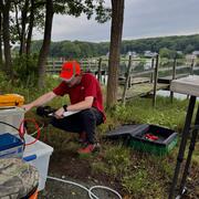
Embayment Monitoring to Support Nutrient Management Activities in Connecticut for Long Island Sound
The USGS, in cooperation with the Connecticut Department of Energy and Environmental Protection will be collecting water-quality and hydrologic data at six embayments from April 2021 to June 2027: Mystic, Norwalk, Saugatuck, Sasco-Southport complex, Farm, and Poquonnock.

Estuarine Processes, Hazards, and Ecosystems
Estuarine processes, hazards, and ecosystems describes several interdisciplinary projects that aim to quantify and understand estuarine processes through observations and numerical modeling. Both the spatial and temporal scales of these mechanisms are important, and therefore require modern instrumentation and state-of-the-art hydrodynamic models. These projects are led from the U.S. Geological...

Estuarine Processes Coastal Hazards
Extreme tides and coastal storms transfer high water levels to estuaries through natural and managed entrances. The size of the transfer depends on the duration of the event and the geomorphology of the estuary. We use observational data and modeling scenarios to understand and spatially map this transfer at our study sites.

Estuarine Processes Model Development
We are developing new routines within the COAWST model framework to represent coupled bio-physical processes in estuarine and coastal regions. These include routines for marsh vulnerability to waves, estuarine biogeochemistry, and feedbacks between aquatic vegetation and hydrodynamics.

Using Microbial Source Tracking to Identify Pollution Sources in Pathogen Impaired Embayments in Long Island, New York
Problem The presence of pathogens in Long Island marine embayments and the hazards they pose to marine resources and human health is of increasing concern. Many waterbodies on the New York State Section 303(d) List of Impaired Waters have pathogens listed as the primary pollutant that are suspected to originate from urban/storm runoff. There is neither a clear understanding of the...

Comprehensive Delineation of Groundwater Source Areas and Times-of-travel to Long Island Streams and Estuaries
Problem The discharge of freshwater and associated loading of nutrients and other dissolved constituents from the Long Island aquifer system to surrounding estuaries and their tributaries are increasingly recognized as critical factors in the health of these ecosystems. However, further work is needed to scientifically characterize these factors and present them to the public in an...

Continuous and Spatially Distributed Dissolved Oxygen Monitoring in Long Island Estuaries in Support of Coastal Resource Management.
Problem Dissolved oxygen (DO) is an important indicator of water quality that until recently has been cost-prohibitive to monitor extensively in both space and time. Continuous water-quality data, particularly in coastal environments with bidirectional tidal flow, is necessary for resource managers to understand the dynamic changes in water quality that occur tidally, daily, seasonally...

Monitoring Tidal Water Elevation and Water Quality to Assess Tidal Wetland Loss in Four Embayments of Long Island Sound, New York
Introduction Recent trends analysis examining the effectiveness of tidal wetland regulations and the regulatory program of the New York State Department of Environmental Conservation (NYSDEC) revealed that the regulations and regulatory program were highly effective in stemming the historic "fill and build" activities. However, the trends also revealed that tidal wetlands—specifically...