
David C Lampe
David attended University of Ilinois (B.S. Geology, 2001) and Indiana University (M.S. Geology, 2004) and has been employed as a hydrologist with the USGS Indiana Water Science Center since 2003. Scientific interests include borehole geophysics, horizontal borehole flowmeters, and three-dimensional data visualization techniques.
Science and Products
Investigating Links between Chloride and Harmful Algal Blooms in the Great Lakes
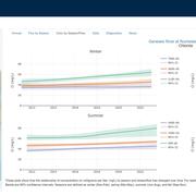
The USGS is investigating links between chloride concentrations in Great Lakes tributaries as a catalyst for Harmful Algal Blooms (HABs).

Hydrogeologic Mapping and Three-Dimensional Geologic Modeling of Glacial Deposits in a Multicounty Area of Southeastern Michigan, Northeastern Indiana, and Northwestern Ohio
Groundwater resources in southern Michigan, northeastern Indiana, and northwestern Ohio, have been a recurring subject of interest related to sources of public, irrigation, and other water supplies and the potential of glacial deposits to supply water to adjacent parts of Ohio. The glacial deposits that are part of the aquifer system informally known as the “Michindoh aquifer” are a principal...

Groundwater Age Estimates, Groundwater Quality, and Hydrogeologic Characteristics of Chase Street Flowing Well and Similar Confined Wells, Little Calumet River Basin, Indiana
In cooperation with The Little Calumet River Basin Development Commission and the Urban Waters Federal Partnership The Little Calumet River Basin Development Commission (LCRBDC) is developing a park around a local cultural landmark, known locally as the Chase Street flowing well, in Gary, Indiana, a community in the Urban Waters Federal Partnership--Northwest Indiana Area. Groundwater from the...
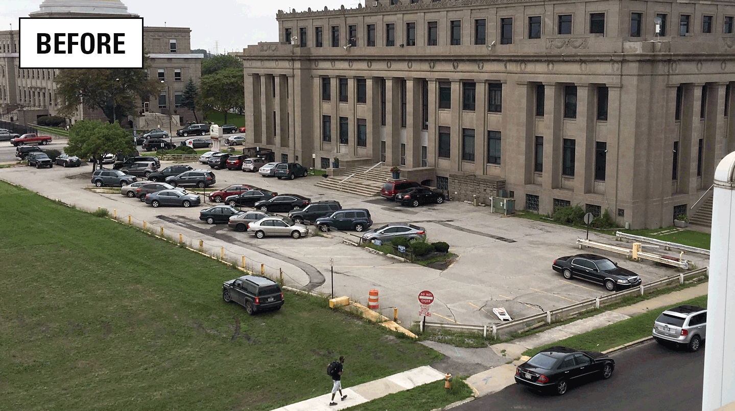
Assessing stormwater reduction using green infrastructure: Gary City Hall (Gary, Ind.)
The effectiveness of green infrastructure (rain gardens and decreased impervious surface) at reducing stormwater runoff and capturing dissolved chloride is being assessed at a redevelopment project at Gary City Hall (Gary, Indiana). This study will evaluate pre- and post-construction hydrologic conditions using data collected by monitoring storm-sewer flow, groundwater levels, soil moisture, and...

Water Quality Monitoring and Algal Community Composition Analysis in Support of Eutrophication Beneficial Use Impairment Evaluation in the Grand Calumet River Area of Concern, Northwest Indiana
In cooperation with the Indiana Department of Environmental Management and the U.S. Environmental Protection Agency

Indiana Volunteer Groundwater Monitoring Network
The USGS Indiana Water Science Center, in cooperation with the Indiana Department of Natural Resources, have developed a quality assured volunteer groundwater data collection system to enhance the existing groundwater-level network for the state and provide usable data to the public. Individuals interested in providing data to the Indiana Volunteer groundwater monitoring network can find more...

Indiana-Kentucky Climate Response Network
Do you recall the drought of 2012? Precipitation deficits during July 2012 were widespread. Morse Reservoir was a prominent sight that was highly visible in the news. Photos showed million dollar mansions with boats stranded on the lakebed. This drought took many by surprise, however, there were hydrologic signs during 2011. Events like this (and California) have brought some welcome attention to...

Indiana Discrete Measurement Groundwater Networks
Discrete groundwater measurements are made at 159 wells located in Lake, Hamilton, and St. Joseph Counties.

Kankakee River at Davis, IN Mega Gage: Monitoring Groundwater/Surface-Water Interactions
What is the groundwater contribution to nitrates in surface water? That's the question we are trying to answer by looking at surface-water and groundwater interaction and the role each play in the movement of nitrates. We have added additional monitoring equipment to the USGS super gage Kankakee River at Davis, IN, which will allow us to calculate the nitrate load in groundwater using flow...
Science and Products
Investigating Links between Chloride and Harmful Algal Blooms in the Great Lakes
The USGS is investigating links between chloride concentrations in Great Lakes tributaries as a catalyst for Harmful Algal Blooms (HABs).
Hydrogeologic Mapping and Three-Dimensional Geologic Modeling of Glacial Deposits in a Multicounty Area of Southeastern Michigan, Northeastern Indiana, and Northwestern Ohio
Groundwater resources in southern Michigan, northeastern Indiana, and northwestern Ohio, have been a recurring subject of interest related to sources of public, irrigation, and other water supplies and the potential of glacial deposits to supply water to adjacent parts of Ohio. The glacial deposits that are part of the aquifer system informally known as the “Michindoh aquifer” are a principal...
Groundwater Age Estimates, Groundwater Quality, and Hydrogeologic Characteristics of Chase Street Flowing Well and Similar Confined Wells, Little Calumet River Basin, Indiana
In cooperation with The Little Calumet River Basin Development Commission and the Urban Waters Federal Partnership The Little Calumet River Basin Development Commission (LCRBDC) is developing a park around a local cultural landmark, known locally as the Chase Street flowing well, in Gary, Indiana, a community in the Urban Waters Federal Partnership--Northwest Indiana Area. Groundwater from the...
Assessing stormwater reduction using green infrastructure: Gary City Hall (Gary, Ind.)
The effectiveness of green infrastructure (rain gardens and decreased impervious surface) at reducing stormwater runoff and capturing dissolved chloride is being assessed at a redevelopment project at Gary City Hall (Gary, Indiana). This study will evaluate pre- and post-construction hydrologic conditions using data collected by monitoring storm-sewer flow, groundwater levels, soil moisture, and...
Water Quality Monitoring and Algal Community Composition Analysis in Support of Eutrophication Beneficial Use Impairment Evaluation in the Grand Calumet River Area of Concern, Northwest Indiana
In cooperation with the Indiana Department of Environmental Management and the U.S. Environmental Protection Agency
Indiana Volunteer Groundwater Monitoring Network
The USGS Indiana Water Science Center, in cooperation with the Indiana Department of Natural Resources, have developed a quality assured volunteer groundwater data collection system to enhance the existing groundwater-level network for the state and provide usable data to the public. Individuals interested in providing data to the Indiana Volunteer groundwater monitoring network can find more...
Indiana-Kentucky Climate Response Network
Do you recall the drought of 2012? Precipitation deficits during July 2012 were widespread. Morse Reservoir was a prominent sight that was highly visible in the news. Photos showed million dollar mansions with boats stranded on the lakebed. This drought took many by surprise, however, there were hydrologic signs during 2011. Events like this (and California) have brought some welcome attention to...
Indiana Discrete Measurement Groundwater Networks
Discrete groundwater measurements are made at 159 wells located in Lake, Hamilton, and St. Joseph Counties.
Kankakee River at Davis, IN Mega Gage: Monitoring Groundwater/Surface-Water Interactions
What is the groundwater contribution to nitrates in surface water? That's the question we are trying to answer by looking at surface-water and groundwater interaction and the role each play in the movement of nitrates. We have added additional monitoring equipment to the USGS super gage Kankakee River at Davis, IN, which will allow us to calculate the nitrate load in groundwater using flow...