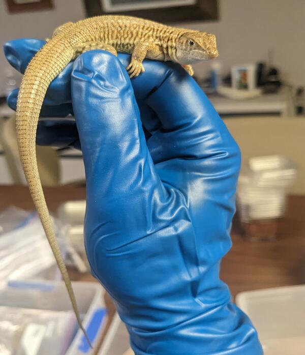
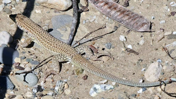
Dr. Robert Fisher is a conservation biologist with the U.S. Geological Survey’s Western Ecological Research Center and works as part of a large integrated team.
His focus has been on how natural systems are responding to the Anthropocene, and what types of resiliency they have or lack as it relates to maintaining ecological integrity and biodiversity. Additionally, through understanding individual species and community responses to perturbations through modern monitoring techniques, he and his team can determine appropriate management experiments or options to possibly recover resiliency. Geographically they have two foci, the first is southern California where urbanization and conservation planning bring various direct and indirect drivers of ecological change, and climate variability is currently extreme and drives landscape level drought and wildfires. Their second foci are the tropical islands of the Pacific Basin, from Palau and Papua New Guinea east to Hawai’i. These islands have also been driven by human change and are on the front line as extreme recent weather variability in the cyclone belt impact terrestrial ecosystems. Understanding how biodiversity was generated in this ecoregion is critical to managing its loss, and their team focuses across time and space (biogeography) to understand these processes utilizing molecular tools tied to expeditions of discovery in this poorly studied ecoregion.
RESEARCH INTERESTS
- Conservation biology
- Biogeography
- Modelling
- Natural history
- Speciation
- Invasive species
- Climate variability
- Anthropocene
Education and Certifications
Ph.D., Population Biology, University of California, Davis, CA 1995
M.S., Zoology, University of California, Davis, CA 1991
B.S., Biology, University of California, Irvine, CA 1988
Science and Products
Tracking Bats and Coronaviruses
Pacific Pocket Mouse Monitoring and Research Program
Reptile and Amphibian Road Ecology
WERC Fire Science
Amphibian Research in Southern California
Golden Eagles in Coastal Southern California
Reptile Biodiversity in the Pacific Basin Islands
San Diego Field Station
Elucidating mechanisms underlying amphibian declines in North America using hierarchical spatial models
Raster data files for Prioritizing conserved areas threatened by wildfire for monitoring and management.
Western Spadefoot Survey Data in Northern and Central California (2019)
Long-distance movements of non-migratory golden eagles in western North America, 2007-2017
Detection/non-detection data on territorial pairs of golden eagles in coastal southern California, 2016-2017
Western Spadefoot Habitat Selection Based on Radio Telemetry in Orange County, California 2019
Species Observations from Pitfall Trap Arrays, Species Pool Matrices, and Patch Locations in Southern California from 1995-2015
Amphibian capture mark-recapture
Masticophis occupancy in southern California, 1995-2000
Predictor, null model, response variable, and habitat suitability prediction rasters for a golden eagle hierarchical Bayesian synoptic model used for habitat selection in San Diego County, California. Derived from golden eagle data collected from November
Microsatellite genotype scores for a contemporary, range-wide sample of Santa Ana sucker in southern California
New record of California red-legged frogs (Rana draytonii) in Whitewater Canyon, Riverside County, CA, USA
Data release for persistence of historical population structure in an endangered species despite near-complete biome conversion in Californias San Joaquin Desert
Harnessing island–ocean connections to maximize marine benefits of island conservation
Genetic structure and historic demography of endangered unarmoured threespine stickleback at southern latitudes signals a potential new management approach
Updates for Wake Atoll biosecurity management, biological control, survey, and management, and integrated pest management plans
Natural and anthropogenic landscape factors shape functional connectivity of an ecological specialist in urban Southern California
Research to inform passage spacing for migratory amphibians and to evaluate efficacy and designs for open elevated road segment (ERS) passages
Reference genome of the California glossy snake, Arizona elegans occidentalis: A declining California Species of Special Concern
Interpreting long-distance movements of non-migratory golden eagles: Prospecting and nomadism?
Cryptic extinction risk in a western Pacific lizard radiation
Hidden in plain sight: Detecting invasive species when they are morphologically similar to native species
Range-wide persistence of the endangered arroyo toad (Anaxyrus californicus) for 20+ years following a prolonged drought
Fijian sea krait behavior relates to fine-scale environmental heterogeneity in old-growth coastal forest: The importance of integrated land–sea management for protecting amphibious animals
Multi-scale patterns in occurrence of an ephemeral pool-breeding amphibian
Science and Products
- Science
Tracking Bats and Coronaviruses
Below are the USGS 2020 Coronavirus Aid, Relief and Economic Security Act (CARES Act) research projects related to tracking bats and coronaviruses. Select tabs above for related items.Pacific Pocket Mouse Monitoring and Research Program
Once thought to be extinct, the Pacific pocket mouse (Perognathus longimembris pacificus) was rediscovered in 1993 and is currently found at three population sites along the southern California coast. USGS researchers and their partners developed a comprehensive long-term monitoring plan to assess the status and trends of Pacific pocket mouse and identify important drivers of population dynamics...Reptile and Amphibian Road Ecology
USGS is working with many partners to help reptiles, amphibians and other animals cross roads safely, improving access to essential habitat.WERC Fire Science
WERC scientists are defining the past, present, and future of wildfires for wildlife and human communities. Explore this webpage to learn about specific, ongoing projects across California and parts of Nevada.Amphibian Research in Southern California
Amphibian populations have declined in many areas around the world. Initially, there was skepticism as to whether the observed declines were merely minor population fluctuations, but it has become increasingly clear that many declines are both real and sustained. At the request of the U.S. Department of the Interior, USGS Western Ecological Research Center (WERC) scientists are supporting the...Golden Eagles in Coastal Southern California
The status of the golden eagle (Aquila chrysaetos) in coastal southern California is unclear. To address this knowledge gap, Dr. Robert Fisher in collaboration with local, State and other Federal agencies begin a multi-year survey and tracking program of golden eagles to address questions regarding habitat use, movement behavior, nest occupancy, genetic population structure, and human impacts on...Reptile Biodiversity in the Pacific Basin Islands
Dr. Robert Fisher and his colleagues have teamed up with the U.S. Fish and Wildlife, The Nature Conservancy and multiple universities to conduct several types of studies that will address high priority issues related to reptiles in the Pacific Basin Islands. These studies will provide new information about species diversity, endemicity, biology and demography of reptile fauna and will lay the...San Diego Field Station
The San Diego Field Station is the site of research on golden eagles, endangered amphibians and reptiles, and more. Click on the "Science" tab for a comprehensive summary of this study site's projects.Elucidating mechanisms underlying amphibian declines in North America using hierarchical spatial models
Amphibian populations are declining globally at unprecedented rates but statistically rigorous identification of mechanisms is lacking. Identification of reasons underlying large-scale declines is imperative to plan and implement effective conservation efforts. Most research on amphibian population decline has focused on local populations and local factors. However, the ubiquity of declines across - Data
Raster data files for Prioritizing conserved areas threatened by wildfire for monitoring and management.
The data set consists of 12 input data rasters that cover San Diego County, California. These input rasters represent criteria used in a Pareto ranking algorithm in the manuscript. These include three rasters related to fire threats, three rasters related to habitat fragmentation threats, four rasters related to species biodiversity, and two rasters related to genetic biodiversity. (see the PLOS OWestern Spadefoot Survey Data in Northern and Central California (2019)
Species distributions are governed by processes occurring at multiple spatial scales. For species with complex life cycles, the needs of all life stages must be met within the dispersal limitations of the species. Multi-scale processes can be particularly important for these species, where small-scale patterns in specific habitat components can affect the distribution of one life stage, whereas laLong-distance movements of non-migratory golden eagles in western North America, 2007-2017
We studied >500 golden eagles tracked by telemetry over a 10-year period in western North America, of which 160 engaged in non-routine, long-distance (> 300 km) movements. We identified spatial and temporal correlates of those movements at both small and large scales, and we quantified movement timing and direction. We further tested which age and sex classes of eagles were more likely to engage iDetection/non-detection data on territorial pairs of golden eagles in coastal southern California, 2016-2017
This dataset contains detection-nondetection data for territorial pairs of Golden Eagles at survey sites randomly selected from a grid of equal-sized (13.9 km2) hexagonal sample cells overlaid across the region of interest in Coastal Southern California during 2016 and 2017. We partitioned surveys within seasons based on approximate transition dates for stages in the breeding cycle of golden eagleWestern Spadefoot Habitat Selection Based on Radio Telemetry in Orange County, California 2019
We conducted a radio telemetry study of adult western spadefoots (Spea hammondii) at 2 sites in southern California to characterize their survival, behavior, and movements from breeding through aestivation to inform conservation and management for the species. These data support the following publication: Halstead, B.J., Baumberger, K.L., Backlin, A.R., Kleeman, P.M., Wong, M.N., Gallegos, E.Species Observations from Pitfall Trap Arrays, Species Pool Matrices, and Patch Locations in Southern California from 1995-2015
Observations (reduced to detected/not detected) of 45 vertebrate species (seven mammals, seven amphibians, and 31 reptiles) across Southern California pitfall sampling projects conducted between 1995 through 2015. Habitat patch locations of every pitfall sampling project presented in a shapefile. Habitat patches were measured based on the size when pitfall sampling began within each. Sampling projAmphibian capture mark-recapture
These data represent capture mark recapture data along with associated disease status for boreal toads (Anaxyrus boreas) from Wyoming and Montana from 2004-2016 and four frog species (Rana draytonii, R. muscosa, R. pretiosa, R. sierrae) from 2001-2016.Masticophis occupancy in southern California, 1995-2000
These data are CSV files comprised of a heading and tables from Appendix 1 and Appendix 2 in the accompanying paper. The tables show the sampling dates and locations for the coachwhip (Masticophis flagellum) and striped racer (Masticophis lateralis) in pit-fall arrays (Fisher et al. 2008) monitored in southern California from 1995-2000. GPS data are shown in decimal degrees and were collected in tPredictor, null model, response variable, and habitat suitability prediction rasters for a golden eagle hierarchical Bayesian synoptic model used for habitat selection in San Diego County, California. Derived from golden eagle data collected from November
This data release includes three types of data used in habitat modeling, and predictions from the habitat models. (1) Predictor rasters for proportion urban development within 1-km radius, proportion exurban within 1-km radius, vector ruggedness measure (VRM) within 500-m radius, topographic position index (TPI) within 500-m radius. (2) Twenty-nine null models for space use for 29 different goldenMicrosatellite genotype scores for a contemporary, range-wide sample of Santa Ana sucker in southern California
These data consist of microsatellite genotype scores for all samples of Santa Ana sucker (Catostomus santaanae) used in the study. Scores represent the allele calls for each microsatellite locus (i.e. DNA fragment length containing the microsatellite repeats), with each locus containing two scores representing the two allele copies detected. Included are five tables: Full dataset (includes genotypNew record of California red-legged frogs (Rana draytonii) in Whitewater Canyon, Riverside County, CA, USA
In February 2017, a population of California red-legged frog Rana draytonii was discovered in the southern foothills of the San Bernardino Mountains of Riverside County, California, near the edge of the species historic distribution. A few days after the first sightings of R. draytonii at the Whitewater Preserve, we conducted a visual daytime search for frogs, tadpoles and egg masses followed by aData release for persistence of historical population structure in an endangered species despite near-complete biome conversion in Californias San Joaquin Desert
The recency of large-scale land conversion in Californias San Joaquin Desert raises the probability that the regions numerous endemic species still retain genetic signatures of historical population connectivity. If so, genomic data can serve as a guidance tool for conserving lands that once supported habitat for gene movement. We studied the genetic structuring of the endangered blunt-nosed leopa - Multimedia
- Publications
Filter Total Items: 247
Harnessing island–ocean connections to maximize marine benefits of island conservation
Islands support unique plants, animals, and human societies found nowhere else on the Earth. Local and global stressors threaten the persistence of island ecosystems, with invasive species being among the most damaging, yet solvable, stressors. While the threat of invasive terrestrial mammals on island flora and fauna is well recognized, recent studies have begun to illustrate their extended and dGenetic structure and historic demography of endangered unarmoured threespine stickleback at southern latitudes signals a potential new management approach
Habitat loss, flood control infrastructure, and drought have left most of southern California and northern Baja California's native freshwater fish near extinction, including the endangered unarmoured threespine stickleback (Gasterosteus aculeatus williamsoni). This subspecies, an unusual morph lacking the typical lateral bony plates of the G. aculeatus complex, occurs at arid southern latitudes iUpdates for Wake Atoll biosecurity management, biological control, survey, and management, and integrated pest management plans
Pests and invasive species have been defined as any organism that can have real or perceived adverse effects on operations, or the well-being of personnel, native plants, animals, their environment and ecosystem processes; attack or damage real property, supplies, equipment, or are otherwise undesirable (paraphrased from many sources including 53 Federal Register [FR] 15975, May 4, 1988, as amendeNatural and anthropogenic landscape factors shape functional connectivity of an ecological specialist in urban Southern California
Identifying how natural (i.e., unaltered by human activity) and anthropogenic landscape variables influence contemporary functional connectivity in terrestrial organisms can elucidate the genetic consequences of environmental change. We examine population genetic structure and functional connectivity among populations of a declining species, the Blainville's horned lizard (Phrynosoma blainvillii),Research to inform passage spacing for migratory amphibians and to evaluate efficacy and designs for open elevated road segment (ERS) passages
This is a multifaceted project that includes three main areas of research targeted to inform effective crossing systems for migratory amphibians, a large group of species which are at very high risk from negative impacts from roads within their habitats (Glista et al. 2008, Hamer and McDonnell 2008, Semlitsch 2008, Brehme et al. 2018). The three projects presented in this report are:1) Movement diReference genome of the California glossy snake, Arizona elegans occidentalis: A declining California Species of Special Concern
The glossy snake (Arizona elegans) is a polytypic species broadly distributed across southwestern North America. The species occupies habitats ranging from California’s coastal chaparral to the shortgrass prairies of Texas and southeastern Nebraska, to the extensive arid scrublands of central México. Three subspecies are currently recognized in California, one of which is afforded state-level protInterpreting long-distance movements of non-migratory golden eagles: Prospecting and nomadism?
Movements by animals can serve different functions and occur over a variety of spatial and temporal scales. Routine movement types, such as residency (localized movements) and migration, have been well studied. However, nonroutine movement types, such as dispersal, prospecting, and nomadism, are less well understood. Documenting these rarely detected events requires tracking large numbers of indivCryptic extinction risk in a western Pacific lizard radiation
Cryptic ecologies, the Wallacean Shortfall of undocumented species’ geographical ranges and the Linnaean Shortfall of undescribed diversity, are all major barriers to conservation assessment. When these factors overlap with drivers of extinction risk, such as insular distributions, the number of threatened species in a region or clade may be underestimated, a situation we term ‘cryptic extinctionHidden in plain sight: Detecting invasive species when they are morphologically similar to native species
Early detection and rapid response (EDRR) can help mitigate and control invasive species outbreaks early on but its success is dependent on accurate identification of invasive species. We evaluated a novel outbreak in San Diego County, California of the Sonoran Spotted Whiptail (Aspidoscelis sonorae) in order to confirm their spread as well as quantify how to better detect and potentially manage tRange-wide persistence of the endangered arroyo toad (Anaxyrus californicus) for 20+ years following a prolonged drought
Prolonged drought due to climate change has negatively impacted amphibians in southern California, U.S.A. Due to the severity and length of the current drought, agencies and researchers had growing concern for the persistence of the arroyo toad (Anaxyrus californicus), an endangered endemic amphibian in this region. Range-wide surveys for this species had not been conducted for at least 20 years.Fijian sea krait behavior relates to fine-scale environmental heterogeneity in old-growth coastal forest: The importance of integrated land–sea management for protecting amphibious animals
The importance of terrestrial coastal ecosystems for maintaining healthy coral reef ecosystems remains understudied. Sea kraits are amphibious snakes that require healthy coral reefs for foraging, but little is known about their requirements of terrestrial habitats, where they slough their skin, digest prey, and breed. Using concurrent microclimate measurements and behavior surveys, we show that aMulti-scale patterns in occurrence of an ephemeral pool-breeding amphibian
Species distributions are governed by processes occurring at multiple spatial scales. For species with complex life cycles, the needs of all life stages must be met within the dispersal limitations of the species. Multi-scale processes can be particularly important for these species, where small-scale patterns in specific habitat components can affect the distribution of one life stage, whereas la - News
Filter Total Items: 14