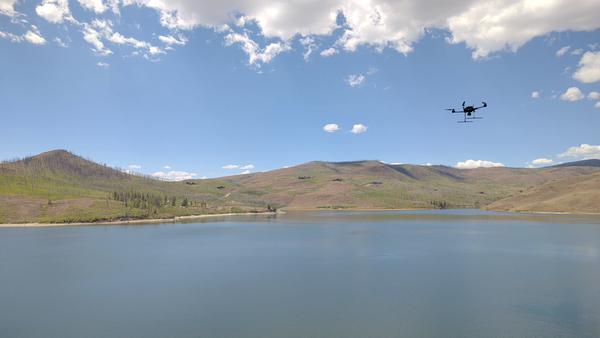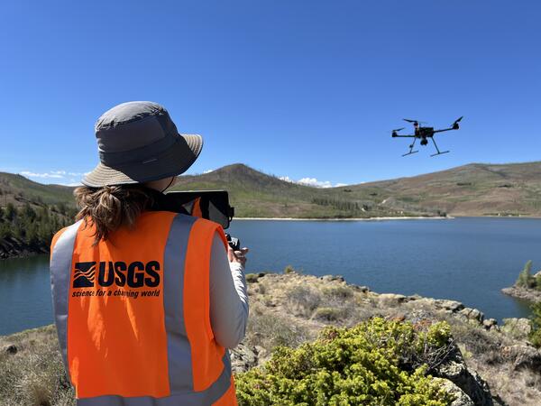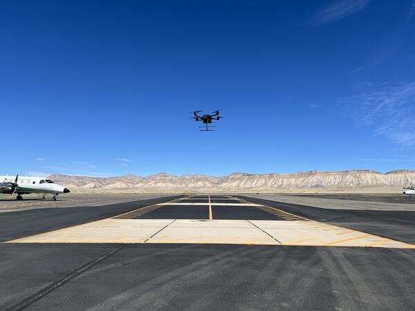
An uncrewed aircraft system (UAS) flies over the open water at Willow Creek Reservoir during a harmful algae bloom research campaign.
Victoria M Scholl
Victoria Scholl is a Physical Scientist at the National Uncrewed Systems Office (NUSO) in the Geosciences and Environmental Change Science Center.
Victoria Scholl is a Physical Scientist and DOI-certified uncrewed aircraft systems (UAS) remote pilot with the USGS National Uncrewed Systems Office. She manages complex projects and UAS field operations to map and monitor natural resources across the United States. Her work focuses on collecting, processing, and analyzing geospatial remote sensing data to support a wide range of federal environmental research needs. Victoria specializes in radiometric data calibration and validation and has extensive experience with multispectral, hyperspectral, and thermal sensors. She collaborates across agencies, academic partners, and USGS mission areas to advance open, reproducible science within the remote sensing and Earth science communities.
Professional Experience
Physical Scientist, U.S. Geological Survey (2020 - Present)
Biological Science Technician, U.S. Geological Survey (2018 - 2020)
Education and Certifications
M.A. in Geography (2019) University of Colorado at Boulder
B.S. in Imaging Science (2016) Rochester Institute of Technology
Science and Products
Absolute radiometric calibration evaluation of Uncrewed Aerial System (UAS) Headwall and MicaSense sensors and improving data quality using the Empirical Line Method Absolute radiometric calibration evaluation of Uncrewed Aerial System (UAS) Headwall and MicaSense sensors and improving data quality using the Empirical Line Method
Applications of unoccupied aerial systems (UAS) in landscape ecology: A review of recent research, challenges and emerging opportunities Applications of unoccupied aerial systems (UAS) in landscape ecology: A review of recent research, challenges and emerging opportunities
Pragmatically mapping Phragmites with unoccupied aerial systems: A comparison of invasive species land cover classification using RGB and multispectral imagery Pragmatically mapping Phragmites with unoccupied aerial systems: A comparison of invasive species land cover classification using RGB and multispectral imagery
Hyperspectral Image Transects during Transient Events in Rivers (HITTER): Framework development and application to a tracer experiment on the Missouri River, USA Hyperspectral Image Transects during Transient Events in Rivers (HITTER): Framework development and application to a tracer experiment on the Missouri River, USA
Guidelines for calibration of uncrewed aircraft systems imagery Guidelines for calibration of uncrewed aircraft systems imagery
Democratizing macroecology: Integrating unoccupied aerial systems with the National Ecological Observatory Network Democratizing macroecology: Integrating unoccupied aerial systems with the National Ecological Observatory Network
National Uncrewed Systems Office
Hyperspectral and Thermal Data Collected during Uncrewed Aircraft System (UAS) Operations near Moab, Utah in May 2025 Hyperspectral and Thermal Data Collected during Uncrewed Aircraft System (UAS) Operations near Moab, Utah in May 2025
2023 ECCOE UAS Multispectral and Hyperspectral Imagery Radiometric Calibration Evaluation Field Data 2023 ECCOE UAS Multispectral and Hyperspectral Imagery Radiometric Calibration Evaluation Field Data
Lidar point cloud, raster, and RTK GNSS survey data for pre- and post-restoration of Ackerson Meadows, Yosemite National Park, California, USA Lidar point cloud, raster, and RTK GNSS survey data for pre- and post-restoration of Ackerson Meadows, Yosemite National Park, California, USA
Uncrewed Aircraft System (UAS) imagery and data products from a multiscale remote sensing field campaign at a biocrust monitoring site located near Castle Valley, Utah in February 2022 Uncrewed Aircraft System (UAS) imagery and data products from a multiscale remote sensing field campaign at a biocrust monitoring site located near Castle Valley, Utah in February 2022
Uncrewed Aircraft Systems (UAS) natural color imagery and structure-from-motion data products collected at the Marsh-Felch Dinosaur Quarry site in Colorado, July 2024 Uncrewed Aircraft Systems (UAS) natural color imagery and structure-from-motion data products collected at the Marsh-Felch Dinosaur Quarry site in Colorado, July 2024
Hyperspectral image transects and field measurements of reflectance, visible dye concentration, and flow velocity acquired during a tracer experiment on the Missouri River near Lexington, MO, on May 11, 2024 Hyperspectral image transects and field measurements of reflectance, visible dye concentration, and flow velocity acquired during a tracer experiment on the Missouri River near Lexington, MO, on May 11, 2024
Spectral reflectance measurements of standard reference materials in laboratory setting using an Analytical Spectral Devices (ASD) FieldSpec® 4 Hi-Res and Ocean Optics OCEAN-HDX-VIS-NIR® (HDX), suitable for comparison to other spectroradiometer measuremen Spectral reflectance measurements of standard reference materials in laboratory setting using an Analytical Spectral Devices (ASD) FieldSpec® 4 Hi-Res and Ocean Optics OCEAN-HDX-VIS-NIR® (HDX), suitable for comparison to other spectroradiometer measuremen
Uncrewed Aircraft Systems (UAS) natural color, multispectral, lidar, and hyperspectral remote sensing data products collected at dryland sites 40 km south of Moab, Utah in May 2023 Uncrewed Aircraft Systems (UAS) natural color, multispectral, lidar, and hyperspectral remote sensing data products collected at dryland sites 40 km south of Moab, Utah in May 2023
Topographic and multispectral reflectance products, aerial imagery, ground spectra, vegetation, and associated GPS data collected during uncrewed aircraft system operations - Dog Head Marsh at South Cape Beach, Mashpee, MA, October 7-8, 2021 Topographic and multispectral reflectance products, aerial imagery, ground spectra, vegetation, and associated GPS data collected during uncrewed aircraft system operations - Dog Head Marsh at South Cape Beach, Mashpee, MA, October 7-8, 2021
Spectral reflectance measurements of radiometric calibration panels for UAS image calibration Spectral reflectance measurements of radiometric calibration panels for UAS image calibration
An uncrewed aircraft system (UAS) flies over the open water at Willow Creek Reservoir during a harmful algae bloom research campaign.
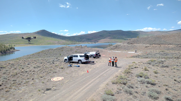
USGS remote pilots fly uncrewed aircraft systems to capture hyperspectral imagery and video footage at Willow Creek Reservoir in support of harmful algae bloom and water quality research led by the Colorado Water Science Center.
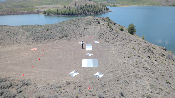
Tarps and targets used in UAS calibration and validation
Tarps and targets used in UAS calibration and validationGreyscale tarps and ground control points were placed on land during harmful algae mapping fieldwork at Willow Creek Reservoir near Granby, CO. These targets enable calibration and validation of hyperspectral data captured by uncrewed aircraft systems (UAS) to study water quality and algae conditions across the reservoir.
Tarps and targets used in UAS calibration and validation
Tarps and targets used in UAS calibration and validationGreyscale tarps and ground control points were placed on land during harmful algae mapping fieldwork at Willow Creek Reservoir near Granby, CO. These targets enable calibration and validation of hyperspectral data captured by uncrewed aircraft systems (UAS) to study water quality and algae conditions across the reservoir.
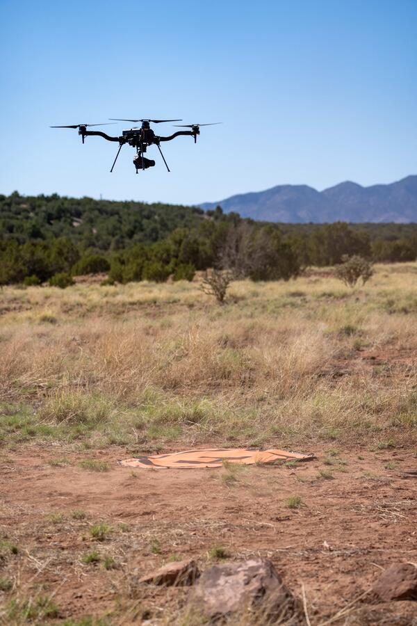
USGS National Uncrewed Systems Office (NUSO) remote pilot flies an uncrewed aircraft system (UAS) carrying a hyperspectral imaging payload at Willow Creek Reservoir near Granby, Colorado. This data collection supported harmful algae bloom and water quality research led by the Colorado Water Science Center.
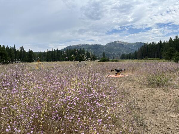
An uncrewed aircraft system (UAS) with a mounted lidar sensor sits on an orange landing pad in a field of purple flowers at Ackerson Meadow in Yosemite National Park, California. Repeat lidar data scans were collected by the USGS National Uncrewed Systems Office (NUSO) to quantify vegetation and topographic changes during meadow restoration.
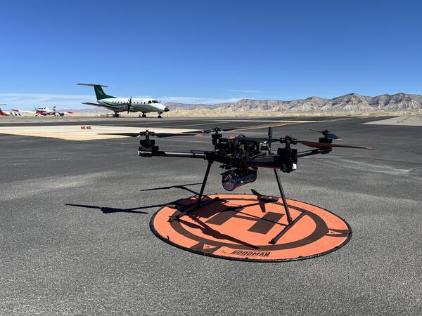
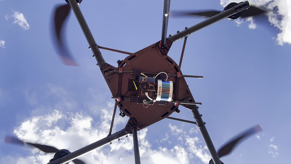
Drone with hyperspectral imaging payload with integrated lidar sensor
Drone with hyperspectral imaging payload with integrated lidar sensorUncrewed aircraft system (UAS) carrying a hyperspectral imaging payload with integrated lidar sensor during test and evaluation flights by the USGS National Uncrewed Systems Office.
Any use of trade, firm, logos, or product names is for descriptive purposes only and does not imply endorsement by the U.S. Government.
Drone with hyperspectral imaging payload with integrated lidar sensor
Drone with hyperspectral imaging payload with integrated lidar sensorUncrewed aircraft system (UAS) carrying a hyperspectral imaging payload with integrated lidar sensor during test and evaluation flights by the USGS National Uncrewed Systems Office.
Any use of trade, firm, logos, or product names is for descriptive purposes only and does not imply endorsement by the U.S. Government.
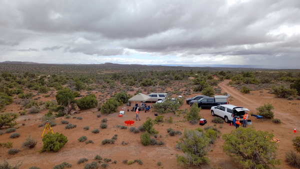
Overhead view taken by drone of a USGS fieldwork site in Moab with multiple cars and a tent shelter
B-Roll: Field and drone remote sensing operations near Moab, Utah – May 2025
B-Roll: Field and drone remote sensing operations near Moab, Utah – May 2025In May 2025, the U.S. Geological Survey (USGS) National Uncrewed Systems Office (NUSO) collected uncrewed aircraft system (UAS, also known as drone) data to support a collaborative field campaign led by Sasha Reed of the Southwest Biological Science Center (SBSC) and Miguel Villarreal of the Western Geographic Science Center (WGSC) near Moab, Utah.
B-Roll: Field and drone remote sensing operations near Moab, Utah – May 2025
B-Roll: Field and drone remote sensing operations near Moab, Utah – May 2025In May 2025, the U.S. Geological Survey (USGS) National Uncrewed Systems Office (NUSO) collected uncrewed aircraft system (UAS, also known as drone) data to support a collaborative field campaign led by Sasha Reed of the Southwest Biological Science Center (SBSC) and Miguel Villarreal of the Western Geographic Science Center (WGSC) near Moab, Utah.
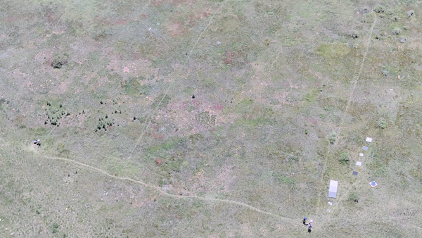
Aerial photo looking down at a field with drone operator and reference objects used for calibration of payload instruments
B-Roll: 2025 UAS radiometric calibration and validation research in Golden, Colorado
B-Roll: 2025 UAS radiometric calibration and validation research in Golden, ColoradoCalibration and validation (cal/val) are essential steps to ensure that remotely sensed data are reliable for scientific use. Radiometric cal/val involves converting digital image pixel values to meaningful units and assessing their accuracy.
B-Roll: 2025 UAS radiometric calibration and validation research in Golden, Colorado
B-Roll: 2025 UAS radiometric calibration and validation research in Golden, ColoradoCalibration and validation (cal/val) are essential steps to ensure that remotely sensed data are reliable for scientific use. Radiometric cal/val involves converting digital image pixel values to meaningful units and assessing their accuracy.
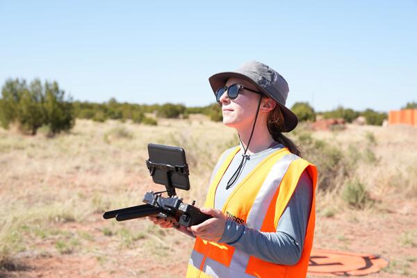
Uncrewed aircraft system (UAS) remote pilot Victoria Scholl
Uncrewed aircraft system (UAS) remote pilot Victoria SchollU.S. Geological Survey remote pilot Victoria Scholl flies a drone with camera payload to capture natural color images for photogrammetric mapping of the Abó Ruins at Salinas Pueblo Missions National Monument in Mountainair, New Mexico.
Uncrewed aircraft system (UAS) remote pilot Victoria Scholl
Uncrewed aircraft system (UAS) remote pilot Victoria SchollU.S. Geological Survey remote pilot Victoria Scholl flies a drone with camera payload to capture natural color images for photogrammetric mapping of the Abó Ruins at Salinas Pueblo Missions National Monument in Mountainair, New Mexico.
Using uncrewed aircraft systems (UAS) to map Abó Ruins
Using uncrewed aircraft systems (UAS) to map Abó RuinsThe U.S. Geological Survey National Uncrewed Systems Office flew uncrewed aircraft systems (UAS) to map the Abó Ruins at Salinas Pueblo Missions National Monument in Mountainair, New Mexico.
Using uncrewed aircraft systems (UAS) to map Abó Ruins
Using uncrewed aircraft systems (UAS) to map Abó RuinsThe U.S. Geological Survey National Uncrewed Systems Office flew uncrewed aircraft systems (UAS) to map the Abó Ruins at Salinas Pueblo Missions National Monument in Mountainair, New Mexico.
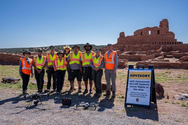
U.S. Geological Survey and National Park Service personnel stand with drone technologies used for mapping the Abó Ruins at Salinas Pueblo Missions National Monument in Mountainair, New Mexico.
Setting up equipment for drone mapping flight near Moab, Utah
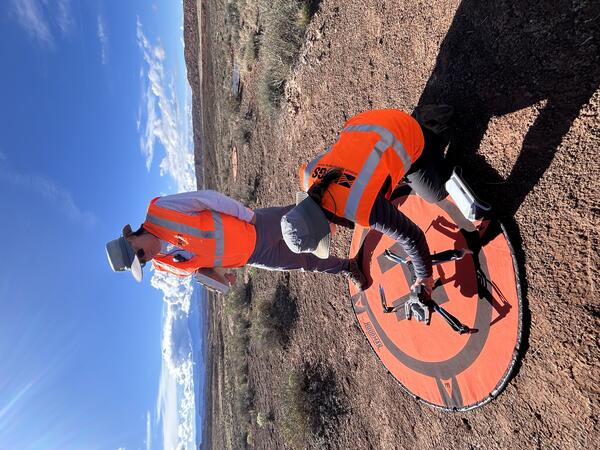
Setting up equipment for drone mapping flight near Moab, UtahUSGS remote pilots Matt Burgess and Victoria Scholl prepare to conduct a drone mapping flight to collect thermal imagery over a dryland study site near Moab, Utah.
Setting up equipment for drone mapping flight near Moab, Utah
Setting up equipment for drone mapping flight near Moab, UtahUSGS remote pilots Matt Burgess and Victoria Scholl prepare to conduct a drone mapping flight to collect thermal imagery over a dryland study site near Moab, Utah.
Uncrewed Aircraft Systems fieldwork site in Moab, Utah
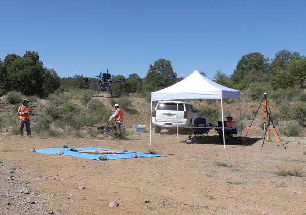
Uncrewed Aircraft Systems fieldwork site in Moab, UtahDrone operations near Moab, Utah to collect spectral remote sensing imagery during a collaborative USGS field campaign in May 2025.
Uncrewed Aircraft Systems fieldwork site in Moab, Utah
Uncrewed Aircraft Systems fieldwork site in Moab, UtahDrone operations near Moab, Utah to collect spectral remote sensing imagery during a collaborative USGS field campaign in May 2025.
UAS Footage at Marsh-Felch Quarry site in Colorado
UAS Footage at Marsh-Felch Quarry site in ColoradoThe U.S.
Fixed-wing UAS used to map landscape at Corral Bluffs, Colorado
The Department of the Interior (DOI) and U.S. Geological Survey (USGS) took an interest in uncrewed aircraft system (UAS) technologies in the early 2000s, when UAS were predominantly being used for military applications.
Gamma Ray Spectrometer on drone in New Mexico.
UAS operations near Moab, Utah for carbon sequestration research on public lands
UAS Operations for Carbon Sequestration Research on Public Lands near Moab, Utah in May 2023
UAS Operations for Carbon Sequestration Research on Public Lands near Moab, Utah in May 2023In support of U.S. Geological Survey (USGS) Southwest Biological Science Center research, the USGS National Uncrewed Systems Office (NUSO) conducted uncrewed aircraft systems (UAS) remote sensing flights near Moab, Utah in May 2023 for multi-scale carbon sequestration research on public lands.
UAS Operations for Carbon Sequestration Research on Public Lands near Moab, Utah in May 2023
UAS Operations for Carbon Sequestration Research on Public Lands near Moab, Utah in May 2023In support of U.S. Geological Survey (USGS) Southwest Biological Science Center research, the USGS National Uncrewed Systems Office (NUSO) conducted uncrewed aircraft systems (UAS) remote sensing flights near Moab, Utah in May 2023 for multi-scale carbon sequestration research on public lands.
Field crew sit on boardwalk while collecting UAS methane measurements in Alaska 2023
USGS using drones to measure methane escaping Arctic permafrost - Aug 2023
USGS using drones to measure methane escaping Arctic permafrost - Aug 2023As permafrost soils in the Arctic warm and thaw, greenhouse gases including methane are released into the atmosphere. USGS Ecologist Kristen Manies of the USGS Geology, Minerals, Energy, and Geophysics Science Center (GMEGSC) is researching low-cost ways to measure methane emissions across these changing ecosystems.
USGS using drones to measure methane escaping Arctic permafrost - Aug 2023
USGS using drones to measure methane escaping Arctic permafrost - Aug 2023As permafrost soils in the Arctic warm and thaw, greenhouse gases including methane are released into the atmosphere. USGS Ecologist Kristen Manies of the USGS Geology, Minerals, Energy, and Geophysics Science Center (GMEGSC) is researching low-cost ways to measure methane emissions across these changing ecosystems.
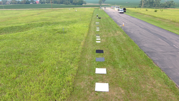
Square, colored reference targets spaced in the grass along roadside
UAS Radiometric Calibration Research in South Dakota, July 2023
UAS Radiometric Calibration Research in South Dakota, July 2023In July 2023, the U.S. Geological Survey (USGS) National Uncrewed Systems Office (NUSO) and the USGS Earth Resources Observation and Science (EROS) Center conducted a joint field campaign in Sioux Falls, South Dakota.
UAS Radiometric Calibration Research in South Dakota, July 2023
UAS Radiometric Calibration Research in South Dakota, July 2023In July 2023, the U.S. Geological Survey (USGS) National Uncrewed Systems Office (NUSO) and the USGS Earth Resources Observation and Science (EROS) Center conducted a joint field campaign in Sioux Falls, South Dakota.
Drone image captured during almond field mapping in the Central Valley of California
Drone-based hyperspectral mapping of agricultural crop fields in California's Central Valley
Drone-based hyperspectral mapping of agricultural crop fields in California's Central ValleyIn August 2023, the USGS National Uncrewed Systems Office (NUSO) participated in a collaborative field campaign to collect remote sensing data over agricultural crop fields in California's Central Valley.
Drone-based hyperspectral mapping of agricultural crop fields in California's Central Valley
Drone-based hyperspectral mapping of agricultural crop fields in California's Central ValleyIn August 2023, the USGS National Uncrewed Systems Office (NUSO) participated in a collaborative field campaign to collect remote sensing data over agricultural crop fields in California's Central Valley.
Field crew sit on boardwalk while collecting UAS methane measurements in Alaska 2023
Field crew sit on boardwalk while collecting UAS methane measurements in Alaska 2023Collaborators Kristen Manies (Geology, Minerals, Energy, and Geophysics Science Center), Joe Adams (National Uncrewed Systems Office, NUSO), Victoria Scholl (NUSO), Brian Gullett U.S.
Field crew sit on boardwalk while collecting UAS methane measurements in Alaska 2023
Field crew sit on boardwalk while collecting UAS methane measurements in Alaska 2023Collaborators Kristen Manies (Geology, Minerals, Energy, and Geophysics Science Center), Joe Adams (National Uncrewed Systems Office, NUSO), Victoria Scholl (NUSO), Brian Gullett U.S.
Science and Products
Absolute radiometric calibration evaluation of Uncrewed Aerial System (UAS) Headwall and MicaSense sensors and improving data quality using the Empirical Line Method Absolute radiometric calibration evaluation of Uncrewed Aerial System (UAS) Headwall and MicaSense sensors and improving data quality using the Empirical Line Method
Applications of unoccupied aerial systems (UAS) in landscape ecology: A review of recent research, challenges and emerging opportunities Applications of unoccupied aerial systems (UAS) in landscape ecology: A review of recent research, challenges and emerging opportunities
Pragmatically mapping Phragmites with unoccupied aerial systems: A comparison of invasive species land cover classification using RGB and multispectral imagery Pragmatically mapping Phragmites with unoccupied aerial systems: A comparison of invasive species land cover classification using RGB and multispectral imagery
Hyperspectral Image Transects during Transient Events in Rivers (HITTER): Framework development and application to a tracer experiment on the Missouri River, USA Hyperspectral Image Transects during Transient Events in Rivers (HITTER): Framework development and application to a tracer experiment on the Missouri River, USA
Guidelines for calibration of uncrewed aircraft systems imagery Guidelines for calibration of uncrewed aircraft systems imagery
Democratizing macroecology: Integrating unoccupied aerial systems with the National Ecological Observatory Network Democratizing macroecology: Integrating unoccupied aerial systems with the National Ecological Observatory Network
National Uncrewed Systems Office
Hyperspectral and Thermal Data Collected during Uncrewed Aircraft System (UAS) Operations near Moab, Utah in May 2025 Hyperspectral and Thermal Data Collected during Uncrewed Aircraft System (UAS) Operations near Moab, Utah in May 2025
2023 ECCOE UAS Multispectral and Hyperspectral Imagery Radiometric Calibration Evaluation Field Data 2023 ECCOE UAS Multispectral and Hyperspectral Imagery Radiometric Calibration Evaluation Field Data
Lidar point cloud, raster, and RTK GNSS survey data for pre- and post-restoration of Ackerson Meadows, Yosemite National Park, California, USA Lidar point cloud, raster, and RTK GNSS survey data for pre- and post-restoration of Ackerson Meadows, Yosemite National Park, California, USA
Uncrewed Aircraft System (UAS) imagery and data products from a multiscale remote sensing field campaign at a biocrust monitoring site located near Castle Valley, Utah in February 2022 Uncrewed Aircraft System (UAS) imagery and data products from a multiscale remote sensing field campaign at a biocrust monitoring site located near Castle Valley, Utah in February 2022
Uncrewed Aircraft Systems (UAS) natural color imagery and structure-from-motion data products collected at the Marsh-Felch Dinosaur Quarry site in Colorado, July 2024 Uncrewed Aircraft Systems (UAS) natural color imagery and structure-from-motion data products collected at the Marsh-Felch Dinosaur Quarry site in Colorado, July 2024
Hyperspectral image transects and field measurements of reflectance, visible dye concentration, and flow velocity acquired during a tracer experiment on the Missouri River near Lexington, MO, on May 11, 2024 Hyperspectral image transects and field measurements of reflectance, visible dye concentration, and flow velocity acquired during a tracer experiment on the Missouri River near Lexington, MO, on May 11, 2024
Spectral reflectance measurements of standard reference materials in laboratory setting using an Analytical Spectral Devices (ASD) FieldSpec® 4 Hi-Res and Ocean Optics OCEAN-HDX-VIS-NIR® (HDX), suitable for comparison to other spectroradiometer measuremen Spectral reflectance measurements of standard reference materials in laboratory setting using an Analytical Spectral Devices (ASD) FieldSpec® 4 Hi-Res and Ocean Optics OCEAN-HDX-VIS-NIR® (HDX), suitable for comparison to other spectroradiometer measuremen
Uncrewed Aircraft Systems (UAS) natural color, multispectral, lidar, and hyperspectral remote sensing data products collected at dryland sites 40 km south of Moab, Utah in May 2023 Uncrewed Aircraft Systems (UAS) natural color, multispectral, lidar, and hyperspectral remote sensing data products collected at dryland sites 40 km south of Moab, Utah in May 2023
Topographic and multispectral reflectance products, aerial imagery, ground spectra, vegetation, and associated GPS data collected during uncrewed aircraft system operations - Dog Head Marsh at South Cape Beach, Mashpee, MA, October 7-8, 2021 Topographic and multispectral reflectance products, aerial imagery, ground spectra, vegetation, and associated GPS data collected during uncrewed aircraft system operations - Dog Head Marsh at South Cape Beach, Mashpee, MA, October 7-8, 2021
Spectral reflectance measurements of radiometric calibration panels for UAS image calibration Spectral reflectance measurements of radiometric calibration panels for UAS image calibration
An uncrewed aircraft system (UAS) flies over the open water at Willow Creek Reservoir during a harmful algae bloom research campaign.
USGS remote pilots fly uncrewed aircraft systems to capture hyperspectral imagery and video footage at Willow Creek Reservoir in support of harmful algae bloom and water quality research led by the Colorado Water Science Center.
Tarps and targets used in UAS calibration and validation
Tarps and targets used in UAS calibration and validationGreyscale tarps and ground control points were placed on land during harmful algae mapping fieldwork at Willow Creek Reservoir near Granby, CO. These targets enable calibration and validation of hyperspectral data captured by uncrewed aircraft systems (UAS) to study water quality and algae conditions across the reservoir.
Tarps and targets used in UAS calibration and validation
Tarps and targets used in UAS calibration and validationGreyscale tarps and ground control points were placed on land during harmful algae mapping fieldwork at Willow Creek Reservoir near Granby, CO. These targets enable calibration and validation of hyperspectral data captured by uncrewed aircraft systems (UAS) to study water quality and algae conditions across the reservoir.
USGS National Uncrewed Systems Office (NUSO) remote pilot flies an uncrewed aircraft system (UAS) carrying a hyperspectral imaging payload at Willow Creek Reservoir near Granby, Colorado. This data collection supported harmful algae bloom and water quality research led by the Colorado Water Science Center.
An uncrewed aircraft system (UAS) with a mounted lidar sensor sits on an orange landing pad in a field of purple flowers at Ackerson Meadow in Yosemite National Park, California. Repeat lidar data scans were collected by the USGS National Uncrewed Systems Office (NUSO) to quantify vegetation and topographic changes during meadow restoration.
Drone with hyperspectral imaging payload with integrated lidar sensor
Drone with hyperspectral imaging payload with integrated lidar sensorUncrewed aircraft system (UAS) carrying a hyperspectral imaging payload with integrated lidar sensor during test and evaluation flights by the USGS National Uncrewed Systems Office.
Any use of trade, firm, logos, or product names is for descriptive purposes only and does not imply endorsement by the U.S. Government.
Drone with hyperspectral imaging payload with integrated lidar sensor
Drone with hyperspectral imaging payload with integrated lidar sensorUncrewed aircraft system (UAS) carrying a hyperspectral imaging payload with integrated lidar sensor during test and evaluation flights by the USGS National Uncrewed Systems Office.
Any use of trade, firm, logos, or product names is for descriptive purposes only and does not imply endorsement by the U.S. Government.
Overhead view taken by drone of a USGS fieldwork site in Moab with multiple cars and a tent shelter
B-Roll: Field and drone remote sensing operations near Moab, Utah – May 2025
B-Roll: Field and drone remote sensing operations near Moab, Utah – May 2025In May 2025, the U.S. Geological Survey (USGS) National Uncrewed Systems Office (NUSO) collected uncrewed aircraft system (UAS, also known as drone) data to support a collaborative field campaign led by Sasha Reed of the Southwest Biological Science Center (SBSC) and Miguel Villarreal of the Western Geographic Science Center (WGSC) near Moab, Utah.
B-Roll: Field and drone remote sensing operations near Moab, Utah – May 2025
B-Roll: Field and drone remote sensing operations near Moab, Utah – May 2025In May 2025, the U.S. Geological Survey (USGS) National Uncrewed Systems Office (NUSO) collected uncrewed aircraft system (UAS, also known as drone) data to support a collaborative field campaign led by Sasha Reed of the Southwest Biological Science Center (SBSC) and Miguel Villarreal of the Western Geographic Science Center (WGSC) near Moab, Utah.
Aerial photo looking down at a field with drone operator and reference objects used for calibration of payload instruments
B-Roll: 2025 UAS radiometric calibration and validation research in Golden, Colorado
B-Roll: 2025 UAS radiometric calibration and validation research in Golden, ColoradoCalibration and validation (cal/val) are essential steps to ensure that remotely sensed data are reliable for scientific use. Radiometric cal/val involves converting digital image pixel values to meaningful units and assessing their accuracy.
B-Roll: 2025 UAS radiometric calibration and validation research in Golden, Colorado
B-Roll: 2025 UAS radiometric calibration and validation research in Golden, ColoradoCalibration and validation (cal/val) are essential steps to ensure that remotely sensed data are reliable for scientific use. Radiometric cal/val involves converting digital image pixel values to meaningful units and assessing their accuracy.
Uncrewed aircraft system (UAS) remote pilot Victoria Scholl
Uncrewed aircraft system (UAS) remote pilot Victoria SchollU.S. Geological Survey remote pilot Victoria Scholl flies a drone with camera payload to capture natural color images for photogrammetric mapping of the Abó Ruins at Salinas Pueblo Missions National Monument in Mountainair, New Mexico.
Uncrewed aircraft system (UAS) remote pilot Victoria Scholl
Uncrewed aircraft system (UAS) remote pilot Victoria SchollU.S. Geological Survey remote pilot Victoria Scholl flies a drone with camera payload to capture natural color images for photogrammetric mapping of the Abó Ruins at Salinas Pueblo Missions National Monument in Mountainair, New Mexico.
Using uncrewed aircraft systems (UAS) to map Abó Ruins
Using uncrewed aircraft systems (UAS) to map Abó RuinsThe U.S. Geological Survey National Uncrewed Systems Office flew uncrewed aircraft systems (UAS) to map the Abó Ruins at Salinas Pueblo Missions National Monument in Mountainair, New Mexico.
Using uncrewed aircraft systems (UAS) to map Abó Ruins
Using uncrewed aircraft systems (UAS) to map Abó RuinsThe U.S. Geological Survey National Uncrewed Systems Office flew uncrewed aircraft systems (UAS) to map the Abó Ruins at Salinas Pueblo Missions National Monument in Mountainair, New Mexico.
U.S. Geological Survey and National Park Service personnel stand with drone technologies used for mapping the Abó Ruins at Salinas Pueblo Missions National Monument in Mountainair, New Mexico.
Setting up equipment for drone mapping flight near Moab, Utah
Setting up equipment for drone mapping flight near Moab, UtahUSGS remote pilots Matt Burgess and Victoria Scholl prepare to conduct a drone mapping flight to collect thermal imagery over a dryland study site near Moab, Utah.
Setting up equipment for drone mapping flight near Moab, Utah
Setting up equipment for drone mapping flight near Moab, UtahUSGS remote pilots Matt Burgess and Victoria Scholl prepare to conduct a drone mapping flight to collect thermal imagery over a dryland study site near Moab, Utah.
Uncrewed Aircraft Systems fieldwork site in Moab, Utah
Uncrewed Aircraft Systems fieldwork site in Moab, UtahDrone operations near Moab, Utah to collect spectral remote sensing imagery during a collaborative USGS field campaign in May 2025.
Uncrewed Aircraft Systems fieldwork site in Moab, Utah
Uncrewed Aircraft Systems fieldwork site in Moab, UtahDrone operations near Moab, Utah to collect spectral remote sensing imagery during a collaborative USGS field campaign in May 2025.
UAS Footage at Marsh-Felch Quarry site in Colorado
UAS Footage at Marsh-Felch Quarry site in ColoradoThe U.S.
Fixed-wing UAS used to map landscape at Corral Bluffs, Colorado
The Department of the Interior (DOI) and U.S. Geological Survey (USGS) took an interest in uncrewed aircraft system (UAS) technologies in the early 2000s, when UAS were predominantly being used for military applications.
Gamma Ray Spectrometer on drone in New Mexico.
UAS operations near Moab, Utah for carbon sequestration research on public lands
UAS Operations for Carbon Sequestration Research on Public Lands near Moab, Utah in May 2023
UAS Operations for Carbon Sequestration Research on Public Lands near Moab, Utah in May 2023In support of U.S. Geological Survey (USGS) Southwest Biological Science Center research, the USGS National Uncrewed Systems Office (NUSO) conducted uncrewed aircraft systems (UAS) remote sensing flights near Moab, Utah in May 2023 for multi-scale carbon sequestration research on public lands.
UAS Operations for Carbon Sequestration Research on Public Lands near Moab, Utah in May 2023
UAS Operations for Carbon Sequestration Research on Public Lands near Moab, Utah in May 2023In support of U.S. Geological Survey (USGS) Southwest Biological Science Center research, the USGS National Uncrewed Systems Office (NUSO) conducted uncrewed aircraft systems (UAS) remote sensing flights near Moab, Utah in May 2023 for multi-scale carbon sequestration research on public lands.
Field crew sit on boardwalk while collecting UAS methane measurements in Alaska 2023
USGS using drones to measure methane escaping Arctic permafrost - Aug 2023
USGS using drones to measure methane escaping Arctic permafrost - Aug 2023As permafrost soils in the Arctic warm and thaw, greenhouse gases including methane are released into the atmosphere. USGS Ecologist Kristen Manies of the USGS Geology, Minerals, Energy, and Geophysics Science Center (GMEGSC) is researching low-cost ways to measure methane emissions across these changing ecosystems.
USGS using drones to measure methane escaping Arctic permafrost - Aug 2023
USGS using drones to measure methane escaping Arctic permafrost - Aug 2023As permafrost soils in the Arctic warm and thaw, greenhouse gases including methane are released into the atmosphere. USGS Ecologist Kristen Manies of the USGS Geology, Minerals, Energy, and Geophysics Science Center (GMEGSC) is researching low-cost ways to measure methane emissions across these changing ecosystems.
Square, colored reference targets spaced in the grass along roadside
UAS Radiometric Calibration Research in South Dakota, July 2023
UAS Radiometric Calibration Research in South Dakota, July 2023In July 2023, the U.S. Geological Survey (USGS) National Uncrewed Systems Office (NUSO) and the USGS Earth Resources Observation and Science (EROS) Center conducted a joint field campaign in Sioux Falls, South Dakota.
UAS Radiometric Calibration Research in South Dakota, July 2023
UAS Radiometric Calibration Research in South Dakota, July 2023In July 2023, the U.S. Geological Survey (USGS) National Uncrewed Systems Office (NUSO) and the USGS Earth Resources Observation and Science (EROS) Center conducted a joint field campaign in Sioux Falls, South Dakota.
Drone image captured during almond field mapping in the Central Valley of California
Drone-based hyperspectral mapping of agricultural crop fields in California's Central Valley
Drone-based hyperspectral mapping of agricultural crop fields in California's Central ValleyIn August 2023, the USGS National Uncrewed Systems Office (NUSO) participated in a collaborative field campaign to collect remote sensing data over agricultural crop fields in California's Central Valley.
Drone-based hyperspectral mapping of agricultural crop fields in California's Central Valley
Drone-based hyperspectral mapping of agricultural crop fields in California's Central ValleyIn August 2023, the USGS National Uncrewed Systems Office (NUSO) participated in a collaborative field campaign to collect remote sensing data over agricultural crop fields in California's Central Valley.
Field crew sit on boardwalk while collecting UAS methane measurements in Alaska 2023
Field crew sit on boardwalk while collecting UAS methane measurements in Alaska 2023Collaborators Kristen Manies (Geology, Minerals, Energy, and Geophysics Science Center), Joe Adams (National Uncrewed Systems Office, NUSO), Victoria Scholl (NUSO), Brian Gullett U.S.
Field crew sit on boardwalk while collecting UAS methane measurements in Alaska 2023
Field crew sit on boardwalk while collecting UAS methane measurements in Alaska 2023Collaborators Kristen Manies (Geology, Minerals, Energy, and Geophysics Science Center), Joe Adams (National Uncrewed Systems Office, NUSO), Victoria Scholl (NUSO), Brian Gullett U.S.