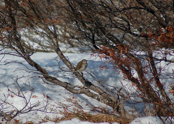
U.S. flag

An official website of the United States government

Images

Browse images from a wide range of science topics covered by USGS. All items in this gallery are considered public domain unless otherwise noted.

Filter Total Items: 1585
Image: Walrus on Chukchi Sea Shores with Skin Lesions
Walrus on Chukchi Sea Shores with Skin Lesions

Large numbers of walruses came ashore to rest near the community of Point Lay, Alaska when sea ice had dissipated from their offshore foraging grounds in the eastern Chukchi Sea during late August through October of 2011.  Walruses in these groups cycled between this coastal resting area and their foraging grounds, both near-shore and offshore.

Large numbers of walruses came ashore to rest near the community of Point Lay, Alaska when sea ice had dissipated from their offshore foraging grounds in the eastern Chukchi Sea during late August through October of 2011.  Walruses in these groups cycled between this coastal resting area and their foraging grounds, both near-shore and offshore.

Image: Kijik Lake
Kijik Lake
Kijik Lake
Kijik Lake

Kijik Lake in Lake Clark National Park and Preserve, Alaska. USGS researchers study salmon ecology in cooperation with NPS.

Kijik Lake in Lake Clark National Park and Preserve, Alaska. USGS researchers study salmon ecology in cooperation with NPS.

Reflections of Tanalian Mountain and Hardenburg Bay in Lake Clark, Alaska
Tanalian Mountain and Hardenburg Bay in Lake Clark, Alaska

Reflections of Tanalian Mountain and Hardenburg Bay in Lake Clark, Alaska. Near Port Alsworth.

Image: Soil Core Sample #1
Soil Core Sample #1
Soil Core Sample #1
Soil Core Sample #1

Soil core obtained from existing goose grazing lawn along the Smith River in the Teshekpuk Lake Special Area of the National Petroleum Reserve - Alaska.  The buried layer of peat beneath goose grazing lawn demonstrates that vegetation change has occurred in this area.

Soil core obtained from existing goose grazing lawn along the Smith River in the Teshekpuk Lake Special Area of the National Petroleum Reserve - Alaska.  The buried layer of peat beneath goose grazing lawn demonstrates that vegetation change has occurred in this area.

Image: Soil Core Sample #2
Soil Core Sample #2
Soil Core Sample #2
Soil Core Sample #2

Soil core obtained from existing goose grazing lawn along the Smith River in the Teshekpuk Lake Special Area of the National Petroleum Reserve - Alaska.  Buried peat layer broken open.  Closer examination of the buried peat layer demonstrates that non-salt-tolerant vegetation from the past was buried in sediment which now supports high-quality goose forage

Soil core obtained from existing goose grazing lawn along the Smith River in the Teshekpuk Lake Special Area of the National Petroleum Reserve - Alaska.  Buried peat layer broken open.  Closer examination of the buried peat layer demonstrates that non-salt-tolerant vegetation from the past was buried in sediment which now supports high-quality goose forage

six walrus on ice in Chukchi sea. Middle walrus has radio-tag.
Radio-Tagged Walruses

Scientists radio-tag walruses in the Chukchi and Bering seas to better understand their movements and foraging behavior. 

Scientists radio-tag walruses in the Chukchi and Bering seas to better understand their movements and foraging behavior. 

A streamgage with the Alyeska pipeline in the background
USGS Station streamgage 15905100 at the Atigun River, Alaska

Streamgage number 15905100 at the Atigun River, Alaska.  The Alyeska oil pipeline is in the background.

Research Vessel Norseman II used to conduct walrus research in Alaska. Chucks of sea ice floating around vessel.
Research Vessel Norseman II

The Research Vessel Norseman II is used to conduct walrus research. USGS and the U.S. Fish and Wildlife Service will observe walruses from June 5 to July 2, 2023, as part of a project to study Pacific walrus population dynamics.

The Research Vessel Norseman II is used to conduct walrus research. USGS and the U.S. Fish and Wildlife Service will observe walruses from June 5 to July 2, 2023, as part of a project to study Pacific walrus population dynamics.

A juvenile female sea otter eating small green urchins in the intertidal. Glacier Bay near Geikie Inlet, Alaska
Juvenile female sea otter eating urchins

A juvenile female sea otter eating small green urchins in the intertidal. Photo taken in Glacier Bay near Geikie Inlet, Alaska.

A juvenile female sea otter eating small green urchins in the intertidal. Photo taken in Glacier Bay near Geikie Inlet, Alaska.

Shade and green houses near the Smith River and Point Lonely on the North Slope of Alaska
Shade and green houses on the North Slope of Alaska

USGS used shade and green houses to understand the effects of both warmer and cooler temperatures on the growth of plants used by geese for forage. These are located near the Smith River and Point Lonely on the North Slope of Alaska.

USGS used shade and green houses to understand the effects of both warmer and cooler temperatures on the growth of plants used by geese for forage. These are located near the Smith River and Point Lonely on the North Slope of Alaska.

Image: Grazing Lawn
Grazing Lawn
Grazing Lawn
Grazing Lawn

Low elevation tundra along the Smith River in the Teshekpuk Lake Special Area of the National Petroleum Reserve – Alaska.  On left is low biomass, high-quality goose forage. On right is typical high biomass, low quality vegetation.

Low elevation tundra along the Smith River in the Teshekpuk Lake Special Area of the National Petroleum Reserve – Alaska.  On left is low biomass, high-quality goose forage. On right is typical high biomass, low quality vegetation.

Image: Permafrost
Permafrost
Permafrost
Permafrost

Coastal erosion reveals the extent of ice-rich permafrost underlying active layer on the Arctic Coastal Plain in the Teshekpuk Lake Special Area of the National Petroleum Reserve - Alaska.

Coastal erosion reveals the extent of ice-rich permafrost underlying active layer on the Arctic Coastal Plain in the Teshekpuk Lake Special Area of the National Petroleum Reserve - Alaska.

Image: Greenhouses and Shadehouses
Greenhouses and Shadehouses

Typical goose grazing lawns along the Smith River in the Teshekpuk Lake Special Area of the National Petroleum Reserve - Alaska.  Greenhouses and Shadehouses are used by USGS biologists to assess the effects of climate change on plant quality and phenology.

Typical goose grazing lawns along the Smith River in the Teshekpuk Lake Special Area of the National Petroleum Reserve - Alaska.  Greenhouses and Shadehouses are used by USGS biologists to assess the effects of climate change on plant quality and phenology.

Caribou grazing near the Dalton Highway in the northern part of Alaska.
Caribou grazing near Dalton Highway, Alaska

Caribou grazing along the Dalton Highway, Alaska. More information can be found on the fact sheet:

Caribou roaming the Arctic Coastal Plain
Caribou
Caribou
Caribou

Caribou foraging on the Arctic Coastal Plain near the Dalton Highway, North Slope of Alaska.

Caribou foraging on the Arctic Coastal Plain near the Dalton Highway, North Slope of Alaska.

Shallow ponds in the Ki’i Unit, on Oahu, Hawaii
Shallow ponds, mowed dike in the Ki’i Unit, Oahu, Hawaii

Shallow ponds and mowed dike in the Ki’i Unit.  Habitats and areas used by Bristle-thighed Curlews in the Ki’i Unit of the James Campbell National Wildlife Refuge on Oahu, Hawaii.

Shallow ponds and mowed dike in the Ki’i Unit.  Habitats and areas used by Bristle-thighed Curlews in the Ki’i Unit of the James Campbell National Wildlife Refuge on Oahu, Hawaii.

Image: Magnificent Seven
Magnificent Seven
Magnificent Seven
Magnificent Seven

Marine ecologists from USGS Western Ecological Research Center, USGS Alaska Science Center, UC Santa Cruz and Monterey Bay Aquarium prepare to board the R/V Alaska Gyre for their 2011 May sea otter capture expedition for the Pacific Nearshore Project.

Marine ecologists from USGS Western Ecological Research Center, USGS Alaska Science Center, UC Santa Cruz and Monterey Bay Aquarium prepare to board the R/V Alaska Gyre for their 2011 May sea otter capture expedition for the Pacific Nearshore Project.

The  R/V Alaskan Gyre in Prince William Sound, Alaska with a mountain background
The R/V Alaskan Gyre with a mountain backdrop, Alaska

The  R/V Alaskan Gyre in Prince William Sound, Alaska with a mountain background

A polar bear walks across rubble ice in the Alaska portion of the southern Beaufort Sea
Polar bear on ice in the southern Beaufort Sea, April 8, 2011

A polar bear walks across rubble ice in the Alaska portion of the southern Beaufort Sea, April 8, 2011

Was this page helpful?