
New Comprehensive Geologic Map of the Moon Released
USGS Astrogeology training astronauts Meteor Crater
Close Up on Jezero Crater on Mars
Lunar Resources at Astrogeology
Learn about USGS Astrogeology's mission science in planetary critical minerals, energy, and resources
Learn about USGS Astrogeology's mission science in planetary critical minerals, energy, and resources
Astrogeology Science Center
Our mission is to serve the Nation, the international planetary science community, and the public in pursuit of new knowledge of our solar system. The USGS Astrogeology Science Center is a national resource for the integration of planetary geoscience, cartography, and remote sensing.


News
Happy International Moon Day!
Happy International Moon Day!
USGS Director Ned Mamula and Team Visit Flagstaff Science Campus, June 1–3: An Astrogeology Account
USGS Director Ned Mamula and Team Visit Flagstaff Science Campus, June 1–3: An Astrogeology Account
USGS Astrogeology at LPSC 2026: Advancing Planetary Science and Collaboration
USGS Astrogeology at LPSC 2026: Advancing Planetary Science and Collaboration
Publications
Mars as one system: Insights from the 8th international conference on Mars polar science and exploration Mars as one system: Insights from the 8th international conference on Mars polar science and exploration
The 8th International Conference on Mars Polar Science and Exploration (ICMPSE) provided new insights into the complex interplay between Martian ice, climate, and atmospheric dynamics. The conference emphasized a holistic view of Mars as a system, where surface processes, subsurface ice, atmospheric dynamics, and historical climate shifts are interconnected. Research updates spanned...
Publisher correction: Strong nickel enrichment co-located with redox-organic interactions in Neretva Vallis, Mars Publisher correction: Strong nickel enrichment co-located with redox-organic interactions in Neretva Vallis, Mars
Correction to: Nature Communications https://doi.org/10.1038/s41467-026-70081-3, published online 31 March 2026
Lunar analog study using portable gamma-ray neutron detector: Radiochemical mapping of silicic-to-basaltic volcanic terrains in the San Francisco Volcanic Field, Arizona Lunar analog study using portable gamma-ray neutron detector: Radiochemical mapping of silicic-to-basaltic volcanic terrains in the San Francisco Volcanic Field, Arizona
Studying lunar silicic volcanism provides key insights into the Moon’s crustal evolution, magmatic processes, and volcanic history. The Lunar-VISE (Lunar Vulkan Imaging and Spectroscopy Explorer) mission will investigate the Gruithuisen domes, a unique lunar region hypothesized to have formed through silicic volcanism. Using instruments on a Firefly Aerospace lander and a Honeybee...
Science
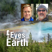
Eyes on Earth Episode 137 – Landsat Takes Yellowstone’s Temperature
How do you keep track of thousands of hot spots in an area the size of Yellowstone National Park? Check out thermal satellite data like Landsat’s!
Python Hyperspectral Analysis Tool (PyHAT)
The Python Hyperspectral Analysis Tool (PyHAT) provides access to data processing, analysis, and machine learning capabilities for spectroscopic applications. It includes a GUI so you can get straight to analyzing data without writing any code. Or, if you are comfortable writing code, PyHAT can be imported just like any other Python package.

Analysis Ready Data
Astrogeology is a world leader in developing and releasing analysis-ready planetary science data sets that are approachable and usable by anyone. We take care of all of the processing and provide data that "just work" so that users can focus on what interests them instead of getting stuck on data processing.