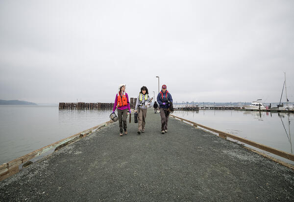
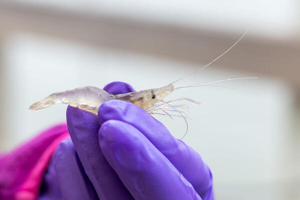
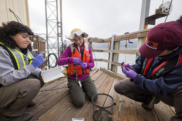
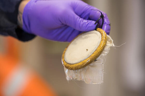
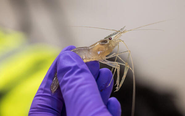
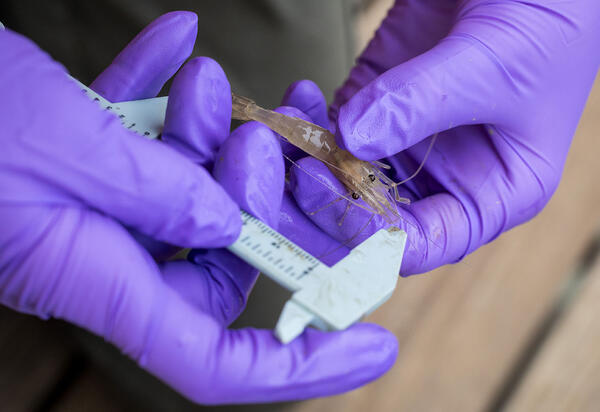
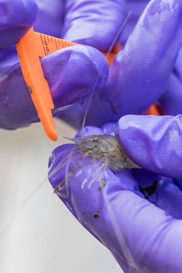
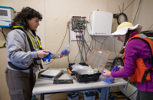
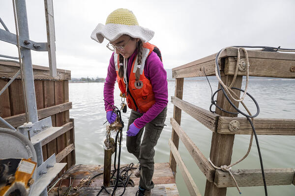
U.S. flag

An official website of the United States government

Images

Images intro.
Filter Total Items: 280
Image of Pacific Golden-Plover
Pacific Golden-Plover (Pluvialis fulva)

The kōlea, or Pacific Golden-Plover (Pluvialis fulva), is a familiar bird in Hawaiʻi that migrates to Alaska each summer to nest. 


The kōlea, or Pacific Golden-Plover (Pluvialis fulva), is a familiar bird in Hawaiʻi that migrates to Alaska each summer to nest. 


Native Hawaiian and Alaska Native participants and project partners gathered at the Knowledge Exchange in Cordova, Alaska.
group_resized.jpg
group_resized.jpg
group_resized.jpg

Native Hawaiian and Alaska Native participants and project partners gathered at the Knowledge Exchange in Cordova, Alaska. 

Native Hawaiian and Alaska Native participants and project partners gathered at the Knowledge Exchange in Cordova, Alaska. 

Aerial shot of bird migration

Aerial shot of bird migration. The kōlea, or Pacific Golden-Plover (Pluvialis fulva), is a familiar bird in Hawaiʻi that migrates to Alaska each summer to nest. 

Aerial shot of bird migration. The kōlea, or Pacific Golden-Plover (Pluvialis fulva), is a familiar bird in Hawaiʻi that migrates to Alaska each summer to nest. 

Image of Pacific Golden-Plover
Pacific Golden-Plover

The kōlea, or Pacific Golden-Plover (Pluvialis fulva), is a familiar bird in Hawaiʻi that migrates to Alaska each summer to nest. 

The kōlea, or Pacific Golden-Plover (Pluvialis fulva), is a familiar bird in Hawaiʻi that migrates to Alaska each summer to nest. 

Lettuce field in the Salinas River Valley

Lettuce field in the Salinas River Valley. California’s Salinas Valley is one of the most productive agricultural basins in the world due to the fertile valley soil, temperate climate, and availability of water for irrigation.

Lettuce field in the Salinas River Valley. California’s Salinas Valley is one of the most productive agricultural basins in the world due to the fertile valley soil, temperate climate, and availability of water for irrigation.

Artichoke field in the Salinas River Valley

Artichoke field in the Salinas River Valley. California’s Salinas Valley is one of the most productive agricultural basins in the world due to the fertile valley soil, temperate climate, and availability of water for irrigation. 

Artichoke field in the Salinas River Valley. California’s Salinas Valley is one of the most productive agricultural basins in the world due to the fertile valley soil, temperate climate, and availability of water for irrigation. 

Santa Ana Sucker Lure

Example of Santa Ana Sucker (Pantosteus santaanae) lure with a PIT tag attached.

Example of Santa Ana Sucker (Pantosteus santaanae) lure with a PIT tag attached.

CAWSC Biogeochemistry group at 2025 IEP Workshop

CAWSC Biogeochemistry group at 2025 IEP Workshop. Left to Right: Back Row - Maura Uebner, Keith Bouma-Gregson, Kyle Leathers; Middle Row - Crystal Sturgeon, Zoё Siman-Tov, Lane Bratz, Emily Richardson, Tamara Kraus, Alex Ryan; Front Row - Nick Framsted 

CAWSC Biogeochemistry group at 2025 IEP Workshop. Left to Right: Back Row - Maura Uebner, Keith Bouma-Gregson, Kyle Leathers; Middle Row - Crystal Sturgeon, Zoё Siman-Tov, Lane Bratz, Emily Richardson, Tamara Kraus, Alex Ryan; Front Row - Nick Framsted 

Santa Ana Sucker research team

The photo shows members of the research team. From left to right: Tevin Bui (RCD), Jordan Buxton (USGS), Brett Mills (RCD), Alicia Ruan (RCD), and Brock Huntsman (USGS). Inset at right are Marissa Wulff (top) and Jeff Gronemyer (bottom), both of the USGS. 

The photo shows members of the research team. From left to right: Tevin Bui (RCD), Jordan Buxton (USGS), Brett Mills (RCD), Alicia Ruan (RCD), and Brock Huntsman (USGS). Inset at right are Marissa Wulff (top) and Jeff Gronemyer (bottom), both of the USGS. 

Poster Presenters at 2025 IEP Workshop

CAWSC poster presenters at 2025 IEP Workshop. Clockwise from upper left: Anna Conlen, Elise Shea, Lex Thomas, Zoё Siman-Tov, Bryan Gopez, Emma Walker, David Hart, Maura Uebner, Lawrence Fujiwara, Trevor Violette.


CAWSC poster presenters at 2025 IEP Workshop. Clockwise from upper left: Anna Conlen, Elise Shea, Lex Thomas, Zoё Siman-Tov, Bryan Gopez, Emma Walker, David Hart, Maura Uebner, Lawrence Fujiwara, Trevor Violette.


Santa Ana Sucker (Pantosteus santaanae)

Santa Ana Sucker (Pantosteus santaanae) being measured in PIT tag study done in the late summer and early fall of 2024.

Santa Ana Sucker (Pantosteus santaanae) being measured in PIT tag study done in the late summer and early fall of 2024.

PIT tag reader
PIT tag reader being tested

This photo shows a passive integrated transponder (PIT) tag reader being used to test a tagged Santa Ana Sucker.

This photo shows a passive integrated transponder (PIT) tag reader being used to test a tagged Santa Ana Sucker.

Raft with PIT tag reader and two cameras and PIT tag attached to a lure

The photo shows (left) the raft outfitted with the PIT tag reader and two cameras, both facing down into the river. And (right) a PIT tag attached to a lure.

Raceways at the RCD facility

The above photos show raceways at the Riverside Corona Resource Conservation District (RCD) facility.

The above photos show raceways at the Riverside Corona Resource Conservation District (RCD) facility.

Footage of Santa Ana Sucker (Pantosteus santaanae) from passive (or stationary) camera.
Passive Camera Footage of Santa Ana Sucker

Footage of Santa Ana Sucker (Pantosteus santaanae) from passive (or stationary) camera. Part of a USGS study on the effectiveness and safety of the PIT tagging sampling method.

Footage of Santa Ana Sucker (Pantosteus santaanae) from passive (or stationary) camera. Part of a USGS study on the effectiveness and safety of the PIT tagging sampling method.

Open-source image recognition program is used to detect the fish and lures
Open-source image recognition footage of Santa Ana Sucker lure

An open-source image recognition program was used to detect the fish and lures in the videos. The program was “trained” to recognize the fish and lures by exposing it to approximately 800 images of fish and non-fish.

An open-source image recognition program was used to detect the fish and lures in the videos. The program was “trained” to recognize the fish and lures by exposing it to approximately 800 images of fish and non-fish.

Active (or moving) camera footage of Santa Ana Sucker (Pantosteus santaanae).
Active (or moving) camera footage of Santa Ana Sucker

Active (or moving) camera footage of Santa Ana Sucker (Pantosteus santaanae). Cameras were attached to “selfie sticks” and walked up and down the raceways (or fabricated streams).

Active (or moving) camera footage of Santa Ana Sucker (Pantosteus santaanae). Cameras were attached to “selfie sticks” and walked up and down the raceways (or fabricated streams).

Historical photo is of the Malakoff Diggins hydraulic gold mine

Historical photo of the Malakoff Diggins hydraulic gold mine in the Sierra Nevada in California. 

screenshot of web tool

This is a screenshot of the web tool: Legacy Mercury Contamination from Historical Gold Mining.

This is a screenshot of the web tool: Legacy Mercury Contamination from Historical Gold Mining.

View of San Francisco from the USGS research vessel.

View of San Francisco from the USGS research vessel. The goal of this study was to identify the reasons for discrepancies between fChl measurements made under different sampling conditions. 

View of San Francisco from the USGS research vessel. The goal of this study was to identify the reasons for discrepancies between fChl measurements made under different sampling conditions. 

Sample map - Legacy Mercury Contamination in California’s Sierra Nevada

Sample map - Legacy Mercury Contamination in California’s Sierra Nevada. This map show locations of remediation efforts.

Was this page helpful?