
The USGS R/V Peterson conducts monthly cruises covering the San Francisco Estuary up to the Sacramento River at Rio Vista, California. The USGS has been researching and monitoring the San Francisco Estuary since 1969.
Images
California Water Science Center Images
Filter Total Items: 307

USGS R/V Peterson
The USGS R/V Peterson conducts monthly cruises covering the San Francisco Estuary up to the Sacramento River at Rio Vista, California. The USGS has been researching and monitoring the San Francisco Estuary since 1969.

High-frequency monitoring of Delta island drainage waters.jpg
High-frequency monitoring of Delta island drainage waters.jpgTwitchell Island Pump Station Monitoring Site. Instruments are housed in vertical PVC pipes.
High-frequency monitoring of Delta island drainage waters.jpg
High-frequency monitoring of Delta island drainage waters.jpgTwitchell Island Pump Station Monitoring Site. Instruments are housed in vertical PVC pipes.

Existing monitoring locations in the Sepulveda Basin v2
Existing monitoring locations in the Sepulveda Basin v2Existing monitoring locations in the Sepulveda Basin v2
Continuous, Water-Quality Monitoring of the Los Angeles River
Existing monitoring locations in the Sepulveda Basin v2
Existing monitoring locations in the Sepulveda Basin v2Existing monitoring locations in the Sepulveda Basin v2
Continuous, Water-Quality Monitoring of the Los Angeles River

Sediment-monitoring locations in the Sepulveda Flood Control Basin 1
Sediment-monitoring locations in the Sepulveda Flood Control Basin 1Sediment-monitoring locations in the Sepulveda Basin Map of the Sediment-monitoring locations in the Sepulveda Flood Control Basin for the Continuous, Water-Quality Monitoring of the Los Angeles River website.

2023 Tahoe Summit crowd
Audience at Tahoe summit, Wednesday, August 9, 2023. With Sen. Alex Padilla as event host.
Audience at Tahoe summit, Wednesday, August 9, 2023. With Sen. Alex Padilla as event host.

USGS Booth at 2023 Tahoe Summit
USGS Booth at 2023 Tahoe Summit - Wednesday, August 9th, 2023, with host Sen. Alex Padilla
USGS Booth at 2023 Tahoe Summit - Wednesday, August 9th, 2023, with host Sen. Alex Padilla

Cover - 2023 Lake Tahoe Summit Info Sheet
Cover - 2023 Lake Tahoe Summit Info Sheet. Title: 2023 Lake Tahoe Water Monitoring and Research Activities
Cover - 2023 Lake Tahoe Summit Info Sheet. Title: 2023 Lake Tahoe Water Monitoring and Research Activities

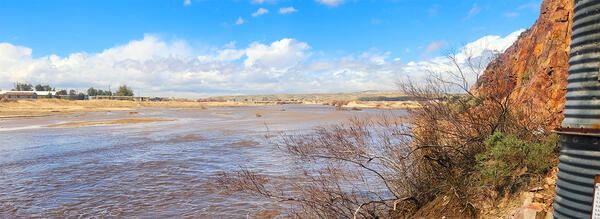
Updated Santa Ana River Over Prado Dam
Santa Ana R BL Prado Dam CA - 11074000
Santa Ana R BL Prado Dam CA - 11074000

Roosevelt Elk on Yurok Tribal Land
Roosevelt elk are primarily found in coastal regions of the Pacific Northwest, including parts of Oregon, Washington, and northern California. They inhabit a variety of habitats, including forests, meadows, and marshlands, and are often associated with old-growth and second-growth forests.
Roosevelt elk are primarily found in coastal regions of the Pacific Northwest, including parts of Oregon, Washington, and northern California. They inhabit a variety of habitats, including forests, meadows, and marshlands, and are often associated with old-growth and second-growth forests.

USGS Hydrotech Jon Ferguson over Sacramento River
USGS Hydrotech Jon Ferguson over Sacramento River. Hydrologic technicians from the USGS California Water Science Center were featured on Sacramento News Channel ABC10 KXTV.
USGS Hydrotech Jon Ferguson over Sacramento River. Hydrologic technicians from the USGS California Water Science Center were featured on Sacramento News Channel ABC10 KXTV.

A USGS technician conducts a phytoplankton net tow to measure harmful algae and toxins in San Francisco Bay.
A USGS technician conducts a phytoplankton net tow to measure harmful algae and toxins in San Francisco Bay.A USGS technician conducts a phytoplankton net tow to measure harmful algae and toxins in San Francisco Bay.

Landscape surrounding a Pacific Gas and Electric Company compressor station in Hinkley, California
Landscape surrounding a Pacific Gas and Electric Company compressor station in Hinkley, CaliforniaHexavalent chromium, a known carcinogen under specific circumstances, occurs naturally in groundwater in the Mojave Desert. However, concentrations of hexavalent chromium increased in California’s Hinkley Valley beginning in 1952 when the Pacific Gas and Electric Company (PG&E) discharged it into unlined ponds.

Hinkley, CA Pacific Gas and Electric Company compressor station
Hinkley, CA Pacific Gas and Electric Company compressor stationA Pacific Gas and Electric Company (PG&E) compressor station in Hinkley, California. Although hexavalent chromium occurs naturally in the groundwater of the Mojave Desert, concentrations increased in Hinkley Valley beginning in 1952.

Loʻipūnāwai on the southern coast of Moloka‘i, Hawaiʻi
Loʻipūnāwai on the southern coast of Moloka‘i, HawaiʻiKaupapaloʻi o Kaʻamola

Children's Water Education Festival
California Water Science Center Geologist Mackenzie Shepherd share drill shavings from groundwater well with a young student at the Children's Water Education Festival in Irvine, CA.
California Water Science Center Geologist Mackenzie Shepherd share drill shavings from groundwater well with a young student at the Children's Water Education Festival in Irvine, CA.

2023iep-thumb.jpg
Sunset over Bay-Delta wetland. Sunset over Bay-Delta wetland. Sunset over Bay-Delta wetland.
Sunset over Bay-Delta wetland. Sunset over Bay-Delta wetland. Sunset over Bay-Delta wetland.

Truckee River at Tahoe City Gaging Station
This is the Truckee River at Tahoe City gage upon arrival during the cold and snowy December morning. The YAGI antenna was covered with over a foot of snow. This gaging station has been a part of the annual Lake Tahoe Summit, which takes place every summer.
This is the Truckee River at Tahoe City gage upon arrival during the cold and snowy December morning. The YAGI antenna was covered with over a foot of snow. This gaging station has been a part of the annual Lake Tahoe Summit, which takes place every summer.

iep-carousel-image-new.jpg
Banner for 2023 IEP workshop. California Water Science Center has many presenters.
Banner for 2023 IEP workshop. California Water Science Center has many presenters.

2023 CAWSC poster presenters
Pictured are a few of the 2023 CAWSC poster presenters: (from L to R) Danielle Palm, Matthew Uychutin, and Andrea Jaegge.
Pictured are a few of the 2023 CAWSC poster presenters: (from L to R) Danielle Palm, Matthew Uychutin, and Andrea Jaegge.
Mojave River near gage - MOJAVE R A BARSTOW 10262500
Mojave River near gage - MOJAVE R A BARSTOW 10262500Mojave River near gage - MOJAVE R A BARSTOW 10262500. Photo taken by Mike Lee, USGS supervisory hydrologist in the southwest region.
Mojave River near gage - MOJAVE R A BARSTOW 10262500
Mojave River near gage - MOJAVE R A BARSTOW 10262500Mojave River near gage - MOJAVE R A BARSTOW 10262500. Photo taken by Mike Lee, USGS supervisory hydrologist in the southwest region.

Map of Feather watershed with SMRUs
Figure 1. Upper Feather River watershed showing 15 different soil moisture response units (SMRU) proposed sites of soil moisture monitoring stations (2 proposed sites for each SMRU).
Figure 1. Upper Feather River watershed showing 15 different soil moisture response units (SMRU) proposed sites of soil moisture monitoring stations (2 proposed sites for each SMRU).